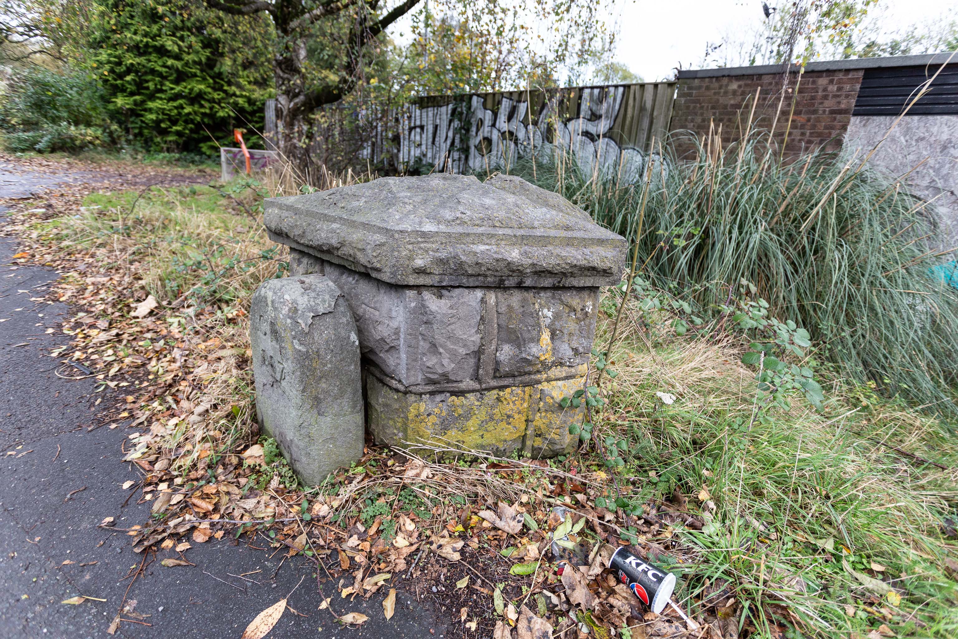
A milestone, perhaps? And there looks to be a benchmark on the bigger bit.
Aha! A quick look at the historic OS maps on Know Your Place finds a marker right on this spot marked "B.S.", which the National Library of Scotland's helpful abbreviations page translates as "Boundary Stone". With that in mind I then had a look on the wonderful geograph site and there it is:
The front stone appears to be an old boundary stone, delineating the Administrative County, Parliamentary County and Rural District boundaries that were part of the Bristol limits in the twentieth century, possibly dated 1897? Behind it is a larger block of stones that may have been part of the Smyth estate further up the hill. On the latter is a partly hidden benchmark.
So I spotted the partly hidden benchmark correctly, too :) There is, of course, a benchmarks directory with an entry for the benchmark itself. What did people do before the internet?
EDIT TO ADD Nearly a year later, I watching a DVD Bristol Railway Stations by Mike Oakley and found out what the larger bit behind the milestone actually is: it's the last remnant of the Clifton Bridge Station buildings, which once faced out onto the road here.
Taken: Sat 6 November 2021 14:06
Rating: ★★
GPS Coordinates:
51.44731, -2.62648
Neighbourhood: Bower Ashton