Tagged: rownham
Snowy Leigh Wander
24 Jan 2021
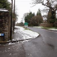
I started this wander with my "support bubble" Sarah and Vik, after Sarah texted me to say "SNOW!" We parted ways on the towpath and I headed up into the bit of Leigh Woods that's not actually the woods—the village-like part in between Leigh Woods and Ashton Court, where I'd noticed on a map a church I'd not seen before. I found St Mary the Virgin and quite a few other things I'd never experienced, despite having walked nearby them many, many times over many years, including a castellated Victorian water tower that's been turned into a house...
I mostly went out to hang out with my friends Sarah and Vik in Bedminster, but along the way I thought I'd take a closer look at something a little nearer home: the last crossing point of the Rownham Ferry.
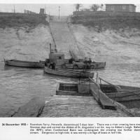
And here's the picture that inspired this little local visit today. A week or so back I was browsing the boxes of books at Rachel's and Michael's Antiques on Princess VIctoria Street, and flipping through their collection of Reece Winstone books. Winstone's famous Bristol As It Was series are an amazing documentary source created by a man who loved both photography and Bristol and effectively became Bristol's foremost documentary photographer for decades. A lot more of Bristol's history is visible today because of him.
In the Bristol As It Was 1939 - 1914 book I saw this picture of the Rownham Ferry. Unfortunately the book was a first edition and priced at £20, so I ordered a cheaper edition from an independent dealer in Stockport when I got home! (Let's consider that as me leaving the rare first edition for the true connoisseurs, rather than just being cheap.)
Here we see the ferry just five days before its closure on the last day of 1932. Looking closely, it seems to be perhaps operating as a reaction ferry, with the boat tethered to a static line across the river, and the ferryman using the rudder to turn the boat and use the power of the flowing water to shuttle the boat from side to side. Clever!
Photo © Reece Winstone Archive. (I recommend buying the books if you like old photos of Bristol. They're amazing!)
A Quick Swing Past Ashton Court
05 Jun 2022
Another day not dissimilar to my last wander: I'm feeling a bit tired and rather than just moping around the house I thought I'd find some tiny bit of somewhere that I'd not yet walked and get outdoors. This time I headed for the Tobacco Factory Market in Bedminster, as I often do, but went the long way around via Ashton Court Mansion as I knew there were some footpaths and a small section of road I'd not ticked off up there. Finishing all the Ashton Court footpaths will be quite a long job, but you've got to start somewhere...
I did feel rather better by the time I got home, and, pretty much astoundingly given the weather forecast, managed to avoid the rain completely.
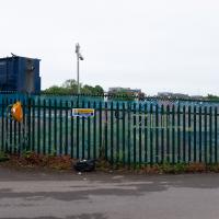
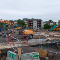
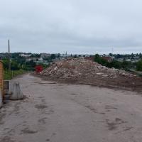
Looks like work has finally started on the new flats on the site of the former railway depot/concrete factory/Bristol International Exhibition site.
Yup, it's definitely all kicking off. They'll probably manage to build an entire development here before the Council finish fixing the bit of Cumberland Road that collapsed just around the corner.
A Constitutional to Burwalls and Back
21 Dec 2021
The recent lack of posts here is mostly due to my feeling very run down following having a couple of wisdom teeth extracted. Having had an emergency appointment yesterday1, hopefully I'll be on the mend now, though it does mean I'm on the kind of antibiotics where you can't touch alcohol for the whole of the Christmas period. I have tried to keep myself a little distracted from the pain by working on the nuts and bolts of this website—you should notice that the front page loads rather faster now than it used to, and that there's a shiny new statistics page that I'll probably be continuing to work on. Oh, and you should find that the tags below the photos are now clickable and will take you to a page of all other wanders that have photos with the same tag.
Today I felt like I needed to drag myself out of the house, but I didn't want to go too far, and I needed to get to the Post Office up in Clifton Village to post a Christmas card (spoiler for my parents: it's going to be late. Sorry.) As luck would have it, idly looking at the map I spotted that I'd missed off a section of Burwalls Road in the past, and that's basically one of the long-ways-round to Clifton Village, crossing the river to Rownham and walking up the hill on the Somerset side before coming back across the Suspension Bridge.
As I was heading for Burwalls Road I decided to make Burwalls itself the focal point of the walk, but unfortunately the mansion grounds are private and the place is hard to snap. Still, at least it gave me a destination. Burwalls was the mansion built by Bristol press magnate Joseph Leech, who I've mentioned before after buying a vintage book he wrote on a previous wander. There's a good article about the house on House and Heritage which has some photos from angles I couldn't ever get to. (Well, maybe with a drone, but it seems like the kind of area where they may be kitted out for clay pigeon shooting, so I probably wouldn't risk it.)
1 My dentist admitted that she probably needed to keep her internal monologue a bit more internal after we started the appointment with her staring into my mouth and immediately saying, "oh, that's weird." These are words one doesn't want to hear from a medical professional.
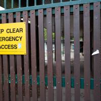
There was a notice of seeking possession on the gate when I got around to the far side. Looks like it's definitely going to be the replacement for the caravan park at Baltic Wharf. Shame for the caravan folk, really; this is sandwiched between major roads and not anything like as close to the pubs and other tourist-friendly places around the harbourside.
Ticking Off a Pocket of Paths in Leigh Woods
03 Jun 2022
I managed to go for a wander a while ago that was meant to finish off a little tangle of paths in Leigh Woods, or at the very least finish off my wandering of the Purple Path there. And I managed to miss doing either of those things through some kind of navigational incompetence.
Today I woke up with a bit of a headache, feeling a bit knackered as soon as I dragged myself out of bed, but at least with the energy to realise that I'd be better off (a) going for a walk in what looked likely to be the last of the Jubilee weekend sunshine than (b) moping around the flat until it started raining, at which point I could mope more thoroughly.
I had a look at my map, considered going to Ashton Court, but remembered that there was a music festival there today, and instead found these little leftovers of Leigh Woods and decided to have one more try at walking them.
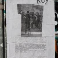
It's quite the commentary. But then if someone believes they can have their life turned around by a fly-posting stranger, perhaps a warning is a reasonable addendum.
Near and Far
05 Jan 2022
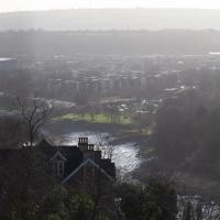
I took advantage of a rare recent day where it wasn't tipping down with rain to get away from my desk on a lunchtime workday and head up to Clifton Village. I'd hoped to snap a reproduction of historical photo which I'd worked out had been taken from the Suspension Bridge, but the gods were not smiling on me. Still, taking only a nice long lens with me worked out very well as the lovely haze of the day made more distant views quite dramatic...
This is almost the photo I wanted to take, but the historical photo I want to reproduce was definitely taken from further to my right, on the bridge, and you should still be able to see the remains of Clifton Bridge Station (hidden from here by the trees on the right) and the last bit of slipway of the Rownham Ferry (hidden by the prominent house in the foreground.) This snap is also a bit marred by the temporary safety fencing I had to shoot through.
Ah well, another day, I suppose.
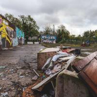
I was just about starting to feel better—the antibiotics seemed to have kicked in for my dental issues, and it had been some days since I'd left the house, and I was at last starting to get itchy feet. So, a wander. But where? Well, there were a few industrial bits near Winterstoke Road in the Ashton/Ashton Vale areas of Bristol that needed walking. I knew they were likely to be quite, well, unattractive, frankly. So why not do them while I wasn't feeling exactly 100% myself? Maybe it would fit my mood. Hopefully you're also in the mood for a bit of post-industrial wasteland, for that's what some of this feels like...
Then, at the last minute, I thought again about the Bristol International Exhibition—I've got a book about it on the way now—and that gave me another goal, which could just about be said to be in the same direction, and I decided to walk significantly further than my normal 1-mile limit and try recreating another historical photo...
Sadly I don't know much about the Ashton area; it's just on the edges of my mile and I rarely have cause to go there. It's brimming with history, I'm sure: the whole South Bristol area rapidly developed from farmland to coal mines to factories to its current interesting mixture of suburbs and industrial work over the last few hundred years. As a more working class area less attention was paid to it by historians, at least historically-speaking, than the Georgian heights of Clifton, and much of it has been knocked down and reinvented rather than listed and preserved. I see here and there some of this lack is being addressed, but I'm afraid I'll be very light on the history myself on this wander, as most of my usual sources aren't throwing up their normal reams of information as when I point them at Clifton, Hotwells or the old city.
Here's the BBC report. This was posted on a telephone junction box in the "Daveside" area, the little strip of Festival Way that's used as a skate park in between the old railway depot and the White City allotments.
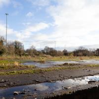
A better view of the ex-railway depot and part of the former Bristol International Exhibition site that I've mused about before. That's why we're on this wander, in fact: curiosity about an old photo of the site. But not a photo from round here: one taken from quite a ways beyond my normal mile radius. It's going to be a bit of a hike.
There will also be some terrifyingly industrial bits of south Bristol along the way, so be prepared for a bit of urban decay and industrial scenes.
I went out simply wanting to knock off the very last little unwalked section of Clanage Road, over by Bower Ashton, which has been annoying me for a while as it's quite close by and I've walked the other bits of it several times. So, my plan was to nip over to Greville Smyth Park via a slightly unusual route to wander Clanage Road and tick it off.
Along the way, though, I inevitably got a bit distracted. I took a few photos of Stork House, a grand Hotwell Road building that's recently been done up a bit (I imagine it's student lets, though I'm not sure) and which I found a reference to in a book about the Port Railway and Pier the other week, and also tried to match up a historical photo of Hotwells before the Cumberland Basin Flyover System laid it waste, which included some interesting markers I'll have to do a bit more digging into...
Because yes, we have just had a little excursion into Somerset, technically. So welcome back to Bristol, home of traffic jams.
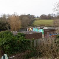
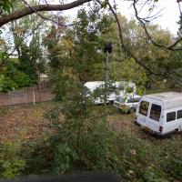
Or possibly a caravan-park-to-be. This is the old Police stables and kennels, and dog-training ground, I think. There are plans afoot for the Baltic Wharf caravan park, forced out of its home by the plan to redevelop the area as flats (which I imagine will be touted as "affordable" and then turn out to be luxury apartments with at most 5% barely-"affordable" apartments around the back), to this site.
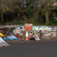
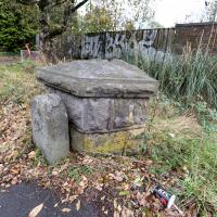
A milestone, perhaps? And there looks to be a benchmark on the bigger bit.
Aha! A quick look at the historic OS maps on Know Your Place finds a marker right on this spot marked "B.S.", which the National Library of Scotland's helpful abbreviations page translates as "Boundary Stone". With that in mind I then had a look on the wonderful geograph site and there it is:
The front stone appears to be an old boundary stone, delineating the Administrative County, Parliamentary County and Rural District boundaries that were part of the Bristol limits in the twentieth century, possibly dated 1897? Behind it is a larger block of stones that may have been part of the Smyth estate further up the hill. On the latter is a partly hidden benchmark.
So I spotted the partly hidden benchmark correctly, too :) There is, of course, a benchmarks directory with an entry for the benchmark itself. What did people do before the internet?
EDIT TO ADD Nearly a year later, I watching a DVD Bristol Railway Stations by Mike Oakley and found out what the larger bit behind the milestone actually is: it's the last remnant of the Clifton Bridge Station buildings, which once faced out onto the road here.
View into the car park of the former stables/kennels. I just poked my camera through a big hole in the gate.
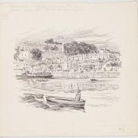
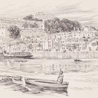
I recently indulged myself by buying a little piece of history. I've mentioned Samuel Loxton and featured and linked to his drawings before, often in the eminently browsable Loxton Collection albums that Bristol Libraries has on Flickr. So when I saw a Loxton drawing of Hotwells pop up on eBay, I decided to get myself a little treat.
I don't think there's any Loxton drawing that features the road I actually live in—it's not very visible from anywhere else, not being one of these Clifton terraces that's perched at the top of a hill, or anything like that, and it's invisible in most views of the area. However, this Loxton drawing, Hotwells, Looking across the river from near the Clifton Bridge station, is probably the closest near-miss I've seen.
I decided to wander out one morning and see if I could reproduce the picture, and also take a photo or two of what's now become of the Clifton Bridge Station, which is still just about discernible in places.
(Then on an even stranger whim I decided to check out a possible little cut-through from Cumberland Road to the harbourside I'd been eyeing up on my commute to work, so walked to Wapping Wharf for a croissant via this potential new route, but that bit's not quite as interesting...)
Site of the Rownham Ferry. Follow the link for a charming Loxton ink drawing on Know Your Place, also viewable at the Bristol Libraries Flickr collection.
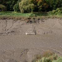
This was a later site for the ferry, which earlier was a tad further out along the river. It would have been a key crossing point at this end of Bristol before the arrival of any bridges near here. Before the Ashton Swing Bridge and the Vauxhall footbridge arrived, the next-nearest crossing point would have been the Vauxhall ferry, which was where Vauxhaull Bridge stands now, I think.
Here's a photo of the entire original Samuel Loxton ink drawing, including the title, Hotwells, Looking across the river from near the Clifton Bridge station.
I bought this from eBay on something of a whim. I have no provenance for it, and the listing mentioned it was "circa 1910". It certainly seems to be (a) original, and (b) by Loxton. The very faded pencil below the picture seems to be very in keeping with Loxton's work: there are instructions for reducing the picture for print use, and I think a mention of the Bristol Observer, where Loxton's pictures were regularly published. It's very hard to make out the writing, though.
