Tagged: bristol-international-exhibition
I was just about starting to feel better—the antibiotics seemed to have kicked in for my dental issues, and it had been some days since I'd left the house, and I was at last starting to get itchy feet. So, a wander. But where? Well, there were a few industrial bits near Winterstoke Road in the Ashton/Ashton Vale areas of Bristol that needed walking. I knew they were likely to be quite, well, unattractive, frankly. So why not do them while I wasn't feeling exactly 100% myself? Maybe it would fit my mood. Hopefully you're also in the mood for a bit of post-industrial wasteland, for that's what some of this feels like...
Then, at the last minute, I thought again about the Bristol International Exhibition—I've got a book about it on the way now—and that gave me another goal, which could just about be said to be in the same direction, and I decided to walk significantly further than my normal 1-mile limit and try recreating another historical photo...
Sadly I don't know much about the Ashton area; it's just on the edges of my mile and I rarely have cause to go there. It's brimming with history, I'm sure: the whole South Bristol area rapidly developed from farmland to coal mines to factories to its current interesting mixture of suburbs and industrial work over the last few hundred years. As a more working class area less attention was paid to it by historians, at least historically-speaking, than the Georgian heights of Clifton, and much of it has been knocked down and reinvented rather than listed and preserved. I see here and there some of this lack is being addressed, but I'm afraid I'll be very light on the history myself on this wander, as most of my usual sources aren't throwing up their normal reams of information as when I point them at Clifton, Hotwells or the old city.
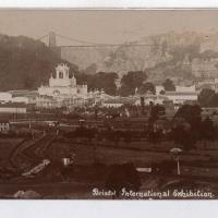
Source: Bristol Archives, Vaughan Collection.
Here we look, apparently from Bedminster Down, towards the "white city", the Bristol International Exhibition buildings of 1914.
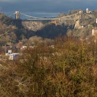
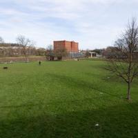
This is the photo I've trooped all this way to reproduce. Have I managed to find the right spot?
I did take a lot of slightly different angles, clambering around on the slippery slopes of Bedminster Down and having the occasional entanglement with trees. I think this shows pretty much the same view as the historical photo, or at least as close as you can get by wandering around on the ground in about the right place today.
It was nice to be able to find it, and I've never walked to Bedminster Down before. And it's a nice palate cleanser after all that rather dreary industrial stuff, anyway...
And that's the note I'll leave things on, as it was already getting a bit dark for photography, so I mostly plodded my weary way home without any further snapping. At more than 9km it's not my longest wander ever, but it's about twice as long as the average, so I may have overdone it...
Bower Ashton is an interesting little area just south of the river from me—in fact, the Rownham Ferry used to take people over from Hotwells to Bower Ashton, operating from at least the twelfth century to around the 1930s.
It's a strangely contradictory little area, with a cluster of old and new houses sandwiched in between the busy A-roads and significantly more industrial area of Ashton and the bucolic country estate of Ashton court roughly east to west, and also between Somerset and Bristol, north to south.
I've been around here before, mostly poking around Bower Ashton's arguably most well-known bit, the Arts faculty campus of the University of the West of England, but I'd missed at least Parklands Road and Blackmoors Lane, so I initially planned just to nip across briefly and wander down each in turn. On a whim, though, I texted my friends Sarah and Vik in case they were out and about, and ended up diverting to the Tobacco Factory Sunday market first, to grab a quick flat white with them, extending my journey a fair bit.
To start with, though, I nipped to a much more local destination, to see something that you can't actually see at all, the Gridiron...
(I also used this wander as a test of the cameras in my new phone. I finally upgraded after a few years, and the new one has extra, separate wide and telephoto lenses compared to the paltry single lens on my old phone. Gawd. I remember when speed-dial was the latest innovation in phones...)
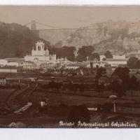
I thought this was such an impressive sight I should pop an archive photo up in the wander for you to see.
Postcard from the Vaughan Collection/Bristol Archives.
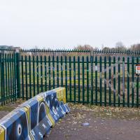
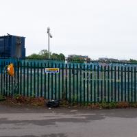
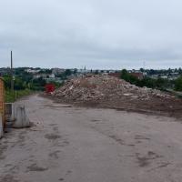
There's not much to see here. However, trying to find out what was here has been quite fascinating.
By the looks of it, this was part of the site of the Bristol International Exhibition, and I also found a photo of "Bristol's Own B Company" geotagged here—apparently the Glosters were stationed on the site of the exhibition after its early closure, so that might tie up, especially as the photo is dated 1914-1919 and the Glosters were here until 1919.
Aha! Yes, as you can see from this other postcard, that building was indeed part of the exhibition. Gosh. I hadn't really realised just how grand the exhibition ground was—you can certainly see why they called it the White City.
So, this would definitely have been part of the exhibition ground—around where the grandstand was—as would almost all of the surrounding area. Wow. Must've been quite something. They had everything from a rifle range to a replica of Bristol Castle.
As for this particular derelict bit of fenced-off ground, I give it five years before we see some architectural drawings of luxury flats with the bare minimum of affordable housing hidden around the back. Will it be as well-built as the plasterboard and gypsum White City? Who knows...
Later edit: Ah! On a later wander I found the key piece of information about this strip of land that let me search for it properly: its name. This strip of land, from the Stone Yard we just saw to here is the Ashton Gate Depot, a former railway sidings, and apparently I may have been overly cynical about the luxury flats, though there are definitely plans to turn it into flats, according to the Evening Post:
The proposed redevelopment of the site would include 99 one-bed apartments, 138 two-bed apartments, two three-bed apartments and 14 four-bed townhouses.
According to plans submitted to the council, all the new housing will be affordable because it will either be shared ownership or socially rented.
The development will span across five buildings between four and nine stories high.
There's more info and a detailed map on this planning document.
From all the old maps I can see, the actual railway sidings were in between this strip of land and the new development at Paxton Drive, around where the dedicated Metrobus line now runs. Perhaps this strip to the west of them was used for general railway storage, or maintenance buildings, or what-have-you. Now I've found out a bit more it should be easier to dig into the history; knowing railway enthusiasts there's probably a quaint little three-volume hardback set on The History of the Ashton Railway Depot...
A Quick Swing Past Ashton Court
05 Jun 2022
Another day not dissimilar to my last wander: I'm feeling a bit tired and rather than just moping around the house I thought I'd find some tiny bit of somewhere that I'd not yet walked and get outdoors. This time I headed for the Tobacco Factory Market in Bedminster, as I often do, but went the long way around via Ashton Court Mansion as I knew there were some footpaths and a small section of road I'd not ticked off up there. Finishing all the Ashton Court footpaths will be quite a long job, but you've got to start somewhere...
I did feel rather better by the time I got home, and, pretty much astoundingly given the weather forecast, managed to avoid the rain completely.
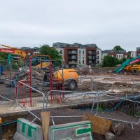
Looks like work has finally started on the new flats on the site of the former railway depot/concrete factory/Bristol International Exhibition site.
Yup, it's definitely all kicking off. They'll probably manage to build an entire development here before the Council finish fixing the bit of Cumberland Road that collapsed just around the corner.
Bedminster Trip for New Walking Shoes
26 Feb 2022
I needed to buy new walking shoes—my old ones were squeaking and it was driving me up the wall—so I ordered some for collection from Taunton Leisure on East Street in Bedminster, and decided to make picking them up an official wander.
I didn't cover any new ground within my mile, but I did take advantage of the trip to take in a few interesting things just outside my normal radius, mostly New Gaol-related. Along the way there are a couple of sanitation-related diversions, including a visit to a rare manhole cover. You can hardly wait, I can tell!
Back in the days of the Bristol International Exhibition we'd have been standing about where the replica of Bristol Castle was, looking toward the Dominions Pavilion and a bandstand.
On the left, B Bond, in the middle, A Bond, and on this side of the New Cut, the C Bond warehouse.
Lunchtime Reproduction (of an old photo...)
17 Jan 2022
This was basically the quick lunchtime jaunt I tried to do at the beginning of January, only this time I actually managed to get to roughly the viewpoint I'd been hoping for to recreate a historical photo of the Bristol International Exhibition.
I did this walk about a month ago, but I've been a bit poorly and not really up to doing much in my spare time, and it's taken me this long to even face processing even these few photos. Hopefully normal service will be resumed at some point and I can carry on trying to walk any roads and paths that I need to do to make this project feel complete...
From Bristol's Lost City, by Clive Burlton, available from Bristol Books; photograph from the author's own collection.
(And extra credit goes to my parents for buying me the book for my birthday! Thanks!)
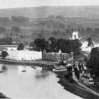
The Bristol International Exhibition site, presumably around 1914 or not long after. You can see the Rownham Ferry in use, too. I still find it pretty amazing that there used to be a busy ferry and a significant railway station on this little scrap of land that I just used to know as the grassy bit at the start of the towpath, let alone a replica of Bristol Castle!
Unlike my last attempt I successfully managed to get somewhere near the vantage point of the historic photo this time...
I should probably have tried to get it at high tide to make it a bit more comparable, but you can't have everything.
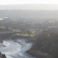
You can see the White City Allotments—those glints of light toward the middle are mostly reflections from greenhouses—where the "White City" of the Exhibition used to stand. There's still a glimpse or two of the railway line to Portishead to be seen, too, along with a vestige of the Rownham Ferry slipway.
Mostly though it's the modern things that stand out—the long line of flats along Paxton Drive, the curve of Brunel Way across the river, and the roof of Ashton Gate Stadium...
