Tagged: cloud
Lunchtime Reproduction (of an old photo...)
17 Jan 2022
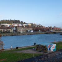
This was basically the quick lunchtime jaunt I tried to do at the beginning of January, only this time I actually managed to get to roughly the viewpoint I'd been hoping for to recreate a historical photo of the Bristol International Exhibition.
I did this walk about a month ago, but I've been a bit poorly and not really up to doing much in my spare time, and it's taken me this long to even face processing even these few photos. Hopefully normal service will be resumed at some point and I can carry on trying to walk any roads and paths that I need to do to make this project feel complete...
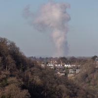
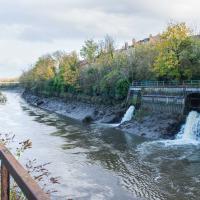
I think this may be the "avonmouth monster"; a plume of outflow from the works at Avonmouth. I took a photo of it some years back and asked BBC weatherman Ian Fergusson about it in the comments on this blog post—I'd recently done a tiny segment for his show "Wild Weather of the West" on how to photograph lightning—and that's what he said it was. This looks suspiciously similar and is in the right direction.
I've been pretty awful at reading so far this year, apparently averaging about one book per month. That's a far cry from 2019, say, where I got through 41 books in the year. Today's wander was prompted by my rubbish reading, as I needed to go hand back some books to the library, because I'd managed to renew them so many times that I hit the limit on renewals. Oops. Several of them were still unread.
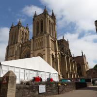
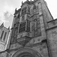
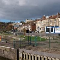
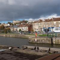
So, off to the Central Library for me, tail between my legs. On the way there I did my best to recreate a historical photo of Dowry Square; while I was in the area I walked under the adjacent Norman arch and poked around behind the Cathedral, and I also had a little diversion to the city centre and came back along the south side of the river, hitting some trouble with the lock gates as I finally crossed the harbour back towards home.
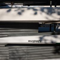
This was the poster on the A-board at the head of the alley that leads to the Centrespace Gallery, and is usually worth a look. It wasn't particularly eyecatching, though, with an A4 poster rather lost in the middle of the much larger board...
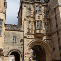
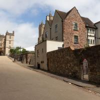
And now we've teleported down the Hotwell Road to College Green, where I found that the library wasn't open yet (I'd forgotten they didn't open until 1pm on a Sunday) so carried on past it and turned through an old Norman archway.
This was a section I wanted to walk, as although I have actually wandered through the arch and pottered around this bit of Bristol before, I think that was one of the days my GPS battery died halfway through a walk, so I never posted any records of it. Here I can redress the issue. We've seen the other side of this grand bit of architecture before, and the next photo has the information plaque which will tell you more about it more concisely than I could.
One fact that isn't on the plaque is that Catherine Hughes, the local artist who made the pomegranates for the front of the Cabot Cafe, had her studio in one of the upper rooms for a time. I presume this was wangled by her father, a local estate agent who was heavily involved in the whole College Green area. From the Clifton and Redland Free Press, 18 April 1900:
Comparatively few people are aware that the interesting structure known as the Abbey Gate House, College Green, the fifteenth century building above the fine old Norman archway, is now given over to the fine arts. It is the studio of Miss Catherine Hughes, and a private view of a charming exhibition of water colour drawings, by that young lady and Miss Ludlow, both local limners, was held last week, when a large number of ladies and gentlemen accepted the invitation to inspect the works, among the company being some local artists. Miss Hughes and Miss Ludlow studied under Ludovici in London, and are now following their profession in Bristol
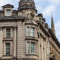
A fairly wrong clock, given that I took this at about 12:40. This used to be the Midland Bank.
And now I've killed some time wandering around town, here we are back at the other side of the Abbot's gate on the way to collect the book I wanted from the library now it's actually past 1pm and the place is open. At least I accidentally found an interesting art exhibition along the way.
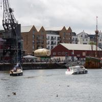
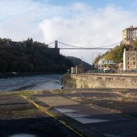
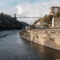
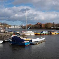
Library business concluded, I decided that my feet weren't quite sore enough, so decided to head back home by completing a circuit of the harbour rathter than just heading back down the noisy Hotwell Road. Wandering past the Arnolfini, I spotted this from a viewpoint not far from where the status of John Cabot stands, surveying the docks.
For now, though, I escaped the hustle and bustle of Wapping Wharf by crossing Gaol Ferry Bridge—soon to be closed for "at least six to nine months" much to the distress of local businesses. And I imagine the local businesses know what the Council normally mean by "six to nine months": somewhere between two and three years would be my guess.
Mokoko
26 Oct 2020
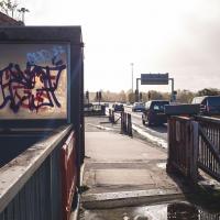
A dash around the harbourside to see if I can get to Mokoko and back in my lunch hour.
This was my first wander and I was still getting the hang of the technology. I managed to record only part of the way back on my GPS, by the looks of it, so I've had to bodge things a bit to pick up the photos, which is why there are photos in places the track doesn't reach!
I also need to fix a few technical things including managing my photo timezones more carefully. This wander was the day after the clocks went back for winter, and I think my camera may still have been in BST, which may not have helped me tie things up. Need to do a bit of research into how my cameras, Lightroom and the code I'm writing on this website handle BST and GMT, but at least I have until the last Sunday in March before things get urgent, I think...
Greville Smyth
28 Oct 2020
Popped out for a coffee in Greville Smyth park, and got a view of the Andy Council work on the side of the Ashton Avenue sewage pumping station on the way back.
Catherine Progress
29 Oct 2020
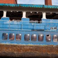
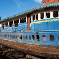
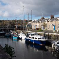
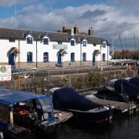
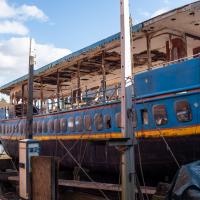
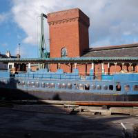
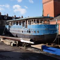
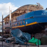
They're refurbishing (by which they seem to mean ripping almost completely apart and rebuilding) the Catherine in Underfall Yard at the moment. I like checking on the progress when I pass by the Patent Slip.
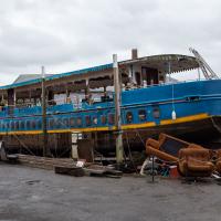
Most of the refit of the Catherine so far seems to have involved throwing increasingly large chunks of it away. I thought those chairs looked really comfy, though, apart from the fact they'd have been sopping wet from the rain. And who knows what else, given the Catherine's rather chequered past—apparently it was a brothel for a while, among other things.
Bedminster
31 Oct 2020
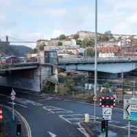
Starting up close in Hotwells with a few bits around the Cumberland Basin flyover system, I walked to Bedminster and back on Hallowe'en, including finding some excellent decoration work.
I like the way I can sometimes make something that seems pretty out of the less-attractive bits of the Cumberland Road Flyover System
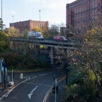
Not sure I've walked along the flyover here. Have I ever seen the Cumberland Basin from this angle before?
The spike of land with the dockkeepers' cottage on it has been cordoned off for the last couple months as I write this (on 4 Jan 2021; I'm processing my backlog.) Back in October you could wander up to the end unimpeded.
I don't normally do HDR photography, and I still find this looks a little unnatural, but hey, it was just an experiment.
Royal York Crescent
02 Nov 2020
I've taken a lot of photos of Royal York Crescent over the years. This time I walked right to the dead-end bit at the far west corner and found a plaque to the Empress of the French. Call me hard to impress, but among the scientists, novelists, architects and artists whose plaques litter the rest of the area, that seems quite minor claim to fame.
A gated community, apparently. There's a few of these little enclaves in Clifton, often hidden "around the back", as mews always were, I suppose.
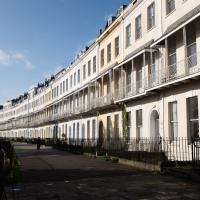
I enjoy walking along Royal York Crescent enough that it's a frequent diversion from my quickest way home
Local
03 Nov 2020
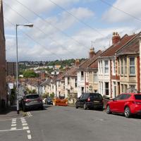
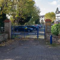
A very local exploration today, but there are still bits of the near field that I never need to walk down, so it didn't take me long to find somewhere I haven't been in a decade or more, the little enclave of smaller Victorian houses around Oldfield Road and Sandford Road. I'd really like to live in one of those houses, but I doubt I could afford it.
I imagine it got more use when the GP surgery down the road was still open. Dr. Ring retired a few years ago, and couldn't find anyone to take it over, more's the pity.
I think the "TS" is Training Ship, but I was in the Air Cadets, so I don't know for sure.
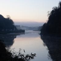
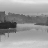
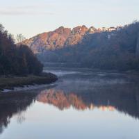
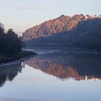
Morning Mist
05 Nov 2020
I spotted the fog and decided to go for a morning walk rather than a lunchtime walk today. It was cold on the Portway, but it was worth it. Most of my One Mile Matt photos are "record shots", but it's nice to get the chance to do something a bit more artistic.
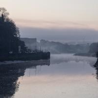
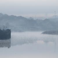
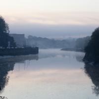
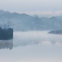
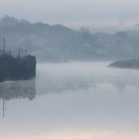
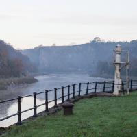
The edge of Durdham Down, where the railings are, top right, is known as Sea Walls, but nobody really knows why. It's not like the sea is anywhere nearby, and they're not walls.
This impression is reinforced to some degree by another fairly recent local name. In the Avon Gorge, the main high rock-face below Durham Downs, in Westbury on Trym parish, is Black Rock, which is sometimes loosely known as Sea Walls. Sea Wall appears on the OS 6" map of Gloucestershire (1888) in a position corresponding to the actual wall built on the cliff edge by John Wallis in 1746 (Goldthorpe 2006: 38), and the name originally given to this structure, Wallis's Wall, was replaced at an uncertain date by the present non-obvious one. Given that the term sea-wall is a usual one in the Severn area for the artificial sea-banks protecting the saltmarshes (as in the See Walles in Henbury parish in 1550; PN G/ 3: 136), it is strange that it should have been adopted for this inland cliff-edge structure. The earliest record so far found is also in the title of a painting, an early work by Francis Danby, "The Avon Gorge from the Stop Gate below Sea Walls" of c.1815. — Some Local Place-Names in Medieval and Early-Modern Bristol, by RICHARD COATES with the collaboration of JENNIFER SCHERR
Very Local
06 Nov 2020
It's surprisingly easy to overlook the giant Wesleyan Grenville Chapel—now converted into flats—if you've lived here a while. Other sights that seem to slip from my memory include the modest Ashton Avenue, a tidy terrace of little houses on a road that presumably gave its name to the Ashton Avenue bridge.
I keep on hoping this will be broken down so I can make a terrible "that doesn't auger well" joke, but so far I've been disappointed.