Tagged: trains
Mokoko
26 Oct 2020
A dash around the harbourside to see if I can get to Mokoko and back in my lunch hour.
This was my first wander and I was still getting the hang of the technology. I managed to record only part of the way back on my GPS, by the looks of it, so I've had to bodge things a bit to pick up the photos, which is why there are photos in places the track doesn't reach!
I also need to fix a few technical things including managing my photo timezones more carefully. This wander was the day after the clocks went back for winter, and I think my camera may still have been in BST, which may not have helped me tie things up. Need to do a bit of research into how my cameras, Lightroom and the code I'm writing on this website handle BST and GMT, but at least I have until the last Sunday in March before things get urgent, I think...
Museum of the Moon, and a Bit of Redland
21 Aug 2021
Lisa and I mostly went out to have a look at Luke Jerram's Museum of the Moon as its tour hit Bristol Cathedral—I missed it when it was previously in town, at Wills Hall, I think—but we also took a trek up to Redland. Lisa's kind enough to indulge my strange current fascination with the Edwardian eccentrics that made up the Stella Matutina, so we swung by a couple of places with a vague connection to the Bristol branch of the organisation. Well, it was good walking, anyway...
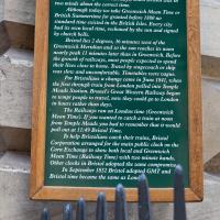
As a stunning bonus, one of the picture's descriptions has more information than you'd probably want on the Bristol Port Railway and Pier's Clifton Extension Railway line, but I did happen to coincidentally write up this wander after reading about the extension line during my lunch hour at work today. It's a thrilling life, I tell you...
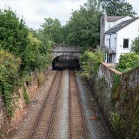
There's actually a Hotwells connection here, fairly literally. This section of track, from Ashley Hill, Montpellier, Redland, this bit right here, then Clifton Down and through a tunnel under the Downs to Sneyd Park Junction and Sea Mills station, was built as the Bristol Port Railway extension line, the Clifton Extension Railway.
The original Bristol Port Railway and Pier connected Hotwells to a deep-water pier at Avonmouth (with a few stations along the way) avoiding the need to have ships wait for the right tide to come into Bristol to unload. We've previously been inside one of its tunnels.
It was also used by plenty of passengers—during WWI an extra platform was added in Hotwells to cope with the sheer number of Bristolians commuting to the docks and munitions factories daily as part of the war effort, as well as troop movements and incoming wounded on hospital trains.
Later on this isolated Bristol Port track needed to join up to the existing railway network to survive, so this extension line was added to connect it with Ashley Hill with help from the Great Western and Midland railways. Only later did the section to Hotwells fall into disuse and close in favour of the Portway road.
(Information mostly courtesy Colin Maggs' The Bristol Port Railway & Pier, Oakwood Press, 1975.)
Bedmo and Ashton Court
21 Nov 2020
A rather more wide-ranging weekend wander with Sarah and Vik, taking in some mock Tudor bits of Bedmo (I should note that I've subsequently been corrected to "Bemmie", but I'm an outsider and have been calling it "Bedmo" for short for decades...), a chunk of Ashton, a path up Rownham Hill called Dead Badger's Bottom(!), The Ashton Court estate, a bit of the UWE campus at Bower Ashton, and some of the Festival Way path.
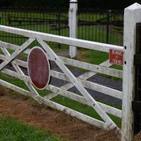
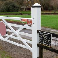
I guess we may now know where the bloke with this sign on his gate from earlier bought his signage.
I've been pretty awful at reading so far this year, apparently averaging about one book per month. That's a far cry from 2019, say, where I got through 41 books in the year. Today's wander was prompted by my rubbish reading, as I needed to go hand back some books to the library, because I'd managed to renew them so many times that I hit the limit on renewals. Oops. Several of them were still unread.
So, off to the Central Library for me, tail between my legs. On the way there I did my best to recreate a historical photo of Dowry Square; while I was in the area I walked under the adjacent Norman arch and poked around behind the Cathedral, and I also had a little diversion to the city centre and came back along the south side of the river, hitting some trouble with the lock gates as I finally crossed the harbour back towards home.
I recently indulged myself by buying a little piece of history. I've mentioned Samuel Loxton and featured and linked to his drawings before, often in the eminently browsable Loxton Collection albums that Bristol Libraries has on Flickr. So when I saw a Loxton drawing of Hotwells pop up on eBay, I decided to get myself a little treat.
I don't think there's any Loxton drawing that features the road I actually live in—it's not very visible from anywhere else, not being one of these Clifton terraces that's perched at the top of a hill, or anything like that, and it's invisible in most views of the area. However, this Loxton drawing, Hotwells, Looking across the river from near the Clifton Bridge station, is probably the closest near-miss I've seen.
I decided to wander out one morning and see if I could reproduce the picture, and also take a photo or two of what's now become of the Clifton Bridge Station, which is still just about discernible in places.
(Then on an even stranger whim I decided to check out a possible little cut-through from Cumberland Road to the harbourside I'd been eyeing up on my commute to work, so walked to Wapping Wharf for a croissant via this potential new route, but that bit's not quite as interesting...)
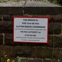
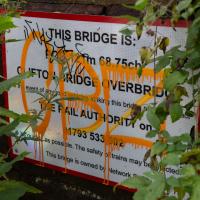
At the other end of the Clifton Bridge Railway Station is a little road bridge that I've crossed many times. It's nice to see, under the inevitable tagging, that it's called Clifton Bridge Overbridge, so the name of the old station does live on a little in reality, at least for Network Rail.
(The footbridge from earlier is called Rownham Hill Bridge on its little placard.)
