Tagged: field
A Door, a Square, a Few Night Shots
04 Dec 2021
I didn't take many pictures on this quite long wander, partly because Lisa and I wandered across to Bedminster via Bower Ashton, which I've snapped quite a lot of on the last couple of walks, and also because we lost the light fairly quickly, though spending a half-hour drinking mulled wine in the Ashton might have had a little to do with that...
Before we left Hotwells I wanted to visit a door I'd heard about on Cornwallis Crescent and also take a little look at a couple of houses in Dowry Square to consider the 1960s regeneration of Hotwells.
They should form a pub. This is just over the road from The Ashton, so there's perhaps a little too much local competition. Lisa and I popped in for a mulled wine.
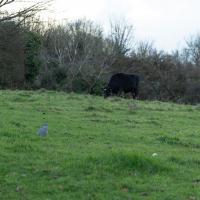
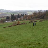
This is arguably better than the last time I tried to snap a cow in this field, but it's still terrible. Maybe next time I'll have a longer lens, or the cow will be closer...
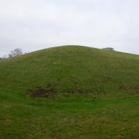
This field is called St John's Chapel. On the oldest map I can find, from somewhere between 1844 and 1888 it's marked as the "Site of St John's Chapel" but with no sign of the chapel, so it must be very long-gone. "The Chapel was dedicated as St. John or St. James depending on the source consulted, and it presumably fell into decay after the village was deserted, in the 13th or 14th century. No trace remains above ground level today, and the site is just a field" says The Churches of Britain and Ireland.
I can see on the same map that there's clearly been a pub where The Ashton is for a very long time. It was called The Smyth Arms back then.
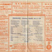
Since setting up a search for Hotwells on eBay I've mostly managed to restrain myself from buying much (or in one case, was outbid, luckily for my finances.) However, I couldn't resist a 1902 flyer for a singalong at the Terrett Memorial Hall, which would have stood five minutes' walk from my flat, overlooking Howard's Lock.
I've found out a fair bit about this non-denominational seaman's mission, including tracking down both a Loxton drawing and an aerial photo of it. The main thing that's eluded me, ironically enough, is finding out who Terrett was, so as a Memorial Hall it didn't do a very good job 😀.
EDIT: Ah! Did a little more digging and found that the Bristol Archives has a Bristol Dock Company document on file called "William Terrett, Esq.; corresp. etc. re proposed erection of a Mission Hall at Cumberland Basin, 1892", so that might be worth a look once the Archives are properly open again. Given that:
Sarah Terrett died suddenly on 25 November 1889, aged 53, after speaking at a meeting of the White Ribbon Army, the temperance organization she had founded in 1878. Following her death many people sent letters of sympathy to her bereaved husband, William. One of these, from the Rev. W. F. James, a minister of the Bible Christians, makes for especially interesting reading. The Bible Christian denomination, to which Sarah and William belonged, was one of the smaller Methodist connexions, and had its heartland in rural Devon, the area where she had grown up. James recalled the hospitality he enjoyed when visiting the Terretts’ home, Church House, in Bedminster, south Bristol...
...I wonder if William Terrett built the hall in memory of his late wife. They were clearly just the kind of temperance movement people who would've founded a seaman's mission to get people together to have a nice non-alcoholic singsong rather than a night out on the tiles.
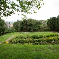
Anyway. This walk to grab a coffee from Hopper Coffee in Greville Smyth Park was mostly an excuse to post the leaflet, a few other things I found related to it, and some pictures of how the site looks now. I would suggest that the present day is not an improvement.
I find the adverts fascinating. My first optician in Bristol was Dunscombe's on St Augustine's Parade, so they were there a long time. They've closed now (or at least moved) but were still there as recently as 2008, I think. Interesting to see gas lighting systems being advertised, too!
A Longer-than-it-looks Walk With Lisa
06 Jun 2021
The track on the map doesn't tell the whole story of this walk with Lisa around and about Clifton, Berkeley Square, Brandon Hill and the harbourside, because the batteries on my GPS ran out while we were on the roof of Trenchard Street car park, it seems. Oh well. I think I did most of the area I was interested in finishing off around the University; there were only a few new bits around Brandon Hill that won't be on the track, and I can easily do them again.
Still, technology woes aside it was a nice walk, albeit a bit warm for climbing all those hills, and sat on the harbourside watching the world go by for a while, too. It was good to see the Bristol Ferry Boats carrying people around again, especially.
Mirror Maze
10 Jan 2021
Went for a wander with my friend Lisa—the current lockdown rules seem to be that one local walk for exercise per day with a maximum of one person not in one's "bubble" is fine—up to the University of Bristol area right at the edge of my one-mile perimeter to see the Jeppe Hein Mirror Maze, among other things. On the way we mused about Merchant Venturers, the slave and tobacco trades, and dating in the time of Covid.
Not many people know there's a giant reservoir in the middle of Clifton. I found a fascinating tidbit in 'To Keep Open and Unenclosed':
The Management of Durdham down since 1861, by Gerry Nichols, that also explains why the toilets and changing rooms on Durdham down are where they are (right next to the giant water tower):
Bristol Water Works Company (BWW) was incorporated by Act of Parliament in 1846 and its first engineering works included three service reservoirs: Bedminster Down for the area south of the River Avon; Victoria Reservoir at Oakfield Road for the lower areas north of the Avon; and the Durdham Down Reservoir for the higher districts. The water flowed from the Barrow Reservoir to Oakfield Road by gravity where there was a pump driven by a steam engine to raise the water to the Downs level. Land was purchased from the Lords of the Manor of Henbury for the Durdham Down Reservoir free of any covenants or restrictions on building. As noted above, the requirement in the 1861 Act for the Downs to be 'open and unenclosed' has always been interpreted as a ban on permanent buildings on the Downs. Thus BWW land has been used for public toilets (1893) and Dressing Rooms (1932 and 1994) to avoid challenges under the 1861 Act.
Bedmo and Ashton Court
21 Nov 2020
A rather more wide-ranging weekend wander with Sarah and Vik, taking in some mock Tudor bits of Bedmo (I should note that I've subsequently been corrected to "Bemmie", but I'm an outsider and have been calling it "Bedmo" for short for decades...), a chunk of Ashton, a path up Rownham Hill called Dead Badger's Bottom(!), The Ashton Court estate, a bit of the UWE campus at Bower Ashton, and some of the Festival Way path.
I guess someone's living on this patch of ground. I think this used to be where the police horses were stabled. Not sure, though.
A Random New Year's Day Wander
01 Jan 2022
I picked a fairly arbitrary reason for a wander today. Really, I just wanted to do a New Year's Day wander just to get out of the house and to set a precedent for the year to come.
My ostensible reason was to investigate what looked like a road on my map that quartered the lawn in front of the Ashton Court mansion. As it turned out, this is just a muddy footpath/desire line similar to a half-dozen other tracks nearby, and must be some kind of bug or misclassification with the mapping system I'm using, but that's not important. What's important is that I went for a little walk on the first day of the year. As a bonus, I did happen to wander down a couple of sections of new footpath, so technically I broke some new ground too, which is nice.
There were quite a lot of people about; I think a New Year's Day walk is still quite the tradition. Good.
Bower Ashton is an interesting little area just south of the river from me—in fact, the Rownham Ferry used to take people over from Hotwells to Bower Ashton, operating from at least the twelfth century to around the 1930s.
It's a strangely contradictory little area, with a cluster of old and new houses sandwiched in between the busy A-roads and significantly more industrial area of Ashton and the bucolic country estate of Ashton court roughly east to west, and also between Somerset and Bristol, north to south.
I've been around here before, mostly poking around Bower Ashton's arguably most well-known bit, the Arts faculty campus of the University of the West of England, but I'd missed at least Parklands Road and Blackmoors Lane, so I initially planned just to nip across briefly and wander down each in turn. On a whim, though, I texted my friends Sarah and Vik in case they were out and about, and ended up diverting to the Tobacco Factory Sunday market first, to grab a quick flat white with them, extending my journey a fair bit.
To start with, though, I nipped to a much more local destination, to see something that you can't actually see at all, the Gridiron...
(I also used this wander as a test of the cameras in my new phone. I finally upgraded after a few years, and the new one has extra, separate wide and telephoto lenses compared to the paltry single lens on my old phone. Gawd. I remember when speed-dial was the latest innovation in phones...)
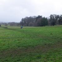
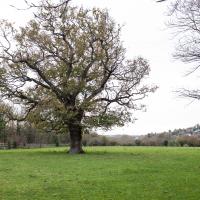
All of a sudden, everything's a bit quieter and there's open fields in front of me. And livestock, if you can spot the cow in the far distance, just to the right of the tree.
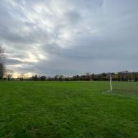
Presumably these are school playing fields, though there was no great barrier to entry. They seem to be school-adjacent, but maybe they're more public... I followed some people who looked like they knew where they were going, which I find is often an expedient way of getting lost.
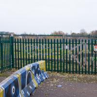
There's not much to see here. However, trying to find out what was here has been quite fascinating.
By the looks of it, this was part of the site of the Bristol International Exhibition, and I also found a photo of "Bristol's Own B Company" geotagged here—apparently the Glosters were stationed on the site of the exhibition after its early closure, so that might tie up, especially as the photo is dated 1914-1919 and the Glosters were here until 1919.
Aha! Yes, as you can see from this other postcard, that building was indeed part of the exhibition. Gosh. I hadn't really realised just how grand the exhibition ground was—you can certainly see why they called it the White City.
So, this would definitely have been part of the exhibition ground—around where the grandstand was—as would almost all of the surrounding area. Wow. Must've been quite something. They had everything from a rifle range to a replica of Bristol Castle.
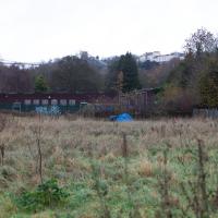
As for this particular derelict bit of fenced-off ground, I give it five years before we see some architectural drawings of luxury flats with the bare minimum of affordable housing hidden around the back. Will it be as well-built as the plasterboard and gypsum White City? Who knows...
Later edit: Ah! On a later wander I found the key piece of information about this strip of land that let me search for it properly: its name. This strip of land, from the Stone Yard we just saw to here is the Ashton Gate Depot, a former railway sidings, and apparently I may have been overly cynical about the luxury flats, though there are definitely plans to turn it into flats, according to the Evening Post:
The proposed redevelopment of the site would include 99 one-bed apartments, 138 two-bed apartments, two three-bed apartments and 14 four-bed townhouses.
According to plans submitted to the council, all the new housing will be affordable because it will either be shared ownership or socially rented.
The development will span across five buildings between four and nine stories high.
There's more info and a detailed map on this planning document.
From all the old maps I can see, the actual railway sidings were in between this strip of land and the new development at Paxton Drive, around where the dedicated Metrobus line now runs. Perhaps this strip to the west of them was used for general railway storage, or maintenance buildings, or what-have-you. Now I've found out a bit more it should be easier to dig into the history; knowing railway enthusiasts there's probably a quaint little three-volume hardback set on The History of the Ashton Railway Depot...
