Tagged: plant-community
A Cliftonwood Revisit with Lisa
10 Jul 2021
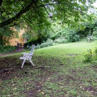
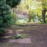
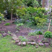
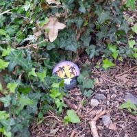
Lisa had a couple of hours to spare before going up in a hot air balloon (exciting!) so we went for a quick local walk, revisiting a bit of Cliftonwood we've seen before, exploring the secret garden I'd visited before that I thought she'd enjoy (I didn't take any new photos there) and then pushing on to another garden, Cherry Garden. Last time we passed this way, I'd noticed the gate, but we hadn't gone in as I'd assumed it was private. I'd since found it on CHIS's list of communal gardens in Clifton, so I wanted to have a look inside this time, and try to figure out whether it was private-communal or public, and possibly Council-owned, like several of the other gardens in Clifton.
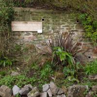
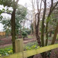
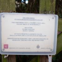
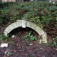
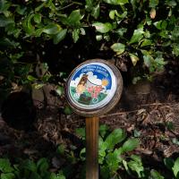
This was today's mildly underwhelming destination: I only realised after walking past the gates on an earlier walk and then seeing it later on the CHIS Clifton's Communal Gardens page that this was a public garden, so popped it on my list to take a second look. As Clifton communal gardens go it's small and fairly dark on a day like this, but I don't imagine many people know about it or use it, so it's appealing to me, as a generally quite introverted person, especially one who prefers shade to sun on bright days...
Leftovers with Lisa
01 May 2021
I didn't get to all the little leftover streets around the northeastern part of my area in today's wander, but I definitely knocked a few off the list, plus Lisa and I enjoyed the walk, and didn't get rained on too badly. We spotted the hotting-up of Wisteria season, checked out Birdcage Walk (both old and new), ventured onto the wrong side of the tracks1 and generally enjoyed the architecture.
1 Well, technically we probably shouldn't have been on the grounds of those retirement flats, but nobody started chasing us around the garden with a Zimmer frame
I've been here before, but thought Lisa might want to see this off-the-beaten-track public garden.
Clifton Village, including Oxford Place
15 Feb 2021
I've noticed Oxford Place as a tiny little side/back road I've overlooked on my wanders a few times. Today I decided to pop down and have a look, as well as taking a few general snaps of Princess Victoria Street, which I thought deserved more pictures, as it's basically my closest decent shops, and in the Beforetimes I'd visit the Co-Op up there all the time, as well as the cafes (you'll be missed, Clifton Village branch of Boston Tea Party, recently closed in favour of Eat a Pitta.)
I'm definitely becoming more familiar with the area through the One Mile Matt jaunts and associated reading. Today I didn't just think, "oh, I'll head home down that weird alleyway with the electrical substation in it"—no, I thought, "I'll head home down Hanover Lane", because I actually knew its name. And on the way back from there I nodded sagely to myself as I passed St Vincent's Road, knowing now which St Vincent it's likely to be (St Vincent of Saragossa) and also eyed up the modern flats on Clifton Vale and wondered if they might have been built on the site of the former Vauxhall Pleasure Gardens... I don't know all the answers, but at least I have some idea of the historical questions I'm interested in.
Arlington Villas and WH Smith Destruction
10 Feb 2021
I actually dashed up to Clifton to take a look at Arlington Villas, just around the back of St Paul's Road, one of those slightly odd little enclaves of overlooked housing that you know is there, but you never have a reason to visit or travel down. As it turned out, interesting though the (public) garden is, I actually took far more pictures of the now-completely-demolished site bounded by King's Road, Boyce's Avenue and Clifton Down Road where WH Smith and other places used to stand.
It's interesting to imagine how nice this little area would be if turned into a permanent public square, but of course the developers already have their planning permission to build it right back up again.
In Between
06 Feb 2021
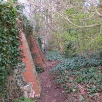
A lovely walk in the early spring sunshine with my friend Lisa. We headed directly for Jacobs Wells Road, to start off around the scene of one of our earlier walks, but this time took in Jacobs Wells from QEH upward, stopping to snap some photos of a Bear With Me, some interesting areas between Park Street and Brandon Hill including a peculiarly quiet enclave with a ruined old build I'd never found before, then crossed the Centre to grab take-away pies from Pieminister (I had the Heidi Pie) and head back to my place down the harbourside.
It's basically in the back yard of the Trinity Rooms, which is a house on Hotwell Road that I believe once connected in some way with Holy Trinity Church. My guess would be that that is some bit of leftover architecture from some demolition or change or other and someone's taken it upon themselves to keep it there as a bit of local history. Interesting!
Jacob's Well Wander
01 Feb 2021
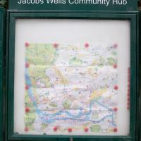
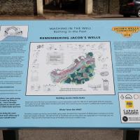
I just wanted to get some exercise, really, so I set out to knock off the lower bit of Jacobs Wells Road that I'd not managed to walk up yet. I set the new signboard that the community association had had erected as my destination, after reading about it on their blog.
As it turned out, I couldn't even read it, as the building that houses the actual Jacob's Well had water flooding out onto the pavement. I wonder if it was actual Jacob's Well water? Have the soles of my walking shoes been mystically blessed now?
You can't see much of the flood in the photos I snapped, but I did shoot a little video, too. Ed on Twitter said:
I spoke to the seller at the time with a view to buying it - I mentioned an old friend who grew up nearby remembers it flooding regularly. He swore blind my friend was wrong.
This was quite hard to read in person and I only nipped out for a quick walk in my lunch hour, so I didn't have the time to spend checking it out.
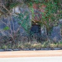
I'm glad my friend Lisa joined me today; she drove in from Shirehampton and told me that the Portway was looking rather lovely, so we set off that way. She's also braver than I am when it comes to doing urbex stuff, so this was just the opportunity to take a peek into the Portnalls Number One Railway Tunnel/Bridge Road Deep Valley Shelter whose entrance I'd found on a previous wander.
It was definitely dark and spooky and impressively big, with a side tunnel that Lisa explored that leads to a little door I don't think I've previously noticed on the side of the Portway. I didn't get many photos—even my astoundingly powerful little torch (£) didn't do much to light things up, and you're not going to get much joy hand-holding a camera in that darkness—but I did shoot a little video, which I might edit and add later.
After plumbing the bowels of the earth, we went up Bridge Valley Path to Clifton, explored some bits around the College and Pembroke Road, then came home via Foliage Cafe for coffee. Nice.
Lisa went right to the end of the side tunnel that leads to this door inside the Portnalls tunnel.
A Day Off Wander in Clifton
26 Feb 2021
I'm on the first day of a long weekend, and I certainly picked the right one for it. This may be the first proper spring-like day of the year in Bristol; it was glorious.
I headed up to Clifton, around the area where I got my Covid vaccine jab the other day, to knock off a few remaining roads in that area and because it would be good exercise for an extended lunchtime walk.
Along the way I saw some very Clifton sights, including an Aston Martin, some Jacobethan architecture, and some private college sports grounds. Mostly, though, I just enjoyed the sunshine, and took every opportunity I could to snap views across the city.
I wasn't going to take a very long walk on this nice spring evening; it just happened. I was going to knock off a path or two on Brandon Hill, home over centuries to hermits and windmills, cannons and Chartists, and then just wander home, stopping only to fill up my milk bottle at the vending machine in the Pump House car park.
However, when I heard a distant gas burner I stayed on the hill long enough to see if I could get a decent photo of both the hot air balloon drifting over with Cabot Tower in the same frame (spoiler: I couldn't. And only having the fixed-focal-length Fuji with me didn't help) and then, on the way home, bumped into my "support bubble", Sarah and Vik, and extended my walk even further do creep carefully down the slipway next to the old paddle steamer landing stage and get some photos from its furthest extreme during a very low tide...
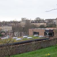
This is clearly the modern corner of QEH, though the turrets at the far right are from the 1847 Tudor Gothic Revival building. QEH was founded in 1586, but was originally housed in Gaunt's Hospital mansion house, Unity Street. (There's more information on the name Gaunt in an earlier photo of Gaunts Lane)...
John Carr's Terrace
16 Mar 2021
I wanted a nice simple lunch-hour walk that took me past a cafe today, and I managed to find the perfect road to knock off my list of targets to do it. Situated just off Jacobs Wells Road, right next to Queen Elizabeth's Hospital, John Carr's Terrace, and Rosebery terrace above it, which I'd completely forgotten existed, are a little cul-de-sac that many Bristolians will have wandered past a thousand times without ever seeing.
There's a reason it's next to QEH:
Known traditionally as "The City School", Queen Elizabeth's Hospital was founded by the will of affluent merchant John Carr in 1586, gaining its first royal charter in 1590.
John Carr's terrace itself isn't much to write home about, architecturally, but I like the secluded feel of it, and I really liked Rosebery Terrace with its little houses, commanding position and friendly, slightly tumbledown feel.
On the way home I popped into Foliage Cafe for a coffee and a very pleasant nutella and banana pastry, then walked home past the refurbishment of the old Thali Cafe into a new and interesting clinic...
Now the well house seems to have stopped overflowing and the sign board is no longer cordoned off, it's time for a closer look. Lots of good info here.
