Tagged: building
Nipping Up the Zig Zag to the Shops
19 Aug 2023
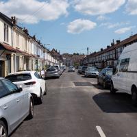
It's been a long while since I did one of these walks.
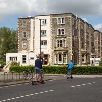
I'm thinking of finishing up the project by walking one or two last bits of road, thus being able to declare with all honesty that I've done my best to walk every public road within my mile (and quite a few alleyways besides.) As a prelude, and just because I felt like it, I decided to drag out the camera and GPS on this little wander to the local shops.
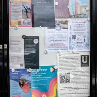
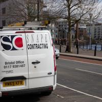
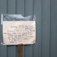
More notices, including a couple of newcomers to the local businesses: Hopewell, an estate agency, has opened up just down Hopechapel Hill in the place of The Landmark Practice (an environmental consultancy firm that seem to have moved out to Long Ashton) and HappyBack, who I'd noticed appearing down on the Hotwell Road a month or two ago.
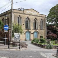
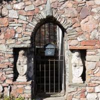
I may not personally be a fan of evangelical Christianity, but at least they keep the place looking nice. It's still very tidy since the recent renovation, installaltion of solar panels on the roof and repainting of the HOPE CHAPEL sign.
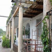
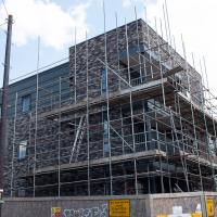
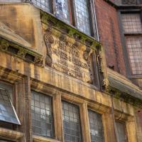
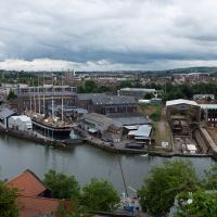
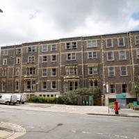
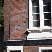
I was concerned about the state of Rock House, or at least its southern half, the last time I took a closer look at it while passing. Happily it seems to have been bought by someone prepared to fix up that drooping balcony. Here's hoping these repairs continue and my next photo of the place shows both sides of this old house (dated back to at least 1731 by a William Halfpenny engraving, no matter what the Listing says.)
Just behind Rock House you can see a bit of the Colonnade, sawn off at the end to make room for the widened Hotwell Road, I believe. Back in the day, according to 1925's The Bristol guide; being a complete ancient and modern history of the city of Bristol, the Hotwells and Clifton:
For those who prefer exercise to silting, there is the Colonade with shops, built beneath the rocks, and a parade about 800 feet long, shaded with trees, by the side of the river, so that the company may enjoy a dry and pleasant walk when it rains, or an airy, cool, and shady walk in the warmest season: also during the influx and efflux of the river, they may be entertained with the sight of the Merchant's ships, Steam packets, and Coasting vessels that generally pass up or down.
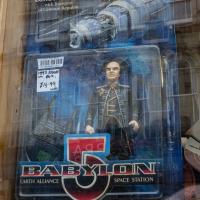
A random reminder of a TV show of my youth: Londo Mollari, the Centauri Ambassador to Babylon 5. Spotted in the window of the Oxfam shop on Victoria Street after I grabbed a coffee from Foliage Cafe.
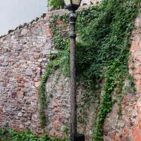
One of many exemplars of the sorry state of the historic cast iron lamp posts of Clifton Village. I get the feeling that the Council wish they'd all just rust away so that they can be replaced by cheap ugly lighting rather than needing any kind of maintenance.
On that somewhat sour note, I headed home before the few spots of rain I felt became anything more severe.
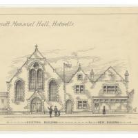
Since setting up a search for Hotwells on eBay I've mostly managed to restrain myself from buying much (or in one case, was outbid, luckily for my finances.) However, I couldn't resist a 1902 flyer for a singalong at the Terrett Memorial Hall, which would have stood five minutes' walk from my flat, overlooking Howard's Lock.
I've found out a fair bit about this non-denominational seaman's mission, including tracking down both a Loxton drawing and an aerial photo of it. The main thing that's eluded me, ironically enough, is finding out who Terrett was, so as a Memorial Hall it didn't do a very good job 😀.
EDIT: Ah! Did a little more digging and found that the Bristol Archives has a Bristol Dock Company document on file called "William Terrett, Esq.; corresp. etc. re proposed erection of a Mission Hall at Cumberland Basin, 1892", so that might be worth a look once the Archives are properly open again. Given that:
Sarah Terrett died suddenly on 25 November 1889, aged 53, after speaking at a meeting of the White Ribbon Army, the temperance organization she had founded in 1878. Following her death many people sent letters of sympathy to her bereaved husband, William. One of these, from the Rev. W. F. James, a minister of the Bible Christians, makes for especially interesting reading. The Bible Christian denomination, to which Sarah and William belonged, was one of the smaller Methodist connexions, and had its heartland in rural Devon, the area where she had grown up. James recalled the hospitality he enjoyed when visiting the Terretts’ home, Church House, in Bedminster, south Bristol...
...I wonder if William Terrett built the hall in memory of his late wife. They were clearly just the kind of temperance movement people who would've founded a seaman's mission to get people together to have a nice non-alcoholic singsong rather than a night out on the tiles.
Anyway. This walk to grab a coffee from Hopper Coffee in Greville Smyth Park was mostly an excuse to post the leaflet, a few other things I found related to it, and some pictures of how the site looks now. I would suggest that the present day is not an improvement.
The Loxton Collection, part of Bristol Library's Reference collection, has over 2000 pen and ink drawings that were created by Samuel Loxton in the first decades of the twentieth century for the Bristol Evening Post and Bristol Observer.
Helpfully, many of them have been scanned and posted to Flickr; you can browse more Loxton drawings including this one in the album "Loxton Illustrations: Part 3" (this picture is item #Q1071), and browse more albums of the drawings from the Library's albums page
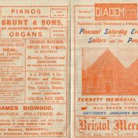
This was my random eBay purchase. I had no idea that the Terrett Memorial Hall had ever existed until I saw this leaflet up for sale.
There's some information on the hall on the Places of Worship database; as you can guess from the title of the leaflet it was basically a seaman's mission, with the aim "to promote the social, moral and religious welfare of sailors and provide sleeping accomodation for seamen, also free beds for destitute seafarers"
My favourite random thing on this leaflet is probably that the Surgeon Dentist is called Mr Heal.
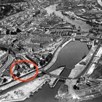
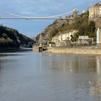
I was fairly sure the Terrett Memorial Hall would have faced Entrance Lock—after all, they'd be wanting to drum up trade from sailors!—and I eventually came across an aerial photo from 1934 on the ever-helpful Bristol City Docks website's Cumberland Basin page that confirmed my hunch.
I haven't had the time to find out when it was demolished, but the whole Cumberland Basin Flyover System (which you can see being built on that web page) had replaced this area by the mid-1960s.
This is photo PBA487 on that page, I think courtesy Bristol Museums Galleries and Archives.
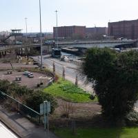
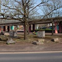
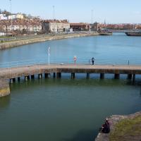
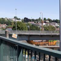
If the Terrett Memorial Hall were still there, its frontage would be roughly where those boulders are between the curve of railing in the middle of the picture and the flyover up to the Plimsoll Bridge a little further back, facing towards the lock gate you can just see on the other side of the road.
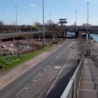
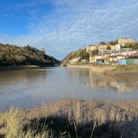
Here we'd be facing Terrett Hall square on. Crouching at work in the middle of the picture is one of the tireless people who are constantly found sprucing up Cumberland Piazza (or at least trying their best to make it look a little less awful.)
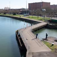
Complete with a fisherman. Quite at the moment, but as a sport it does at least already have a reputation for social distancing.
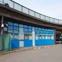
Which sounds imposing, but apparently it wasn't that secure, at least as far as a place to store the golden regalia of Bristol's mayor and mayoress goes, anyway. Oops.
I took this photo to remind myself to see if the Archives were open at all in this time of Covid. I've never been in, but all this recentl historical research has made it tempting.
I'm in the habit of going over to the Tobacco Factory Market on a Sunday. I think I've walked all the routes around that way, but as a Plimsoll Bridge swing let me cross the road to the far side of Brunel Way on my return journey and I took a couple of photos of the brownfield development at the old Ashton Gate Depot site I thought I'd call it a Wander and pop some photos up.
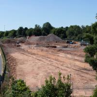
I walked back to the point I'd spotted all this activity from the far side of the road. This is the old tile merchant/concrete works/Ashton Gate Railway Depot/Bristol International Exhibition site. I imagine it was plenty of other things along the way, too. Here's an earlier snap with a bad photo from the far side of the site, but some detail on what the site was/will be along with a link to planning documents.
I'm currently toying with the idea of a little mini-website that takes a digitised and vectorised version of the Bristol International Exhibition plan (from 1914) and superimposes it on the same area today. It'd be interesting to see exactly where things were. My best guess from eyeballing it at the moment is that in 1914, this view would be looking towards the International Pavilion, Concert Hall and Art Gallery areas of the Exhibition, and we'd be standing on the train tracks that used to head for Ashton Avenue Bridge, which back then would have been a double-decker road and rail swing bridge, with the trains on the ground level deck, the road on the top deck, and a high-level swing control room above it all. Quite some feat of engineering.
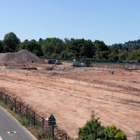
I wonder how many different things this patch of land has been over the years? I imagine it was one of the choice "brownfield" sites for some new flats down here. It's certainly doing its best to look very "brownfield" today!
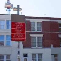
The Clean Air Zone is being introduced later this year (currently they say 28 November 2022, but I think it's already been delayed twice.)
The scheme will see charges instituted for certain vehicles entering parts of the city, especially older diesel cars. This is to encourage people to change these older cars or find alternative routes or modes of transport. Apparently there are grants and loans available for upgrades on offer to private citizens and businesses.
This should only have positive effects for me, as I live just inside the zone, and I drive a recentish petrol car with an efficient and not-so-pollutey engine. In a perfect world, therefore, this scheme means my area might eventually start meeting the government's standards for air quality. This Bristol 24/7 article has some good info, including an estimate that there are currently 300 premature deaths per year from traffic-related air pollution in the proposed Bristol zone.
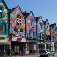
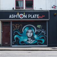
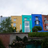
The street art is still looking good, but one of these properties has been turned into such low-end multiple-occupancy accommodation that it got into the Bristol Post this week with pictures of one tiny room with a shower alongside the bed serving as the sole room per person, with a toilet shared between four "studio rooms". I suppose this is actually better than the student accommodation I had in my first year at Warwick, but at least that was actually on campus...
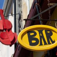
El Rincon is a long-established Spanish cafe/bar on North Street. The BAR sign always reminds me of the quirky typefaces used in things like The Pink Panther.
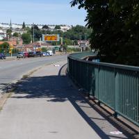
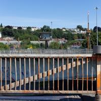
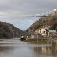
Ah, but it seems like the bridge is closing, which might make it nice and safe to cross over and have more of a look from the other side. First, though, we'll nip down and have a look at what's causing the swing.
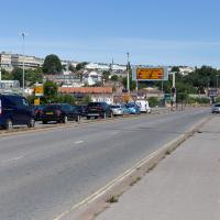
Now, what's actually meant to happen at this point is that all the traffic follows the giant flashing ALL TRAFFIC sign pointing to the exit ramp on the left. Then they go down the ramp, along a short stretch of road, cross the harbour at Merchants Road bridge (officially Junction Swing Bridge, in fact), join the Hotwell Road and continue on their merry way, without any cause for delay.
This never actually seems to happen, and a queue just forms here. Today this particularly annoyed the driver of a Waitrose van, presumably late for a delivery and stuck behind what he clearly thought were a line of idiots that he hooted angrily at for quite some time, to as much effect as you'd imagine.
Pastures New!
17 Jul 2021
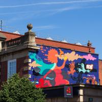
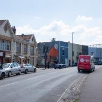
Okay, not much in the way of actual pasture to be had in Bedminster these days, like most of Bristol, but I did take advantage of the current rather toasty weather in Bristol to go and sit under a tree in Greville Smyth Park to read a book for a while before firing up the GPS and taking a little detour around some back streets of Ashton and Bedminster rather than going straight to Coffee #1 for an espresso frappé. This is the first walk in a while where I've actually crossed off an entire new street (the frankly unexciting Carrington Road) as well as exploring a couple of back alleys, just because they were there, really. Along the way I spotted a few examples of graffiti of various qualities, including a live work-in-progress by SNUB23 on Ashton Road and the finished Six Sisters project on North Street.

By all accounts a fine cafe in the greasy spoon archetype. Top right you can see a little tribute to Ashton Gate football stadium, a stone's throw away. Currently the stadium is being used as a Covid-19 vaccination centre.
It was actually the sound of Six Underground, the astoundingly good Sneaker Pimps number, coming from this direction that caught my ear before the in-progress mural caught my eye, but they both had the same source, as it turned out...
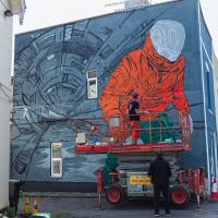
I think I'm right in saying that that's snub_23 popping up a new piece, but I'm only really basing that off some quick Instagram research and some assumptions; I'm not exactly plugged into the Bristol graff scene and I didn't want to interrupt the conversation.
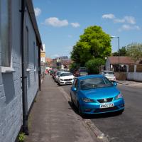
I'd noticed I'd missed this end bit of Durnford Street in previous wanders, so on my way to knocking off some full-length roads (and alleyways, as it turned out) I took a snap. It's not very prepossessing.
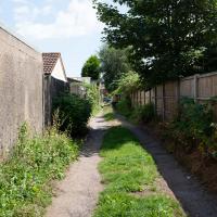
In my defence, this little alleyway/service road looked more like a road on the map. Still, seeing as I'm here...
With bonus transom. I thought I might have snapped the transom before, but I think I was thinking of this one.
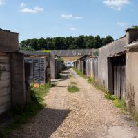
Not much to say, really. The strange mock-Tudor upper halves of the right-hand-side of the street were about the only distinguising feature, and personally I'm not sure that's distinguishing in a good way.
I've clearly sniped this one from the end of the road on a previous pass, but this is definitely the first time I've actually walked the length of it.
According to Google Street View, a few years ago this was just a modest corner house. I imagine someone's made a tidy profit.
Man on a Mission
17 Apr 2021
I went rather outside my area today, as I went to pick something up from the Warhammer shop on Wine Street (Games Workshop as-was, and before that I think perhaps a rare retail outlet for Her Majesty's Stationery Office? I may be mis-remembering...) Anyway, a friend of mine wanted something picking up and posting to him, so I figured I'd knock some streets off my list along the way.
I first headed for the St George's Road area, walking down the narrow Brandon Steps and finding some strange wall art on Brandon Steep, then headed to the Old City via Zed Alley. The Warhammer shop visit was friendly and efficient, and, mission accomplished, I treated myself to a sausage roll and a flat white from Spicer + Cole, to take away and eat in Queen Square with its current decoration of hearts. I finished off with a detour up Park Street, looking out for St John's Conduit markers, before finally crossing Brandon Hill on the way home.
Quite a long wander, all told, and I'm a bit knackered today...
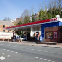
Who was it that decided that petrol stations had to be ugly? It's not like oil companies don't have money...
Apparently they're a "Cloud and Cyber Security Specialist". Let's not let them near this website, please; I wrote a lot of the code in a hurry when I was tired...
A Cliftonwood Revisit with Lisa
10 Jul 2021
Lisa had a couple of hours to spare before going up in a hot air balloon (exciting!) so we went for a quick local walk, revisiting a bit of Cliftonwood we've seen before, exploring the secret garden I'd visited before that I thought she'd enjoy (I didn't take any new photos there) and then pushing on to another garden, Cherry Garden. Last time we passed this way, I'd noticed the gate, but we hadn't gone in as I'd assumed it was private. I'd since found it on CHIS's list of communal gardens in Clifton, so I wanted to have a look inside this time, and try to figure out whether it was private-communal or public, and possibly Council-owned, like several of the other gardens in Clifton.
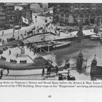
Photo taken from the book Bygone Bristol: Hotwells and the City Docks, by Janet and Derek Fisher.
You can see the gate from the previous photo at the start of Narrow Quay. Plenty of other changes in the area, too: the statue of Neptune stands at the head of the water; there are no Cascade Steps yet; cranes still stand on Broad Quay, and you can just about tell that there's still a main road running right across the middle of Queen Square in the distance.
The gate stands half-closed; presumably before the E and W sheds were converted into the cinemas, bars and restaurants of the Watershed and other publically-accessible attractions there was still some need to keep the (working) dockside a little more secure, and I'm guessing it might have been locked at night.
The gates are listed and have apparently been there since 1894.
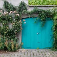
I'm assuming it doesn't get opened much, or there'd be a little more pruning going on. Still, very pretty for a garage...
I was just about starting to feel better—the antibiotics seemed to have kicked in for my dental issues, and it had been some days since I'd left the house, and I was at last starting to get itchy feet. So, a wander. But where? Well, there were a few industrial bits near Winterstoke Road in the Ashton/Ashton Vale areas of Bristol that needed walking. I knew they were likely to be quite, well, unattractive, frankly. So why not do them while I wasn't feeling exactly 100% myself? Maybe it would fit my mood. Hopefully you're also in the mood for a bit of post-industrial wasteland, for that's what some of this feels like...
Then, at the last minute, I thought again about the Bristol International Exhibition—I've got a book about it on the way now—and that gave me another goal, which could just about be said to be in the same direction, and I decided to walk significantly further than my normal 1-mile limit and try recreating another historical photo...
Sadly I don't know much about the Ashton area; it's just on the edges of my mile and I rarely have cause to go there. It's brimming with history, I'm sure: the whole South Bristol area rapidly developed from farmland to coal mines to factories to its current interesting mixture of suburbs and industrial work over the last few hundred years. As a more working class area less attention was paid to it by historians, at least historically-speaking, than the Georgian heights of Clifton, and much of it has been knocked down and reinvented rather than listed and preserved. I see here and there some of this lack is being addressed, but I'm afraid I'll be very light on the history myself on this wander, as most of my usual sources aren't throwing up their normal reams of information as when I point them at Clifton, Hotwells or the old city.
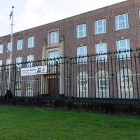
If one tried to conjure an image from just the phrase "HMS Flying Fox", this probably isn't what would spring to mind, is it? It's not a ship, it's not flying, and it's not a fox, for starters.
Royal Navy Reserves HQ for Wales & South West of England, I think it says on the sign at the far end.
Note the Egyptian kings on pillars at the top of the pilasters bracing the doorway. No earthly clue what they're doing there. As usual, Bristol's historical sources seem to peter out south of the river.
Wikipedia says on Egyptian Revival Architecture:
By the end of the 19th century, the style had very nearly disappeared, but in 1922 with Howard Carter's discovery of Tutankhamun's tomb the style underwent a dramatic revival it was used particularly for cinema architecture and sometimes for factory buildings.
...and given the surroundings it wouldn't entirely surprise me to find that this was originally a factory, at least, though the 1940 date in between the Egyptians suggests they were a little late with the styling.
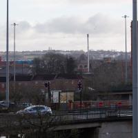
This may be somewhere around my actual destination today, though perhaps a little too much toward the east.
The buildings and green space on the hill in the background are the Knowle West Health Park. I'm pleased to have figured this out by using an OS map and a ruler and projecting a line from where I'm standing through the Tobacco Factory flag that you can just see poking up from Bedminster (you can see it on the corner of the building in this earlier pic](https://omm.gothick.org.uk/image/7175), then looking for densely-packed contour lines further out of town. Very old-school, but it worked!
I'm probably heading in more of a Bedminster Down direction. It's a similarly elevated green space further west, which is hidden behind the bond warehouse on the right in this pic.
I nearly didn't take this photo, having snapped this view so many times before, but I do find it almost completely irresistible.
I've often wondered about writing some kind of neural-computing based app that could look through all of my photos for snaps of this view and mash them all together into a time-lapse, or something, but that would be quite the project.
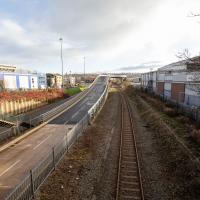
Raised section of the Metrobus route. I've been this way before on a Wander, but also, on a day when there weren't any buses, actually walked that ramp. It was fairly underwhelming.
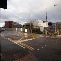
I did know this existed at some point, I think, but I'd completely forgotten that there was a level crossing within my mile. We need to wander over it, too, as this road, Ashton Vale Road, is one of the roads within my mile that I've not ventured down yet.
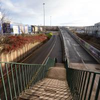
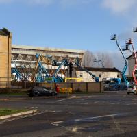
Partly that's because no bugger wants to walk down roads like this with me, as it's basically just industrial wasteland, especially in this interregnum period, where there's not even the buzz of industry to keep things interesting, but seeing as we're here...
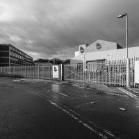
"Hello? Yes, I'd like to order a cubic mile of bland industrial building, please. No, anything'll do."
A Longer-than-it-looks Walk With Lisa
06 Jun 2021
The track on the map doesn't tell the whole story of this walk with Lisa around and about Clifton, Berkeley Square, Brandon Hill and the harbourside, because the batteries on my GPS ran out while we were on the roof of Trenchard Street car park, it seems. Oh well. I think I did most of the area I was interested in finishing off around the University; there were only a few new bits around Brandon Hill that won't be on the track, and I can easily do them again.
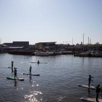
Still, technology woes aside it was a nice walk, albeit a bit warm for climbing all those hills, and sat on the harbourside watching the world go by for a while, too. It was good to see the Bristol Ferry Boats carrying people around again, especially.
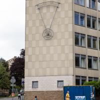
I've sometimes idly wondered what this thing on the side of Richmond Heights is. I'm told by KYP Bristol (who certainly know their local history) that it used to have the name of the building on it, but the letters fell off.
This means that somewhere out there, a student almost certainly has all the letters they need to make a large sign saying "CHERISH MID THONG"...
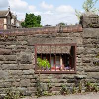
No idea why there's a window in this wall. The wall looks a lot older than everything surrounding it, so perhaps it's just some historical vestige leftover in between bits of University development.
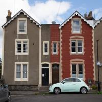
We're just outside my mile radius here, but Osborne Villas Looked too tempting to just walk past.
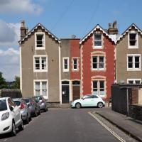
Looked a bit to me like number 16 had tilted over to the left a bit since it was built...
John Carr's Terrace
16 Mar 2021
I wanted a nice simple lunch-hour walk that took me past a cafe today, and I managed to find the perfect road to knock off my list of targets to do it. Situated just off Jacobs Wells Road, right next to Queen Elizabeth's Hospital, John Carr's Terrace, and Rosebery terrace above it, which I'd completely forgotten existed, are a little cul-de-sac that many Bristolians will have wandered past a thousand times without ever seeing.
There's a reason it's next to QEH:
Known traditionally as "The City School", Queen Elizabeth's Hospital was founded by the will of affluent merchant John Carr in 1586, gaining its first royal charter in 1590.
John Carr's terrace itself isn't much to write home about, architecturally, but I like the secluded feel of it, and I really liked Rosebery Terrace with its little houses, commanding position and friendly, slightly tumbledown feel.
On the way home I popped into Foliage Cafe for a coffee and a very pleasant nutella and banana pastry, then walked home past the refurbishment of the old Thali Cafe into a new and interesting clinic...
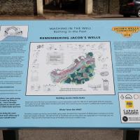
Now the well house seems to have stopped overflowing and the sign board is no longer cordoned off, it's time for a closer look. Lots of good info here.
Just adjacent to QEH, John Carr's terrace is named for the 16th-century English merchant and founder of the school next door.
Bower Ashton is an interesting little area just south of the river from me—in fact, the Rownham Ferry used to take people over from Hotwells to Bower Ashton, operating from at least the twelfth century to around the 1930s.
It's a strangely contradictory little area, with a cluster of old and new houses sandwiched in between the busy A-roads and significantly more industrial area of Ashton and the bucolic country estate of Ashton court roughly east to west, and also between Somerset and Bristol, north to south.
I've been around here before, mostly poking around Bower Ashton's arguably most well-known bit, the Arts faculty campus of the University of the West of England, but I'd missed at least Parklands Road and Blackmoors Lane, so I initially planned just to nip across briefly and wander down each in turn. On a whim, though, I texted my friends Sarah and Vik in case they were out and about, and ended up diverting to the Tobacco Factory Sunday market first, to grab a quick flat white with them, extending my journey a fair bit.
To start with, though, I nipped to a much more local destination, to see something that you can't actually see at all, the Gridiron...
(I also used this wander as a test of the cameras in my new phone. I finally upgraded after a few years, and the new one has extra, separate wide and telephoto lenses compared to the paltry single lens on my old phone. Gawd. I remember when speed-dial was the latest innovation in phones...)
Maybe I'll have to go have a look at the front of these houses; I think I missed them on earlier walks
I decided to try out the three lenses on my new iPhone camera. This is the "telephoto" lens. It does a reasonably creditable job, though the phone is oversharpening things a bit and I'm not sure I like the colours much.
And here's the middling lens on the camera. Not bad, though on every shot I've taken on the iPhone so far where it's been able to see blue sky it's managed to oversaturate it for my tastes. Still, I guess they're aiming at the mass market, and the mass market does seem to like oversaturated colour and the sharpening turned up to eleven.
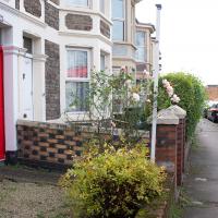
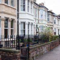
Most of the front gardens on this little stretch retain what's presumably the original garden walls, all rather nicely put together in a chequerboard pattern of bricks.
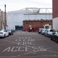
It's a nice little terrace, but given that it backs onto the city ground, I'd imagine you have to be a football fan to really enjoy it here.
At this point I've already abandoned my original plan of heading straight to Parklands Road, as some friends had texted me to say there were at the tobacco factory market and would I like to join them for a coffee? Best laid plans, so forth...
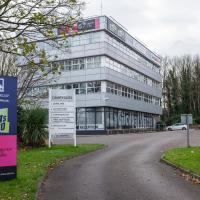
The South West Broadcast Centre for Celador Radio, it says. That certainly explains the big dipole antenna on the roof. I haven't heard of Hits Radio, but I suppose I'm generally more your Radio 4 type.
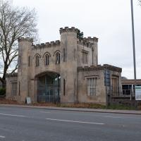
The original entrance to the Ashton Court Estate, apparently. The Clifton Lodge entrance is rather grander.