Tagged: knowle-west
Near and Far
05 Jan 2022
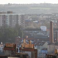
I took advantage of a rare recent day where it wasn't tipping down with rain to get away from my desk on a lunchtime workday and head up to Clifton Village. I'd hoped to snap a reproduction of historical photo which I'd worked out had been taken from the Suspension Bridge, but the gods were not smiling on me. Still, taking only a nice long lens with me worked out very well as the lovely haze of the day made more distant views quite dramatic...
The Nova Scotia pub bottom right, then behind it the chimney of the previously coal-fired pump house at Underfall Yard. In the background behind that and to the right is the Tobacco Factory, with what looks like a little red shed on its roof that I presume is actually a stairwell exit to the roof. On the left-hand side at about the same distance away is the large council block of Little Cross House. It always seems quite calm and tidy when I pass it, which is very regularly, but the Bristol Post painted a different picture in 2019 in their story headlined "Residents of 'forgotten' tower block demand council action over 'nightmare' living conditions":
People living in Little Cross House, a 13-storey council tower block in Southville, said their lives are plagued by poor living conditions, damp and mould, and neighbours from hell, drug dealers, discarded needles, vandalism and anti-social behaviour.
In the far distance, across the Southville rooftops, are the green hills of the Knowle West Health Park, I think.
I was just about starting to feel better—the antibiotics seemed to have kicked in for my dental issues, and it had been some days since I'd left the house, and I was at last starting to get itchy feet. So, a wander. But where? Well, there were a few industrial bits near Winterstoke Road in the Ashton/Ashton Vale areas of Bristol that needed walking. I knew they were likely to be quite, well, unattractive, frankly. So why not do them while I wasn't feeling exactly 100% myself? Maybe it would fit my mood. Hopefully you're also in the mood for a bit of post-industrial wasteland, for that's what some of this feels like...
Then, at the last minute, I thought again about the Bristol International Exhibition—I've got a book about it on the way now—and that gave me another goal, which could just about be said to be in the same direction, and I decided to walk significantly further than my normal 1-mile limit and try recreating another historical photo...
Sadly I don't know much about the Ashton area; it's just on the edges of my mile and I rarely have cause to go there. It's brimming with history, I'm sure: the whole South Bristol area rapidly developed from farmland to coal mines to factories to its current interesting mixture of suburbs and industrial work over the last few hundred years. As a more working class area less attention was paid to it by historians, at least historically-speaking, than the Georgian heights of Clifton, and much of it has been knocked down and reinvented rather than listed and preserved. I see here and there some of this lack is being addressed, but I'm afraid I'll be very light on the history myself on this wander, as most of my usual sources aren't throwing up their normal reams of information as when I point them at Clifton, Hotwells or the old city.
This may be somewhere around my actual destination today, though perhaps a little too much toward the east.
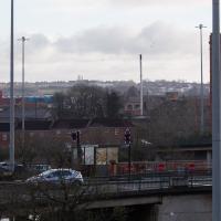
The buildings and green space on the hill in the background are the Knowle West Health Park. I'm pleased to have figured this out by using an OS map and a ruler and projecting a line from where I'm standing through the Tobacco Factory flag that you can just see poking up from Bedminster (you can see it on the corner of the building in this earlier pic](https://omm.gothick.org.uk/image/7175), then looking for densely-packed contour lines further out of town. Very old-school, but it worked!
I'm probably heading in more of a Bedminster Down direction. It's a similarly elevated green space further west, which is hidden behind the bond warehouse on the right in this pic.

