Tagged: electricity
Bower Ashton is an interesting little area just south of the river from me—in fact, the Rownham Ferry used to take people over from Hotwells to Bower Ashton, operating from at least the twelfth century to around the 1930s.
It's a strangely contradictory little area, with a cluster of old and new houses sandwiched in between the busy A-roads and significantly more industrial area of Ashton and the bucolic country estate of Ashton court roughly east to west, and also between Somerset and Bristol, north to south.
I've been around here before, mostly poking around Bower Ashton's arguably most well-known bit, the Arts faculty campus of the University of the West of England, but I'd missed at least Parklands Road and Blackmoors Lane, so I initially planned just to nip across briefly and wander down each in turn. On a whim, though, I texted my friends Sarah and Vik in case they were out and about, and ended up diverting to the Tobacco Factory Sunday market first, to grab a quick flat white with them, extending my journey a fair bit.
To start with, though, I nipped to a much more local destination, to see something that you can't actually see at all, the Gridiron...
(I also used this wander as a test of the cameras in my new phone. I finally upgraded after a few years, and the new one has extra, separate wide and telephoto lenses compared to the paltry single lens on my old phone. Gawd. I remember when speed-dial was the latest innovation in phones...)
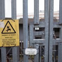
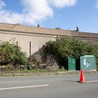
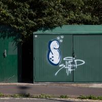
That's quite some hefty kit. I presume the nearer thing is a heat exchanger for the transformer. Certainly a different look from the last substation I remember snapping.
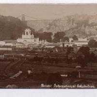
I thought this was such an impressive sight I should pop an archive photo up in the wander for you to see.
Postcard from the Vaughan Collection/Bristol Archives.
Nowhere New
10 Dec 2020
I didn't have any time to find a new place to go today, so I'm treading old ground here. I did buy a tub of duck food from Amazon last week and today I remembered to take a little bagful of it with me on my trip to Imagine That coffee, and spent a few minutes feeding the marina slipway ducks on the way back. This is a Bristol tradition I've seen other people doing many times, but never tried myself. It was quite genteel until the seagulls cottoned on, then it became something of a brawl.
"A dramatic modern space behind a conventional facade; The Underfall Yard electricity substation on Avon Crescent was begun in 1905. It was probably the first reinforced concrete building in the city, and one of the earliest in the UK." — via KYPBristol
I'm afraid that this is a bit of a badly-curated wander, where I mostly just popped out to find out a little of the history of Underfall Yard and poke around the various open workshops, and, in hindsight, really didn't take pictures in any kind of coherent order. So there's a lot of pictures, but they don't really tell the story that, in hindsight, I seem to have been trying to tell, of the unusual electrical substation in Avon Crescent, the Bristol Electricity that predates the National Grid but is still in use, the history of the hydraulic power house... It's a bit of a mess.
But I suppose sometimes these wanders—always chronologically presented in the order I walked and took photos—simply will sometimes be a bit of a mess. Let's hope you still get something out of it, anyway...
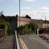
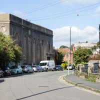
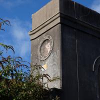
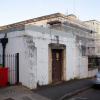
It's very hard to get a decent look at this building. This is the top half of the back of it.
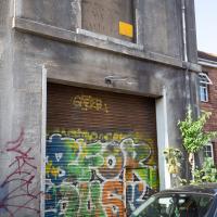
This building is, or was, an electrical substation. I heard an unconfirmed rumour that the building itself is now actually empty, and that the entire substation guts are now in these boxes. I have no idea whether that's true or not.
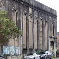
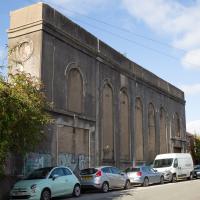
You can see this once apparently bright and airy building has had every window bricked up.
I understand that something in or around this building still supplies the odd electrical requirements (specifically, 360V "Bristol voltage") for some bits of Underfall Yard, which is our next stop, so more about that when we get there.
While it's not a listed building, is is notable: it's one of the earliest reinforced concrete buildings in the UK, apparently, construction starting in 1905. I assume it was up by 1907, as that's when Undefall Yard installed their electric pumps.
This oddity of history predates the National Grid and was originally fed from Feeder Road power station (well, Avonbank, on Feeder Road, to be precise. We've seen a bit of that history before, as a line marker for the line from Portishead to Feeder Road.) It was connected to Feeder Road by 1906, with a 6,600V line.
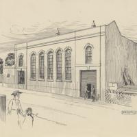
I've added a couple of historic views of the building as the next two photos in the wander, but I'll also pop this link to a Loxton drawing of the Avonbank electricity works, 1908 here.
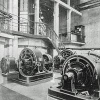
Via this Tweet and taken from KYP Bristol, showing the interior with a couple of Westinghouse rotary converters and a Peebles-La Cour motor converter, assuming this picture ties up roughly with this 1908 Institute of Mechanical Engineers' visit to works.
You can see a picture of similar Westinghouse converters to the two at the back in the Wikipedia rotary converter page and a Peebles converter that looks very similar to the one in the foreground on the cover of the Peebles motor converter catalogue in the sidebar of their entry in Grace's Guide. I'm guessing the additions on the ends of the Westinghouse converters were for different voltages? A rotary converter is basically a motor connected to a dynamo, so extra dynamos with different windings would give you different voltage outputs, I suppose, but I know very little about power generation.
And here's the Loxton picture of the exterior, from the Bristol Libraries collection. Seems such a shame to have bricked up those lovely windows.
An Evening Wander to the Gallows
06 Apr 2021
I'd originally intended just to pop up to the area around Alma Road, where I'd missed a few streets on earlier wanders. It was such a nice evening, though, I decided to extend my walk up to the very top of Pembroke Road, just outside my one mile radius, to take a few snaps of something intriguing I'd found in my researches.
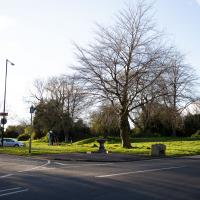
I've driven, walked and jogged past the little triangle of land at the top of Pembroke road a great deal in my time in Bristol, but I didn't know that it used to be the site of a gibbet, in fact that the road itself there used to be called Gallows Acre Lane. According to the Durdham Down history trail, by Francis Greenacre (an excellent name for a Downs researcher!) among other sources:
...it was below this quarry near the top of Pembroke Road, once called Gallows Acre Lane, that a gibbet stood. It was sometimes occupied by those who had committed robberies on the Downs and was last used in 1783 to hang Shenkin Protheroe for the murder of a drover. Stories quickly spread that he descended from the gibbet at midnight every night and stalked through Clifton. Such was the alarm that his body was cut down
and buried.
Also very close to this little triangle of land was one of the gates of the extensive turnpike system...
Anyway. Along the way I encountered a wooden tortoise and a real squirrel, among other things. It was a good walk, and more light in the evenings means I can move my wanders out of the ticking countdown clock of work lunch-hours and be a bit more leisurely.
...was the former name of this part of Pembroke Road. From The Downs History Trails No 1:
. It was below this quarry near the top of Pembroke Road, once called Gallows Acre Lane, that a gibbet stood. It was sometimes occupied by those who had committed robberies on the Downs and was last used in 1783 to hang Shenkin Protheroe for the murder of a drover. Stories quickly spread that he descended from the gibbet at midnight every night and stalked through Clifton. Such was the alarm that his body was cut down
and buried.
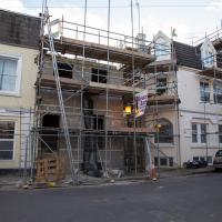
I seem to remember that number 19 was one of those places that looked like it could fall down at any minute. Maybe it did.
Autonomous Vehicle
14 Jul 2021
As it turned out, I didn't manage to get a coffee on my lunchtime coffee trip, as Imagine That were briefly shut down by a Covid-19 exposure notification (false alarm, it seems.) On the plus side, my trip was made worthwhile by spotting a couple of people from the University of Bath Mechanical Engineering Department testing an autonomous body-finding catamaran, which isn't a phrase I was ever expecting to write...
Sequel Injection
07 May 2021
I saw this tweet the other day and started thinking of my second Covid-19 vaccination as my "Sequel Injection" (to a geek, it's funny. You'll have to take my word for it.) Whatever you call it, this morning I went and got it.
It was in the same place I got my initial injection—my left arm! No, okay, it was at the Clifton College Prep School. I didn't take any photos of the event itself; the NHS production line is so efficient you barely have time to do anything else, even if the privacy of other patients wasn't a factor.
Along the way I mused at all the road resurfacing going on in Clifton, and also discovered a secret (okay, not-well-known and possibly slightly trespassey) way into Canynge Square, and on the way back I knocked off a few streets from my "leftovers list" of north-east Clifton. I've got much of Clifton done now, with the only obvious "to dos" on the east side of Whiteladies Road...
It was quite a long walk, and I'm feeling pretty tired now, though that might be the effects of the jab too, I suppose. Anyway. Tomorrow and Monday I'm walking outside Bristol, I think, and I imagine my feet will need some recovery time on Sunday, so it might be a while before I post another Wander.
Leftovers with Lisa
01 May 2021
I didn't get to all the little leftover streets around the northeastern part of my area in today's wander, but I definitely knocked a few off the list, plus Lisa and I enjoyed the walk, and didn't get rained on too badly. We spotted the hotting-up of Wisteria season, checked out Birdcage Walk (both old and new), ventured onto the wrong side of the tracks1 and generally enjoyed the architecture.
1 Well, technically we probably shouldn't have been on the grounds of those retirement flats, but nobody started chasing us around the garden with a Zimmer frame
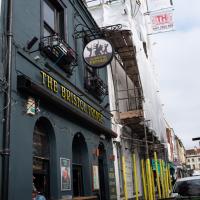
Apparently they're a London-based multimedia production house and this is their first "regional facility". Which presumably explains why they're just over the road from the BBC; I imagine they want to provide outsourcing to Auntie.
Clifton Village, including Oxford Place
15 Feb 2021
I've noticed Oxford Place as a tiny little side/back road I've overlooked on my wanders a few times. Today I decided to pop down and have a look, as well as taking a few general snaps of Princess Victoria Street, which I thought deserved more pictures, as it's basically my closest decent shops, and in the Beforetimes I'd visit the Co-Op up there all the time, as well as the cafes (you'll be missed, Clifton Village branch of Boston Tea Party, recently closed in favour of Eat a Pitta.)
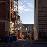
I'm definitely becoming more familiar with the area through the One Mile Matt jaunts and associated reading. Today I didn't just think, "oh, I'll head home down that weird alleyway with the electrical substation in it"—no, I thought, "I'll head home down Hanover Lane", because I actually knew its name. And on the way back from there I nodded sagely to myself as I passed St Vincent's Road, knowing now which St Vincent it's likely to be (St Vincent of Saragossa) and also eyed up the modern flats on Clifton Vale and wondered if they might have been built on the site of the former Vauxhall Pleasure Gardens... I don't know all the answers, but at least I have some idea of the historical questions I'm interested in.
Last time I was in I saw a jazz gig in the back room. It wasn't entirely my cup of tea, but hey, it was better than being cooped up at home for a year, so Yay! for the Beforetimes.
Arlington Villas and WH Smith Destruction
10 Feb 2021
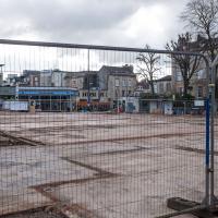
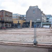
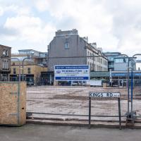
I actually dashed up to Clifton to take a look at Arlington Villas, just around the back of St Paul's Road, one of those slightly odd little enclaves of overlooked housing that you know is there, but you never have a reason to visit or travel down. As it turned out, interesting though the (public) garden is, I actually took far more pictures of the now-completely-demolished site bounded by King's Road, Boyce's Avenue and Clifton Down Road where WH Smith and other places used to stand.
It's interesting to imagine how nice this little area would be if turned into a permanent public square, but of course the developers already have their planning permission to build it right back up again.
In Between
06 Feb 2021
A lovely walk in the early spring sunshine with my friend Lisa. We headed directly for Jacobs Wells Road, to start off around the scene of one of our earlier walks, but this time took in Jacobs Wells from QEH upward, stopping to snap some photos of a Bear With Me, some interesting areas between Park Street and Brandon Hill including a peculiarly quiet enclave with a ruined old build I'd never found before, then crossed the Centre to grab take-away pies from Pieminister (I had the Heidi Pie) and head back to my place down the harbourside.
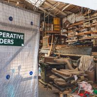
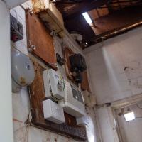
No idea what this place would have been, but there's what looks like one of those old-school bells for a phone that needs to be heard across a work site of some kind, and the sockets say "SITE POWER". Given the lack of integrity in the roof, I doubt it's still connected...
