Tagged: electricity
A Random New Year's Day Wander
01 Jan 2022
I picked a fairly arbitrary reason for a wander today. Really, I just wanted to do a New Year's Day wander just to get out of the house and to set a precedent for the year to come.
My ostensible reason was to investigate what looked like a road on my map that quartered the lawn in front of the Ashton Court mansion. As it turned out, this is just a muddy footpath/desire line similar to a half-dozen other tracks nearby, and must be some kind of bug or misclassification with the mapping system I'm using, but that's not important. What's important is that I went for a little walk on the first day of the year. As a bonus, I did happen to wander down a couple of sections of new footpath, so technically I broke some new ground too, which is nice.
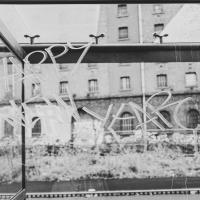
It didn't take long for someone to scrawl the sentiments of the season on a bus shelter.
Near and Far
05 Jan 2022
I took advantage of a rare recent day where it wasn't tipping down with rain to get away from my desk on a lunchtime workday and head up to Clifton Village. I'd hoped to snap a reproduction of historical photo which I'd worked out had been taken from the Suspension Bridge, but the gods were not smiling on me. Still, taking only a nice long lens with me worked out very well as the lovely haze of the day made more distant views quite dramatic...
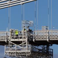
If I'd really considered it, the fact that there was a bloke in high vis standing on the bit of the bridge I wanted to take a photograph of might have warned me what was going to happen...
Damn it. That's the bit I wanted to take my photo from. Still, at least on the way here I got some nice pics that I probably wouldn't have tried if I hadn't taken long lens out specially.
Lunchtime Reproduction (of an old photo...)
17 Jan 2022
This was basically the quick lunchtime jaunt I tried to do at the beginning of January, only this time I actually managed to get to roughly the viewpoint I'd been hoping for to recreate a historical photo of the Bristol International Exhibition.
I did this walk about a month ago, but I've been a bit poorly and not really up to doing much in my spare time, and it's taken me this long to even face processing even these few photos. Hopefully normal service will be resumed at some point and I can carry on trying to walk any roads and paths that I need to do to make this project feel complete...
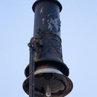
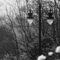
Poor thing needs a lick of paint. If it did used to be an electric arc lamp, I wonder when it last actually worked like one?
Anyway, time to stop my historical wanderings for the day, it's time to pop back home for an afternoon's work, more's the pity...
Leigh Woods Purple Path
12 Mar 2022
There's a few tracks in Leigh Woods that lie within my mile and show up on my map but that I've not walked yet, so I decided to take one of my traditional big long walks through the woods on this nice crisp sunny morning.
For years—decades, even—I've been doing a similar route from my place, along the towpath to the far woods entrance, up the hill for a varied walk on one of the marked tracks and then across the Suspension Bridge to Clifton Village for a coffee-based reward. It's my default "long walk", really, and I almost always enjoy it. Today, at last, spring actually seemed to be springing, which made for some extra positivity...
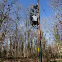
Presumably, at some point in the past, the electric lines rising out of the ground here were actually connected to somewhere else from this post.
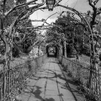
Easter Monday Gardens and Flowers
18 Apr 2022
I didn't really set out with a theme of flowers and gardens in mind for this walk. I just fancied heading up to Clifton Village to get lunch. As it turned out, though, Spring was springing, so a minor theme emerged as I started off with the graveyard flowers of Hope Chapel and wandered up to see the beginnings of the new wildflower garden at Clifton Hill Meadow.
I've been pretty awful at reading so far this year, apparently averaging about one book per month. That's a far cry from 2019, say, where I got through 41 books in the year. Today's wander was prompted by my rubbish reading, as I needed to go hand back some books to the library, because I'd managed to renew them so many times that I hit the limit on renewals. Oops. Several of them were still unread.
So, off to the Central Library for me, tail between my legs. On the way there I did my best to recreate a historical photo of Dowry Square; while I was in the area I walked under the adjacent Norman arch and poked around behind the Cathedral, and I also had a little diversion to the city centre and came back along the south side of the river, hitting some trouble with the lock gates as I finally crossed the harbour back towards home.
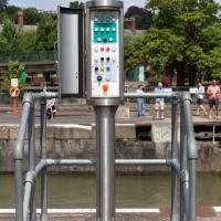
...which was good in some ways; I've always been curious about the control panel for the lock gates, and as the lockkeeper went to have a closer look at the gates themsevles I took this snap and, in the next photo, a close-up.
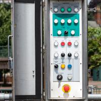
There's something very pleasing about industrial switchgear to me. This is comparatively modern, put in the last time the lock gates were replaced/refurbished, from what I remember, but still has that pleasingly 1950s look of good solid gear.