Tagged: mountain
Ticking Off a Pocket of Paths in Leigh Woods
03 Jun 2022
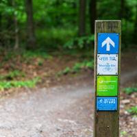
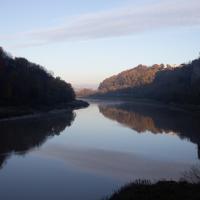
I managed to go for a wander a while ago that was meant to finish off a little tangle of paths in Leigh Woods, or at the very least finish off my wandering of the Purple Path there. And I managed to miss doing either of those things through some kind of navigational incompetence.
Today I woke up with a bit of a headache, feeling a bit knackered as soon as I dragged myself out of bed, but at least with the energy to realise that I'd be better off (a) going for a walk in what looked likely to be the last of the Jubilee weekend sunshine than (b) moping around the flat until it started raining, at which point I could mope more thoroughly.
I had a look at my map, considered going to Ashton Court, but remembered that there was a music festival there today, and instead found these little leftovers of Leigh Woods and decided to have one more try at walking them.
Royal York Crescent
02 Nov 2020
I've taken a lot of photos of Royal York Crescent over the years. This time I walked right to the dead-end bit at the far west corner and found a plaque to the Empress of the French. Call me hard to impress, but among the scientists, novelists, architects and artists whose plaques litter the rest of the area, that seems quite minor claim to fame.
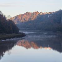
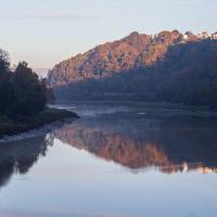
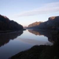
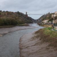
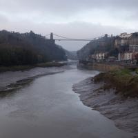
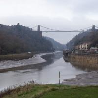
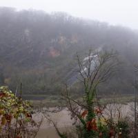
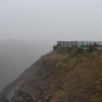
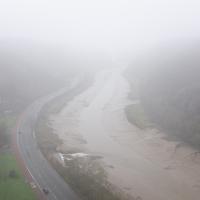
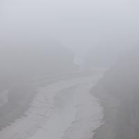
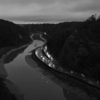
Morning Mist
05 Nov 2020
I spotted the fog and decided to go for a morning walk rather than a lunchtime walk today. It was cold on the Portway, but it was worth it. Most of my One Mile Matt photos are "record shots", but it's nice to get the chance to do something a bit more artistic.
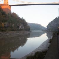
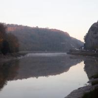
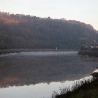
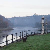
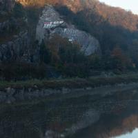
The edge of Durdham Down, where the railings are, top right, is known as Sea Walls, but nobody really knows why. It's not like the sea is anywhere nearby, and they're not walls.
This impression is reinforced to some degree by another fairly recent local name. In the Avon Gorge, the main high rock-face below Durham Downs, in Westbury on Trym parish, is Black Rock, which is sometimes loosely known as Sea Walls. Sea Wall appears on the OS 6" map of Gloucestershire (1888) in a position corresponding to the actual wall built on the cliff edge by John Wallis in 1746 (Goldthorpe 2006: 38), and the name originally given to this structure, Wallis's Wall, was replaced at an uncertain date by the present non-obvious one. Given that the term sea-wall is a usual one in the Severn area for the artificial sea-banks protecting the saltmarshes (as in the See Walles in Henbury parish in 1550; PN G/ 3: 136), it is strange that it should have been adopted for this inland cliff-edge structure. The earliest record so far found is also in the title of a painting, an early work by Francis Danby, "The Avon Gorge from the Stop Gate below Sea Walls" of c.1815. — Some Local Place-Names in Medieval and Early-Modern Bristol, by RICHARD COATES with the collaboration of JENNIFER SCHERR
Rabbits, bad pedestrian signage and good coffee
13 Nov 2020
A quick trip with the aim of finding a better way to Greville Smyth park and a good coffee. Sadly I was stymied yet again with the former—it turns out that you do apparently have to take a strange loop around the houses (or at least around the roads) to get to Greville Smyth any way other than my normal route, unless you're prepared to vault some railings. It may be that the disused steps from where the skater kids hang out to the flyover above might once have led to a shorter route, but it's hard to tell. The geography in the area has always confused me.
On the plus side, Rich, who runs Hopper Coffee from a Piaggio Ape does a great flat white and often has a good sign. (I collect cafe signs...)
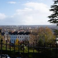
Hotwells and Clifton/Clifton Village
14 Nov 2020
A local walk with my friend Lisa in tow, including a coffee from the cafe in the Clifton Observatory, where I have fond memories of experiencing my first camera obscura, and cake from Twelve in Clifton Village, one of my favourite recent finds for both food and flat whites.
Outside the Zone
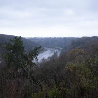
01 Nov 2020
This started as a little local walk with my friend Lisa, but when we randomly met my friends Sarah and Vik at Ashton Court, turned into joining them for a very long wander out to Abbots Leigh Pool. Most of this was well outside my one-mile radius but it was a lovely walk.
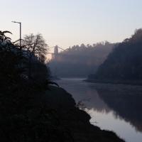
The Long Lunchtime at the End of the World
27 Nov 2020
I took an extra-long break at lunchtime today as I'd taken the day off my normal day-job to do the accounts for my previous side-job, which is still generating paperwork, though not much in the way of money. This took me through some undiscovered bits of Cliftonwood, including Worlds End Lane, which unexpectedly leads to White Hart Steps. That's certainly not where I expected the end of the world to lead to...
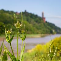
A long ramble, starting with trying to find the Hot Well of Hotwells and leading up the side of the Avon Gorge to the Downs and then through Clifton for coffee.
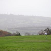
Solstice Rain
21 Dec 2020
Despite the weather, Sarah and Vik and I wandered around Ashton Court a bit as the sun rose. Not that you could really tell. Sadly, the bit we wanted to watch the sunrise from was closed, because people hadn't been treating the deer with appropriate respect. Ah well, at least it was some exercise.
On Christmas Day in the Morning
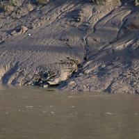
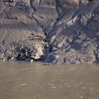
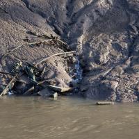
25 Dec 2020
A Christmas Day walk with my friends Sarah and Vik, taking in the shipwrecked Shadow and a hilly chunk of Leigh Woods.