Tagged: terrain
Quick Coffee
19 Nov 2020
A sunny day, and though I should have probably headed for less well-travelled territory I just headed over to the Marina to grab a flat white from Imagine That's horsebox café.
Leigh Woods Walk
14 Mar 2021
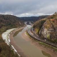
An enormous walk today, or at least it felt enormous. My feet are sore, anyway. I started off recreating a couple of local historical photos in Hotwells, but then headed for my traditional walk along the towpath in the Avon Gorge to the far extreme of Leigh Woods, up and through the woods to the height of the Suspension Bridge, finally crossing into Clifton Village for a well-deserved vanilla latte.
I say "traditional" because this used to be a very regular route for me, first walking, years and years ago, and later jogging—this route combined with a circuit of the Downs on the other side used to be my way of making sure I was fit to do a half-marathon (I did six of them in total, between 2010 and 2014).
I miss the routine of this walk, even though it's a long way and it used to pretty much wipe me out when I did it—I'd come back home and collapse and do very little for the rest of the day. But perhaps that's what Sundays are for, and I should try to remember that.
Doing this walk regularly was quite a meditative experience. Not so much of that today, but once I got to the further extreme of the towpath, where the roar of the Portway traffic on the other side of the river dwindles and I turned into Leigh Woods to climb ever closer to birdsong and further from rushing cars, I did seem to recapture a little of the feeling of previous walks. (I would say my mind cleared, but I was mentally singing along to Life Without Buildings' The Leanover for most of the wander. There are worse songs to have stuck in one's head, though; it's a great track...)
Anyway. Apparently the walk made me more likely to ramble in words, too. I'll stop now :)
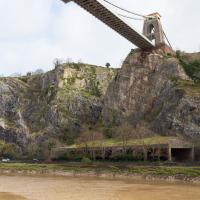
The roofed area below the Suspension Bridge is called The Gallery; it's there to prevent rocks from the particularly friable cliff face below the bridge from falling onto the Portway. It's also the rough former location of the Hotwells railway station on the Port Railway and Pier, which I explore in more details on a later wander.
Towpath Evening
25 Mar 2021
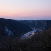
I was honestly just about to do the homework from my oh-so-thrilling ITIL course when my friends Sarah and Vik asked me if I'd like to come out for a wander down the towpath with them. I enjoyed the company, the evening light and the delicate clouds.
Since setting up a search for Hotwells on eBay I've mostly managed to restrain myself from buying much (or in one case, was outbid, luckily for my finances.) However, I couldn't resist a 1902 flyer for a singalong at the Terrett Memorial Hall, which would have stood five minutes' walk from my flat, overlooking Howard's Lock.
I've found out a fair bit about this non-denominational seaman's mission, including tracking down both a Loxton drawing and an aerial photo of it. The main thing that's eluded me, ironically enough, is finding out who Terrett was, so as a Memorial Hall it didn't do a very good job 😀.
EDIT: Ah! Did a little more digging and found that the Bristol Archives has a Bristol Dock Company document on file called "William Terrett, Esq.; corresp. etc. re proposed erection of a Mission Hall at Cumberland Basin, 1892", so that might be worth a look once the Archives are properly open again. Given that:
Sarah Terrett died suddenly on 25 November 1889, aged 53, after speaking at a meeting of the White Ribbon Army, the temperance organization she had founded in 1878. Following her death many people sent letters of sympathy to her bereaved husband, William. One of these, from the Rev. W. F. James, a minister of the Bible Christians, makes for especially interesting reading. The Bible Christian denomination, to which Sarah and William belonged, was one of the smaller Methodist connexions, and had its heartland in rural Devon, the area where she had grown up. James recalled the hospitality he enjoyed when visiting the Terretts’ home, Church House, in Bedminster, south Bristol...
...I wonder if William Terrett built the hall in memory of his late wife. They were clearly just the kind of temperance movement people who would've founded a seaman's mission to get people together to have a nice non-alcoholic singsong rather than a night out on the tiles.
Anyway. This walk to grab a coffee from Hopper Coffee in Greville Smyth Park was mostly an excuse to post the leaflet, a few other things I found related to it, and some pictures of how the site looks now. I would suggest that the present day is not an improvement.
Snowy Leigh Wander
24 Jan 2021
I started this wander with my "support bubble" Sarah and Vik, after Sarah texted me to say "SNOW!" We parted ways on the towpath and I headed up into the bit of Leigh Woods that's not actually the woods—the village-like part in between Leigh Woods and Ashton Court, where I'd noticed on a map a church I'd not seen before. I found St Mary the Virgin and quite a few other things I'd never experienced, despite having walked nearby them many, many times over many years, including a castellated Victorian water tower that's been turned into a house...
I noticed I'd missed a bit of Circular Road and Ladies Mile, and it was a nice evening for a sunset wander up to Clifton. There was something I recorded along the way, not photographically but in video.
Bristol Zoo, the world's oldest provincial zoo, has recently decided to close its Clifton site after 185 years of occupation, which means that the sounds of wild animals will no longer drift incongruously through this leafy Georgian area. They're moving everything up to their existing second site, The Wild Place Project near Cribbs Causeway. As I was wandering the Downs, I heard some fierce roaring noises, so I decided to see if I could get a little closer while they were still going on and record a sound that's soon to disappear.
I don't have a way yet to put video directly on this site, so here's a link to the video of my attempt to catch a bit of the zoo noises that I just popped on YouTube. It's sad that this might be the last time I hear such noises in Clifton.
Leigh Woods Solo
19 Jun 2021
I hadn't really planned to go out for a wander yesterday; I just got the urge and thought "why not?" (Well, the weather forecast was one possible reason, but I managed to avoid the rain, luckily.)
I wanted to finish off the A369—as it turns out I may still have a small section to go, but I've now walked the bulk of it out to my one-mile radius—and also a few random tracks in Leigh Woods. I'm still not really sure that I'm going to walk them all, especially after discovering today that "the map is not the territory" applies even more in the woods, where one of the marked tracks on the map wasn't really that recognisable as a track in real life... I'm glad I'd programmed the route into the GPS in advance!
Anyway. A pleasant enough walk, oddly bookended, photographically at least, by unusual vehicles. Leigh Woods was fairly busy, especially the section I'd chosen, which was positively dripping with teenage schoolkids with rah accents muttering opprobrium about the Duke of Edinburgh. I'm presuming the harsh remarks were more about taking part in his award scheme than the late Consort himself, but I didn't eavesdrop enough to be certain...
Mirror Maze
10 Jan 2021
Went for a wander with my friend Lisa—the current lockdown rules seem to be that one local walk for exercise per day with a maximum of one person not in one's "bubble" is fine—up to the University of Bristol area right at the edge of my one-mile perimeter to see the Jeppe Hein Mirror Maze, among other things. On the way we mused about Merchant Venturers, the slave and tobacco trades, and dating in the time of Covid.
Not many people know there's a giant reservoir in the middle of Clifton. I found a fascinating tidbit in 'To Keep Open and Unenclosed':
The Management of Durdham down since 1861, by Gerry Nichols, that also explains why the toilets and changing rooms on Durdham down are where they are (right next to the giant water tower):
Bristol Water Works Company (BWW) was incorporated by Act of Parliament in 1846 and its first engineering works included three service reservoirs: Bedminster Down for the area south of the River Avon; Victoria Reservoir at Oakfield Road for the lower areas north of the Avon; and the Durdham Down Reservoir for the higher districts. The water flowed from the Barrow Reservoir to Oakfield Road by gravity where there was a pump driven by a steam engine to raise the water to the Downs level. Land was purchased from the Lords of the Manor of Henbury for the Durdham Down Reservoir free of any covenants or restrictions on building. As noted above, the requirement in the 1861 Act for the Downs to be 'open and unenclosed' has always been interpreted as a ban on permanent buildings on the Downs. Thus BWW land has been used for public toilets (1893) and Dressing Rooms (1932 and 1994) to avoid challenges under the 1861 Act.
Saint Vincent's Spring
28 Dec 2020
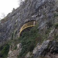
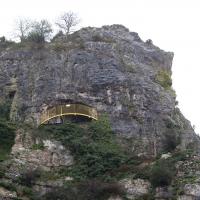
Fractionally outside my one-mile zone, but I got curious about Saint Vincent's spring, whose last remnants you can see in a defunct drinking fountain on the Portway. Along the way I passed Gyston's cave, sometimes called St Vincent's cave, in the sheer wall of the gorge. It's now accessible by a tunnel from the observatory—I tried it about twenty years ago, I think, and still recall the vertiginous moment of looking down from the protruding balcony and realising that you could see straight through the grille floor to the drop below—but from what I can work out the tunnel is relatively recent. Before the tunnel was dug it was accessible only by access across the cliff face, which must have been even more terrifying.
This cave was first mentioned as being a chapel in the year AD 305 and excavations, in which Romano-British pottery has been found, have revealed that it has been both a holy place and a place of refuge at various times in its history.
A few different sources say that the cave became a hermitage and chapel to St Vincent following Bristol's early trading in Iberian wines; St Vincent of Saragossa is Lisbon's patron saint, and a lot of nearby things bear the name.
I'm not sure where the crossover of Vincent and Ghyston happens, though. On the giants Goram and Vincent (or Ghyston), Wikipedia says:
The name Vincent for one of the giants rests on the fact that at Clifton, at the narrowest point of the Avon Gorge, there was formerly an ancient hermitage and chapel dedicated to St Vincent, at or near the present cave in the cliff-face which bears his name. Another (apparently modern) version of the story calls the Clifton giant Ghyston, which is in fact the name, of obscure origin, for the whole of the cliff-face of the Avon Gorge at least as early as the mid-fifteenth century, in the detailed description of the Bristol area by William Worcestre. The place-name was personified to produce the giant's name. Vincent's Cave is called Ghyston cave or The Giant’s Hole in an article in the July 1837 issue of Felix Farley’s Bristol Journal.
In my research on the original Hot Well House, I've seen quite a few contemporary paintings which state their viewpoint as "from St. Vincent's Rock", so in the 16th century it seems the cliff-face name was typically St Vincent Rock rather than Ghyston's Rock, perhaps.
I am, as you can tell, no historian!
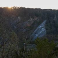
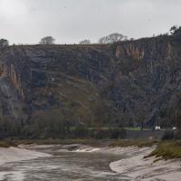
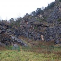
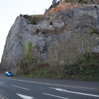
On the way, I also wandered around the base of the popular climbing area, which I think is the site of the old Black Rock quarry.
The interesting-looking modern block at the top of the cliff on the left is Seawalls, on Seawalls Road, built in 1977. Zoopla's estimated price for a two-bedroom flat there looks to be around half a million pounds.
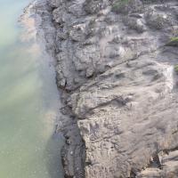
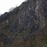
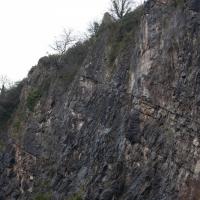
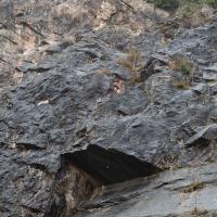
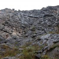
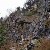
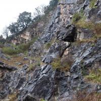
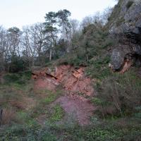
What can I say? I went to a quarry in the Avon Gorge. Most of my pictures are going to be of rocks. Sorry.
These are all in the rock-climibing area in the old quarry below Peregrine Watch Point. I saw no peregrines.
My historical research took a wander underground recently, partly inspired by the Canynge Square sinkhole, partly by St Vincent's (Ghyston's) cave and its tunnel to the Observatory, and I was surprised to find that there might be an intact tunnel from the Bristol Port Railway and Pier still just sitting there under Bridge Valley Road. A quick search turned up this recent video by an intrepid explorer, so it's definitely still there.
I went looking for the entrances today, and definitely found the south entrance, at the start of the Bridge Valley Path, the footpath that starts with steps at the bottom of Bridge Valley Road. It's easy to miss if you're not looking for it. I think I've figured out where the north entrance is, too, but it was getting dark at that stage and the Portway was still busy enough that crossing the road was still the normal nuisance, so I thought I'd leave further explorations for another day.
