Tagged: a4
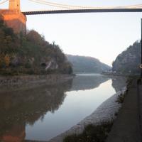
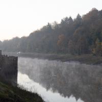
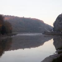
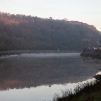
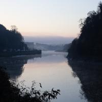
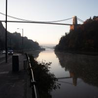
Morning Mist
05 Nov 2020
I spotted the fog and decided to go for a morning walk rather than a lunchtime walk today. It was cold on the Portway, but it was worth it. Most of my One Mile Matt photos are "record shots", but it's nice to get the chance to do something a bit more artistic.
A long ramble, starting with trying to find the Hot Well of Hotwells and leading up the side of the Avon Gorge to the Downs and then through Clifton for coffee.
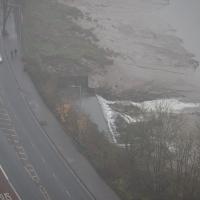
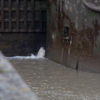
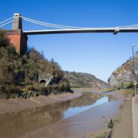
In full flow. The flat top of the water to the left of the overflowing rim sits above a semicircular-profile concrete trough that's designed to calm the water and channel it into the fairly calm wide flow you see here to reduce the erosion it would otherwise cause.
Solstice Rain
21 Dec 2020
Despite the weather, Sarah and Vik and I wandered around Ashton Court a bit as the sun rose. Not that you could really tell. Sadly, the bit we wanted to watch the sunrise from was closed, because people hadn't been treating the deer with appropriate respect. Ah well, at least it was some exercise.
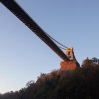
Saint Vincent's Spring
28 Dec 2020
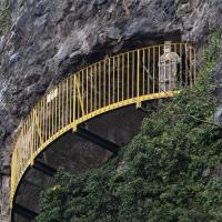
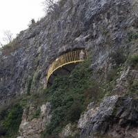
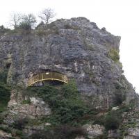
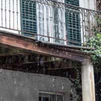
Fractionally outside my one-mile zone, but I got curious about Saint Vincent's spring, whose last remnants you can see in a defunct drinking fountain on the Portway. Along the way I passed Gyston's cave, sometimes called St Vincent's cave, in the sheer wall of the gorge. It's now accessible by a tunnel from the observatory—I tried it about twenty years ago, I think, and still recall the vertiginous moment of looking down from the protruding balcony and realising that you could see straight through the grille floor to the drop below—but from what I can work out the tunnel is relatively recent. Before the tunnel was dug it was accessible only by access across the cliff face, which must have been even more terrifying.
This cave was first mentioned as being a chapel in the year AD 305 and excavations, in which Romano-British pottery has been found, have revealed that it has been both a holy place and a place of refuge at various times in its history.
A few different sources say that the cave became a hermitage and chapel to St Vincent following Bristol's early trading in Iberian wines; St Vincent of Saragossa is Lisbon's patron saint, and a lot of nearby things bear the name.
I'm not sure where the crossover of Vincent and Ghyston happens, though. On the giants Goram and Vincent (or Ghyston), Wikipedia says:
The name Vincent for one of the giants rests on the fact that at Clifton, at the narrowest point of the Avon Gorge, there was formerly an ancient hermitage and chapel dedicated to St Vincent, at or near the present cave in the cliff-face which bears his name. Another (apparently modern) version of the story calls the Clifton giant Ghyston, which is in fact the name, of obscure origin, for the whole of the cliff-face of the Avon Gorge at least as early as the mid-fifteenth century, in the detailed description of the Bristol area by William Worcestre. The place-name was personified to produce the giant's name. Vincent's Cave is called Ghyston cave or The Giant’s Hole in an article in the July 1837 issue of Felix Farley’s Bristol Journal.
In my research on the original Hot Well House, I've seen quite a few contemporary paintings which state their viewpoint as "from St. Vincent's Rock", so in the 16th century it seems the cliff-face name was typically St Vincent Rock rather than Ghyston's Rock, perhaps.
I am, as you can tell, no historian!
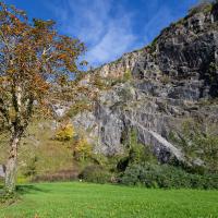
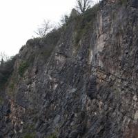
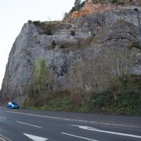
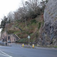
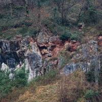
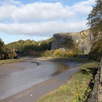
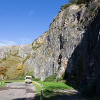
On the way, I also wandered around the base of the popular climbing area, which I think is the site of the old Black Rock quarry.
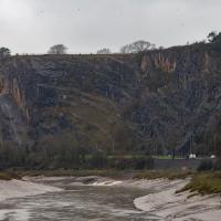
The interesting-looking modern block at the top of the cliff on the left is Seawalls, on Seawalls Road, built in 1977. Zoopla's estimated price for a two-bedroom flat there looks to be around half a million pounds.
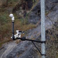
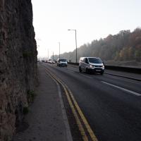
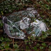
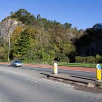
There are a lot of crashes on the Portway, which has always felt like a well-designed, safe, wide road with a reasonable speed limit to me. Maybe someone's trying to figure out why...
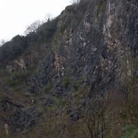
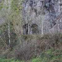
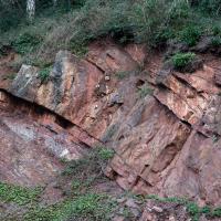
What can I say? I went to a quarry in the Avon Gorge. Most of my pictures are going to be of rocks. Sorry.
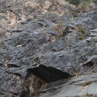
These are all in the rock-climibing area in the old quarry below Peregrine Watch Point. I saw no peregrines.
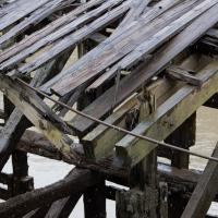
My historical research took a wander underground recently, partly inspired by the Canynge Square sinkhole, partly by St Vincent's (Ghyston's) cave and its tunnel to the Observatory, and I was surprised to find that there might be an intact tunnel from the Bristol Port Railway and Pier still just sitting there under Bridge Valley Road. A quick search turned up this recent video by an intrepid explorer, so it's definitely still there.
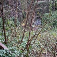
I went looking for the entrances today, and definitely found the south entrance, at the start of the Bridge Valley Path, the footpath that starts with steps at the bottom of Bridge Valley Road. It's easy to miss if you're not looking for it. I think I've figured out where the north entrance is, too, but it was getting dark at that stage and the Portway was still busy enough that crossing the road was still the normal nuisance, so I thought I'd leave further explorations for another day.
You can see a drawing of its better days here; "in 1946, the cast-iron pump was removed to the Underfall Yard of Bristol City Docks, and in 1961 there were reports that it had been donated to the City Museum."
Up until
Despite its looks, this is neither of the two footpaths actually called the Zig Zag (the Zig Zag itself, closer to town, and the New Zig Zag, further out.) This is in fact the Bridge Valley Path
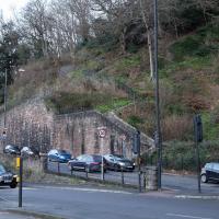
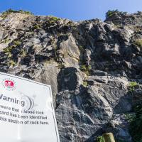
Every surface of the cliff face around here is basically bolted on to stop it falling into the road.
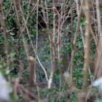
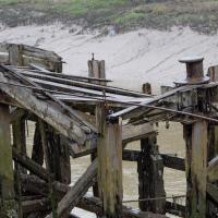
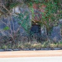
Peeking down over the edge of the start of the Bridge Valley Path you can just make out the entrance to the Portnalls railway tunnel under Bridge Valley Road. It opened in 1865 and ran to Avonmouth from a terminus in Hotwells, but was closed to enable the construction of the Portway in 1922 (source: Peaceful Portway "Memorable Walks" leaflet)
...and on the other side is the exit from the tunnel section closer to town. I don't know if that was also part of the Portnalls Number One tunnel or if it had a separate name. Either way, the railway would have run from Hotwells Halt on the city side all the way to Avonmouth, from what I can work out.
A Promenade on New Year's Day
01 Jan 2021
I wandered along the gorge today and found the entrance to the disused Portnalls Number 1 railway tunnel of the Bristol Port Railway and Pier. The door was unlocked, but as soon as I opened it I felt a sense of current habitation and decided discretion was the best option. There's a lot of people homeless in Bristol at the moment, and they don't need disturbing. For the same reason, I've omitted posting some pictures of a little encampment somewhat off the beaten track of the new Zig Zag, where I reversed direction as soon as I realised I'd come across a current habitation of some sort.
Up in Clifton it took me a little while to work out that the picture of the Promenade I was trying to reproduce was taken from the viewpoint I'd thought, it was just that the Alderman's fountain was moved from the top of Bridge Valley Road to the other side of the promenade in 1987, so trying to use it as my initial landmark wasn't very helpful!
Finally I swung past the Society of Merchant Venturers, who presumably still own most of Clifton, having bought the entire manor, including Clifton Down, in 1676, and I imagine aren't in much danger of running out of money. That's true to their motto: indocilis pauperiem pati is apparently from the Odes of Horace, and translates as "will not learn to endure poverty"...
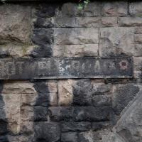
The older signs in Bristol just say e.g. 8 instead of the full postcode district of BS8.
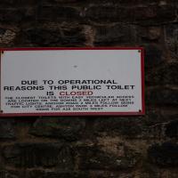
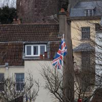
This sign, on the grotto that used to house the last remaining Hot Well pump, is the last Hotwell Road sign before it turns into the Portway. Which seems reasonable, as the Hotwell Road should obviously include the Hot Well...
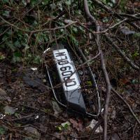
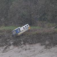
Was, apparently, a blue Ford Fiesta. It passed its last MOT on 24 October 2019, and hasn't been through one since. Can't think why that might have been.
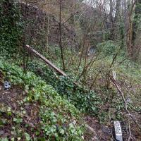
The steps still do the job. The handrail, however, is only tenuously attached to anything at the top end.
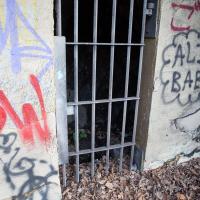
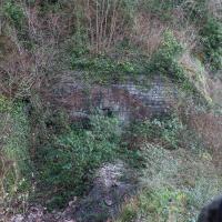
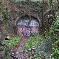
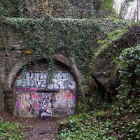
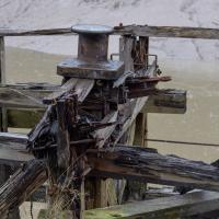
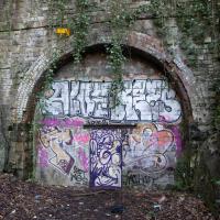
This is what I'd been looking for. An accessible entrance to the Portnalls Number One tunnel.
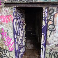
Oooh, it opens. However, it also looks like it closes fairly solidly and can be bolted from the outside. And it felt just a tad like there might be someone inside. So I didn't venture in.
Unexpected Snow
31 Jan 2021
I just nipped out to post a blood test (not Covid-related) and check that my car was okay, because I've not driven it for weeks. I was just going to walk up to Clifton Village, but I spotted the opportunity to re-park the car on my street rather than up the hill around the corner where it was, so instead I got in, intending just to move a hundred metres, but it turned over slowly before it started, and then warned me that the battery was very low and I should go for a long drive to recharge it.
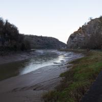
So, I did my best, zipping up the A4018 to the motorway junction and back again, dropping off my blood at a postbox along the way, and while I did that, it started snowing. I noticed it was low tide, too, so when I got back home I headed back out again, this time on foot and with a camera so I could see if I could find any evidence of the Hot Well steaming.
I saw not a single sign of the Hot Well steaming, but it was quite a nice quick outing and I enjoyed my brief walk in the snow. Iike Hinton Lane, too, and while it's all old ground I was re-treading, I did at least get a picture or two with a bit of snow and some of the cold winter atmosphere of the trip, I think.
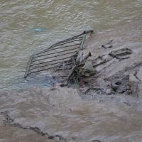
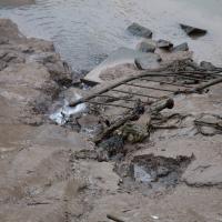
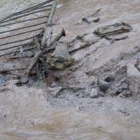
Went down to see if I could see it steaming. No dice. I really want to clear the spring of all that junk every time I see it, but I have no means to do it, let alone the knowledge and wisdom to know if it might do more harm than good...
Brief Jaunt to the not-so-Hot Well
13 Feb 2021
It's been very cold the last few days, so seeing as it was low tide at a convenient afternoon hour, I just wandered out to see if I could see the hot well steaming. I've been told that you sometimes can, on a cold day, but today, as with every other day I've tried, there was nothing in evidence.
It may be that the emergent spring has already filtered through too much cold river silt by the time it hits the surface these days, or even that it's running cooler than it used to. But perhaps I've just been unlucky.
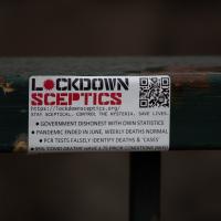
You'll forgive me if I don't get my factual information on the pandemic from stickers on railings.
The latest Public Health England information shows that since 21 March 2020, there have been 89,698 excess (compared to recent previous averages) deaths in England (stats to end of January 2021). 105,081 deaths mentioned Covid-19. For the most recent week we have figures, nearly 5,000 people died compared to the same week in recent years.
(Also, who gives a toss if the people had some kind of "prior condition"? They still fucking died. 'Oh, well, he was two stone overweight, and his wife had anaemia. It's perfectly fine they died an agonising death from Covid-19 in their forties, because they were clearly too weak to bother about anyway...")
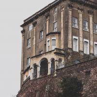
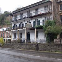
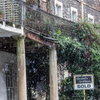
According to the estate agent's brochure I just found, including the cellars this place has 567 square metres of space to offer. There was not a price in the brochure, but back in 2017 they were asking for "offers over £1,995,000".
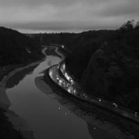
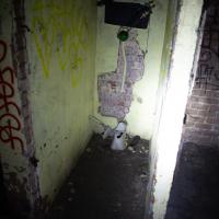
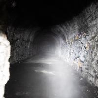
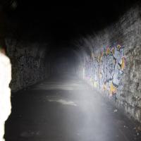
I'm glad my friend Lisa joined me today; she drove in from Shirehampton and told me that the Portway was looking rather lovely, so we set off that way. She's also braver than I am when it comes to doing urbex stuff, so this was just the opportunity to take a peek into the Portnalls Number One Railway Tunnel/Bridge Road Deep Valley Shelter whose entrance I'd found on a previous wander.
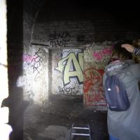
It was definitely dark and spooky and impressively big, with a side tunnel that Lisa explored that leads to a little door I don't think I've previously noticed on the side of the Portway. I didn't get many photos—even my astoundingly powerful little torch (£) didn't do much to light things up, and you're not going to get much joy hand-holding a camera in that darkness—but I did shoot a little video, which I might edit and add later.
After plumbing the bowels of the earth, we went up Bridge Valley Path to Clifton, explored some bits around the College and Pembroke Road, then came home via Foliage Cafe for coffee. Nice.
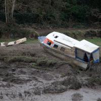
A Bristol estate agent would probably sell this as having an excellent view, too.
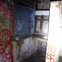
Lisa went right to the end of the side tunnel that leads to this door inside the Portnalls tunnel.
The more I research it, the more I find that Hotwells had far better transport links back in Victorian and Edwardian times than it has today. Along with buses that went to more useful places than the City Centre, there were trams, the funicular up to Clifton, the landing stage for paddle steamer services and two railway stations all within easy walking distance of me.
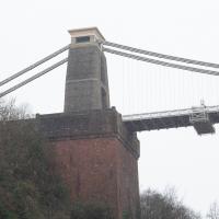
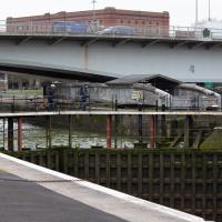
Today I took a day off work as preparation for doing the bookkeeping for my tax return1, and took a wander along to the site of what would have been my nearest station, Hotwells (or Clifton, as it started out in life), nestled in the shadow of the suspension bridge, the Bristol terminus of the Bristol Port Railway and Pier.
From there I wandered down the Portway, following the original line, until I got to the area around Sneyd Park Junction, where the tunnel from the slightly later Clifton Extension Railway joined up with this originally-isolated BPR line. Then I headed up to Clifton through the "goat gully" at Walcombe Slade, seeing the few above-ground bits of evidence of the tunnel (which is still in regular use) along the way.
It was a lovely day, and a good walk, and it was interesting to daydream of the times when I could have walked a few minutes from my flat down to Dowry Parade, caught a short tram ride to Hotwells Stations, and then headed from there to Avonmouth, perhaps even to board a transatlantic passenger service. The completion of the Clifton Extension Railway that linked the Avonmouth station with Temple Meads made relatively direct transatlantic travel from London via Bristol possible, with passengers travelling up from Paddington to Temple Meads, on to Avonmouth on the Clifton Extension Railway and Port Railway and Pier line, then perhaps catching a Cambpell's paddle steamer—which sometimes acted as tenders for large steamers—to a larger ship that was headed out for Canada, say.
1 I've learned that the best approach is to take two days off and deliberately do something that's not my bookkeeping on the first day, as otherwise I just inevitably end up procrastinating and feeling guilty on the first day no matter what. I have an odd brain, but at least I'm learning strategies for dealing with its strange ways as I get older...
2 Information mostly gleaned from Colin Maggs' The Bristol Port Railway & Pier and the Clifton Extension Railway, The Oakwood Press, 1975.
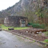
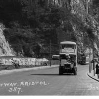
Here we see the Portway road, presumably fairly shiny and new, after many, many things, including the railway line from Hotwells to Sea Mills, were removed to make way for it. As you can see, they've done a splendid job of redeveloping the space where the station was into a little mini-park area, back in the day when the traffic wasn't a constant rush of noise and fumes and you didn't have to scamper across like you were playing a game of Frogger. It might well have been a pleasant place to sit. It certainly wouldn't be now.
Also, guess what there is fencing in the park area? Yes, some nice iron railings. I have no idea whether these are same ones I found—today's seem in surprisingly good nick considering this photo would have likely been taken almost a hundred years ago, and also how many railings were torn up during WWII.
This photo was taken before the war, as you can see a tram still running in the background—a Luftwaffe bomb took the tram system down in 1941 and it was never replaced. It also was obviously taken after 1926, as the Portway opened to traffic on 2 July 1926, having cost £800,000 to build, about £47m in today's money. So, that fixes it to a 15-year period, I think, but I'm not enough of a historian to be able to pin it down further.
Bottom section of the postcard. I like the way there's a bus and a tram in it, but I'd quite like the bus not to be there so we can see the whole of the former station site. Motion blur makes it hard to figure out the bus and tram details.
That's Sneyd Park up in the distance. We're heading that way to join up with the nearest extant bit of the Port Railway.
We'll be over there in a bit, at the entrance to the Gully. Before that, though, we'll just head to the other side of the quarry on the left.
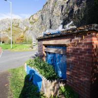
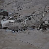
I have literally no idea what the hell this is. Weird that it seems to have been filled with expanding foam and has a little fence.
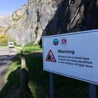
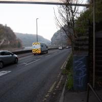
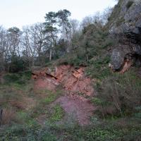
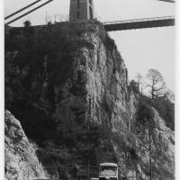
This is known for being something of a fragile area. Here's a picture of the earlier dangerous face being blasted away in the summer of '76, to stop it falling on the Portway. Every year the Portway is closed for a day or two to allow for a close inspection that can lead to the planning of remedial works. I'll often get a bit of notice of this, as they have to put the warning signs up quite early down in Hotwells so people can plan their alternative routes.
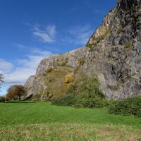
If it weren't for the gert big road next to it, this would be a lovely place to spend some time.