Tagged: nonbuilding-structure
Morning Mist
05 Nov 2020
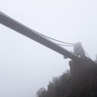
I spotted the fog and decided to go for a morning walk rather than a lunchtime walk today. It was cold on the Portway, but it was worth it. Most of my One Mile Matt photos are "record shots", but it's nice to get the chance to do something a bit more artistic.
Hotwells and Clifton/Clifton Village
14 Nov 2020
A local walk with my friend Lisa in tow, including a coffee from the cafe in the Clifton Observatory, where I have fond memories of experiencing my first camera obscura, and cake from Twelve in Clifton Village, one of my favourite recent finds for both food and flat whites.
Outside the Zone
01 Nov 2020
This started as a little local walk with my friend Lisa, but when we randomly met my friends Sarah and Vik at Ashton Court, turned into joining them for a very long wander out to Abbots Leigh Pool. Most of this was well outside my one-mile radius but it was a lovely walk.
Sunday Afternoon
15 Nov 2020
A walk back from Bedminster to my place, mostly down Duckmoor Road, which I found a little dull—probably because it reminded me a little of the suburbs I grew up in on the outskirts of London—then held up slightly by some filming on Ashton Avenue Bridge. They were trying not to let the crowds build up too much in between takes, it seems, so it wasn't a long delay.
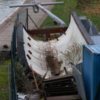
Last saw this in use to work on the lock gates at Junction Lock, I think, when it was refurbished. They lower the entire thing into the water in a corner of the harbourside, making a roughly watertight seal along the muddy bottom and the harbour walss, and run a pump to suck/keep the water out of it, leaving a little dry corner that someone can work in without needing a drysuit or similar. And, you know, actually being able to see what they're doing.
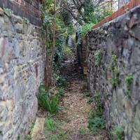
Jaunt to a Closed Coffee Shop
17 Nov 2020
A fruitless wander, as Spoke and Stringer (who I thought might do a decent flat white) were closed, and the only other harbourside inlet offering were a bit too busy to wait at, especially as I'd spent some time wandering some of the convolutions of Rownham Mead. This last congeries of dull alleyways and brown-painted garages was at least somewhere I've never been before, in parts.
Clifton Village Mini Wander
20 Nov 2020
Just a quick wander up the hill to get a flat white from Twelve. I really enjoyed the spooky mannequin (?) in the window.
And Back Down the Hill from the Flu Jab
21 Nov 2020
This is my return from getting my annual flu jab at Christ Church, as explained in more detail in my wander up the hill.
The Long Lunchtime at the End of the World
27 Nov 2020
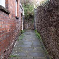
I took an extra-long break at lunchtime today as I'd taken the day off my normal day-job to do the accounts for my previous side-job, which is still generating paperwork, though not much in the way of money. This took me through some undiscovered bits of Cliftonwood, including Worlds End Lane, which unexpectedly leads to White Hart Steps. That's certainly not where I expected the end of the world to lead to...
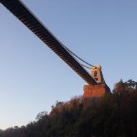
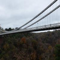
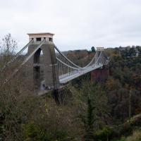
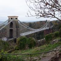
A long ramble, starting with trying to find the Hot Well of Hotwells and leading up the side of the Avon Gorge to the Downs and then through Clifton for coffee.
More Cliftonwood
05 Dec 2020
Back to Cliftonwood for a wander that included some of the belle views of Bellevue Crescent and other bits of the easternmost part. Highlights included watching someone bump-starting an elderly Nissan Micra in the narrow confines of Bellevue Crescent.