Tagged: prairie
I went to get my first dose of the Oxford/AstraZeneca Covid-19 vaccine today. Handily, the vaccination centre was Clifton College Prep School in Northcote road, next to Bristol Zoo, a road that's just within my 1-mile range that I hadn't visited before.
I parked up near Ladies Mile and tried to find a few of the tracks marked on the map I'm using, but couldn't see most of them. Whether that's just because they've disappeared over time, or with the recent lack of use or waterlogging from the 24 hours of rain we just had, I'm not sure. It was a pretty fruitless search, anyway.
The vaccine shot was virtually the same setup as when I got my winter flu jab back in November, except for the venue. I snapped a couple of pictures of the school while I was there, but I was in and out in five minutes, and you probably don't want to linger around a vaccination centre, I suppose.
Instead I wandered around the compact block of the Zoo, now sadly scheduled for closure. By coincidence I finished E H Young's Chatterton Square this morning: set in Clifton (fictionalised as "Upper Radstowe") near the Zoo, the occasional roars of the lions that can be heard by the residents of the square (Canynge Square in real life) form part of the background of the novel. The book's set in 1938 (though written and published post-war, in 1947). It seems a shame that the incongruous sounds of the jungle will no longer be heard from 2022. All I heard today were some exotic birds and, I think, some monkeys.
I was told not to drive for fifteen minutes following the jab, so I wandered out of my area up to the top of Upper Belgrave Road to check out an interesting factoid I'd read while looking into the history of the reservoir at Oakfield Road, that the site of 46 Upper Belgrave Road was a bungalow, shorter than the adjacent houses, and owned by Bristol Water, kept specifically low so that the pump man at Oakfield Road could see the standpipe for the Downs Reservoir (presumably by or on the water tower on the Downs) and turn the pump off when it started overflowing. Sadly I couldn't confirm it. There is one particularly low house on that stretch, but it's number 44, and though small, it's two-storey, not a bungalow, so nothing really seems to quite fit in with the tale.
I'm writing this about nine hours after getting the jab, by the way, and haven't noticed any ill effects at all. My arm's not even sore, as it usually would be after the normal flu jab. In twelve weeks I should get an appointment to get the second dose.
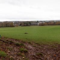
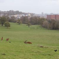
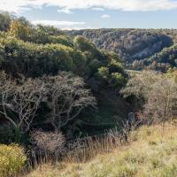
The Downs are an amazing resource for Bristol, but you can't really do them justice with a photograph, especially on a dreary, waterlogged day.
Leigh Woods Solo
19 Jun 2021
I hadn't really planned to go out for a wander yesterday; I just got the urge and thought "why not?" (Well, the weather forecast was one possible reason, but I managed to avoid the rain, luckily.)
I wanted to finish off the A369—as it turns out I may still have a small section to go, but I've now walked the bulk of it out to my one-mile radius—and also a few random tracks in Leigh Woods. I'm still not really sure that I'm going to walk them all, especially after discovering today that "the map is not the territory" applies even more in the woods, where one of the marked tracks on the map wasn't really that recognisable as a track in real life... I'm glad I'd programmed the route into the GPS in advance!
Anyway. A pleasant enough walk, oddly bookended, photographically at least, by unusual vehicles. Leigh Woods was fairly busy, especially the section I'd chosen, which was positively dripping with teenage schoolkids with rah accents muttering opprobrium about the Duke of Edinburgh. I'm presuming the harsh remarks were more about taking part in his award scheme than the late Consort himself, but I didn't eavesdrop enough to be certain...
Looking up the hill to the Iron Age fort of Stokeleigh Camp. We're going to do a loop of the perimeter.
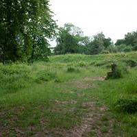
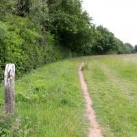
This was allegedly the path on Open Street Map that I used to plan my walk; I'm glad I had the GPS to tell me it was a path, because it barely looks like one.
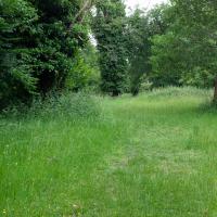
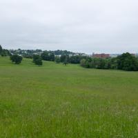
I believe this is "the plain"; the only surviving bit of this particular neck of the woods that was all once pasture that's not turned into forest. The main bit of the woods, to the east of the parish wall, is mostly ancient growth, I think.
On Christmas Day in the Morning
25 Dec 2020
A Christmas Day walk with my friends Sarah and Vik, taking in the shipwrecked Shadow and a hilly chunk of Leigh Woods.
Bedmo and Ashton Court
21 Nov 2020
A rather more wide-ranging weekend wander with Sarah and Vik, taking in some mock Tudor bits of Bedmo (I should note that I've subsequently been corrected to "Bemmie", but I'm an outsider and have been calling it "Bedmo" for short for decades...), a chunk of Ashton, a path up Rownham Hill called Dead Badger's Bottom(!), The Ashton Court estate, a bit of the UWE campus at Bower Ashton, and some of the Festival Way path.
I guess someone's living on this patch of ground. I think this used to be where the police horses were stabled. Not sure, though.
Outside the Zone
01 Nov 2020
This started as a little local walk with my friend Lisa, but when we randomly met my friends Sarah and Vik at Ashton Court, turned into joining them for a very long wander out to Abbots Leigh Pool. Most of this was well outside my one-mile radius but it was a lovely walk.
A Quick Swing Past Ashton Court
05 Jun 2022
Another day not dissimilar to my last wander: I'm feeling a bit tired and rather than just moping around the house I thought I'd find some tiny bit of somewhere that I'd not yet walked and get outdoors. This time I headed for the Tobacco Factory Market in Bedminster, as I often do, but went the long way around via Ashton Court Mansion as I knew there were some footpaths and a small section of road I'd not ticked off up there. Finishing all the Ashton Court footpaths will be quite a long job, but you've got to start somewhere...
I did feel rather better by the time I got home, and, pretty much astoundingly given the weather forecast, managed to avoid the rain completely.
I do enjoy the bits of my walks where I can look back and see Hotwells, or at least the higher bits surrounding Hotwells.
Ticking Off a Pocket of Paths in Leigh Woods
03 Jun 2022
I managed to go for a wander a while ago that was meant to finish off a little tangle of paths in Leigh Woods, or at the very least finish off my wandering of the Purple Path there. And I managed to miss doing either of those things through some kind of navigational incompetence.
Today I woke up with a bit of a headache, feeling a bit knackered as soon as I dragged myself out of bed, but at least with the energy to realise that I'd be better off (a) going for a walk in what looked likely to be the last of the Jubilee weekend sunshine than (b) moping around the flat until it started raining, at which point I could mope more thoroughly.
I had a look at my map, considered going to Ashton Court, but remembered that there was a music festival there today, and instead found these little leftovers of Leigh Woods and decided to have one more try at walking them.
I think I'm pretty much a mile away from my house right here. Nice of someone to erect a marker.
So, I finished off my route along the uncompleted sections of the paths, and by then felt a bit lost, with all the turning around and circling. I headed in what I hoped was the right direction, wondering if I'd spot a landmark, and then realised that the giant hill I was right next to was the man-made iron age fort of Stokeleigh Camp, and of course I knew where I was. D'oh. Sometimes you really can't see the wood for the trees.
I was put into something of an altered state by the little pilgrimage to this random little area of the woods and my backwards-and-forwards wandering. This kind of state has been used, apparently, as a form of divination, which is something I've been researching a bit recently.
It took me a while to find the right term. At first I thought that divination through walking along my map routes might be cartomancy, by comparison with cartography, but of course the "cart" comes from the Latin for "card", so cartomancy covers divination by cards, like the Tarot. Then I thought perhaps geomancy, what with it being somewhat geographical, but the "geo" bit is "earth" in Greek, and geomancy covers, as Chambers says, "divination by shapes formed, eg when earth is thrown down onto a surface".
In the end I tripped over the right name: ambulomancy—"any of various forms of divination that involve walking, often in circles", according to Wictionary. Lexico puts its appearance as early 19th century.
Of course, presumably one actually has to divine something to be an ambulomancer, and the main thing I was divining was that there was coffee and and sandwich in my future now I knew I was near the Leigh Woods exit that would take me across the bridge to Clifton Village.
A Random New Year's Day Wander
01 Jan 2022
I picked a fairly arbitrary reason for a wander today. Really, I just wanted to do a New Year's Day wander just to get out of the house and to set a precedent for the year to come.
My ostensible reason was to investigate what looked like a road on my map that quartered the lawn in front of the Ashton Court mansion. As it turned out, this is just a muddy footpath/desire line similar to a half-dozen other tracks nearby, and must be some kind of bug or misclassification with the mapping system I'm using, but that's not important. What's important is that I went for a little walk on the first day of the year. As a bonus, I did happen to wander down a couple of sections of new footpath, so technically I broke some new ground too, which is nice.
There were quite a lot of people about; I think a New Year's Day walk is still quite the tradition. Good.
The more I research it, the more I find that Hotwells had far better transport links back in Victorian and Edwardian times than it has today. Along with buses that went to more useful places than the City Centre, there were trams, the funicular up to Clifton, the landing stage for paddle steamer services and two railway stations all within easy walking distance of me.
Today I took a day off work as preparation for doing the bookkeeping for my tax return1, and took a wander along to the site of what would have been my nearest station, Hotwells (or Clifton, as it started out in life), nestled in the shadow of the suspension bridge, the Bristol terminus of the Bristol Port Railway and Pier.
From there I wandered down the Portway, following the original line, until I got to the area around Sneyd Park Junction, where the tunnel from the slightly later Clifton Extension Railway joined up with this originally-isolated BPR line. Then I headed up to Clifton through the "goat gully" at Walcombe Slade, seeing the few above-ground bits of evidence of the tunnel (which is still in regular use) along the way.
It was a lovely day, and a good walk, and it was interesting to daydream of the times when I could have walked a few minutes from my flat down to Dowry Parade, caught a short tram ride to Hotwells Stations, and then headed from there to Avonmouth, perhaps even to board a transatlantic passenger service. The completion of the Clifton Extension Railway that linked the Avonmouth station with Temple Meads made relatively direct transatlantic travel from London via Bristol possible, with passengers travelling up from Paddington to Temple Meads, on to Avonmouth on the Clifton Extension Railway and Port Railway and Pier line, then perhaps catching a Cambpell's paddle steamer—which sometimes acted as tenders for large steamers—to a larger ship that was headed out for Canada, say.
1 I've learned that the best approach is to take two days off and deliberately do something that's not my bookkeeping on the first day, as otherwise I just inevitably end up procrastinating and feeling guilty on the first day no matter what. I have an odd brain, but at least I'm learning strategies for dealing with its strange ways as I get older...
2 Information mostly gleaned from Colin Maggs' The Bristol Port Railway & Pier and the Clifton Extension Railway, The Oakwood Press, 1975.
A Door, a Square, a Few Night Shots
04 Dec 2021
I didn't take many pictures on this quite long wander, partly because Lisa and I wandered across to Bedminster via Bower Ashton, which I've snapped quite a lot of on the last couple of walks, and also because we lost the light fairly quickly, though spending a half-hour drinking mulled wine in the Ashton might have had a little to do with that...
Before we left Hotwells I wanted to visit a door I'd heard about on Cornwallis Crescent and also take a little look at a couple of houses in Dowry Square to consider the 1960s regeneration of Hotwells.
They should form a pub. This is just over the road from The Ashton, so there's perhaps a little too much local competition. Lisa and I popped in for a mulled wine.
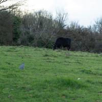
This is arguably better than the last time I tried to snap a cow in this field, but it's still terrible. Maybe next time I'll have a longer lens, or the cow will be closer...
This field is called St John's Chapel. On the oldest map I can find, from somewhere between 1844 and 1888 it's marked as the "Site of St John's Chapel" but with no sign of the chapel, so it must be very long-gone. "The Chapel was dedicated as St. John or St. James depending on the source consulted, and it presumably fell into decay after the village was deserted, in the 13th or 14th century. No trace remains above ground level today, and the site is just a field" says The Churches of Britain and Ireland.
I can see on the same map that there's clearly been a pub where The Ashton is for a very long time. It was called The Smyth Arms back then.
