Tagged: plant-community
Lunchtime Reproduction (of an old photo...)
17 Jan 2022
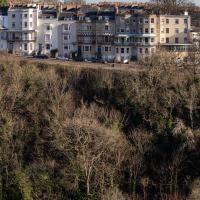
This was basically the quick lunchtime jaunt I tried to do at the beginning of January, only this time I actually managed to get to roughly the viewpoint I'd been hoping for to recreate a historical photo of the Bristol International Exhibition.
I did this walk about a month ago, but I've been a bit poorly and not really up to doing much in my spare time, and it's taken me this long to even face processing even these few photos. Hopefully normal service will be resumed at some point and I can carry on trying to walk any roads and paths that I need to do to make this project feel complete...
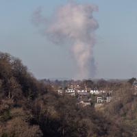
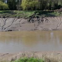
I think this may be the "avonmouth monster"; a plume of outflow from the works at Avonmouth. I took a photo of it some years back and asked BBC weatherman Ian Fergusson about it in the comments on this blog post—I'd recently done a tiny segment for his show "Wild Weather of the West" on how to photograph lightning—and that's what he said it was. This looks suspiciously similar and is in the right direction.
Bedminster Trip for New Walking Shoes
26 Feb 2022
I needed to buy new walking shoes—my old ones were squeaking and it was driving me up the wall—so I ordered some for collection from Taunton Leisure on East Street in Bedminster, and decided to make picking them up an official wander.
I didn't cover any new ground within my mile, but I did take advantage of the trip to take in a few interesting things just outside my normal radius, mostly New Gaol-related. Along the way there are a couple of sanitation-related diversions, including a visit to a rare manhole cover. You can hardly wait, I can tell!
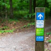
Leigh Woods Purple Path
12 Mar 2022
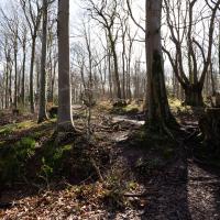
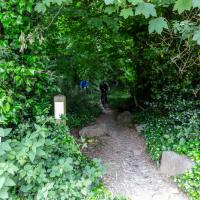
There's a few tracks in Leigh Woods that lie within my mile and show up on my map but that I've not walked yet, so I decided to take one of my traditional big long walks through the woods on this nice crisp sunny morning.
For years—decades, even—I've been doing a similar route from my place, along the towpath to the far woods entrance, up the hill for a varied walk on one of the marked tracks and then across the Suspension Bridge to Clifton Village for a coffee-based reward. It's my default "long walk", really, and I almost always enjoy it. Today, at last, spring actually seemed to be springing, which made for some extra positivity...
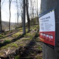
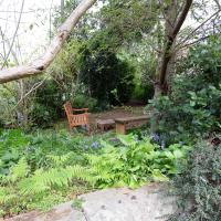
I was heading for my usual mid-walk picnic bench but I guess they're logging in that area right now, so I had to divert.
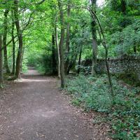
Approaching what amounts to the "main road" through Leigh Woods, that runs along the crest of the slope down to the towpath.
I mostly went out to hang out with my friends Sarah and Vik in Bedminster, but along the way I thought I'd take a closer look at something a little nearer home: the last crossing point of the Rownham Ferry.
Yes, okay, it's quite the challenge to spot the hand-made historic artifact in this picture. In the next pic I'll zoom in a bit.
I noticed I had a few things on my "potential wanders" list that could all be done relatively close to home, and in a fairly straight line, so I set off at lunchtime to recreate a photo of a now-defunct pub, wander behind a Spar (which turned out to be more interesting than I'd expected, but I admit it's a low bar) and spend some time browsing in Dreadnought Books before coming home via a coffee from Spoke & Stringer, a little diversion up Gasworks Lane and a tiny bit of the Rownham Mead estate I'd somehow previously skipped.
On my way home I popped through Rownham Mead estate and snapped a few things, starting with this house number that I've always enjoyed. This used to be my regular cut-through to the commuter ferry service back when I used to get the boat to work, so I'm very familiar with this little area.
As usual, the somewhat bland housing estate is elevating itself by means of the horticulture—I really do like the job their landscapers do in general, but most of the houses also seem to take a lot of pride in the individual gardens, too.
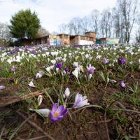
Easter Monday Gardens and Flowers
18 Apr 2022
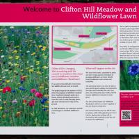
I didn't really set out with a theme of flowers and gardens in mind for this walk. I just fancied heading up to Clifton Village to get lunch. As it turned out, though, Spring was springing, so a minor theme emerged as I started off with the graveyard flowers of Hope Chapel and wandered up to see the beginnings of the new wildflower garden at Clifton Hill Meadow.
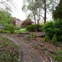
A lovely garden. Sadly a little lacking in facilities at the moment, after some scrote (or presumably a team thereof) had it away with their cast iron table and chair set at the end of March. This is why we can't have nice things, etc. etc.
This is the south end of Camden Terrace's little private garden, seeing as I seem to be on a bit of a garden and flower theme at the mo.
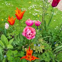
Continuing our minor theme of flowers and gardens, here's some from the Albert Lodge garden.

With a special Platinum Jubilee celebration on offer, too. I imagine The Mall Gardens will do that rather well.
The "Brigstowe Village Band" is a whimsical name. Brigstow—the bridge at the meeting point—is the origin of the modern "Bristol". Apparently they're "modelled on the village bands of Thomas Hardy’s day when local musicians played for all the local gatherings and celebrations."
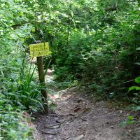
Ticking Off a Pocket of Paths in Leigh Woods
03 Jun 2022
I managed to go for a wander a while ago that was meant to finish off a little tangle of paths in Leigh Woods, or at the very least finish off my wandering of the Purple Path there. And I managed to miss doing either of those things through some kind of navigational incompetence.
Today I woke up with a bit of a headache, feeling a bit knackered as soon as I dragged myself out of bed, but at least with the energy to realise that I'd be better off (a) going for a walk in what looked likely to be the last of the Jubilee weekend sunshine than (b) moping around the flat until it started raining, at which point I could mope more thoroughly.
I had a look at my map, considered going to Ashton Court, but remembered that there was a music festival there today, and instead found these little leftovers of Leigh Woods and decided to have one more try at walking them.
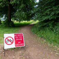
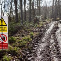
Guessing this is a polite hint from the golf club. In my mind's eye I can see an irate greenkeeper chasing a couple of mountain bikers in his golf buggy.
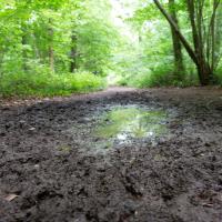
If it's rained for a few days in a row in Leigh Woods, some of the lower paths can get pretty muddy; in some past years I've even had to turn back and find another route, given that I mostly just wear ankle-high walking shoes. Today wasn't too bad.
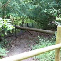
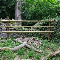
Possibly fenced off to stop people trying to clamber or mountain bike over it and cause more damage before it can be rebuilt?
Opposite the exit from Leigh Woods on North Road.
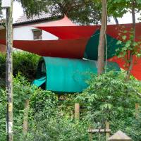
This may be an example of the rule that if a scrap of land in the South West sits unused for long enough, a twee AirBnb rental will spontaneously pop up on it.
A Quick Swing Past Ashton Court
05 Jun 2022
Another day not dissimilar to my last wander: I'm feeling a bit tired and rather than just moping around the house I thought I'd find some tiny bit of somewhere that I'd not yet walked and get outdoors. This time I headed for the Tobacco Factory Market in Bedminster, as I often do, but went the long way around via Ashton Court Mansion as I knew there were some footpaths and a small section of road I'd not ticked off up there. Finishing all the Ashton Court footpaths will be quite a long job, but you've got to start somewhere...
I did feel rather better by the time I got home, and, pretty much astoundingly given the weather forecast, managed to avoid the rain completely.
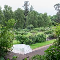
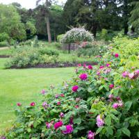
Alan Barber, late campaigner for public parks and green spaces, helped design this rose garden at Ashton Court, and it was dedicated to him in 2008.
Nipping Up the Zig Zag to the Shops
19 Aug 2023
It's been a long while since I did one of these walks.
I'm thinking of finishing up the project by walking one or two last bits of road, thus being able to declare with all honesty that I've done my best to walk every public road within my mile (and quite a few alleyways besides.) As a prelude, and just because I felt like it, I decided to drag out the camera and GPS on this little wander to the local shops.
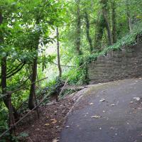
I did take a couple of other pictures of zigs and zags in the Zig Zag, but they didn't turn out too well; possibly my hands were shaking too much from the exertion of climbing this violently steep old track.
From near the top of the Zig Zag you can look down a couple of levels and see how vertiginous it is.