Tagged: gridiron
Bower Ashton is an interesting little area just south of the river from me—in fact, the Rownham Ferry used to take people over from Hotwells to Bower Ashton, operating from at least the twelfth century to around the 1930s.
It's a strangely contradictory little area, with a cluster of old and new houses sandwiched in between the busy A-roads and significantly more industrial area of Ashton and the bucolic country estate of Ashton court roughly east to west, and also between Somerset and Bristol, north to south.
I've been around here before, mostly poking around Bower Ashton's arguably most well-known bit, the Arts faculty campus of the University of the West of England, but I'd missed at least Parklands Road and Blackmoors Lane, so I initially planned just to nip across briefly and wander down each in turn. On a whim, though, I texted my friends Sarah and Vik in case they were out and about, and ended up diverting to the Tobacco Factory Sunday market first, to grab a quick flat white with them, extending my journey a fair bit.
To start with, though, I nipped to a much more local destination, to see something that you can't actually see at all, the Gridiron...
(I also used this wander as a test of the cameras in my new phone. I finally upgraded after a few years, and the new one has extra, separate wide and telephoto lenses compared to the paltry single lens on my old phone. Gawd. I remember when speed-dial was the latest innovation in phones...)
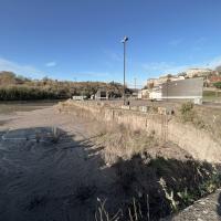
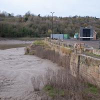
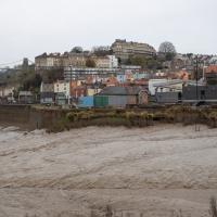
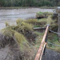
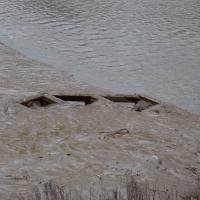
You can't actually see the Gridiron in this photo, but I believe it's still there, under that amazing buildup of silt.
The Gridiron—one of the few photos of it can be seen on the Maritime Mud and Miasma page of About Bristol—was a cheaper alternative to putting your boat in a dry dock. It was a 200-foot long grid (there seems to be some debate over whether the grid itself is actually metal, or in fact timber; I'll have to try to find out), 38 feet wide, nestled here between the north and south entrance locks. A ship captain could sail his vessel over here at high tide, then as the tide gradually receded, the ship—up to 250 feet, as overhanging a bit was apparently okay—would settle onto the gridiron.
At that point an inspection and repair crew could make their way down to the gridiron by ladder and do whatever work they could manage before the tide rose up again.
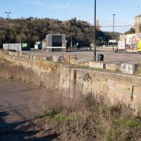
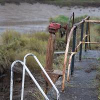
You can still see some ladders in place, I can only presume they were there to get you down to the gridiron, but that is just a guess; information on it seems quite hard to find.
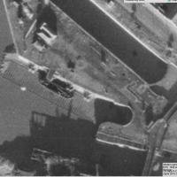
Image from 1946 Aerial layer of KYP Bristol/English Heritage.
As you can see, it was pretty big, and clearly still in use in 1946...
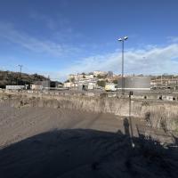
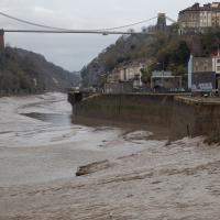
One last snap before we move on. I'm using the wide lens on the iPhone here, and have managed to include a silhouette selfie...
The Gridiron and Bower Ashton Part Two
03 Dec 2021
On my last wander, to Bower Ashton, I was intending to knock Blackmoors Lane off my list "to-do" list, but got a bit diverted. I also took a little look into the history of the Gridiron, once a cheaper alternative to dry dock that was nestled just south of North Entrance Lock.
Today I had to go to send a parcel off somewhere, so I decided on going to the North Street Post Office via Blackmoors Lane. I didn't have much intention of anything else, but as luck would have it I walked out both at low tide and also as some lockkeepers seemed to be having a bit of a training session, and one of the more senior people was (a) happy to answer a few random questions on the Gridiron and (b) actually knew a lot about it, as Gridiron maintenance had been one of his jobs, more than twenty years ago...
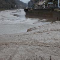
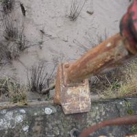
If you recall, before I left this area on the outbound leg of the wander, I had a chat with one of the more senior lockkeepers. He told me that the gridiron was definitely still there, and, look—there at the far left-hand side. What's that poking out of the silt?
Yes, having compared it with old photos and the 1946 aerial view I posted on Sunday I'm sure that that's the end of the gridiron, all 200 feet of which is apparently still there beneath the silt.
The lockkeeper told me that the gridiron was in use as recently as 2000, and that it used to be his job to wash the silt build-up away, using a sluicing system we'll get to in a moment.
I didn't realise I'd buggered up the focus on this shot until I got home and saw it on the big screen. They can't all be winners...
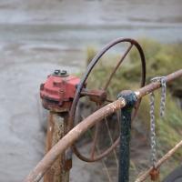
I've always wondered what this wheel is for. It's part of the Gridiron's cleaning system. Water is drawn from North Entrance Lock through a sluice channel and could be diverted one way and another across the surface of the gridiron. I wasn't clear from my conversation with the lockkeeper whether this would open the sluice channel or was the control used to divert the water first to the left of this central point of the gridiron, then to the right, but it's definitely part of the cleaning mechanism.
He said he also used to have to go down the ladder and hose it all down after sluicing it out, and that he found the whole process quite fun!
This is about halfway along the Gridiron. You'd sluice water back and forth from this point to rinse the silt off the Gridiron as part of its regular maintenance. This was still being done until around the year 2000, when it apparently became more trouble/cost than it was worth for the dwindling number of boats using it.
According to the lockkeeper, the last time a boat was on the gridiron was around the year 2000. He thought it might have been either the PS Waverley—a still-running paddle steamer I'm dying to have a go on at some point!—or the MV Balmoral, another vintage excursion ship. He had a recollection of the Balmoral needing to free something that had got tangled around its propeller.
Before then, he remembered the ship Samuel Plimsoll being on the gridiron in 1998.
So, this is all that can be seen today of a 200-foot long, 38-foot wide grid of wood, I think—at first I figured it was metal, but Nick Howes posted a historic photo on Twitter where the grid itself certainly looks to be made of timber—hidden completely by a simple build-up of silt.
Up until the year 2000, it had been in use since some time in the 1890s, I think. Grace's guide's copy of the Institution of Civil Engineer's obituary of John McCurrich certainly attributes the construction of a gridiron to him while he was Docks Engineer for Bristol, and he held that post from 1890 until his death in 1899.
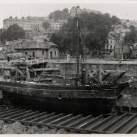
Here's the best photo of the Gridiron I've found so far: Item PG/3596 in the Isle of Man Photographic Archives.
The photo is dated 14 May 1946 and by amazing coincidence, looking at the boat's configuration and position, I think it may be exactly the same boat that's in the 1946 aerial photo from Sunday's wander.
Edit: later I found this colour picture of the Gridiron on Jem Southam’s Instagram feed, which was a lovely surprise!
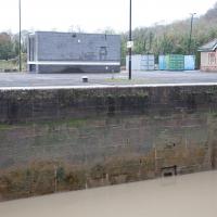
You can see how this sluice channel entrance in the side of the Entrance Lock wall is about level with the control wheel we saw on the far side—if you look closely, you can see it immediately to the left of and behind the modern building in the background. Given what the lockkeeper described to me, I'm confident that this is where the water for sluicing the Gridion clean of silt came from—they fill Entrance lock, then open the sluice to carry water—which must be under reasonable pressure with a full lock—across to the far side where the Gridiron is, washing off the accumulated silt.
Clever, these Bristol engineers: no actual pumping required. Just tides and gravity.
And that's the last of my musing on the Gridiron. I'm not sure why I became so fascinated by a giant Victorian boat-sieve, but I did!
