Tagged: plant-community
Desultory Coffee Wander
16 Apr 2021
Another day, another quick dash out for a coffee. I did at least try to take a different route from normal, especially on the way back, where I yet again got a bit lost in the strange paths, flyovers and underpasses that make up the odd maze of pedestrian "infrastructure" among the concrete jungle between the west of Greville Smyth and my neck of the woods in Hotwells. I swear one day I'll take a turn I've not tried before and end up being gored by a Bristolian minotaur.
I'd heard there was going to be something of a wild party in Greville Smyth to mark the end of lockdown. It seems it may be the start of a regular thing, with a dance festival bringing 8,000 people to the park. I imagine I'll be able to hear it from my place, and therefore safely avoid it.
Man on a Mission
17 Apr 2021
I went rather outside my area today, as I went to pick something up from the Warhammer shop on Wine Street (Games Workshop as-was, and before that I think perhaps a rare retail outlet for Her Majesty's Stationery Office? I may be mis-remembering...) Anyway, a friend of mine wanted something picking up and posting to him, so I figured I'd knock some streets off my list along the way.
I first headed for the St George's Road area, walking down the narrow Brandon Steps and finding some strange wall art on Brandon Steep, then headed to the Old City via Zed Alley. The Warhammer shop visit was friendly and efficient, and, mission accomplished, I treated myself to a sausage roll and a flat white from Spicer + Cole, to take away and eat in Queen Square with its current decoration of hearts. I finished off with a detour up Park Street, looking out for St John's Conduit markers, before finally crossing Brandon Hill on the way home.
Quite a long wander, all told, and I'm a bit knackered today...
Leftovers with Lisa
01 May 2021
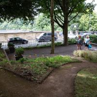
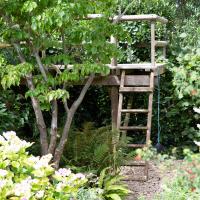
I didn't get to all the little leftover streets around the northeastern part of my area in today's wander, but I definitely knocked a few off the list, plus Lisa and I enjoyed the walk, and didn't get rained on too badly. We spotted the hotting-up of Wisteria season, checked out Birdcage Walk (both old and new), ventured onto the wrong side of the tracks1 and generally enjoyed the architecture.
1 Well, technically we probably shouldn't have been on the grounds of those retirement flats, but nobody started chasing us around the garden with a Zimmer frame
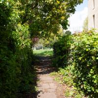
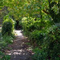
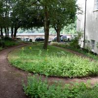
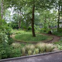
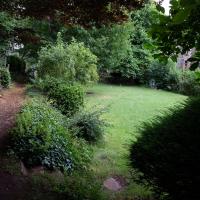
I've been here before, but thought Lisa might want to see this off-the-beaten-track public garden.
Victoria Square Underpass
06 May 2021
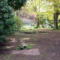
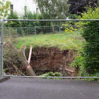
I'm meant to be taking a little break from this project, but in my Victoria Square researches after my last walk I noticed a curiosity I wanted to investigate. The community layer on Know Your Place has a single photograph captioned, "The remains of an 'underpass' in Victoria Square".
Looking back through the maps, I could see that there really did used to be an underpass across what used to be Birdcage Walk. I can only guess that it was there to join the two halves of the square's private garden that used to be separated by tall railings that were taken away during WWII. Maybe it was a landscaping curiosity, maybe it was just to save them having to un-lock and re-lock two gates and risk mixing with the hoi polloi on the public path in the middle...
Anyway. Intrigued, I popped up to Clifton Village this lunchtime for a post-voting coffee, and on the way examined the remains of the underpass—still there, but only if you know what you're looking for, I'd say—and also visited a tiny little road with a cottage and a townhouse I'd never seen before, just off Clifton Hill, and got distracted by wandering the little garden with the war memorial in St Andrew's churchyard just because the gate happened to be open.
EDIT: Aha! Found this snippet when I was researching something completely different, of course. From the ever-helpful CHIS website:
When there were railings all round the garden and down the central path, in order that the children could play together in either garden there was a tunnel for them to go through. This was filled in during the 1970s but almost at the south east end of the path if one looks over the low wall the top of the arches can still be seen.
I hadn't realised, from the other end, that this little alley was part of the churchyard rather than a way through into a private back garden; it looked as though it might pop up in the Bishop's House, and you don't want to disturb a bishop. When I worked out it just led through to the main church area I decided to walk it just for completeness, looping around and out through the memorial garden again.
This is more convincing as a walled-off underpass entrance. You can see there's a sheet of steel that's been placed in front of what looks like an entrance before it's been buried with earth.
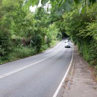
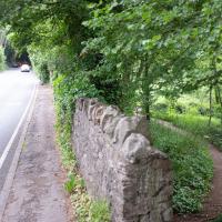
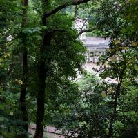
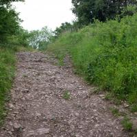
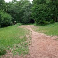
Leigh Woods Solo
19 Jun 2021
I hadn't really planned to go out for a wander yesterday; I just got the urge and thought "why not?" (Well, the weather forecast was one possible reason, but I managed to avoid the rain, luckily.)
I wanted to finish off the A369—as it turns out I may still have a small section to go, but I've now walked the bulk of it out to my one-mile radius—and also a few random tracks in Leigh Woods. I'm still not really sure that I'm going to walk them all, especially after discovering today that "the map is not the territory" applies even more in the woods, where one of the marked tracks on the map wasn't really that recognisable as a track in real life... I'm glad I'd programmed the route into the GPS in advance!
Anyway. A pleasant enough walk, oddly bookended, photographically at least, by unusual vehicles. Leigh Woods was fairly busy, especially the section I'd chosen, which was positively dripping with teenage schoolkids with rah accents muttering opprobrium about the Duke of Edinburgh. I'm presuming the harsh remarks were more about taking part in his award scheme than the late Consort himself, but I didn't eavesdrop enough to be certain...
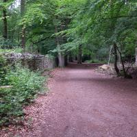
I think it was at this point I decided not to bother walking alongside the road up Rownham Hill and instead divert into Dead Badger's Bottom, which is a prettier alternative. That could be a slogan for this rather mundane strech: "The road up Rownham Hill: less attractive than a dead badger's bottom".
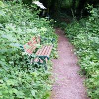
I ended up clambering over and under a couple of downed trees and then scrabbling up this steep bank to squeeze under this railing and back onto the main path. I think Sarah did a similar route the last time we came up here, but I wasn't feeling up to off-piste exploring back then.
Whoever maintains this place—I imagine there's a Friends of Dead Badger's Bottom, or whatever, probably the litter-pickers I saw—does a lovely job.
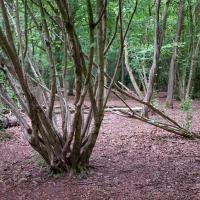
I think it was Leigh Woods that taught me the difference between coppicing and pollarding.
Library, Bookshop, Coffee
03 Jul 2021
I was headed into town to return RA Gilbert's biography of AE Waite to the library and along the way I noticed that Dreadnought had finished their refurbishment, but wouldn't be open until midday. That left me some time to kill, so I bimbled around the old St Augustine's/Gaunt's area for a while, then headed up Park Street for a coffee and a snack to eat on Brandon Hill before heading home the way I'd came so I could pop in and buy a pamphlet on the Hot Well I'd been interested in for a while.
A Cliftonwood Revisit with Lisa
10 Jul 2021
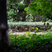
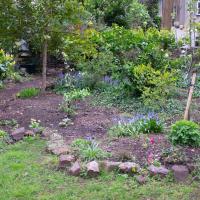
Lisa had a couple of hours to spare before going up in a hot air balloon (exciting!) so we went for a quick local walk, revisiting a bit of Cliftonwood we've seen before, exploring the secret garden I'd visited before that I thought she'd enjoy (I didn't take any new photos there) and then pushing on to another garden, Cherry Garden. Last time we passed this way, I'd noticed the gate, but we hadn't gone in as I'd assumed it was private. I'd since found it on CHIS's list of communal gardens in Clifton, so I wanted to have a look inside this time, and try to figure out whether it was private-communal or public, and possibly Council-owned, like several of the other gardens in Clifton.
This was today's mildly underwhelming destination: I only realised after walking past the gates on an earlier walk and then seeing it later on the CHIS Clifton's Communal Gardens page that this was a public garden, so popped it on my list to take a second look. As Clifton communal gardens go it's small and fairly dark on a day like this, but I don't imagine many people know about it or use it, so it's appealing to me, as a generally quite introverted person, especially one who prefers shade to sun on bright days...
Green Squares and Secret Gardens
31 Jul 2021
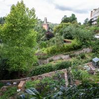
At the end of July I went to have a look around some of the private gardens opened up by the annual Green Squares and Secret Gardens event. Sadly it was compressed into a single day this year, for various Covid-related reasons, it seems, so I didn't get to poke around too many places. I went to:
- A talk by the oldest resident of Victoria Square
- The St Vincent's Rocks Hotel garden
- The Paragon garden
- Cornwallis Crescent gardens, both east and west
- The Polygon garden
And snapped a few things in between, too. It was a lovely day—a bit too hot, if anything—and it was interesting to get into a few places I'd only ever seen from the outside, especially The Paragon and Cornwallis gardens, which are the least visible to passing strangers of all of them.
I think at the far left edge of this photo, near the bottom, you can see about as far as I got down the old Prince's Lane on a previous wander. This pic was, I believe, taken looking up at the garden in the foreground. I think the greenhouse there is still being constructed, and wasn't there during my earlier wander, but you can see some of the building materials, I think.
Mostly the Metal Animals of a Clifton Garden
30 Aug 2021
Lisa and I went for a longish walk, but I didn't take many photos. Mostly we just wandered and nattered. Unusually, my target was outside my 1-mile radius on Burlington Road in Redland, where I snapped quite a few photos of the collection of artistic animals by Julian Warren. This was mostly to provide a fairly arbitrary destination for a roundabout walk in Clifton...
I recently indulged myself by buying a little piece of history. I've mentioned Samuel Loxton and featured and linked to his drawings before, often in the eminently browsable Loxton Collection albums that Bristol Libraries has on Flickr. So when I saw a Loxton drawing of Hotwells pop up on eBay, I decided to get myself a little treat.
I don't think there's any Loxton drawing that features the road I actually live in—it's not very visible from anywhere else, not being one of these Clifton terraces that's perched at the top of a hill, or anything like that, and it's invisible in most views of the area. However, this Loxton drawing, Hotwells, Looking across the river from near the Clifton Bridge station, is probably the closest near-miss I've seen.
I decided to wander out one morning and see if I could reproduce the picture, and also take a photo or two of what's now become of the Clifton Bridge Station, which is still just about discernible in places.
(Then on an even stranger whim I decided to check out a possible little cut-through from Cumberland Road to the harbourside I'd been eyeing up on my commute to work, so walked to Wapping Wharf for a croissant via this potential new route, but that bit's not quite as interesting...)
Site of the Rownham Ferry. Follow the link for a charming Loxton ink drawing on Know Your Place, also viewable at the Bristol Libraries Flickr collection.
This was a later site for the ferry, which earlier was a tad further out along the river. It would have been a key crossing point at this end of Bristol before the arrival of any bridges near here. Before the Ashton Swing Bridge and the Vauxhall footbridge arrived, the next-nearest crossing point would have been the Vauxhall ferry, which was where Vauxhaull Bridge stands now, I think.
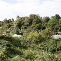
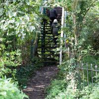
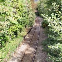
After carefully skirting the edges of the homeless people's camp that I accidentally found skirting the edges of the tall grass between the allotments and here, I came across my first destination: the footbridge from Clifton Bridge railway station. This is apparently the actual station footbridge, still in service for crossing the lines.
Many people in Bristol will know this as one of the chief ways people from this end of town used to get to Ashton Court, especially for the music festival or the balloon fiesta, before the shiny new Festival Way footpath was installed a decade or two back.
I've been across it before on my wanders, but I didn't know then that it was a remnant of a railway station, rather than just a standalone bridge.
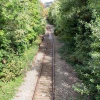
You can just about make out the platform still, there on the left. There used to be a second line and an eastern platform, too.
Clifton Bridge Railway Station was also known as Rownham Station from 1891 to 1910.
It was part of the Port and Pier railyway (as was Hotwells/Clifton station on the north side, nearer my house), opened in 1867, and closed, inevitably, by Beeching, with passenger services stopping in 1964 and freight a year later.
Wikipedia says "Freight trains continued to pass through the station, but their number decreased over time, with the line falling out of regular use from 30 March 1981. The route however was kept intact by British Rail, with occasional freight trains, and in 2002 a single track was relaid to allow rail access to Royal Portbury Dock", so I suppose even the single line we see here is newish.
Adjacent to the station was the New Inn, Rownham, which you can see a bit of in this photo from the Tarring Collection on KYP (or in this Tweet.
People will know the station site as the place where the local police's mounted and dog sections had their headquarters/stables/kennels, though they moved out a couple of years ago, I think.
Although the line is scheduled to return to passenger service as part of MetroWest, the nearest station will still be Temple Meads, so even though there may be passenger trains heading out to Pill and Portishead through here, ten minutes' walk from my house, I'd have to get all the way into town to come back out again, so it would probably be quicker for me to drive. Shame.