Tagged: picket-fence
Shops, Hedgehogs and Cows
06 Jul 2021
I really only took the GPS and camera on a "just in case" basis, as I knew I was only going for a coffee in Greville Smyth Park along a well-trodden path this lunchtime. Still, I saw a few new things along the way, so I figured it was worth uploading the handful of photos I took...
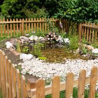
I see from the Facebook group that it was Rich from Hopper Coffee—the little coffee van I was visiting today—who first started the building of the pond, after finding dehydrated hedgehogs suffering in the park. It looks like it then became a group effort with several volunteers and donations of materials. Nice.
Leftovers with Lisa
01 May 2021
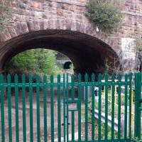
I didn't get to all the little leftover streets around the northeastern part of my area in today's wander, but I definitely knocked a few off the list, plus Lisa and I enjoyed the walk, and didn't get rained on too badly. We spotted the hotting-up of Wisteria season, checked out Birdcage Walk (both old and new), ventured onto the wrong side of the tracks1 and generally enjoyed the architecture.
1 Well, technically we probably shouldn't have been on the grounds of those retirement flats, but nobody started chasing us around the garden with a Zimmer frame
I've walked above these tracks many a time, but I've never been down on this level on this side of them—the other side is the pub next to the station, where I've been quite a few times...
Coffee Run
31 Mar 2021
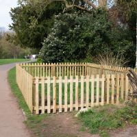
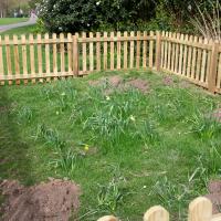
Not a literal run, but I didn't hang about, as I had a job interview to get to (I was an interviewer, not the interviewee, but you still have to be there on time...) Along the way to pick up a lunchtime coffee I mostly seemed to take photos of the high tide, though I also came across a bit of outreach work for small spiny mammals...
The enclosure seems to be there to keep some daffodils safe, but that sounds too much like overkill to be true.
Sunday Bedmo
20 Dec 2020
A long meander around bits of Bedminster, from the river to the north to Winterstoke Road to the south, taking a few roads I've seen before, and a few I haven't. The Christmas decorations were an extra bonus.
Sadly, I couldn't walk down Gibbs Way, as it's basically just the back alley for some houses. Not sure how it's even got a name, really.
The only thing I can find out about this alleyway is that someone once discovered a bag with two giant machetes in it here. Odd.
Bedminster, Ashton, Ashton Court sunset walk
12 Dec 2020
A walk with Sarah focusing on Ashton and the surrounds, taken on a day with really nice light around sunset. Just what I needed.
Bedmo and Ashton Court
21 Nov 2020
A rather more wide-ranging weekend wander with Sarah and Vik, taking in some mock Tudor bits of Bedmo (I should note that I've subsequently been corrected to "Bemmie", but I'm an outsider and have been calling it "Bedmo" for short for decades...), a chunk of Ashton, a path up Rownham Hill called Dead Badger's Bottom(!), The Ashton Court estate, a bit of the UWE campus at Bower Ashton, and some of the Festival Way path.
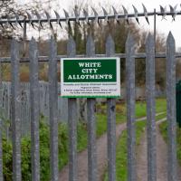
Gosh. I had no idea why it's called the White City Allotments, but apparently:
Bristol International Exhibition opened in May 1914 promising to be 'a place of pleasure and delight', celebrating 'the resourcefulness and progress of Great Britain and her Dominions'. 32 acres in Ashton Gate were transformed by palaces and pavilions. It quickly became known as the ‘White City’ because of the plaster used on the temporary buildings.
A Quick Swing Past Ashton Court
05 Jun 2022
Another day not dissimilar to my last wander: I'm feeling a bit tired and rather than just moping around the house I thought I'd find some tiny bit of somewhere that I'd not yet walked and get outdoors. This time I headed for the Tobacco Factory Market in Bedminster, as I often do, but went the long way around via Ashton Court Mansion as I knew there were some footpaths and a small section of road I'd not ticked off up there. Finishing all the Ashton Court footpaths will be quite a long job, but you've got to start somewhere...
I did feel rather better by the time I got home, and, pretty much astoundingly given the weather forecast, managed to avoid the rain completely.
Looks like work has finally started on the new flats on the site of the former railway depot/concrete factory/Bristol International Exhibition site.
Bower Ashton is an interesting little area just south of the river from me—in fact, the Rownham Ferry used to take people over from Hotwells to Bower Ashton, operating from at least the twelfth century to around the 1930s.
It's a strangely contradictory little area, with a cluster of old and new houses sandwiched in between the busy A-roads and significantly more industrial area of Ashton and the bucolic country estate of Ashton court roughly east to west, and also between Somerset and Bristol, north to south.
I've been around here before, mostly poking around Bower Ashton's arguably most well-known bit, the Arts faculty campus of the University of the West of England, but I'd missed at least Parklands Road and Blackmoors Lane, so I initially planned just to nip across briefly and wander down each in turn. On a whim, though, I texted my friends Sarah and Vik in case they were out and about, and ended up diverting to the Tobacco Factory Sunday market first, to grab a quick flat white with them, extending my journey a fair bit.
To start with, though, I nipped to a much more local destination, to see something that you can't actually see at all, the Gridiron...
(I also used this wander as a test of the cameras in my new phone. I finally upgraded after a few years, and the new one has extra, separate wide and telephoto lenses compared to the paltry single lens on my old phone. Gawd. I remember when speed-dial was the latest innovation in phones...)
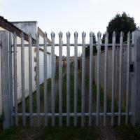
There's not much to see here. However, trying to find out what was here has been quite fascinating.
By the looks of it, this was part of the site of the Bristol International Exhibition, and I also found a photo of "Bristol's Own B Company" geotagged here—apparently the Glosters were stationed on the site of the exhibition after its early closure, so that might tie up, especially as the photo is dated 1914-1919 and the Glosters were here until 1919.
Aha! Yes, as you can see from this other postcard, that building was indeed part of the exhibition. Gosh. I hadn't really realised just how grand the exhibition ground was—you can certainly see why they called it the White City.
So, this would definitely have been part of the exhibition ground—around where the grandstand was—as would almost all of the surrounding area. Wow. Must've been quite something. They had everything from a rifle range to a replica of Bristol Castle.
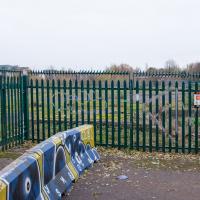
As for this particular derelict bit of fenced-off ground, I give it five years before we see some architectural drawings of luxury flats with the bare minimum of affordable housing hidden around the back. Will it be as well-built as the plasterboard and gypsum White City? Who knows...
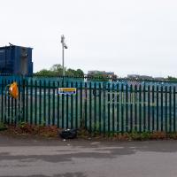
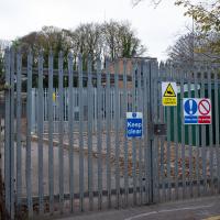
Later edit: Ah! On a later wander I found the key piece of information about this strip of land that let me search for it properly: its name. This strip of land, from the Stone Yard we just saw to here is the Ashton Gate Depot, a former railway sidings, and apparently I may have been overly cynical about the luxury flats, though there are definitely plans to turn it into flats, according to the Evening Post:
The proposed redevelopment of the site would include 99 one-bed apartments, 138 two-bed apartments, two three-bed apartments and 14 four-bed townhouses.
According to plans submitted to the council, all the new housing will be affordable because it will either be shared ownership or socially rented.
The development will span across five buildings between four and nine stories high.
There's more info and a detailed map on this planning document.
From all the old maps I can see, the actual railway sidings were in between this strip of land and the new development at Paxton Drive, around where the dedicated Metrobus line now runs. Perhaps this strip to the west of them was used for general railway storage, or maintenance buildings, or what-have-you. Now I've found out a bit more it should be easier to dig into the history; knowing railway enthusiasts there's probably a quaint little three-volume hardback set on The History of the Ashton Railway Depot...
I went out simply wanting to knock off the very last little unwalked section of Clanage Road, over by Bower Ashton, which has been annoying me for a while as it's quite close by and I've walked the other bits of it several times. So, my plan was to nip over to Greville Smyth Park via a slightly unusual route to wander Clanage Road and tick it off.
Along the way, though, I inevitably got a bit distracted. I took a few photos of Stork House, a grand Hotwell Road building that's recently been done up a bit (I imagine it's student lets, though I'm not sure) and which I found a reference to in a book about the Port Railway and Pier the other week, and also tried to match up a historical photo of Hotwells before the Cumberland Basin Flyover System laid it waste, which included some interesting markers I'll have to do a bit more digging into...
