Tagged: later
I got interested in Bristol's medieval water supplies after poking around near Jacobs Wells Road and Brandon Hill. It was during that research I found out about a pipe that's still there today, and, as far as I know, still actually functioning, that was originally commissioned by Carmelite monks in the 13th century. They wanted a supply of spring water from Brandon Hill to their priory on the site of what's now the Bristol Beacon—Colston Hall, as-was. It was created around 1267, and later, in 1376, extended generously with an extra "feather" pipe to St John's On The Wall, giving the pipework its modern name of "St John's Conduit".
St John's on the Wall is still there, guarding the remaining city gate at the end of Broad Street, and the outlet tap area was recently refurbished. It doesn't run continuously now, like it did when I first moved to Bristol and worked at the end of Broad Street, in the Everard Building, but I believe the pipe still functions. One day I'd like to see that tap running...
There are a few links on the web about the pipe, but by far the best thing to do is to watch this short and fascinating 1970s TV documentary called The Hidden Source, which has some footage of the actual pipe and also lots of fantastic general footage of Bristol in the seventies.
On my walk today I was actually just going to the building society in town, but I decided to trace some of the route of the Carmelite pipe, including visiting streets it runs under, like Park Street, Christmas Street, and, of course, Pipe Lane. I also went a bit out of my way to check out St James' Priory, the oldest building in Bristol, seeing as it was just around the corner from the building society.
There are far too many pictures from this walk, and my feet are now quite sore, because it was a long one. But I enjoyed it.
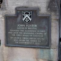
Tags: Bristol Places UK onemilematt united kingdom City Centre John Foster almshouse
Auto-Tags: Leaf Motor vehicle Font Headstone Grass Grave Cemetery Landmark Commemorative plaque Monument Public utility Plant History Memorial Sign
Text Recognition Tags: JOHN FOSTER MAYOR OF BRISTOL FOUNDED THIS ALMSHOUSE IN 1483 AND LATER THE ADJOINING CHAPEL OF THE THREE KINGS OF COLOGNE. DR GEORGE OWEN, PHYSICIAN TO KING HENRY VIII. ADDED TO THE ENDOWMENT IN 1553 JOHN FOSTER MAYOR OF BRISTOL FOUNDED THIS ALMSHOUSE IN 1483 AND LATER THE ADJOINING CHAPEL OF THE THREE KINGS OF COLOGNE. DR GEORGE OWEN, PHYSICIAN TO KING HENRY VIII. ADDED TO THE ENDOWMENT IN 1553
One Albermarle Row, Granby Green and... People
12 Mar 2021
I was browsing some historical photos the other day, and came across "Rear of Unspecified House" in the Bristol Archives' John Trelawny Ross collection, and immediately recognised it as being the back of 1 Albermarle Row, just around the corner from me. I've not had much time to research the history of this odd little addition to Albermarle Row, or what happened to 1-4 Cumberland Place, number 4 of which used to be attached to the side of 1 Albermarle Row, but it was interesting to look at old maps for a few minutes and work out what used to be where.
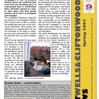
That all connects with the little local bit of land at Granby Green, too, as it used to be numbers 1-3 Cumberland Place. There was something of a planning battle over Granby Green, and I've included an old edition of Hotwells & Cliftonwood News that I found online, a copy of which would have been popped through my letterbox at the time.
I was also inspired by some old pictures of Hotwell Road to try to put a few more people in my pictures, though I set my pre-focus a couple of extra metres out from normal to make sure I didn't get too close to anyone!
Tags: Bristol Places UK onemilematt united kingdom Hotwells Cumberland Place Granby Green
Auto-Tags: Tire Automotive tire Newspaper Publication Motor vehicle Tread Font Wheel Material property News Vehicle Automotive wheel system Advertising Tire care Screenshot
Text Recognition Tags: Decision time for new h&cca Open Space in Hotwells HOTWELLS & CLIFTONWOOD COMMUNITY ASSOCIATION A recent poll of the people who sion granted to Edward Ware Homes campaigned in vain to preserve makes it clear that the whole site must Granby Green has confirmed that be landscaped and maintained for a year most want the remaining piece of before adoption by the Council, The undeveloped land in Cumberland original plan for the garden was heavily Place, Hotwells retained as a pub- criticised by members of Friends of lic open space with local people Granby Green as over-complex and having a say in how it is developed 'institutional but FROGG members are reviewing revised proposals that were The consultation followed an approach produced last year. They are hopeful by solicitors to the developers Edward that a partnership can be established with the Council Parks Dept. to ensure the residual land they own to the Com that the site is managed in a way that munity Association. Most people who reflects local needs without it being a responded to a questionnaire did not major financial burden for the Commu- ed by and managed. Ware Homes with an offer to transfer see ownership of the space as impor- nity Association. tant but were concermed that it should The whole development has been the be protected from any future develop- subject of a number of planning breaches and consequent enforcement Part of the site intended for open space action by the Council, described as a 'nightmare by an offi- cer in the Planning De- Alkhough Granby Hill is now open to traffic, the planned improvements to the footpath and highway have not yet ment. is owned by Bristol City Council and there is a provision in the planning agreement for the developer's section to be transferred to partment. Bristol C.C. owmership as well. The offer of ownership of one part of the site to the CA taken place. If you want to be in- volved with the pro- posed garden or have any comment on the scheme contact Mike would not therefore overcome the prob lems of split ownership or guarantee the out- come that local people Timmins tel: 9291804 want. The planning permis- The s of the panned garden Granby Green -a short history This apace had cared for by local residents a an informal community garden from as far back as the 1970s unail a fance was erected by a develaper, to establiah a tde with the Land Ragistry in May 2002 Tha 4 day interruption to pubic access later proved to be a crudal factor in the IB legal battle to regster the space as Town Green which would have protected it from developmere, n renoved by a recent High pnenas of Graby Green) campagned to Ibeen regardiess of ownership (iroricaly. chis technical objection has now been Court rulng A support group of around 100 local people prevent the loss of the space and the group tced a professional legal team at a three day publik in In this edition: Community News Winning ideas - Meet Your Neighbour -6 Events & Activities - quiry At one point, Town Green satus wos con ferred by the Bristol CC Open Spaces committee but bear rescinded folawing thrests of legal action by the then ownieri, Etward Ware Homes. Local resident Mike Timmin has ggeed that the now smaler space below Walace Place, che new 4 block of Mats should be christened Gromit Gar. 7 dens Rey Smth Contacts 8 HOTWELLS&CLIFTONWOe Spring 2007 SM3N Published y Hetwells A CIenweed Cemmunity Aassetaten, Htepe Chapel, Hepe Chapel Hill, Hetwells, Brtatel. BSa 4ND Decision time for new h&cca Open Space in Hotwells HOTWELLS & CLIFTONWOOD COMMUNITY ASSOCIATION A recent poll of the people who sion granted to Edward Ware Homes campaigned in vain to preserve makes it clear that the whole site must Granby Green has confirmed that be landscaped and maintained for a year most want the remaining piece of before adoption by the Council, The undeveloped land in Cumberland original plan for the garden was heavily Place, Hotwells retained as a pub- criticised by members of Friends of lic open space with local people Granby Green as over-complex and having a say in how it is developed 'institutional but FROGG members are reviewing revised proposals that were The consultation followed an approach produced last year. They are hopeful by solicitors to the developers Edward that a partnership can be established with the Council Parks Dept. to ensure the residual land they own to the Com that the site is managed in a way that munity Association. Most people who reflects local needs without it being a responded to a questionnaire did not major financial burden for the Commu- ed by and managed. Ware Homes with an offer to transfer see ownership of the space as impor- nity Association. tant but were concermed that it should The whole development has been the be protected from any future develop- subject of a number of planning breaches and consequent enforcement Part of the site intended for open space action by the Council, described as a 'nightmare by an offi- cer in the Planning De- Alkhough Granby Hill is now open to traffic, the planned improvements to the footpath and highway have not yet ment. is owned by Bristol City Council and there is a provision in the planning agreement for the developer's section to be transferred to partment. Bristol C.C. owmership as well. The offer of ownership of one part of the site to the CA taken place. If you want to be in- volved with the pro- posed garden or have any comment on the scheme contact Mike would not therefore overcome the prob lems of split ownership or guarantee the out- come that local people Timmins tel: 9291804 want. The planning permis- The s of the panned garden Granby Green -a short history This apace had cared for by local residents a an informal community garden from as far back as the 1970s unail a fance was erected by a develaper, to establiah a tde with the Land Ragistry in May 2002 Tha 4 day interruption to pubic access later proved to be a crudal factor in the IB legal battle to regster the space as Town Green which would have protected it from developmere, n renoved by a recent High pnenas of Graby Green) campagned to Ibeen regardiess of ownership (iroricaly. chis technical objection has now been Court rulng A support group of around 100 local people prevent the loss of the space and the group tced a professional legal team at a three day publik in In this edition: Community News Winning ideas - Meet Your Neighbour -6 Events & Activities - quiry At one point, Town Green satus wos con ferred by the Bristol CC Open Spaces committee but bear rescinded folawing thrests of legal action by the then ownieri, Etward Ware Homes. Local resident Mike Timmin has ggeed that the now smaler space below Walace Place, che new 4 block of Mats should be christened Gromit Gar. 7 dens Rey Smth Contacts 8 HOTWELLS&CLIFTONWOe Spring 2007 SM3N Published y Hetwells A CIenweed Cemmunity Aassetaten, Htepe Chapel, Hepe Chapel Hill, Hetwells, Brtatel. BSa 4ND
Prince's Lane
06 Jan 2021
The International Grotto Directory website says:
Prince’s Lane might have been one of the original ancient tracks from Hotwells to Clifton, in the Avon Gorge. The site later formed part of Rownham Woods which comprised some thirteen acres. By the end of the 18th century and the early 19th century, the Society of Merchant Venturers granted to Samuel Powell a building lease, for The Colonnade (1786), St. Vincent’s Parade (1790), Prince’s Buildings (1796), and Rock House. Rock House is generally considered to be the oldest surviving building associated with the Hotwell (see Chapter 20). John Power conveyed part of the woods to William Watts for the construction of Windsor Terrace (1790-1808).
The above development of the Avon Gorge cleared Rownham Woods, and created a triangle of land on the north side of the gorge, that became enclosed as a result, by Mansion Houses, whose garden walls all entered on to Prince’s Lane. The Lane started at the bottom of the gorge, at the base rock of Windsor Terrace, and came out half way up Sion Hill. It is clearly shown as a public footpath, dotted with trees, in Ashmead’s map of 1828. Some of the gardens were quite steep in parts and therefore, had to be terraced, because of the gradient of the gorge.
I've passed Prince's Lane literally thousands of times in my life, every time I've walked past the Avon Gorge Hotel, which itself started (in 1898) as the Grand Clifton Spa and Hydropathic Institution and pumped water up from the Hot Well for its hydropathic treatments. I've never actually ventured down it until today, or at least nothing like as far down it as I did this afternoon—I may have poked my head around the back of the hotel to see the original pump rooms at some point in the past.
This was a great wander, though it does very much feel like a private road, and frankly I may have been pushing my luck a bit by winding my way between the astoundingly big back gardens of the houses of some presumably very wealthy Cliftonites, but I felt vaguely justified in exploring the history of one of the oldest footpaths in my part of Bristol...
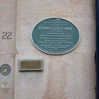
One thing it doesn't mention is that he became the Father of Australian Architecture after being transported for forgery, having gone bankrupt, forged a financial document, been caught, pled guilty, and been sentenced to death, which I think is an interesting detail...
Tags: Bristol Places UK onemilematt united kingdom Clifton Village
Auto-Tags: Wood Font Door Gas Circle Commemorative plaque Signage Public utility Number History Metal Facade Memorial Concrete Sign
Text Recognition Tags: THE CLITONAND BOTWELIS MEROVEMENT OCETY Di bading originaly un leelA y Roens e Cien Soungloen wdenigned by FRANCIS GREENWAY 1777-1837 later known as the 22 Father of Australian Architecture Thin plaque was sponsored in 2008 by The Australian H Conmiion The Dritaiauralia Selery WeatContry ranch The Cann Chuy M Pa Maes sod M maty Punal direndeicendam of he tect. THE CLITONAND BOTWELIS MEROVEMENT OCETY Di bading originaly un leelA y Roens e Cien Soungloen wdenigned by FRANCIS GREENWAY 1777-1837 later known as the 22 Father of Australian Architecture Thin plaque was sponsored in 2008 by The Australian H Conmiion The Dritaiauralia Selery WeatContry ranch The Cann Chuy M Pa Maes sod M maty Punal direndeicendam of he tect.
I've been pretty awful at reading so far this year, apparently averaging about one book per month. That's a far cry from 2019, say, where I got through 41 books in the year. Today's wander was prompted by my rubbish reading, as I needed to go hand back some books to the library, because I'd managed to renew them so many times that I hit the limit on renewals. Oops. Several of them were still unread.
So, off to the Central Library for me, tail between my legs. On the way there I did my best to recreate a historical photo of Dowry Square; while I was in the area I walked under the adjacent Norman arch and poked around behind the Cathedral, and I also had a little diversion to the city centre and came back along the south side of the river, hitting some trouble with the lock gates as I finally crossed the harbour back towards home.
Tags: Bristol Places UK onemilematt united kingdom City Centre St Augustine's Cathedral Choir School Cathedral School college square
Auto-Tags: Font Rectangle Pink Material property Magenta Publication Pattern Wood Carmine Paper Paper product Commemorative plaque Signage Circle History
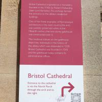
Text Recognition Tags: Abbot's Gatehouse Bristol Cathedral originated as a monastery founded in the 1140s by Robert Fitzharding (later Lord Berkeley) This archway formed the entrance to the abbey's residential buildings One of the finest examples of Romanesque architecture in the west country, the arch was carefully preserved when, in the fifteenth century, the two-storey gatehouse was constructed over it. The medieval statues on the gatehouse depict key individuals in the history of the abbey, which was disbanded in 1539. Bristol Cathedral was founded in 1542 and the gatehouse today contains its administrative offices. Bristol Cathedral Entrance to the cathedral is via the North Porch through the arch and to the right SHAND 200 ACER B HODERN Abbot's Gatehouse Bristol Cathedral originated as a monastery founded in the 1140s by Robert Fitzharding ( later Lord Berkeley ) This archway formed the entrance to the abbey's residential buildings One of the finest examples of Romanesque architecture in the west country , the arch was carefully preserved when , in the fifteenth century , the two - storey gatehouse was constructed over it . The medieval statues on the gatehouse depict key individuals in the history of the abbey , which was disbanded in 1539 . Bristol Cathedral was founded in 1542 and the gatehouse today contains its administrative offices . Bristol Cathedral Entrance to the cathedral is via the North Porch through the arch and to the right SHAND 200 ACER B HODERN
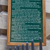
A bit more detail if you fancy it.
Tags: Bristol Places UK onemilematt united kingdom City Centre Saint Nicholas Market St Nicholas Market St. Nicholas Market Corn Street old city
Auto-Tags: Wood Font Wall Landmark Commemorative plaque Tree History Signage Memorial Metal Public utility Interior design Kitchen utensil Idiophone
Text Recognition Tags: THE CORN EXCHANGE CLOCK The clock on this building with an extra minute hand recalls early Victorian days, when Bristol was in two minds about the correct time. Although today we take Greenwich Mean Time or British Summertime for granted before 1880 no standard time existed in the British Isles. Every city had its own local time, reckoned by the sun and signed by church bells. Bristol lies 2 degrees, 36 minutes west of the Greenwich Meridian and so the sun reaches its noon nearly peak 11 minutes later than in Greenwich. Before the growth of railways, most people expected to spend their lives close to home. Travel by stagecoach or ship was slow and uncomfortable. Timetables were vague. For Bristolians a change came in June 1841, when the first through train from London pulled into Temple Meads Station. Brunel's Great Western Railway began to tempt people to travel, now they could go to London in hours rather than days. The Railways ran on London time (Greenwich Mean Time). If you wanted to catch a train at noon from Temple Meads you had to remember that it would pull out at 11:49 Bristol Time. To help Bristolians catch their trains, Bristol Corporation arranged for the main public clock on the Corn Exchange to show both local and Greenwich Mean Time (Railway Time) with two minute hands. Other clocks in Bristol adopted the same compromise, In September 1852 Bristol adopted GMT and Bristol time became the same as Lond THE CORN EXCHANGE CLOCK The clock on this building with an extra minute hand recalls early Victorian days , when Bristol was in two minds about the correct time . Although today we take Greenwich Mean Time or British Summertime for granted before 1880 no standard time existed in the British Isles . Every city had its own local time , reckoned by the sun and signed by church bells . Bristol lies 2 degrees , 36 minutes west of the Greenwich Meridian and so the sun reaches its noon nearly peak 11 minutes later than in Greenwich . Before the growth of railways , most people expected to spend their lives close to home . Travel by stagecoach or ship was slow and uncomfortable . Timetables were vague . For Bristolians a change came in June 1841 , when the first through train from London pulled into Temple Meads Station . Brunel's Great Western Railway began to tempt people to travel , now they could go to London in hours rather than days . The Railways ran on London time ( Greenwich Mean Time ) . If you wanted to catch a train at noon from Temple Meads you had to remember that it would pull out at 11:49 Bristol Time . To help Bristolians catch their trains , Bristol Corporation arranged for the main public clock on the Corn Exchange to show both local and Greenwich Mean Time ( Railway Time ) with two minute hands . Other clocks in Bristol adopted the same compromise , In September 1852 Bristol adopted GMT and Bristol time became the same as Lond
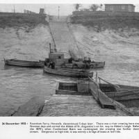
I mostly went out to hang out with my friends Sarah and Vik in Bedminster, but along the way I thought I'd take a closer look at something a little nearer home: the last crossing point of the Rownham Ferry.
And here's the picture that inspired this little local visit today. A week or so back I was browsing the boxes of books at Rachel's and Michael's Antiques on Princess VIctoria Street, and flipping through their collection of Reece Winstone books. Winstone's famous Bristol As It Was series are an amazing documentary source created by a man who loved both photography and Bristol and effectively became Bristol's foremost documentary photographer for decades. A lot more of Bristol's history is visible today because of him.
In the Bristol As It Was 1939 - 1914 book I saw this picture of the Rownham Ferry. Unfortunately the book was a first edition and priced at £20, so I ordered a cheaper edition from an independent dealer in Stockport when I got home! (Let's consider that as me leaving the rare first edition for the true connoisseurs, rather than just being cheap.)
Here we see the ferry just five days before its closure on the last day of 1932. Looking closely, it seems to be perhaps operating as a reaction ferry, with the boat tethered to a static line across the river, and the ferryman using the rudder to turn the boat and use the power of the flowing water to shuttle the boat from side to side. Clever!
Photo © Reece Winstone Archive. (I recommend buying the books if you like old photos of Bristol. They're amazing!)
Tags: Bristol Places UK onemilematt united kingdom river avon avon new cut Spike Island history Rownham Ferry
Auto-Tags: Boat Water Watercraft Vehicle Naval architecture Boats and boating--Equipment and supplies Ship Motor vehicle History Monochrome Water transportation Stock photography Lake Monochrome photography Sky
Text Recognition Tags: (63) 26 December 1932 : Rownham Ferry, Hotwells, discontinued 5 days later. There was a river crossing here since Norman days and carried the Abbot of St. Augustine's on his way to Abbot's Leigh. Before the 1870's when Cumberland Basin was re-designed, the crossing was further down- stream. Dangerous at high tide, it was merely a bridge of boats at low tide. (63) 26 December 1932 : Rownham Ferry, Hotwells, discontinued 5 days later. There was a river crossing here since Norman days and carried the Abbot of St. Augustine's on his way to Abbot's Leigh. Before the 1870's when Cumberland Basin was re-designed, the crossing was further down- stream. Dangerous at high tide, it was merely a bridge of boats at low tide.
