Tagged: bedminster-down
I was just about starting to feel better—the antibiotics seemed to have kicked in for my dental issues, and it had been some days since I'd left the house, and I was at last starting to get itchy feet. So, a wander. But where? Well, there were a few industrial bits near Winterstoke Road in the Ashton/Ashton Vale areas of Bristol that needed walking. I knew they were likely to be quite, well, unattractive, frankly. So why not do them while I wasn't feeling exactly 100% myself? Maybe it would fit my mood. Hopefully you're also in the mood for a bit of post-industrial wasteland, for that's what some of this feels like...
Then, at the last minute, I thought again about the Bristol International Exhibition—I've got a book about it on the way now—and that gave me another goal, which could just about be said to be in the same direction, and I decided to walk significantly further than my normal 1-mile limit and try recreating another historical photo...
Sadly I don't know much about the Ashton area; it's just on the edges of my mile and I rarely have cause to go there. It's brimming with history, I'm sure: the whole South Bristol area rapidly developed from farmland to coal mines to factories to its current interesting mixture of suburbs and industrial work over the last few hundred years. As a more working class area less attention was paid to it by historians, at least historically-speaking, than the Georgian heights of Clifton, and much of it has been knocked down and reinvented rather than listed and preserved. I see here and there some of this lack is being addressed, but I'm afraid I'll be very light on the history myself on this wander, as most of my usual sources aren't throwing up their normal reams of information as when I point them at Clifton, Hotwells or the old city.
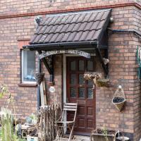
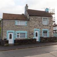
Fascinating architecture. Can't find anything out about this place from my usual sources, but a lot of the historical sources do seem to concentrate on things north of the river. If this was in Clifton I bet if would be on the Local List, at least. From the sign on the gate, it's 95 Bedminster Down Road, I think. I like the way the gambrel roof to the big barn-looking thing in the garden echoes the main building.
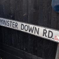
We're now through BS3 and into BS13, which the Bedminster Down district falls into. This sign's certainly seen better days.
I imagine the view was rather less industrial back then, though perhaps not: quite a lot of the scene from the front windows would have been open-cast collieries, thinking about it...
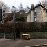
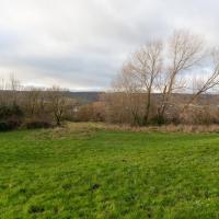
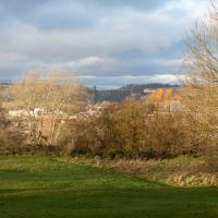
This is near the view I'm trying to recreate. Here are the fringes of Bedminster Down.
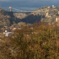
I did take a lot of slightly different angles, clambering around on the slippery slopes of Bedminster Down and having the occasional entanglement with trees. I think this shows pretty much the same view as the historical photo, or at least as close as you can get by wandering around on the ground in about the right place today.
It was nice to be able to find it, and I've never walked to Bedminster Down before. And it's a nice palate cleanser after all that rather dreary industrial stuff, anyway...
And that's the note I'll leave things on, as it was already getting a bit dark for photography, so I mostly plodded my weary way home without any further snapping. At more than 9km it's not my longest wander ever, but it's about twice as long as the average, so I may have overdone it...
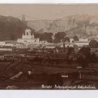
Source: Bristol Archives, Vaughan Collection.
Here we look, apparently from Bedminster Down, towards the "white city", the Bristol International Exhibition buildings of 1914.
This is the photo I've trooped all this way to reproduce. Have I managed to find the right spot?
