Tagged: naval-architecture
I bumped into my friend Lisa in town during yesterday's wander, and we decided to have a wander today, too. We managed quite a long ramble, starting up through Clifton and nipping down Park Row to investigate the two tower blocks I'd noticed popping up behind Park Street yesterday, then took in a few roads I'd not managed to get to before, including cutting through the grounds of Bristol Grammar School.
A London Wander in Southville
10 Apr 2021
There's a bit of Southville that I've been meaning to get to for some time, where the streets seem to take some strong inspiration from London. There's a Camden Road that crosses with an Islington Road, and a Dalston Road, even an Edgeware Road. For me these names are more evocative than the rather more exotic names I passed by to get there—Sydney Row or Hanover Place, say, because I've actually been to the places in London. The last time I was in Islington I saw Monkey Swallows the Universe play at The Angel, and I can't think of Camden without remembering a gondola trip with my friend Tara where a cheery youth played Beatles music for us on a saz...
I really liked this little area, with its mostly well-kept pretty houses and hints here and there of the creative side of the residents. It's arty and down-to-earth at the same time, and I wouldn't mind living there, I think.
On the way there I got the chance to walk through Underfall Yard for the first time in a while, and on the way back I had my first take-away hot food for many months, grabbing some crispy fried squid from the excellent Woky Ko at Wapping Wharf.
Coffee, Pirates and a Spitfire
15 Apr 2021
Just a quick trip to Imagine That for a flat white and a date ball (they're really nice), snapping the general sights along the way. No new roads, as has rapidly become the default on my lunchtime wanders, but as I'm in the routine of this project it almost seems strange not to pop my wanders up on the site.
A Longer-than-it-looks Walk With Lisa
06 Jun 2021
The track on the map doesn't tell the whole story of this walk with Lisa around and about Clifton, Berkeley Square, Brandon Hill and the harbourside, because the batteries on my GPS ran out while we were on the roof of Trenchard Street car park, it seems. Oh well. I think I did most of the area I was interested in finishing off around the University; there were only a few new bits around Brandon Hill that won't be on the track, and I can easily do them again.
Still, technology woes aside it was a nice walk, albeit a bit warm for climbing all those hills, and sat on the harbourside watching the world go by for a while, too. It was good to see the Bristol Ferry Boats carrying people around again, especially.
A Trip to the Library
08 Jun 2021
I had to return a book to the library—Ellic Howe's Magicians of the Golden Dawn, very interesting, thanks for asking—so I decided to pick the Central Library as my drop-off point and walk down a segment of Deanery Road that I've surprisingly overlooked so far. In any normal time I'd have been walking to work that way quite often, or heading through at the weekend on the way to do some shopping in the city centre, or for a coffee at St Nick's, but those excursions have been quite thin on the ground for the last year or so, for obvious reasons.
I've never been inside a single building on Deanery Road itself; the Library is technically on College Green and the rest is mostly student accommodation or Bristol College buildings, by the looks of things. It's a fairly mediocre street, used merely to get to other places. (St George's Road, which merges into it, at least has the distinction of several good shops verging from the practical and long-lived car radio fitters to the excellent little Dreadnought Books, sadly currently closed for refurbishment...)
After dropping off my book I came home via the harbourside, the better to enjoy the nice sunny blue skies of the day.
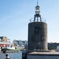
It's the remains of an old steam crane. It was fitted in 1891; not sure when it was scrapped. See next pic for what it used to look like.
Library, Bookshop, Coffee
03 Jul 2021
I was headed into town to return RA Gilbert's biography of AE Waite to the library and along the way I noticed that Dreadnought had finished their refurbishment, but wouldn't be open until midday. That left me some time to kill, so I bimbled around the old St Augustine's/Gaunt's area for a while, then headed up Park Street for a coffee and a snack to eat on Brandon Hill before heading home the way I'd came so I could pop in and buy a pamphlet on the Hot Well I'd been interested in for a while.
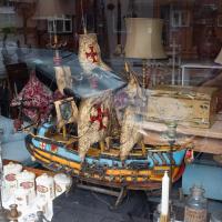
I could also do with a few of the "ANTI FOG LOZENGES" from the bottle at the front. This is the always-interesting window of Bristol Brocante.
A brocante in France is basically a flea market; the purported etymology I've seen is the Dutch word brok, meaning a piece or fragment.
Autonomous Vehicle
14 Jul 2021
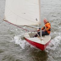
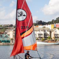
As it turned out, I didn't manage to get a coffee on my lunchtime coffee trip, as Imagine That were briefly shut down by a Covid-19 exposure notification (false alarm, it seems.) On the plus side, my trip was made worthwhile by spotting a couple of people from the University of Bath Mechanical Engineering Department testing an autonomous body-finding catamaran, which isn't a phrase I was ever expecting to write...
A Journey to the Far East
25 Jul 2021
The far east of the intersection of my one-mile radius and Bedminster, anyway. I was feeling a bit tired this morning, so I motivated myself to get out of the door by imagining one of Mokoko's almond croissants. That got me on my way, and I wandered across to Bedminster, through Greville Smyth Park, along most of the length of North Street (looking out for new Upfest 75-pieces-in-75-days artwork as I went) and then onto some new roads at the far end.
I only wanted to knock a few streets off my "to do" list, but by the time I'd diverted here and there to check out various bits of graffiti and other attractions and come back via the aforementioned purveyors of Bristol's finest croissants, I'd walked 7.4km. Not bad for someone who woke up tired, and at least I've done something with my day. I'm very glad the weather broke (we had tremendous thunderstorms yesterday), even if some of the pictures might've looked better with a blue sky. I was getting fed up with walking around in 29°C heat...
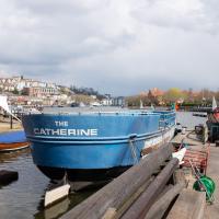
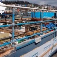
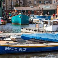
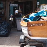
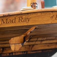
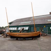
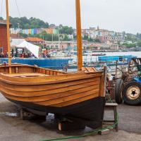
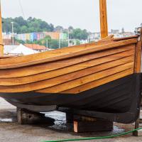
This boat's been under construction at Underfall Yard for quite some time. Here she is back in April. This is the first time I've seen it out of the boat-builder's shed, so I presume it's finished, or nearly so.
I really, really hope he's got another boat called Sea Airer.
Docks Heritage Weekend Day One
09 Oct 2021
I could spend a lot of time at the Docks Heritage Weekend, poking my nose into industrial places along the harbourside that are usually closed off, but throw open their doors once a year to show off a bit of the backstage area of Bristol's floating harbour. In fact, I warn you: the next wander is a long one, and will have quite a few photos.
However, for today's wander, on the Saturday, my friend Lisa needed a shorter walk than our usual long rambles, as she's recovering from an operation and still a little under the weather, so we just wandered into town for some food and back, with me making mental notes of the places I wanted to come back to on the Sunday... We walked through Underfall Yard, along to the L Shed (this is the warehouse next to the M Shed museum, where they still have the kind of fun old industrial stuff that used to be crammed into the M Shed's predecessor, the old Industrial Museum), through the street food market in town to Ahh Toots for cake and then back home. So, still quite a walk, but no hills and not so much of Lisa having to hang around waiting for me to fool around taking photos as usual, at least...
Fresh Fields
17 Oct 2021
For the first time in a while, I had the time and energy to go further afield and knock off some new roads from my "to do" list. I headed through the first Hotwells Festival to Ashton and Bedminster to cross off a few of the suburban roads south of North Street.
First, though, I decided to try to reproduce an old photo of the now-demolished Rownham Hotel just around the corner from where I live...
