Tagged: garage
Gothic Revival
08 Dec 2020
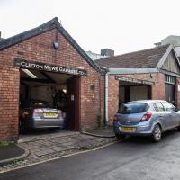
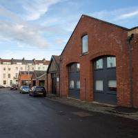
I had a chance to dash down a few new roads during my lunchtime jaunt today. My favourite feature was 7 Wetherell Place, at the corner of Frederick Place, one street behind the University of Bristol Students' Union building. Apparently I'm a sucker for gothic revival, which seems appropriate for this little project, which is reviving my interest in the local area.
The listing starts "1860. By JA Hansom. For himself".
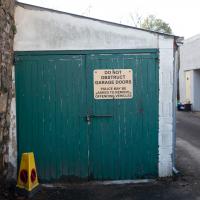
From the little white sign you can't read, they seem to be linked in some way to Automotive Solutions Ltd, who used to occupy the E Edwards building in Alma Vale Road I took a photo of at the weekend.
This is one of those streets you don't really go down unless you have a reason, which is why I always forget there's a busy garage right here. The nearest building seems to be offices, but I don't know if they're connected to the garage.
Better Look at an Extension
14 Apr 2021
Apart from a lovely coffee and a slice of Victoria sponge from Twelve, there weren't any new sights on this little lunchtime jaunt except for a slightly better look at the long raised extension at the back of the St Vincent's Rocks Hotel, where I at least got to see the arches it's raised up on. I also got a fair bit of exercise by walking up the Zig Zag to get there, and saw far more people out than I have in months, what with the lockdown having just been significantly lifted. As I walked past The Mall pub they were turning people away from their already-full garden, and the (outdoor) cafe tables were pretty full up.
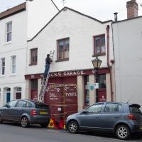
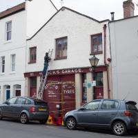
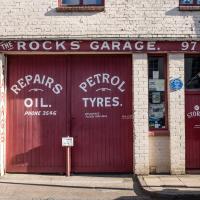
Nice to see someone keeping The Rocks Garage well-maintained. And they've safely wrapped Maggie Shapland's plaque in a carrier bag to protect it from paint drips, too. Excellent work.
Nice to see someone keeping The Rocks Garage well-maintained. And they've safely wrapped Maggie Shapland's plaque in a carrier bag to protect it from paint drips, too. Excellent work.
An Evening Wander to the Gallows
06 Apr 2021
I'd originally intended just to pop up to the area around Alma Road, where I'd missed a few streets on earlier wanders. It was such a nice evening, though, I decided to extend my walk up to the very top of Pembroke Road, just outside my one mile radius, to take a few snaps of something intriguing I'd found in my researches.
I've driven, walked and jogged past the little triangle of land at the top of Pembroke road a great deal in my time in Bristol, but I didn't know that it used to be the site of a gibbet, in fact that the road itself there used to be called Gallows Acre Lane. According to the Durdham Down history trail, by Francis Greenacre (an excellent name for a Downs researcher!) among other sources:
...it was below this quarry near the top of Pembroke Road, once called Gallows Acre Lane, that a gibbet stood. It was sometimes occupied by those who had committed robberies on the Downs and was last used in 1783 to hang Shenkin Protheroe for the murder of a drover. Stories quickly spread that he descended from the gibbet at midnight every night and stalked through Clifton. Such was the alarm that his body was cut down
and buried.
Also very close to this little triangle of land was one of the gates of the extensive turnpike system...
Anyway. Along the way I encountered a wooden tortoise and a real squirrel, among other things. It was a good walk, and more light in the evenings means I can move my wanders out of the ticking countdown clock of work lunch-hours and be a bit more leisurely.
I went to have a peep at the giant sinkhole that's opened up in Canynge Square—ironically, having recently discovered the gardens were public I'd had the (triangular!) square on my list to re-visit for a few days, but now there's no entrance to the gardens due to the danger. The area was well fenced-off for safety, but I tried to get a couple of photos from behind the barriers.
I also explored the area around Camp Road, an real melange of architectures, one of the most mixed-up areas I've seen in Clifton, in fact, and confirmed my friend Claire's suspicion that an earlier snap of a sign from Manilla Road was in fact for a fire hydrant. Nice.
