Tagged: monochrome-photography
A Quick Swing Past Ashton Court
05 Jun 2022
Another day not dissimilar to my last wander: I'm feeling a bit tired and rather than just moping around the house I thought I'd find some tiny bit of somewhere that I'd not yet walked and get outdoors. This time I headed for the Tobacco Factory Market in Bedminster, as I often do, but went the long way around via Ashton Court Mansion as I knew there were some footpaths and a small section of road I'd not ticked off up there. Finishing all the Ashton Court footpaths will be quite a long job, but you've got to start somewhere...
I did feel rather better by the time I got home, and, pretty much astoundingly given the weather forecast, managed to avoid the rain completely.
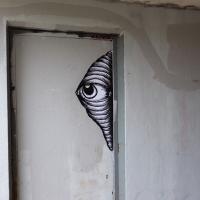
We're suddenly out of the woods and a fair distance away; I didn't take any snaps on my way through the little alleyway I've used before to get to Rownham village and down Parklands Road back toward Bedminster. Here we see an eye peeking out at the start of an underpass.
I've been pretty awful at reading so far this year, apparently averaging about one book per month. That's a far cry from 2019, say, where I got through 41 books in the year. Today's wander was prompted by my rubbish reading, as I needed to go hand back some books to the library, because I'd managed to renew them so many times that I hit the limit on renewals. Oops. Several of them were still unread.
So, off to the Central Library for me, tail between my legs. On the way there I did my best to recreate a historical photo of Dowry Square; while I was in the area I walked under the adjacent Norman arch and poked around behind the Cathedral, and I also had a little diversion to the city centre and came back along the south side of the river, hitting some trouble with the lock gates as I finally crossed the harbour back towards home.
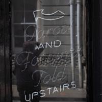
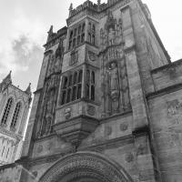
And now I've killed some time wandering around town, here we are back at the other side of the Abbot's gate on the way to collect the book I wanted from the library now it's actually past 1pm and the place is open. At least I accidentally found an interesting art exhibition along the way.
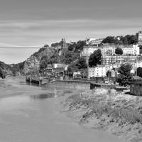
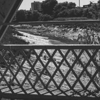
I'm in the habit of going over to the Tobacco Factory Market on a Sunday. I think I've walked all the routes around that way, but as a Plimsoll Bridge swing let me cross the road to the far side of Brunel Way on my return journey and I took a couple of photos of the brownfield development at the old Ashton Gate Depot site I thought I'd call it a Wander and pop some photos up.
I've recently been playing the computer game Life Is Strange, and it's inspired me to get a bit more snappy. The heroine is a photography student, and part of the game is to go around snapping artistic pics with her Polaroid camera. I don't have a polaroid, but the game did inspire me to stick the simple 50mm prime lens on the camera and to trust my instincts on things to snap. This was probably the best result of the day.