Tagged: residential-area
A Journey to the Far East
25 Jul 2021
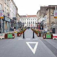
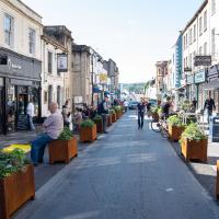
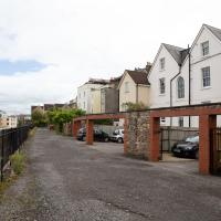
The far east of the intersection of my one-mile radius and Bedminster, anyway. I was feeling a bit tired this morning, so I motivated myself to get out of the door by imagining one of Mokoko's almond croissants. That got me on my way, and I wandered across to Bedminster, through Greville Smyth Park, along most of the length of North Street (looking out for new Upfest 75-pieces-in-75-days artwork as I went) and then onto some new roads at the far end.
I only wanted to knock a few streets off my "to do" list, but by the time I'd diverted here and there to check out various bits of graffiti and other attractions and come back via the aforementioned purveyors of Bristol's finest croissants, I'd walked 7.4km. Not bad for someone who woke up tired, and at least I've done something with my day. I'm very glad the weather broke (we had tremendous thunderstorms yesterday), even if some of the pictures might've looked better with a blue sky. I was getting fed up with walking around in 29°C heat...
Best coffee on North Street, for my money. I made the practical choice and abstained, though, as it's hard to take photos with a coffee in one hand.
It looked interesting, but then I realised I'd actually walked through it at night, some time back...
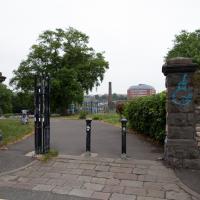
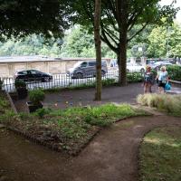
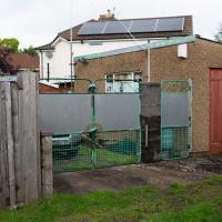
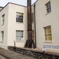
Must be nice for Morley Road to have its own entrance onto the park. Dame Emily Smyth was one of the last members of the Smyth family (as in Greville Smyth Park, the part at the other end of Bedminster that I often visit for a coffee from Hopper), and many, many things in and around the Ashton Court Estate are named for members of the family.
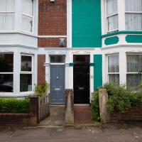
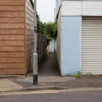
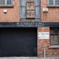
One of those streets with Bedminster's tradition of named houses in evidence. I do enjoy them.
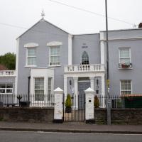
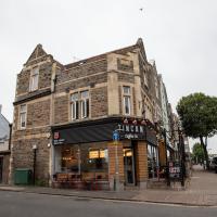
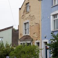
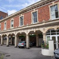
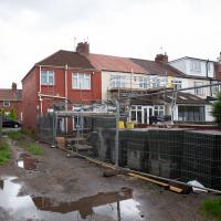
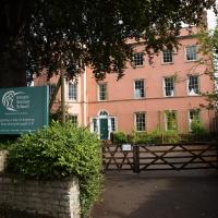
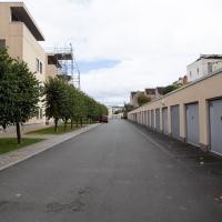
It has many good reviews on Tripadvisor. Certainly looks well-kept. This area, especially Coronation Road, is quite well-known for its reasonably-priced bed-and-breakfasts.
Green Squares and Secret Gardens
31 Jul 2021
At the end of July I went to have a look around some of the private gardens opened up by the annual Green Squares and Secret Gardens event. Sadly it was compressed into a single day this year, for various Covid-related reasons, it seems, so I didn't get to poke around too many places. I went to:
- A talk by the oldest resident of Victoria Square
- The St Vincent's Rocks Hotel garden
- The Paragon garden
- Cornwallis Crescent gardens, both east and west
- The Polygon garden
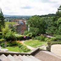
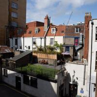
And snapped a few things in between, too. It was a lovely day—a bit too hot, if anything—and it was interesting to get into a few places I'd only ever seen from the outside, especially The Paragon and Cornwallis gardens, which are the least visible to passing strangers of all of them.
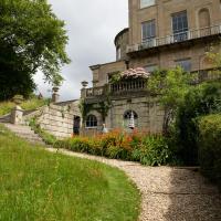
I've been wanting to go through these gates for a while; you can only get tantalising glimpses of the listed extension from the bit of grass adjacent.
Here's the listing. This bit's described thus:
To the rear a late C19 long brick extension raised on open arches
I've been trying to get a decent picture of this for a while.
Freshly painted, with the scaffolding only recently removed, and looking rather lovely. To its right is the old entrance to the earlier Hotwell pump house that used to stand down on the Hotwell Road, and just to the right of that is the entrance to the Clfiton Rocks Railway. Behind all that is the site of the original Clifton Spa pump room, a grand "long room" that was later used as a cinema and then a ball room. I wonder if there are any plans to renovate it? It was still disused, last I heard, but that was a long time ago, when I peeped through from a Rocks Railway open day....
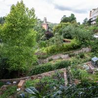
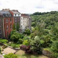
I think at the far left edge of this photo, near the bottom, you can see about as far as I got down the old Prince's Lane on a previous wander. This pic was, I believe, taken looking up at the garden in the foreground. I think the greenhouse there is still being constructed, and wasn't there during my earlier wander, but you can see some of the building materials, I think.
A Long Wander Of Miscellany and Magick
08 Aug 2021
This was a wide-ranging wander. I started off crossing the river to Bedminster, to walk a single little cul-de-sac, Hardy Avenue, that I'd managed to miss on at least one previous walk. Then, pausing only to explore a few back alleyways, I headed for a few destinations related mostly by the Hughes family, who I've been researching a little as part of background for a possible novel, as several of them were involved in the Stella Matutina.
However, mostly it's the artistic side of the family I wanted to explore today, as that's where most of their public history lies (as you might expect, there's often not much in the public record about the workings of an occult organisation.) First I visited College Green, where the façade of the Catch 22 Fish & Chip shop still bears the work of Catherine Edith Hughes. Then I wandered up to the top of Park Street to pop into the Clifton Arts Club's annual exhibition, as Catherine, her half-brother Donald, his wife Hope and at least two other Hugheses were members. Donald was chairman for 40 solid years; Hope was Secretary for eight, and Ellard and Margaret Hughes, two more Hughes siblings, were members along with Catherine.
Finally I walked home with a small diversion to Berkeley Square, to confirm the location of Donald Hughes's house by checking for a particular plaque by the front door.
I must admit I'm not entirely sure where all this research is really leading me, but I'm finding it quite interesting to bump across the faint lines of history that link the Hermetic Order of the Golden Dawn, founded in 1888, to modern, quotidian Bristol.
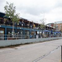
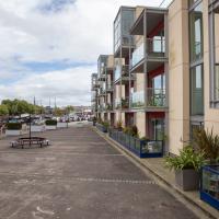
The extra strip of modular shops and eateries at Wapping Wharf seems to be doing quite well.
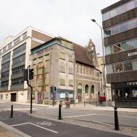
The rather derelict looking building on the corner of Prince Street and Royal Oak Avenue was at one point a Seaman's Mission & Instutue, and more recently an evangelilcal church of some kind. It was damaged during the war and seems to now be some kind of Frankenstein's monster of architecture with an odd modern frontage. The rather more together-looking (but still, frankly, unattractive!) building to the left is Prince House.
Edit to add: (19 June 2022): Know Your Place has just tweeted some amazing photos of the chapel interior (here's some more) that have just been added to the Community Layer on their incredibly useful website.
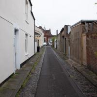
I wandered into a back alleyway that I hadn't explored before.
I reckon this is the back of Denmark Street, around where Smoke and Mirrors is.
It's almost like I planned this in advance. This is the 111th annual open exhibition of the Clifton Arts Club, founded 1906.
The Clifton Arts Club featured several members of the Hughes family. The three I'm interested in are Catherine Huges, of the earlier pomegranates, her brother Donald Hughes, and his wife Hope Hughes. They were all at some point members of the Stella Matutina as well as various arts groups in the city. Donald was a member of the Bristol Savages—ahem, sorry, Bristol 1904 Arts, as they've recently rebranded—and apparently something of a leading light on the Bristol art scene.
Museum of the Moon, and a Bit of Redland
21 Aug 2021
Lisa and I mostly went out to have a look at Luke Jerram's Museum of the Moon as its tour hit Bristol Cathedral—I missed it when it was previously in town, at Wills Hall, I think—but we also took a trek up to Redland. Lisa's kind enough to indulge my strange current fascination with the Edwardian eccentrics that made up the Stella Matutina, so we swung by a couple of places with a vague connection to the Bristol branch of the organisation. Well, it was good walking, anyway...
As a stunning bonus, one of the picture's descriptions has more information than you'd probably want on the Bristol Port Railway and Pier's Clifton Extension Railway line, but I did happen to coincidentally write up this wander after reading about the extension line during my lunch hour at work today. It's a thrilling life, I tell you...
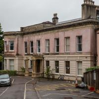
Cotham House seems to make more architectural sense from the back. Maybe this was originally the front?
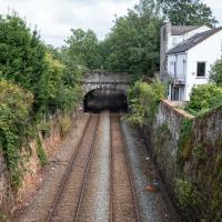
There's actually a Hotwells connection here, fairly literally. This section of track, from Ashley Hill, Montpellier, Redland, this bit right here, then Clifton Down and through a tunnel under the Downs to Sneyd Park Junction and Sea Mills station, was built as the Bristol Port Railway extension line, the Clifton Extension Railway.
The original Bristol Port Railway and Pier connected Hotwells to a deep-water pier at Avonmouth (with a few stations along the way) avoiding the need to have ships wait for the right tide to come into Bristol to unload. We've previously been inside one of its tunnels.
It was also used by plenty of passengers—during WWI an extra platform was added in Hotwells to cope with the sheer number of Bristolians commuting to the docks and munitions factories daily as part of the war effort, as well as troop movements and incoming wounded on hospital trains.
Later on this isolated Bristol Port track needed to join up to the existing railway network to survive, so this extension line was added to connect it with Ashley Hill with help from the Great Western and Midland railways. Only later did the section to Hotwells fall into disuse and close in favour of the Portway road.
(Information mostly courtesy Colin Maggs' The Bristol Port Railway & Pier, Oakwood Press, 1975.)
I don't know if there's any connection between the Bristol Hermes Temple and the Bristol Steiner School specifically, but I know that at least one of the Temple Chiefs met Rudolf Steiner and became quite enamoured of anthroposophy, so it's interesting that the school is so close to where Catherine Hughes, one of the first three chiefs, used to live, just down the road from here.
Mostly the Metal Animals of a Clifton Garden
30 Aug 2021
Lisa and I went for a longish walk, but I didn't take many photos. Mostly we just wandered and nattered. Unusually, my target was outside my 1-mile radius on Burlington Road in Redland, where I snapped quite a few photos of the collection of artistic animals by Julian Warren. This was mostly to provide a fairly arbitrary destination for a roundabout walk in Clifton...
The controversy about the pedestrianisation of this section of Princess Victoria Street continues to rage on NextDoor (seriously; I just had a look and the most recent thread about it had more than three hundred comments!)
Anything to do with parking/people driving into Clifton Village is always an insanely hot topic. I've never been able to get that worked up about it, myself, but then I live within walking distance (and I'm not trying to run a business that relies on people driving to me...)
Short and Sweet
06 Sep 2021
As if to prove that I don't have to go on giant rambles, here's a quick four-photo trip up to Clifton Village for a bit of cake. No new streets, just a tiny slice of life.
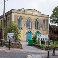
Shiny New Hope
24 Sep 2021
A quick lunchtime jaunt to Clifton Village. Along the way I admired the new sign on Hope Chapel and added to my tsundoku collection.
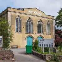
The scaffolding is down and there's a nice new sign (reminiscent of a historical one, I think,but I can't find the photo at the moment because Know Your Place Bristol is down) and you can just see the newly-installed solar panels on the roof behind it.
Among the many arguments about this pedestrianisation experiment, there has been quite the sub-debate over the delightfully modern COR-TEN steel steel/hideously ugly rusty* planters.
- Delete as applicable
A Morning of Research and a Cafe in a Castle
25 Sep 2021
I needed to pop to the library, as they'd kindly dug a book out of the reserve store at the B Bond warehouse for me and emailed me to let me know it was ready. So, I took a little trip to town, straight down the Hotwell Road, and spent a few hours reading before stretching my legs with a walk to a new cafe in the actual castle (or remnants thereof, anyway) of Castle Park, before heading back home down the other side of the harbour. As well as books and coffee, I bumped into a remote-controlled pirate ship, which isn't something you see every day, even in Bristol.
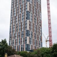
And towering over one of Bristol's oldest buildings, here's one of Bristol's newest, Castle Park View. Its 26 storeys towering up at 98 metres, it's now Bristol's tallest building, having beaten the 80m Castlemead and St Mary Redcliffe to joint second earlier this year. I'm not sure I'd fancy living in one of the 375 flats, but the view must be nice.
Rear of King Street. I would say "interesting frontage", but presumably this is interesting backage.
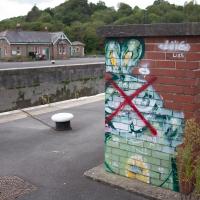
There's a deeply disturbing reason that this rabbit has been crossed out, but I've written that up in a later Wander, so you'll have to wait for an upcoming photo in October.
It's bad enough that the terrace opposite was demolished, without some hurriedly-qualified HGV reversing into the new1 buildings on this side...
1 I suppose "new" is relative. But on most of the maps I've been looking at recently these flats don't exist yet. I think the earlier buildings included a smithy and at one stage what looks like a tap-room, the Stork Tap, for the larger Stork pub that used to occupy what's now Stork House on the main road below. You basically couldn't move in Hotwells without falling into a pub throughout most of its history. The modern-day suburb seems positively teetotal in comparison...
I recently indulged myself by buying a little piece of history. I've mentioned Samuel Loxton and featured and linked to his drawings before, often in the eminently browsable Loxton Collection albums that Bristol Libraries has on Flickr. So when I saw a Loxton drawing of Hotwells pop up on eBay, I decided to get myself a little treat.
I don't think there's any Loxton drawing that features the road I actually live in—it's not very visible from anywhere else, not being one of these Clifton terraces that's perched at the top of a hill, or anything like that, and it's invisible in most views of the area. However, this Loxton drawing, Hotwells, Looking across the river from near the Clifton Bridge station, is probably the closest near-miss I've seen.
I decided to wander out one morning and see if I could reproduce the picture, and also take a photo or two of what's now become of the Clifton Bridge Station, which is still just about discernible in places.
(Then on an even stranger whim I decided to check out a possible little cut-through from Cumberland Road to the harbourside I'd been eyeing up on my commute to work, so walked to Wapping Wharf for a croissant via this potential new route, but that bit's not quite as interesting...)
I'd broadly planned to figure out the vantage point Loxton had used for his drawing by lining up Windsor Terrace with The Paragon, so I started taking bearings fairly early.

This, on the higher level, is the garages around the back of the houses on Cumberland Road.
And that, on the far side, is my regular commuting route in the mornings (and often the evenings—I only walk along the north side of the harbour if I'm late for work or if I fancy a change, as the Hotwell Road is a bit too trafficky to be that pleasant.)
So, this must be where everyone from the harbourside flats parks their cars. I never really thought to wonder where the parking was before.
This is my more usual view of the modern flats in question. I have to say, I do rather like these flats. If I had a spare million quid, I might even buy one...
I'm afraid that this is a bit of a badly-curated wander, where I mostly just popped out to find out a little of the history of Underfall Yard and poke around the various open workshops, and, in hindsight, really didn't take pictures in any kind of coherent order. So there's a lot of pictures, but they don't really tell the story that, in hindsight, I seem to have been trying to tell, of the unusual electrical substation in Avon Crescent, the Bristol Electricity that predates the National Grid but is still in use, the history of the hydraulic power house... It's a bit of a mess.
But I suppose sometimes these wanders—always chronologically presented in the order I walked and took photos—simply will sometimes be a bit of a mess. Let's hope you still get something out of it, anyway...
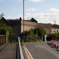
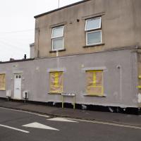
It's very hard to get a decent look at this building. This is the top half of the back of it.
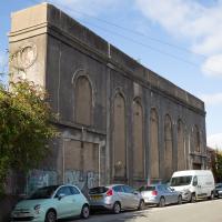
You can see this once apparently bright and airy building has had every window bricked up.
I understand that something in or around this building still supplies the odd electrical requirements (specifically, 360V "Bristol voltage") for some bits of Underfall Yard, which is our next stop, so more about that when we get there.
While it's not a listed building, is is notable: it's one of the earliest reinforced concrete buildings in the UK, apparently, construction starting in 1905. I assume it was up by 1907, as that's when Undefall Yard installed their electric pumps.
This oddity of history predates the National Grid and was originally fed from Feeder Road power station (well, Avonbank, on Feeder Road, to be precise. We've seen a bit of that history before, as a line marker for the line from Portishead to Feeder Road.) It was connected to Feeder Road by 1906, with a 6,600V line.
I've added a couple of historic views of the building as the next two photos in the wander, but I'll also pop this link to a Loxton drawing of the Avonbank electricity works, 1908 here.
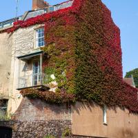
I can rarely resist snapping this house on the end of Freeland Place at this time of year, especially when the sun's catching both of the ivy-covered sides (well, Boston ivy, anyway; parthenocissus tricuspidata, I think.)