Tagged: residential-area
A Coffee and a Curve
27 Mar 2022
I wanted to have a wander along to the Tobacco Factory Market for some shopping, and checking the map for any leftover nearby streets I noticed a tiny curve of road on the way into the modern flats at Paxton Drive that it didn't look like I'd walked down before. I wouldn't take me too far out of my way, so I decided to head there first and then across to North Street to get my groceries and a coffee...
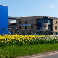
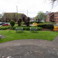
It's better than no daffodils, but they're still rather swamped by the rather industrial setting.
Which then becomes North Street, my destination. I need a coffee and some lunch and some veg.
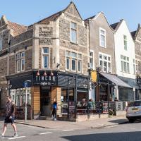
I headed here for a take-away flat white for the walk home. I may have to come here for brunch one day soon; I saw a pair of amazing looking brunch plates being delivered as I was waiting for my coffee. Looking at the brunch menu it could have been the Bubble and Bacon, and the Turkish Tagine.
At some point, the Council say that the Chocolate path will finally be repaired and I can at last add one of my favourite paths in Bristol to my One Mile Matt project.
Here's hoping.
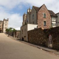
I noticed I had a few things on my "potential wanders" list that could all be done relatively close to home, and in a fairly straight line, so I set off at lunchtime to recreate a photo of a now-defunct pub, wander behind a Spar (which turned out to be more interesting than I'd expected, but I admit it's a low bar) and spend some time browsing in Dreadnought Books before coming home via a coffee from Spoke & Stringer, a little diversion up Gasworks Lane and a tiny bit of the Rownham Mead estate I'd somehow previously skipped.
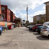
Here we are at the end of Pembroke Place, wandering a little alleyway I'd not previously filled in on the map. I didn't have high hopes for much of interest in this parking area behind Spar and Marcruss Stores. However, I did find something interesting, as we'll see in a couple of photos' time.
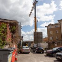
Not much to be seen in this direction except the crane on the site where they're busily filling a gap with new flats. We'll see the front in a little while.
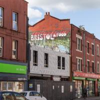
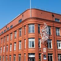
Interesting to think that this street art will presumably be sitting as a layer in between Marcruss Stores and the new-build flats for ever...
Here's a snap from before the cover-up.
Having checked the planning application it seems these may be going to be called the Black Horse Apartments, echoing the former name of Pembroke Place, which is a nice little touch.
And again—imagine it without all the rampant shrubbery and tree blossom. Great job, landscapers.
Easter Monday Gardens and Flowers
18 Apr 2022
I didn't really set out with a theme of flowers and gardens in mind for this walk. I just fancied heading up to Clifton Village to get lunch. As it turned out, though, Spring was springing, so a minor theme emerged as I started off with the graveyard flowers of Hope Chapel and wandered up to see the beginnings of the new wildflower garden at Clifton Hill Meadow.
I've taken plenty of snaps looking at Holy Trinity from the road, but I think this may be my first looking at the road from Holy Trinity.
There was a somewhat precarious path in the road protected by those yellow plastic barriers to get around some holes being dug in the pavement. I chose the safer route through the church garden and thought I might as well take a pic from the main entrance.
Strategically-placed grit box, because this tight blind (hence the mirror) zig-zag is hard enough work without a sheet of ice on the corner on a winter morning.
I thought I'd come and see how the wildflower garden was getting along. It's its first year, after a crowdfunder last year raised nearly £2000 to buy seeds, plug plants and signage.
I reckon this has recently been repainted. It definitely caught my eye in the spring sunshine.
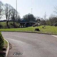
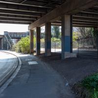
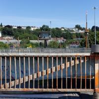
A Swing of the Plimsoll Bridge
24 Apr 2022
I was originally going to head over to the Ashton area to see if I'd missed any bits around the football stadium—and also to grab some lunch from the Tobacco Factory Market—but in the end I got a little distracted by having accidentally chosen exactly the right time to see the Plimsoll Bridge swing on one of the first busy days of Spring, where a lot of pleasure trips tend to head out down the Avon (and possibly the New Cut) from Hotwells.
In the end I mostly snapped that, and just a couple of photos from the Ashton area where I grabbed some lunch but didn't do any new exploring.
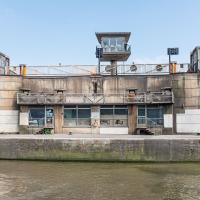
You can see the man whose job it is to work the rather complicated-looking controls in the control tower has come out onto his balcony now the opening procedure is done.
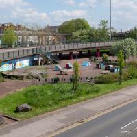
Can't spot any music or a cafe in this photo? I don't blame you. But, if you look mid-left, you'll see a circular concrete plinth where the cafe used to stand near the children's playground in the heyday of the Cumberland Basin. And behind it is what caught my ear as I was crossing the lock gates—a saxophonist is practising his scales.
I've come across practising musicians in this area before. Presumably they've come away from home to avoid annoying the neighbours (or the rest of the family!) The traffic noise covers even unmuted brass quite well—by the time I was at the other end of the footbridge, on the far side of the flyover, I could barely hear him.
A Quick Swing Past Ashton Court
05 Jun 2022
Another day not dissimilar to my last wander: I'm feeling a bit tired and rather than just moping around the house I thought I'd find some tiny bit of somewhere that I'd not yet walked and get outdoors. This time I headed for the Tobacco Factory Market in Bedminster, as I often do, but went the long way around via Ashton Court Mansion as I knew there were some footpaths and a small section of road I'd not ticked off up there. Finishing all the Ashton Court footpaths will be quite a long job, but you've got to start somewhere...
I did feel rather better by the time I got home, and, pretty much astoundingly given the weather forecast, managed to avoid the rain completely.
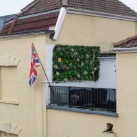
First hint of Jubilee-related decorations on this rather odd balcony at the bottom of Granby Hill. The other decoration on this building is a peeing "KEEP YOU JOB KEEP THE POUND" sticker in the next window along that looks like it dates from the 1990s.
I've been pretty awful at reading so far this year, apparently averaging about one book per month. That's a far cry from 2019, say, where I got through 41 books in the year. Today's wander was prompted by my rubbish reading, as I needed to go hand back some books to the library, because I'd managed to renew them so many times that I hit the limit on renewals. Oops. Several of them were still unread.
So, off to the Central Library for me, tail between my legs. On the way there I did my best to recreate a historical photo of Dowry Square; while I was in the area I walked under the adjacent Norman arch and poked around behind the Cathedral, and I also had a little diversion to the city centre and came back along the south side of the river, hitting some trouble with the lock gates as I finally crossed the harbour back towards home.
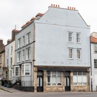
Nowadays known as York House, and apparently offices, this was originally built by George Tully, like a lot of the rest of the square.
According to this Heritage Statement about No. 10 by Mark Hines Architects he started building in 1723, imagining accommodation houses for Hotwells visitors, but later built this large hotel and other buildings like the Clifton Dispensary at No 12 as the spa became more popular and the square evolved into a centre of medicine. I'm a little confused by that claim as the York Hotel went up c. 1780, according to the listing, when Tully had been dead for ten years, but perhaps it means he planned it before he died.
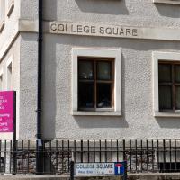
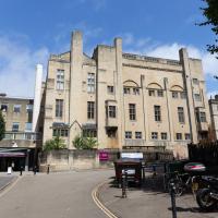
The Bristol Cathedral School has seen some controversy over the years, especially after it was given permission in 2013 for the Primary School to take over some of the Central Library. They turfed out some of the archives, which is presumably why I need to wait a week when I order an old book from the library, as someone now has to hoof it down to the B Bond warehouse to fetch it for me, rather than just downstairs.
Founded in 1140, dissolved and then re-founded by Henry VIII in 1542 after he dissolved the monastery, it's only very recently become a City Academy. It is allegedly non-selective these days, but my guess would be that its pupils' parents are significantly posher and richer than others in the local catchment area.
I'm in the habit of going over to the Tobacco Factory Market on a Sunday. I think I've walked all the routes around that way, but as a Plimsoll Bridge swing let me cross the road to the far side of Brunel Way on my return journey and I took a couple of photos of the brownfield development at the old Ashton Gate Depot site I thought I'd call it a Wander and pop some photos up.
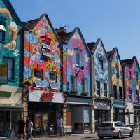
The street art is still looking good, but one of these properties has been turned into such low-end multiple-occupancy accommodation that it got into the Bristol Post this week with pictures of one tiny room with a shower alongside the bed serving as the sole room per person, with a toilet shared between four "studio rooms". I suppose this is actually better than the student accommodation I had in my first year at Warwick, but at least that was actually on campus...
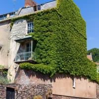
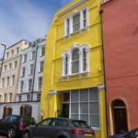
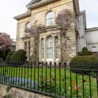
Well, technically that's Freeland Place, I suppose, but I was standing on Granby Hill to take the photo. I wonder how many photos of this fab house with its wrapping of Boston ivy I've taken over the years? I find it hard to resist on a nice clear day, especially if there aren't any cars parked on the hill and the ivy is in full effect.
Nipping Up the Zig Zag to the Shops
19 Aug 2023
It's been a long while since I did one of these walks.
I'm thinking of finishing up the project by walking one or two last bits of road, thus being able to declare with all honesty that I've done my best to walk every public road within my mile (and quite a few alleyways besides.) As a prelude, and just because I felt like it, I decided to drag out the camera and GPS on this little wander to the local shops.
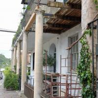
I was concerned about the state of Rock House, or at least its southern half, the last time I took a closer look at it while passing. Happily it seems to have been bought by someone prepared to fix up that drooping balcony. Here's hoping these repairs continue and my next photo of the place shows both sides of this old house (dated back to at least 1731 by a William Halfpenny engraving, no matter what the Listing says.)
Just behind Rock House you can see a bit of the Colonnade, sawn off at the end to make room for the widened Hotwell Road, I believe. Back in the day, according to 1925's The Bristol guide; being a complete ancient and modern history of the city of Bristol, the Hotwells and Clifton:
For those who prefer exercise to silting, there is the Colonade with shops, built beneath the rocks, and a parade about 800 feet long, shaded with trees, by the side of the river, so that the company may enjoy a dry and pleasant walk when it rains, or an airy, cool, and shady walk in the warmest season: also during the influx and efflux of the river, they may be entertained with the sight of the Merchant's ships, Steam packets, and Coasting vessels that generally pass up or down.