Tagged: art-paint
Harbour Circumnavigation
01 Mar 2021
Normally I don't have enough time in my lunch hour to get all the way around the harbourside. This is a shame, as Wapping Wharf is a great place to get coffee and a snack, but it's pretty much diametrically (perimetrically?) opposite me on the harbour. Today I had the day off, so I decided to go and knock off a few streets around Anchor Road that I'd not covered, as well as visiting the site of the Read Dispensary (well, one of them) and dropping into Mokoko for one of their astounding almond croissants. From there I came back along the south side, checking out the views from as much of the Chocolate Path as you can venture down at the moment, and swapping from Cumberland Road to Coronation Road at Vauxhall Bridge.
There's a lot of meh photos on this walk—my chief output from this project could be politely described as "record shots"—but a few turned out well, especially those of Vauxhall Bridge from the Chocolate Path, which reminded me how much of a loss the current closure of the Chocolate Path is to walkers and cyclists in Bristol.
Walking under the bridge next to one of the stanchions, I noticed this big crack. I wonder whether that's just complete coincidence or if they're inspecting the bridge because of some problem that someone's noticed, or a recent accident?
Of Bridges and Buoys
04 Mar 2021
A trip to Imagine That coffee, so no fresh roads knocked off my list, but I stopped off to snap a couple of the engineering-related bits of the docks: the Campbell Buoy (used by P&A Campbell for mooring their paddle steamers) and Brunel's "other" bridge, the foot/horse swing bridge that now sits sadly disused in the shadow of the Plimsoll Bridge at Howard's Lock.
I wasn't going to take a very long walk on this nice spring evening; it just happened. I was going to knock off a path or two on Brandon Hill, home over centuries to hermits and windmills, cannons and Chartists, and then just wander home, stopping only to fill up my milk bottle at the vending machine in the Pump House car park.
However, when I heard a distant gas burner I stayed on the hill long enough to see if I could get a decent photo of both the hot air balloon drifting over with Cabot Tower in the same frame (spoiler: I couldn't. And only having the fixed-focal-length Fuji with me didn't help) and then, on the way home, bumped into my "support bubble", Sarah and Vik, and extended my walk even further do creep carefully down the slipway next to the old paddle steamer landing stage and get some photos from its furthest extreme during a very low tide...
I got interested in Bristol's medieval water supplies after poking around near Jacobs Wells Road and Brandon Hill. It was during that research I found out about a pipe that's still there today, and, as far as I know, still actually functioning, that was originally commissioned by Carmelite monks in the 13th century. They wanted a supply of spring water from Brandon Hill to their priory on the site of what's now the Bristol Beacon—Colston Hall, as-was. It was created around 1267, and later, in 1376, extended generously with an extra "feather" pipe to St John's On The Wall, giving the pipework its modern name of "St John's Conduit".
St John's on the Wall is still there, guarding the remaining city gate at the end of Broad Street, and the outlet tap area was recently refurbished. It doesn't run continuously now, like it did when I first moved to Bristol and worked at the end of Broad Street, in the Everard Building, but I believe the pipe still functions. One day I'd like to see that tap running...
There are a few links on the web about the pipe, but by far the best thing to do is to watch this short and fascinating 1970s TV documentary called The Hidden Source, which has some footage of the actual pipe and also lots of fantastic general footage of Bristol in the seventies.
On my walk today I was actually just going to the building society in town, but I decided to trace some of the route of the Carmelite pipe, including visiting streets it runs under, like Park Street, Christmas Street, and, of course, Pipe Lane. I also went a bit out of my way to check out St James' Priory, the oldest building in Bristol, seeing as it was just around the corner from the building society.
There are far too many pictures from this walk, and my feet are now quite sore, because it was a long one. But I enjoyed it.
Swinging By Sydney Row
01 Apr 2021
Another workday, another quick coffee excursion. This time I decided to swing past Sydney Row on the way back from the marina car park where Imagine That have their horsebox. I didn't know until recently that the terrace was built for workers at the adjacent dockyard.
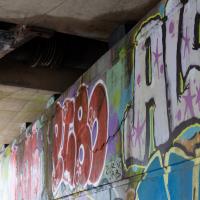
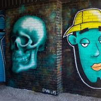
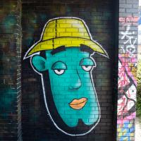
I've also gradually come to the conclusion that I don't really think very two-dimensionally when it comes to finding my way around or associating one place with another. I only realised in the last few days that the odd industrial building that takes up the other half of Syndey Row, the one that's always covered with graffiti, is the back of the dockyard works. In my defence, as it's tucked away in a corner of the little industrial estate that I've never ventured into (I rarely find I have a need for the products of safety valve manufacturers), I don't think I've ever seen the front of the building...
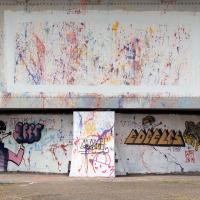
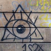
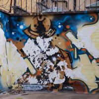
The pivot point of the Plimsoll Bridge is getting a lot of paint-based attention at the moment. Graffiti seems to be rife all round, in fact. I suppose there's not much else going on right now...
Long Bemmie Wander with Lisa
11 Apr 2021
My friend Lisa joined me again, this time for a long wander through "Bemmie". In fact, I tweeted recently using "Bedmo" as my abbreviation for Bedminster, and apparently there's something of a culture war going on. From what I can glean, the longer-term residents call it "Bemmie" and consider "Bedmo" a name made up by hipster gentrifiers.
I had no idea, but then I didn't grow up around here, and I don't live in Bedminster, and I'm not a hipster. I'm not sure I've ever gentrified anywhere, either; Hotwells was already quite gentrified by the time I arrived. I probably just lowered the tone a bit.
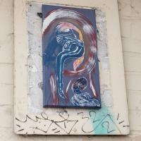
Anyway. Lisa and I entered Bemmie by the traditional toll gate (though actually you'd only have paid if you were coming from the Long Ashton direction, not merely nipping across from Hotwells) and then almost literally combed the streets to knock several new roads off my list of targets. Along the way we saw lots of street art, as you'd expect, and admired the area's panoply of gorgeous knockers.
The new development on the site of the old brewery (which I visited once for a behind-the-scenes peek with some food- and beer-blogger friends) isn't going down that well with the neighbours.
Man on a Mission
17 Apr 2021
I went rather outside my area today, as I went to pick something up from the Warhammer shop on Wine Street (Games Workshop as-was, and before that I think perhaps a rare retail outlet for Her Majesty's Stationery Office? I may be mis-remembering...) Anyway, a friend of mine wanted something picking up and posting to him, so I figured I'd knock some streets off my list along the way.
I first headed for the St George's Road area, walking down the narrow Brandon Steps and finding some strange wall art on Brandon Steep, then headed to the Old City via Zed Alley. The Warhammer shop visit was friendly and efficient, and, mission accomplished, I treated myself to a sausage roll and a flat white from Spicer + Cole, to take away and eat in Queen Square with its current decoration of hearts. I finished off with a detour up Park Street, looking out for St John's Conduit markers, before finally crossing Brandon Hill on the way home.
Quite a long wander, all told, and I'm a bit knackered today...
Coffee, Coronation and Clift House Road
28 May 2021
Another dash to Greville Smyth Park for a coffee from Rich at Hopper, but at least this time I managed to divert a bit and knock off a small section of Cumberland Road I'd managed to miss on previous excursions. Along the way I muse on a strange residence in between a warehouse and a tannery, and wonder if the Mayor might be deliberately letting the Cumberland Road Flyover area go to seed...

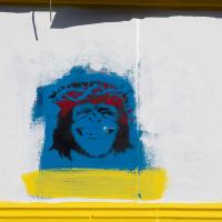
Bank Holiday Street Art
31 May 2021
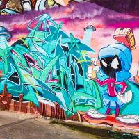
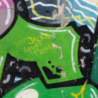
A nice warm Bank Holiday Monday saw me walk back over to Bedminster to do justice to something we glimpsed on my last wander. Along the way I spotted a couple of new pieces of street art tucked away on the south side of the Cumberland Basin Flyover system, so this turned into a micro-graffiti walk.
A Longer-than-it-looks Walk With Lisa
06 Jun 2021
The track on the map doesn't tell the whole story of this walk with Lisa around and about Clifton, Berkeley Square, Brandon Hill and the harbourside, because the batteries on my GPS ran out while we were on the roof of Trenchard Street car park, it seems. Oh well. I think I did most of the area I was interested in finishing off around the University; there were only a few new bits around Brandon Hill that won't be on the track, and I can easily do them again.
Still, technology woes aside it was a nice walk, albeit a bit warm for climbing all those hills, and sat on the harbourside watching the world go by for a while, too. It was good to see the Bristol Ferry Boats carrying people around again, especially.