Tagged: landmark
Long Bemmie Wander with Lisa
11 Apr 2021
My friend Lisa joined me again, this time for a long wander through "Bemmie". In fact, I tweeted recently using "Bedmo" as my abbreviation for Bedminster, and apparently there's something of a culture war going on. From what I can glean, the longer-term residents call it "Bemmie" and consider "Bedmo" a name made up by hipster gentrifiers.
I had no idea, but then I didn't grow up around here, and I don't live in Bedminster, and I'm not a hipster. I'm not sure I've ever gentrified anywhere, either; Hotwells was already quite gentrified by the time I arrived. I probably just lowered the tone a bit.
Anyway. Lisa and I entered Bemmie by the traditional toll gate (though actually you'd only have paid if you were coming from the Long Ashton direction, not merely nipping across from Hotwells) and then almost literally combed the streets to knock several new roads off my list of targets. Along the way we saw lots of street art, as you'd expect, and admired the area's panoply of gorgeous knockers.
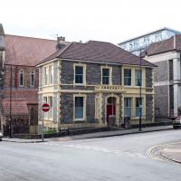
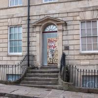
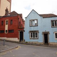
A particularly tidy little house. I really like this style; Lisa found it a bit fussy and overly-ornate, but I think I've had my ornateness-meter recalibrated by all the gothic revival stuff in Clifton...
Man on a Mission
17 Apr 2021
I went rather outside my area today, as I went to pick something up from the Warhammer shop on Wine Street (Games Workshop as-was, and before that I think perhaps a rare retail outlet for Her Majesty's Stationery Office? I may be mis-remembering...) Anyway, a friend of mine wanted something picking up and posting to him, so I figured I'd knock some streets off my list along the way.
I first headed for the St George's Road area, walking down the narrow Brandon Steps and finding some strange wall art on Brandon Steep, then headed to the Old City via Zed Alley. The Warhammer shop visit was friendly and efficient, and, mission accomplished, I treated myself to a sausage roll and a flat white from Spicer + Cole, to take away and eat in Queen Square with its current decoration of hearts. I finished off with a detour up Park Street, looking out for St John's Conduit markers, before finally crossing Brandon Hill on the way home.
Quite a long wander, all told, and I'm a bit knackered today...
With the old Lloyds bank building in the background. When I used to work on Wine Street, around the front of the building, back in the 1990s, every now and again there'd be the sound of sirens as the police stopped the traffic through the centre and armoured cars would drop off or collect (I can't remember which) large amounts of cash from the giant bank vault in this rather defensive-looking concrete building.
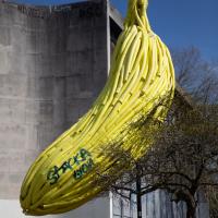
I have to say, whoever moulded this form really has captured the intrinsic banana-ness of the banana very well.
I've mentioned the Lord Mayor's Chapel before when wandering the area behind it, where the Gaunts Hospital used to stand. Now known as either the Lord Mayor's Chapel or St Mark's Church, it was formerly (i.e. before 1722!) known as Gaunt's Chapel. It was built around 1230, and named after Maurice de Gaunt, who founded both the Gaunt's Hospital and this, its attached chapel.
Leftovers with Lisa
01 May 2021
I didn't get to all the little leftover streets around the northeastern part of my area in today's wander, but I definitely knocked a few off the list, plus Lisa and I enjoyed the walk, and didn't get rained on too badly. We spotted the hotting-up of Wisteria season, checked out Birdcage Walk (both old and new), ventured onto the wrong side of the tracks1 and generally enjoyed the architecture.
1 Well, technically we probably shouldn't have been on the grounds of those retirement flats, but nobody started chasing us around the garden with a Zimmer frame
Victoria Square Underpass
06 May 2021
I'm meant to be taking a little break from this project, but in my Victoria Square researches after my last walk I noticed a curiosity I wanted to investigate. The community layer on Know Your Place has a single photograph captioned, "The remains of an 'underpass' in Victoria Square".
Looking back through the maps, I could see that there really did used to be an underpass across what used to be Birdcage Walk. I can only guess that it was there to join the two halves of the square's private garden that used to be separated by tall railings that were taken away during WWII. Maybe it was a landscaping curiosity, maybe it was just to save them having to un-lock and re-lock two gates and risk mixing with the hoi polloi on the public path in the middle...
Anyway. Intrigued, I popped up to Clifton Village this lunchtime for a post-voting coffee, and on the way examined the remains of the underpass—still there, but only if you know what you're looking for, I'd say—and also visited a tiny little road with a cottage and a townhouse I'd never seen before, just off Clifton Hill, and got distracted by wandering the little garden with the war memorial in St Andrew's churchyard just because the gate happened to be open.
EDIT: Aha! Found this snippet when I was researching something completely different, of course. From the ever-helpful CHIS website:
When there were railings all round the garden and down the central path, in order that the children could play together in either garden there was a tunnel for them to go through. This was filled in during the 1970s but almost at the south east end of the path if one looks over the low wall the top of the arches can still be seen.
Sequel Injection
07 May 2021
I saw this tweet the other day and started thinking of my second Covid-19 vaccination as my "Sequel Injection" (to a geek, it's funny. You'll have to take my word for it.) Whatever you call it, this morning I went and got it.
It was in the same place I got my initial injection—my left arm! No, okay, it was at the Clifton College Prep School. I didn't take any photos of the event itself; the NHS production line is so efficient you barely have time to do anything else, even if the privacy of other patients wasn't a factor.
Along the way I mused at all the road resurfacing going on in Clifton, and also discovered a secret (okay, not-well-known and possibly slightly trespassey) way into Canynge Square, and on the way back I knocked off a few streets from my "leftovers list" of north-east Clifton. I've got much of Clifton done now, with the only obvious "to dos" on the east side of Whiteladies Road...
It was quite a long walk, and I'm feeling pretty tired now, though that might be the effects of the jab too, I suppose. Anyway. Tomorrow and Monday I'm walking outside Bristol, I think, and I imagine my feet will need some recovery time on Sunday, so it might be a while before I post another Wander.
Bocye's Avenue Windows
19 May 2021
I just nipped up to Clifton Village to get a coffee, though I did manage to walk down a little alleyway I'd not really noticed before. Or perhaps I had noticed it and it looked private, but today I felt like wandering up its twenty or so feet anyway... The reflections in the shop windows on Boyce's Avenue gave me the idea to take a few snaps of them, so that's the majority of my small amount of snapping today.
Shop Fronts of Regent Street
22 May 2021
I didn't even think I'd manage to get out today, such was the weather forecast. As it turned out, it's been quite a nice day, and I managed to nip up to Clifton Village to pop to the Post Office. As with my last outing, I decided after snapping one shop-front on Regent Street that I might as well snap the whole row, and muse on a few of them, the only service I really offer over and above Google Street View for a lot of my pictures 😀
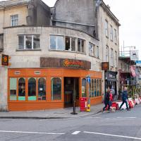
I've not been in since it changed from a Boston Tea Party, but I may have to try it just to sit upstairs and watch the world go by like I used to...
I managed to knock off a reasonable chunk of the roads I had left to walk around the University at the north-eastern extremity of my mile on this nice sunny walk. As well as being impressed by the number of big townhouses now occupied by various departments, I took some time on my way there to check out a war memorial, and some time on the way back to do a little extra wandering of Berkeley Square.
Looks like Hope Chapel is going solar. Seems a good idea, and you can barely see the roof from anywhere.
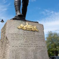
What's Egypt got to do with South Africa, you ask? It's the badge of the Gloucester Regiment.
The Glosters were the only regiment in the British Army to wear a cap badge on both the front and the back of their caps, and it's unsurprising that it references Egypt. At the Battle of Alexandria in 1801:
The front and rear ranks of the 28th were simultaneously engaged, whereby the soldiers received the order "Front rank stay as you are, rear rank about turn" and in commemoration the regiment later adopted a second cap badge, the 'Back Number,' worn at the back of their head-dress.
The Glosters were later merged with a couple of other regiments, but their successors, the Rifles, still wear the back badge.
Woodland Road really has got some grand houses, but they've got such big gardens and trees that it's hard to get a decent snap
A Longer-than-it-looks Walk With Lisa
06 Jun 2021
The track on the map doesn't tell the whole story of this walk with Lisa around and about Clifton, Berkeley Square, Brandon Hill and the harbourside, because the batteries on my GPS ran out while we were on the roof of Trenchard Street car park, it seems. Oh well. I think I did most of the area I was interested in finishing off around the University; there were only a few new bits around Brandon Hill that won't be on the track, and I can easily do them again.
Still, technology woes aside it was a nice walk, albeit a bit warm for climbing all those hills, and sat on the harbourside watching the world go by for a while, too. It was good to see the Bristol Ferry Boats carrying people around again, especially.
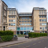
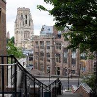
Between University Walk and Woodland Road. Quite the view. I don't get up this way often, so I've rarely seen this side of the Wills Tower.
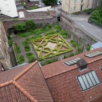
The building I was interested in is the one with those skylights. It's the "wigwam" of an artists' collective that was until quite recently called the Bristol Savages and used native American imagery quite strongly in its branding, and also didn't let women in, apparently.
They were somewhat roasted for this behaviour and have now emerged as Bristol 1904 Arts instead.
I have no tomahawk to grind here; I was merely interested in a former member, Donald Hughes, who painted some interesting scenes of Bristol and whom I believe may have been a member of the Stella Matutina, a long-defunct secret society I'm interested in. (It's a long story.)
A Trip to the Library
08 Jun 2021
I had to return a book to the library—Ellic Howe's Magicians of the Golden Dawn, very interesting, thanks for asking—so I decided to pick the Central Library as my drop-off point and walk down a segment of Deanery Road that I've surprisingly overlooked so far. In any normal time I'd have been walking to work that way quite often, or heading through at the weekend on the way to do some shopping in the city centre, or for a coffee at St Nick's, but those excursions have been quite thin on the ground for the last year or so, for obvious reasons.
I've never been inside a single building on Deanery Road itself; the Library is technically on College Green and the rest is mostly student accommodation or Bristol College buildings, by the looks of things. It's a fairly mediocre street, used merely to get to other places. (St George's Road, which merges into it, at least has the distinction of several good shops verging from the practical and long-lived car radio fitters to the excellent little Dreadnought Books, sadly currently closed for refurbishment...)
After dropping off my book I came home via the harbourside, the better to enjoy the nice sunny blue skies of the day.
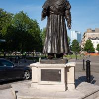
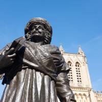
"He was known for his efforts to abolish the practices of sati and child marriage." I was aware of the awful practice of sati purely because it came up in a crossword once. Efforts to abolish it certainly seem statue-worthy.
This statue stands outside the Central Library, between it and City Hall. The Bristol connection is that he travelled to the UK as an ambassador "to ensure that Lord William Bentinck's Bengal Sati Regulation, 1829 banning the practice of Sati was not overturned". He died in Stapleton, Bristol in 1833. As well as this statue, he's buried in a fine mausoleum in the beautiful Arnos Vale cemetery.
It's still a popular moustache style among Indian gentlemen, if erstwhile workmates from Mumbai and other places are anything to go by.

