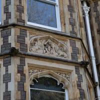
Tagged: molding
I went to have a peep at the giant sinkhole that's opened up in Canynge Square—ironically, having recently discovered the gardens were public I'd had the (triangular!) square on my list to re-visit for a few days, but now there's no entrance to the gardens due to the danger. The area was well fenced-off for safety, but I tried to get a couple of photos from behind the barriers.
I also explored the area around Camp Road, an real melange of architectures, one of the most mixed-up areas I've seen in Clifton, in fact, and confirmed my friend Claire's suspicion that an earlier snap of a sign from Manilla Road was in fact for a fire hydrant. Nice.
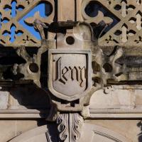
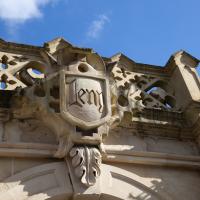
As a Lovecraft fan, I had of course read this as "Leng", but it's actually "Leny". LENY AND ATTACHED GATEWAY AND FRONT GARDEN WALLS AND RAILINGS
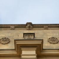
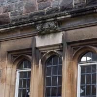
Historically, Albermarle Row was spelled "Albemarle", after George Monck, 1st Duke of Albemarle who was arrested and imprisoned in Bristol in 1642 when he refused to swear an oath supporting the Royalists during the Civil War. Most (but not all) of its street signs are now spelled "Albermarle", apparently after a mistake was perpetuated by a typo in a Council database a while back, and the spelling has spread to Google Maps and the Royal Mail database.
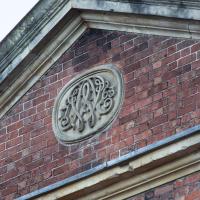
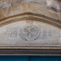
Other incorrect information on the internet about Albe(r)marle Row includes Historic England's listing, which says that this tympanum has "Webb's monogram with 1762."
Prince's Lane
06 Jan 2021
The International Grotto Directory website says:
Prince’s Lane might have been one of the original ancient tracks from Hotwells to Clifton, in the Avon Gorge. The site later formed part of Rownham Woods which comprised some thirteen acres. By the end of the 18th century and the early 19th century, the Society of Merchant Venturers granted to Samuel Powell a building lease, for The Colonnade (1786), St. Vincent’s Parade (1790), Prince’s Buildings (1796), and Rock House. Rock House is generally considered to be the oldest surviving building associated with the Hotwell (see Chapter 20). John Power conveyed part of the woods to William Watts for the construction of Windsor Terrace (1790-1808).
The above development of the Avon Gorge cleared Rownham Woods, and created a triangle of land on the north side of the gorge, that became enclosed as a result, by Mansion Houses, whose garden walls all entered on to Prince’s Lane. The Lane started at the bottom of the gorge, at the base rock of Windsor Terrace, and came out half way up Sion Hill. It is clearly shown as a public footpath, dotted with trees, in Ashmead’s map of 1828. Some of the gardens were quite steep in parts and therefore, had to be terraced, because of the gradient of the gorge.
I've passed Prince's Lane literally thousands of times in my life, every time I've walked past the Avon Gorge Hotel, which itself started (in 1898) as the Grand Clifton Spa and Hydropathic Institution and pumped water up from the Hot Well for its hydropathic treatments. I've never actually ventured down it until today, or at least nothing like as far down it as I did this afternoon—I may have poked my head around the back of the hotel to see the original pump rooms at some point in the past.
This was a great wander, though it does very much feel like a private road, and frankly I may have been pushing my luck a bit by winding my way between the astoundingly big back gardens of the houses of some presumably very wealthy Cliftonites, but I felt vaguely justified in exploring the history of one of the oldest footpaths in my part of Bristol...
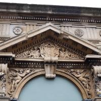
"Built 1894, designed by Philip Monro for Sir George Newnes, the promoter of the scheme", hence the GN in the pediment. He also funded the Clifton Rocks Railway, apparently.
Mirror Maze
10 Jan 2021
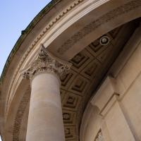
Went for a wander with my friend Lisa—the current lockdown rules seem to be that one local walk for exercise per day with a maximum of one person not in one's "bubble" is fine—up to the University of Bristol area right at the edge of my one-mile perimeter to see the Jeppe Hein Mirror Maze, among other things. On the way we mused about Merchant Venturers, the slave and tobacco trades, and dating in the time of Covid.
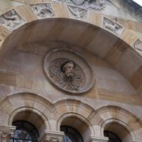
Historic England simply says that he's a Tudor head. Interesting that this arch and the matching arch at the other side have a complete collection of Zodiac signs on them, too—something tells me that's not a particularly Catholic thing?
Northern Clifton
16 Jan 2021
A raggedy wander with my friend Lisa, picking up a few stray streets and venturing only briefly onto Whiteladies Road, where it was too damn busy, given the current pandemic. We retreated fairly quickly. Found a couple of interesting back alleys, and got a very pointed "can I help you?" from a man who was working in his garage in one of the rather run-down garage areas behind some posh houses, and clearly didn't want us just wandering around there.
In Between
06 Feb 2021
A lovely walk in the early spring sunshine with my friend Lisa. We headed directly for Jacobs Wells Road, to start off around the scene of one of our earlier walks, but this time took in Jacobs Wells from QEH upward, stopping to snap some photos of a Bear With Me, some interesting areas between Park Street and Brandon Hill including a peculiarly quiet enclave with a ruined old build I'd never found before, then crossed the Centre to grab take-away pies from Pieminister (I had the Heidi Pie) and head back to my place down the harbourside.
Well, given who occupies this place, you'd expect good masonry work. This is the home of the Freemasons' Provincial Grand Lodge of Bristol. The inside is meant to be pretty special, too, but sadly I missed the last open day. (Not kidding; the hall opens up to visitors on Bristol's popular Open Doors days)
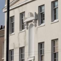
I went to get my first dose of the Oxford/AstraZeneca Covid-19 vaccine today. Handily, the vaccination centre was Clifton College Prep School in Northcote road, next to Bristol Zoo, a road that's just within my 1-mile range that I hadn't visited before.
I parked up near Ladies Mile and tried to find a few of the tracks marked on the map I'm using, but couldn't see most of them. Whether that's just because they've disappeared over time, or with the recent lack of use or waterlogging from the 24 hours of rain we just had, I'm not sure. It was a pretty fruitless search, anyway.
The vaccine shot was virtually the same setup as when I got my winter flu jab back in November, except for the venue. I snapped a couple of pictures of the school while I was there, but I was in and out in five minutes, and you probably don't want to linger around a vaccination centre, I suppose.
Instead I wandered around the compact block of the Zoo, now sadly scheduled for closure. By coincidence I finished E H Young's Chatterton Square this morning: set in Clifton (fictionalised as "Upper Radstowe") near the Zoo, the occasional roars of the lions that can be heard by the residents of the square (Canynge Square in real life) form part of the background of the novel. The book's set in 1938 (though written and published post-war, in 1947). It seems a shame that the incongruous sounds of the jungle will no longer be heard from 2022. All I heard today were some exotic birds and, I think, some monkeys.
I was told not to drive for fifteen minutes following the jab, so I wandered out of my area up to the top of Upper Belgrave Road to check out an interesting factoid I'd read while looking into the history of the reservoir at Oakfield Road, that the site of 46 Upper Belgrave Road was a bungalow, shorter than the adjacent houses, and owned by Bristol Water, kept specifically low so that the pump man at Oakfield Road could see the standpipe for the Downs Reservoir (presumably by or on the water tower on the Downs) and turn the pump off when it started overflowing. Sadly I couldn't confirm it. There is one particularly low house on that stretch, but it's number 44, and though small, it's two-storey, not a bungalow, so nothing really seems to quite fit in with the tale.
I'm writing this about nine hours after getting the jab, by the way, and haven't noticed any ill effects at all. My arm's not even sore, as it usually would be after the normal flu jab. In twelve weeks I should get an appointment to get the second dose.
I'm glad my friend Lisa joined me today; she drove in from Shirehampton and told me that the Portway was looking rather lovely, so we set off that way. She's also braver than I am when it comes to doing urbex stuff, so this was just the opportunity to take a peek into the Portnalls Number One Railway Tunnel/Bridge Road Deep Valley Shelter whose entrance I'd found on a previous wander.
It was definitely dark and spooky and impressively big, with a side tunnel that Lisa explored that leads to a little door I don't think I've previously noticed on the side of the Portway. I didn't get many photos—even my astoundingly powerful little torch (£) didn't do much to light things up, and you're not going to get much joy hand-holding a camera in that darkness—but I did shoot a little video, which I might edit and add later.
After plumbing the bowels of the earth, we went up Bridge Valley Path to Clifton, explored some bits around the College and Pembroke Road, then came home via Foliage Cafe for coffee. Nice.
Harbour Circumnavigation
01 Mar 2021
Normally I don't have enough time in my lunch hour to get all the way around the harbourside. This is a shame, as Wapping Wharf is a great place to get coffee and a snack, but it's pretty much diametrically (perimetrically?) opposite me on the harbour. Today I had the day off, so I decided to go and knock off a few streets around Anchor Road that I'd not covered, as well as visiting the site of the Read Dispensary (well, one of them) and dropping into Mokoko for one of their astounding almond croissants. From there I came back along the south side, checking out the views from as much of the Chocolate Path as you can venture down at the moment, and swapping from Cumberland Road to Coronation Road at Vauxhall Bridge.
There's a lot of meh photos on this walk—my chief output from this project could be politely described as "record shots"—but a few turned out well, especially those of Vauxhall Bridge from the Chocolate Path, which reminded me how much of a loss the current closure of the Chocolate Path is to walkers and cyclists in Bristol.
John Carr's Terrace
16 Mar 2021
I wanted a nice simple lunch-hour walk that took me past a cafe today, and I managed to find the perfect road to knock off my list of targets to do it. Situated just off Jacobs Wells Road, right next to Queen Elizabeth's Hospital, John Carr's Terrace, and Rosebery terrace above it, which I'd completely forgotten existed, are a little cul-de-sac that many Bristolians will have wandered past a thousand times without ever seeing.
There's a reason it's next to QEH:
Known traditionally as "The City School", Queen Elizabeth's Hospital was founded by the will of affluent merchant John Carr in 1586, gaining its first royal charter in 1590.
John Carr's terrace itself isn't much to write home about, architecturally, but I like the secluded feel of it, and I really liked Rosebery Terrace with its little houses, commanding position and friendly, slightly tumbledown feel.
On the way home I popped into Foliage Cafe for a coffee and a very pleasant nutella and banana pastry, then walked home past the refurbishment of the old Thali Cafe into a new and interesting clinic...
Among other things in its colourful history, the former Brandon Methodist Church was, for a while, the Japan Arts Centre, which probably explains this detail from its tympanum. I remember walking past when it had big adverts outside for martial arts. They used to teach Judo, Aikido and Karate, I think.
I got interested in Bristol's medieval water supplies after poking around near Jacobs Wells Road and Brandon Hill. It was during that research I found out about a pipe that's still there today, and, as far as I know, still actually functioning, that was originally commissioned by Carmelite monks in the 13th century. They wanted a supply of spring water from Brandon Hill to their priory on the site of what's now the Bristol Beacon—Colston Hall, as-was. It was created around 1267, and later, in 1376, extended generously with an extra "feather" pipe to St John's On The Wall, giving the pipework its modern name of "St John's Conduit".
St John's on the Wall is still there, guarding the remaining city gate at the end of Broad Street, and the outlet tap area was recently refurbished. It doesn't run continuously now, like it did when I first moved to Bristol and worked at the end of Broad Street, in the Everard Building, but I believe the pipe still functions. One day I'd like to see that tap running...
There are a few links on the web about the pipe, but by far the best thing to do is to watch this short and fascinating 1970s TV documentary called The Hidden Source, which has some footage of the actual pipe and also lots of fantastic general footage of Bristol in the seventies.
On my walk today I was actually just going to the building society in town, but I decided to trace some of the route of the Carmelite pipe, including visiting streets it runs under, like Park Street, Christmas Street, and, of course, Pipe Lane. I also went a bit out of my way to check out St James' Priory, the oldest building in Bristol, seeing as it was just around the corner from the building society.
There are far too many pictures from this walk, and my feet are now quite sore, because it was a long one. But I enjoyed it.