Tagged: recreation
In Which We Begin and End with Love
05 Mar 2022
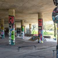
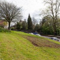
I had a lot to get done around the house, so as soon as I heard there might be a shiny new piece of street art near me, under the Cumberland Basin flyovers, I immediately decided that was all the excuse I needed to set off on a round-the-harbour lunchtime walk to get some fresh air and see if I could spot it. So, here's a circular wander that takes in graffiti, boats, wildlife and graffiti again...
Leigh Woods Purple Path
12 Mar 2022
There's a few tracks in Leigh Woods that lie within my mile and show up on my map but that I've not walked yet, so I decided to take one of my traditional big long walks through the woods on this nice crisp sunny morning.
For years—decades, even—I've been doing a similar route from my place, along the towpath to the far woods entrance, up the hill for a varied walk on one of the marked tracks and then across the Suspension Bridge to Clifton Village for a coffee-based reward. It's my default "long walk", really, and I almost always enjoy it. Today, at last, spring actually seemed to be springing, which made for some extra positivity...
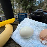
My food varies a bit on these forest walks, but I'm quite set in my ways on the drink: lapsang souchong, brewed straight in the Thermos flask at home, with two ice cubes dropped into it before I seal it up. This ensures that the tea is at a perfectly drinkable temperature at this point on the walk. Some rituals are worth experimenting with and perfecting.
A Coffee and a Curve
27 Mar 2022
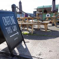
I wanted to have a wander along to the Tobacco Factory Market for some shopping, and checking the map for any leftover nearby streets I noticed a tiny curve of road on the way into the modern flats at Paxton Drive that it didn't look like I'd walked down before. I wouldn't take me too far out of my way, so I decided to head there first and then across to North Street to get my groceries and a coffee...
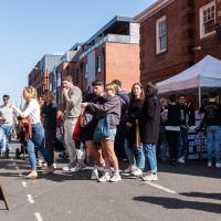
I squeezed through the busy market and grabbed some ham and some cheese, then exited through the farm shop where I picked up a bottle of milk (an actual glass bottle that I can wash and bring back for a refill; they're like that around here) and some veg. Oh, and a honey and chia seed flapjack. Well, it is the weekend...
Easter Monday Gardens and Flowers
18 Apr 2022
I didn't really set out with a theme of flowers and gardens in mind for this walk. I just fancied heading up to Clifton Village to get lunch. As it turned out, though, Spring was springing, so a minor theme emerged as I started off with the graveyard flowers of Hope Chapel and wandered up to see the beginnings of the new wildflower garden at Clifton Hill Meadow.
Although the sign earlier said that you'd still be able to picnic here, I've never actually seen much picnicking. I think that's likely because of the danger of any round picnic items—around here more likely croquettes de foie gras than sausage rolls—escaping down the hill.
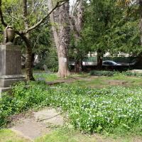
I rather like the stone drape across the funerary urn on the pedestal. Plenty more flowers on show, too. This is the bit where most of the squirrels hang out; I imagine they're in favour of the new dogs-on-leads rule.
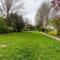
I bought a fantastic sausage roll in The Mall Deli and decided to have it here in the Mall Gardens, seeing as it's finally become warm enough to eat outside...
Ticking Off a Pocket of Paths in Leigh Woods
03 Jun 2022
I managed to go for a wander a while ago that was meant to finish off a little tangle of paths in Leigh Woods, or at the very least finish off my wandering of the Purple Path there. And I managed to miss doing either of those things through some kind of navigational incompetence.
Today I woke up with a bit of a headache, feeling a bit knackered as soon as I dragged myself out of bed, but at least with the energy to realise that I'd be better off (a) going for a walk in what looked likely to be the last of the Jubilee weekend sunshine than (b) moping around the flat until it started raining, at which point I could mope more thoroughly.
I had a look at my map, considered going to Ashton Court, but remembered that there was a music festival there today, and instead found these little leftovers of Leigh Woods and decided to have one more try at walking them.
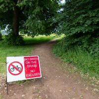
Guessing this is a polite hint from the golf club. In my mind's eye I can see an irate greenkeeper chasing a couple of mountain bikers in his golf buggy.
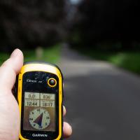
I decided to make sure to cover the whole of the little pocket of paths I was targeting by pre-programming a route into my GPS, and following its instructions to go from point to point. The start of my path is nearly due east from here, and less than a kilometre away.
This will not be the most interesting of walks—it's just some fairly enclosed paths in a forest—so there won't be too many photos...
I've been pretty awful at reading so far this year, apparently averaging about one book per month. That's a far cry from 2019, say, where I got through 41 books in the year. Today's wander was prompted by my rubbish reading, as I needed to go hand back some books to the library, because I'd managed to renew them so many times that I hit the limit on renewals. Oops. Several of them were still unread.
So, off to the Central Library for me, tail between my legs. On the way there I did my best to recreate a historical photo of Dowry Square; while I was in the area I walked under the adjacent Norman arch and poked around behind the Cathedral, and I also had a little diversion to the city centre and came back along the south side of the river, hitting some trouble with the lock gates as I finally crossed the harbour back towards home.
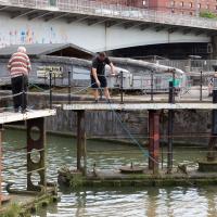
I was expecting them to pull a shopping trolley out at any moment. They weren't managing to snag anything, though.
I'm in the habit of going over to the Tobacco Factory Market on a Sunday. I think I've walked all the routes around that way, but as a Plimsoll Bridge swing let me cross the road to the far side of Brunel Way on my return journey and I took a couple of photos of the brownfield development at the old Ashton Gate Depot site I thought I'd call it a Wander and pop some photos up.
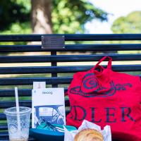
Veg from the Tobacco Factory farm shop in my Idler tote and a market croissant to go with my Coffee #1 iced latte, I feel only the need to sit on a bench and read a Saul Bellow novel to fully sink into my Southville hipster character. I should probably have ridden a penny farthing here and bought some chia seeds.