Tagged: 1
Northern Clifton
16 Jan 2021
A raggedy wander with my friend Lisa, picking up a few stray streets and venturing only briefly onto Whiteladies Road, where it was too damn busy, given the current pandemic. We retreated fairly quickly. Found a couple of interesting back alleys, and got a very pointed "can I help you?" from a man who was working in his garage in one of the rather run-down garage areas behind some posh houses, and clearly didn't want us just wandering around there.
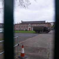
The Artillery Grounds, Whiteladies Road. The Royal Engineers have a troop here as well as the Royal Artillery.
Another Lunchtime, Another Quick Coffee Trip
28 Jan 2021
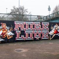
With very little photography, and no new streets. Still, I did manage to buy milk at the "Simple Cow" vending machine—and "simple" is very definitely false advertising; it took me bloody ages to work out how to use the thing—and snap the new ACER/SEPR piece down in Cumberland Piazza.
In Between
06 Feb 2021
A lovely walk in the early spring sunshine with my friend Lisa. We headed directly for Jacobs Wells Road, to start off around the scene of one of our earlier walks, but this time took in Jacobs Wells from QEH upward, stopping to snap some photos of a Bear With Me, some interesting areas between Park Street and Brandon Hill including a peculiarly quiet enclave with a ruined old build I'd never found before, then crossed the Centre to grab take-away pies from Pieminister (I had the Heidi Pie) and head back to my place down the harbourside.
Clifton Village, including Oxford Place
15 Feb 2021
I've noticed Oxford Place as a tiny little side/back road I've overlooked on my wanders a few times. Today I decided to pop down and have a look, as well as taking a few general snaps of Princess Victoria Street, which I thought deserved more pictures, as it's basically my closest decent shops, and in the Beforetimes I'd visit the Co-Op up there all the time, as well as the cafes (you'll be missed, Clifton Village branch of Boston Tea Party, recently closed in favour of Eat a Pitta.)
I'm definitely becoming more familiar with the area through the One Mile Matt jaunts and associated reading. Today I didn't just think, "oh, I'll head home down that weird alleyway with the electrical substation in it"—no, I thought, "I'll head home down Hanover Lane", because I actually knew its name. And on the way back from there I nodded sagely to myself as I passed St Vincent's Road, knowing now which St Vincent it's likely to be (St Vincent of Saragossa) and also eyed up the modern flats on Clifton Vale and wondered if they might have been built on the site of the former Vauxhall Pleasure Gardens... I don't know all the answers, but at least I have some idea of the historical questions I'm interested in.
Their coffee is pretty reliable, but the last few times I've been in one member of staff or another has had ther nose poking out over their face mask, and it's not exactly well-ventilated in there. I think I'll steer clear until the pandemic's over. Spicer+Cole, Foliage and Twelve are all better bets at the moment, for excellent coffee and for not dying of an infectious disease.
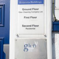
I headed to Bedminster to do a crossword with my support bubble today. On the way I delved into a couple of bits of Hotwells history, first of all snapping a "now" shot to go with a historical photo of Holy Trinity I happened across recently, and second of all to snap the Britannia Buildings.
The Britannia Buildings are a little strip of offices on a corner of the Hotwell Road. They've mostly been the headquarters of a cleaning company for years, but I've often wondered what this distinctive curve of offices, its ground floor standing proudly out from the upper floors, used to be. Well, after my last wander, where I poked about the landing stage just down the road, I found out! Researching the paddleboat company P&A Campbell I came across this nugget in The A-Z of Curious Bristol, by Maurice Fells (£):
The firm of P & A Campbell was the main steamer operator in the Bristol Channel, with its local headquarters in offices close to the Hotwells pier and overlooking the harbour at the Cumberland Basin. Campbell's named their offices Britannia Buildings, after one of the ships in their White Funnel Fleet.
So! Turns out the Britannia Buildings were named after a paddle steamer—you can see some pictures of Britannia here.
In related news, I've now bought three of Maurice Fells' local history books, and they were hand-delivered by the author on Sunday, a half-hour after I ordered them online (through a message exchange on Nextdoor!) Not even Amazon Prime has managed to deliver me anything that quickly...
Leigh Woods Walk
14 Mar 2021
An enormous walk today, or at least it felt enormous. My feet are sore, anyway. I started off recreating a couple of local historical photos in Hotwells, but then headed for my traditional walk along the towpath in the Avon Gorge to the far extreme of Leigh Woods, up and through the woods to the height of the Suspension Bridge, finally crossing into Clifton Village for a well-deserved vanilla latte.
I say "traditional" because this used to be a very regular route for me, first walking, years and years ago, and later jogging—this route combined with a circuit of the Downs on the other side used to be my way of making sure I was fit to do a half-marathon (I did six of them in total, between 2010 and 2014).
I miss the routine of this walk, even though it's a long way and it used to pretty much wipe me out when I did it—I'd come back home and collapse and do very little for the rest of the day. But perhaps that's what Sundays are for, and I should try to remember that.
Doing this walk regularly was quite a meditative experience. Not so much of that today, but once I got to the further extreme of the towpath, where the roar of the Portway traffic on the other side of the river dwindles and I turned into Leigh Woods to climb ever closer to birdsong and further from rushing cars, I did seem to recapture a little of the feeling of previous walks. (I would say my mind cleared, but I was mentally singing along to Life Without Buildings' The Leanover for most of the wander. There are worse songs to have stuck in one's head, though; it's a great track...)
Anyway. Apparently the walk made me more likely to ramble in words, too. I'll stop now :)
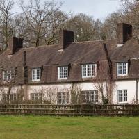
Amusingly, I think this technically fits some definitions of the word "bungalow", given that the upper half is a giant mansard roof with dormer windows.
I bumped into my friend Lisa in town during yesterday's wander, and we decided to have a wander today, too. We managed quite a long ramble, starting up through Clifton and nipping down Park Row to investigate the two tower blocks I'd noticed popping up behind Park Street yesterday, then took in a few roads I'd not managed to get to before, including cutting through the grounds of Bristol Grammar School.
An Evening Wander to the Gallows
06 Apr 2021
I'd originally intended just to pop up to the area around Alma Road, where I'd missed a few streets on earlier wanders. It was such a nice evening, though, I decided to extend my walk up to the very top of Pembroke Road, just outside my one mile radius, to take a few snaps of something intriguing I'd found in my researches.
I've driven, walked and jogged past the little triangle of land at the top of Pembroke road a great deal in my time in Bristol, but I didn't know that it used to be the site of a gibbet, in fact that the road itself there used to be called Gallows Acre Lane. According to the Durdham Down history trail, by Francis Greenacre (an excellent name for a Downs researcher!) among other sources:
...it was below this quarry near the top of Pembroke Road, once called Gallows Acre Lane, that a gibbet stood. It was sometimes occupied by those who had committed robberies on the Downs and was last used in 1783 to hang Shenkin Protheroe for the murder of a drover. Stories quickly spread that he descended from the gibbet at midnight every night and stalked through Clifton. Such was the alarm that his body was cut down and buried.
Also very close to this little triangle of land was one of the gates of the extensive turnpike system...
Anyway. Along the way I encountered a wooden tortoise and a real squirrel, among other things. It was a good walk, and more light in the evenings means I can move my wanders out of the ticking countdown clock of work lunch-hours and be a bit more leisurely.
There's a lot of outdoor trails of one kind or other going on, what with the current cicumstances.
Leftovers with Lisa
01 May 2021
I didn't get to all the little leftover streets around the northeastern part of my area in today's wander, but I definitely knocked a few off the list, plus Lisa and I enjoyed the walk, and didn't get rained on too badly. We spotted the hotting-up of Wisteria season, checked out Birdcage Walk (both old and new), ventured onto the wrong side of the tracks1 and generally enjoyed the architecture.
1 Well, technically we probably shouldn't have been on the grounds of those retirement flats, but nobody started chasing us around the garden with a Zimmer frame
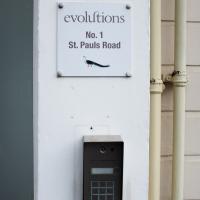
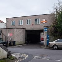
Apparently they're a London-based multimedia production house and this is their first "regional facility". Which presumably explains why they're just over the road from the BBC; I imagine they want to provide outsourcing to Auntie.
Victoria Square Underpass
06 May 2021
I'm meant to be taking a little break from this project, but in my Victoria Square researches after my last walk I noticed a curiosity I wanted to investigate. The community layer on Know Your Place has a single photograph captioned, "The remains of an 'underpass' in Victoria Square".
Looking back through the maps, I could see that there really did used to be an underpass across what used to be Birdcage Walk. I can only guess that it was there to join the two halves of the square's private garden that used to be separated by tall railings that were taken away during WWII. Maybe it was a landscaping curiosity, maybe it was just to save them having to un-lock and re-lock two gates and risk mixing with the hoi polloi on the public path in the middle...
Anyway. Intrigued, I popped up to Clifton Village this lunchtime for a post-voting coffee, and on the way examined the remains of the underpass—still there, but only if you know what you're looking for, I'd say—and also visited a tiny little road with a cottage and a townhouse I'd never seen before, just off Clifton Hill, and got distracted by wandering the little garden with the war memorial in St Andrew's churchyard just because the gate happened to be open.
EDIT: Aha! Found this snippet when I was researching something completely different, of course. From the ever-helpful CHIS website:
When there were railings all round the garden and down the central path, in order that the children could play together in either garden there was a tunnel for them to go through. This was filled in during the 1970s but almost at the south east end of the path if one looks over the low wall the top of the arches can still be seen.