Tagged: branch
Near and Far
05 Jan 2022
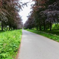
I took advantage of a rare recent day where it wasn't tipping down with rain to get away from my desk on a lunchtime workday and head up to Clifton Village. I'd hoped to snap a reproduction of historical photo which I'd worked out had been taken from the Suspension Bridge, but the gods were not smiling on me. Still, taking only a nice long lens with me worked out very well as the lovely haze of the day made more distant views quite dramatic...
In Which We Begin and End with Love
05 Mar 2022
I had a lot to get done around the house, so as soon as I heard there might be a shiny new piece of street art near me, under the Cumberland Basin flyovers, I immediately decided that was all the excuse I needed to set off on a round-the-harbour lunchtime walk to get some fresh air and see if I could spot it. So, here's a circular wander that takes in graffiti, boats, wildlife and graffiti again...
Leigh Woods Purple Path
12 Mar 2022
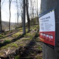
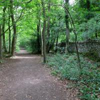
There's a few tracks in Leigh Woods that lie within my mile and show up on my map but that I've not walked yet, so I decided to take one of my traditional big long walks through the woods on this nice crisp sunny morning.
For years—decades, even—I've been doing a similar route from my place, along the towpath to the far woods entrance, up the hill for a varied walk on one of the marked tracks and then across the Suspension Bridge to Clifton Village for a coffee-based reward. It's my default "long walk", really, and I almost always enjoy it. Today, at last, spring actually seemed to be springing, which made for some extra positivity...
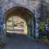
There are several ways into Leigh Woods along the towpath, all underneath bridges of the Portishead branch line that runs above.
At the one before this, which is normally locked and leads into a disused police shooting range, a woman beckoned me over to where she was standing with her bike, looking through the gates. "I think I've found your best shot today," she said Sadly, the very wide lens on the camera would have made any picture of the young deer that was standing in the sunlit distance a bit rubbish, so I contented myself with a few moments just looking at the scene.
One of the things you learn as you improve as a photographer is when not to bother trying to take a photo because you can't do it justice, and to just be in the moment and enjoy it instead.
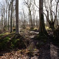
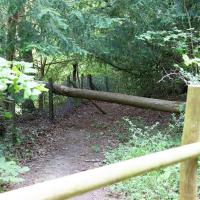
Approaching what amounts to the "main road" through Leigh Woods, that runs along the crest of the slope down to the towpath.
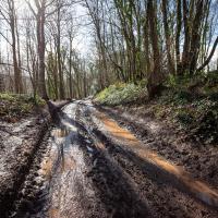
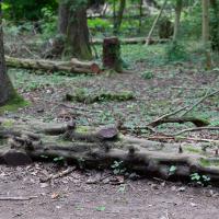
The going is normally a little firmer here. I guess that tractor's been going back and forth a lot, and the recent near-continuous rain probably hasn't helped.
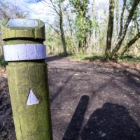
Making sure I'm still on the Purple trail. It wasn't far from here I bumped into Patsy, an erstwhile colleague who apparently still has one of my photos up in her house, which is nice to know. She was looking positively healthy—apparently retirement suits her. She's already been for a swim before her forest walk, so she's clearly keeping fit...
Easter Monday Gardens and Flowers
18 Apr 2022
I didn't really set out with a theme of flowers and gardens in mind for this walk. I just fancied heading up to Clifton Village to get lunch. As it turned out, though, Spring was springing, so a minor theme emerged as I started off with the graveyard flowers of Hope Chapel and wandered up to see the beginnings of the new wildflower garden at Clifton Hill Meadow.
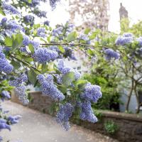
Well, I think it's a California Lilac, Ceanothus. I could be wrong. Whatever it is, it's pretty.

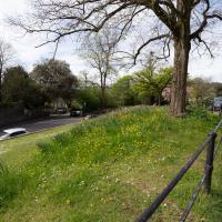
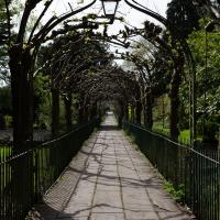
Moving on from Clifton Hill, I fancied wandering through Lime Walk.
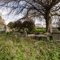
I always take a look for interesting graves as I wander through St Andrew's churchyard, and there's been quite a lot of ivy clearing recently, so there's more on display.
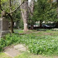
I rather like the stone drape across the funerary urn on the pedestal. Plenty more flowers on show, too. This is the bit where most of the squirrels hang out; I imagine they're in favour of the new dogs-on-leads rule.
Ticking Off a Pocket of Paths in Leigh Woods
03 Jun 2022
I managed to go for a wander a while ago that was meant to finish off a little tangle of paths in Leigh Woods, or at the very least finish off my wandering of the Purple Path there. And I managed to miss doing either of those things through some kind of navigational incompetence.
Today I woke up with a bit of a headache, feeling a bit knackered as soon as I dragged myself out of bed, but at least with the energy to realise that I'd be better off (a) going for a walk in what looked likely to be the last of the Jubilee weekend sunshine than (b) moping around the flat until it started raining, at which point I could mope more thoroughly.
I had a look at my map, considered going to Ashton Court, but remembered that there was a music festival there today, and instead found these little leftovers of Leigh Woods and decided to have one more try at walking them.
Time to exit Ashton Court and head for my main target at Leigh Woods.
I rarely come in this way to Leigh Woods—it's basically the car entrance, and I almost always walk here. On those few occasions I've driven here, I've mostly parked on North Road near my usual pedestrian entrance through sheer habit, rather than driving in and using the official car park that's actually in the woods.
At this point I had gone back and forth a fair bit, following my little satnav pointer, including heading down a couple of paths only to come straight back up them once I was sure I'd completed the un-done parts of the track.
I was a little weird, following this complicated little route. I felt a bit like a bee doing the waggle dance, or something.