Tagged: horizon
Ticking Off a Few Streets in Bedminster
31 Oct 2021
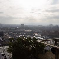
There were only a few streets left to wander in the more residential bit of Bedminster, so I thought I should target those today. The streets themselves weren't that notable, though Balfour Road has a contrasting mix of old and new housing. I tried to snap a few more interesting things along the way there and back, snapping all three of the familiar bond warehouses, nipping onto North Street to find some new street art, and finding a few pumpkins for good measure. It is hallowe'en, after all...
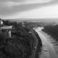
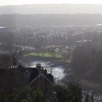
The more I research it, the more I find that Hotwells had far better transport links back in Victorian and Edwardian times than it has today. Along with buses that went to more useful places than the City Centre, there were trams, the funicular up to Clifton, the landing stage for paddle steamer services and two railway stations all within easy walking distance of me.
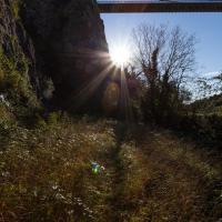
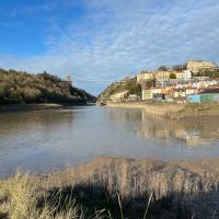
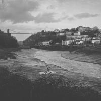
Today I took a day off work as preparation for doing the bookkeeping for my tax return1, and took a wander along to the site of what would have been my nearest station, Hotwells (or Clifton, as it started out in life), nestled in the shadow of the suspension bridge, the Bristol terminus of the Bristol Port Railway and Pier.
From there I wandered down the Portway, following the original line, until I got to the area around Sneyd Park Junction, where the tunnel from the slightly later Clifton Extension Railway joined up with this originally-isolated BPR line. Then I headed up to Clifton through the "goat gully" at Walcombe Slade, seeing the few above-ground bits of evidence of the tunnel (which is still in regular use) along the way.
It was a lovely day, and a good walk, and it was interesting to daydream of the times when I could have walked a few minutes from my flat down to Dowry Parade, caught a short tram ride to Hotwells Stations, and then headed from there to Avonmouth, perhaps even to board a transatlantic passenger service. The completion of the Clifton Extension Railway that linked the Avonmouth station with Temple Meads made relatively direct transatlantic travel from London via Bristol possible, with passengers travelling up from Paddington to Temple Meads, on to Avonmouth on the Clifton Extension Railway and Port Railway and Pier line, then perhaps catching a Cambpell's paddle steamer—which sometimes acted as tenders for large steamers—to a larger ship that was headed out for Canada, say.
1 I've learned that the best approach is to take two days off and deliberately do something that's not my bookkeeping on the first day, as otherwise I just inevitably end up procrastinating and feeling guilty on the first day no matter what. I have an odd brain, but at least I'm learning strategies for dealing with its strange ways as I get older...
2 Information mostly gleaned from Colin Maggs' The Bristol Port Railway & Pier and the Clifton Extension Railway, The Oakwood Press, 1975.
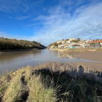
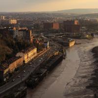
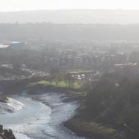
I can't achieve the high vantage point of the next photo, and the sun direction wasn't exactly favourable, but I think this at least proves I'm in the right spot :D
Bower Ashton is an interesting little area just south of the river from me—in fact, the Rownham Ferry used to take people over from Hotwells to Bower Ashton, operating from at least the twelfth century to around the 1930s.
It's a strangely contradictory little area, with a cluster of old and new houses sandwiched in between the busy A-roads and significantly more industrial area of Ashton and the bucolic country estate of Ashton court roughly east to west, and also between Somerset and Bristol, north to south.
I've been around here before, mostly poking around Bower Ashton's arguably most well-known bit, the Arts faculty campus of the University of the West of England, but I'd missed at least Parklands Road and Blackmoors Lane, so I initially planned just to nip across briefly and wander down each in turn. On a whim, though, I texted my friends Sarah and Vik in case they were out and about, and ended up diverting to the Tobacco Factory Sunday market first, to grab a quick flat white with them, extending my journey a fair bit.
To start with, though, I nipped to a much more local destination, to see something that you can't actually see at all, the Gridiron...
(I also used this wander as a test of the cameras in my new phone. I finally upgraded after a few years, and the new one has extra, separate wide and telephoto lenses compared to the paltry single lens on my old phone. Gawd. I remember when speed-dial was the latest innovation in phones...)
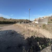
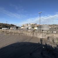
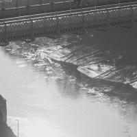
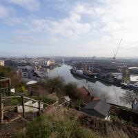
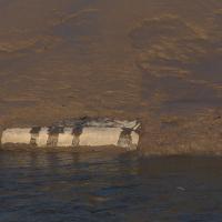
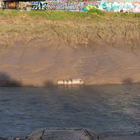
You can't actually see the Gridiron in this photo, but I believe it's still there, under that amazing buildup of silt.
The Gridiron—one of the few photos of it can be seen on the Maritime Mud and Miasma page of About Bristol—was a cheaper alternative to putting your boat in a dry dock. It was a 200-foot long grid (there seems to be some debate over whether the grid itself is actually metal, or in fact timber; I'll have to try to find out), 38 feet wide, nestled here between the north and south entrance locks. A ship captain could sail his vessel over here at high tide, then as the tide gradually receded, the ship—up to 250 feet, as overhanging a bit was apparently okay—would settle onto the gridiron.
At that point an inspection and repair crew could make their way down to the gridiron by ladder and do whatever work they could manage before the tide rose up again.
One last snap before we move on. I'm using the wide lens on the iPhone here, and have managed to include a silhouette selfie...
And here's the middling lens on the camera. Not bad, though on every shot I've taken on the iPhone so far where it's been able to see blue sky it's managed to oversaturate it for my tastes. Still, I guess they're aiming at the mass market, and the mass market does seem to like oversaturated colour and the sharpening turned up to eleven.
Not bad, and it's certainly better than not having a wide-angle lens in your pocket everywhere you go. I won't complain too much. "My iPhone oversaturates my photos. Also my wallet is too small for my fifties and my diamond shoes are pinching..."
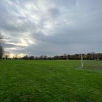
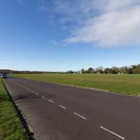
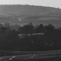
Presumably these are school playing fields, though there was no great barrier to entry. They seem to be school-adjacent, but maybe they're more public... I followed some people who looked like they knew where they were going, which I find is often an expedient way of getting lost.
A Constitutional to Burwalls and Back
21 Dec 2021
The recent lack of posts here is mostly due to my feeling very run down following having a couple of wisdom teeth extracted. Having had an emergency appointment yesterday1, hopefully I'll be on the mend now, though it does mean I'm on the kind of antibiotics where you can't touch alcohol for the whole of the Christmas period. I have tried to keep myself a little distracted from the pain by working on the nuts and bolts of this website—you should notice that the front page loads rather faster now than it used to, and that there's a shiny new statistics page that I'll probably be continuing to work on. Oh, and you should find that the tags below the photos are now clickable and will take you to a page of all other wanders that have photos with the same tag.
Today I felt like I needed to drag myself out of the house, but I didn't want to go too far, and I needed to get to the Post Office up in Clifton Village to post a Christmas card (spoiler for my parents: it's going to be late. Sorry.) As luck would have it, idly looking at the map I spotted that I'd missed off a section of Burwalls Road in the past, and that's basically one of the long-ways-round to Clifton Village, crossing the river to Rownham and walking up the hill on the Somerset side before coming back across the Suspension Bridge.
As I was heading for Burwalls Road I decided to make Burwalls itself the focal point of the walk, but unfortunately the mansion grounds are private and the place is hard to snap. Still, at least it gave me a destination. Burwalls was the mansion built by Bristol press magnate Joseph Leech, who I've mentioned before after buying a vintage book he wrote on a previous wander. There's a good article about the house on House and Heritage which has some photos from angles I couldn't ever get to. (Well, maybe with a drone, but it seems like the kind of area where they may be kitted out for clay pigeon shooting, so I probably wouldn't risk it.)
1 My dentist admitted that she probably needed to keep her internal monologue a bit more internal after we started the appointment with her staring into my mouth and immediately saying, "oh, *that's* weird." These are words one doesn't want to hear from a medical professional.
Technically that's still actually the Hotwell Road down there, and it doesn't become the Portway until the Bridge Valley Road junction, but I needed the alliteration, okay?
This is the kind of photograph that I really like, but is harder to find appreciation for these days—the Panavision aspect ratio I've chosen, 2.35:1, doesn't play nicely with today's standard media consumption device of a mobile phone held in portrait orientation. Maybe one day we'll all be using the internet through VR headsets and landscape orentation will make a comeback.
I was just about starting to feel better—the antibiotics seemed to have kicked in for my dental issues, and it had been some days since I'd left the house, and I was at last starting to get itchy feet. So, a wander. But where? Well, there were a few industrial bits near Winterstoke Road in the Ashton/Ashton Vale areas of Bristol that needed walking. I knew they were likely to be quite, well, unattractive, frankly. So why not do them while I wasn't feeling exactly 100% myself? Maybe it would fit my mood. Hopefully you're also in the mood for a bit of post-industrial wasteland, for that's what some of this feels like...
Then, at the last minute, I thought again about the Bristol International Exhibition—I've got a book about it on the way now—and that gave me another goal, which could just about be said to be in the same direction, and I decided to walk significantly further than my normal 1-mile limit and try recreating another historical photo...
Sadly I don't know much about the Ashton area; it's just on the edges of my mile and I rarely have cause to go there. It's brimming with history, I'm sure: the whole South Bristol area rapidly developed from farmland to coal mines to factories to its current interesting mixture of suburbs and industrial work over the last few hundred years. As a more working class area less attention was paid to it by historians, at least historically-speaking, than the Georgian heights of Clifton, and much of it has been knocked down and reinvented rather than listed and preserved. I see here and there some of this lack is being addressed, but I'm afraid I'll be very light on the history myself on this wander, as most of my usual sources aren't throwing up their normal reams of information as when I point them at Clifton, Hotwells or the old city.
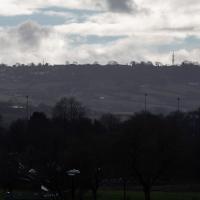
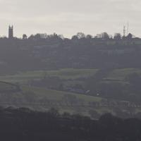
These are some hills I'm not heading for today, but I love the distant view of Dundry from Hotwells. The silhouetted church towards the left is St MIchael's Church, Dundry, whose tower was built in 1481.
The other towers around Dundry have more recent heritage. I believe Dundry East transmitter still sends out the analogue signal for BBC Radio 4, and lets me listen to The Archers on an old Roberts radio when I'm doing my cleaning on a Sunday morning. Some bits of my life are still quite old-fashioned.
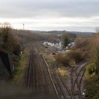
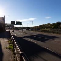
Well out of my one-mile radius now, here's a view from the railway bridge at Bedminster Down Road, looking back to the east.
This is Parson Street Junction, originally called Portishead Junction, where the Bristol to Exeter line, straight on, branches off into the Portishead Railway line, curving away there on the right. Parson Street Station in Bedminster is directly behind us on the other side of the bridge.
Phase One of MetroWest should see the currently-frieght-only Portishead line re-open to passenger traffic, though I wouldn't hold your breath. It seems "Metro-" is an old Roman prefix meaning "multiply all your time and budget estimates by ten".
A Random New Year's Day Wander
01 Jan 2022
I picked a fairly arbitrary reason for a wander today. Really, I just wanted to do a New Year's Day wander just to get out of the house and to set a precedent for the year to come.
My ostensible reason was to investigate what looked like a road on my map that quartered the lawn in front of the Ashton Court mansion. As it turned out, this is just a muddy footpath/desire line similar to a half-dozen other tracks nearby, and must be some kind of bug or misclassification with the mapping system I'm using, but that's not important. What's important is that I went for a little walk on the first day of the year. As a bonus, I did happen to wander down a couple of sections of new footpath, so technically I broke some new ground too, which is nice.
Near and Far
05 Jan 2022
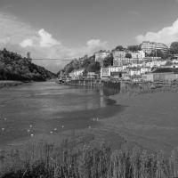
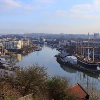
I took advantage of a rare recent day where it wasn't tipping down with rain to get away from my desk on a lunchtime workday and head up to Clifton Village. I'd hoped to snap a reproduction of historical photo which I'd worked out had been taken from the Suspension Bridge, but the gods were not smiling on me. Still, taking only a nice long lens with me worked out very well as the lovely haze of the day made more distant views quite dramatic...
This is almost the photo I wanted to take, but the historical photo I want to reproduce was definitely taken from further to my right, on the bridge, and you should still be able to see the remains of Clifton Bridge Station (hidden from here by the trees on the right) and the last bit of slipway of the Rownham Ferry (hidden by the prominent house in the foreground.) This snap is also a bit marred by the temporary safety fencing I had to shoot through.
Ah well, another day, I suppose.
Lunchtime Reproduction (of an old photo...)
17 Jan 2022
This was basically the quick lunchtime jaunt I tried to do at the beginning of January, only this time I actually managed to get to roughly the viewpoint I'd been hoping for to recreate a historical photo of the Bristol International Exhibition.
I did this walk about a month ago, but I've been a bit poorly and not really up to doing much in my spare time, and it's taken me this long to even face processing even these few photos. Hopefully normal service will be resumed at some point and I can carry on trying to walk any roads and paths that I need to do to make this project feel complete...
Unlike my last attempt I successfully managed to get somewhere near the vantage point of the historic photo this time...
I should probably have tried to get it at high tide to make it a bit more comparable, but you can't have everything.
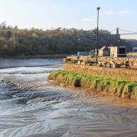
You can see the White City Allotments—those glints of light toward the middle are mostly reflections from greenhouses—where the "White City" of the Exhibition used to stand. There's still a glimpse or two of the railway line to Portishead to be seen, too, along with a vestige of the Rownham Ferry slipway.
Mostly though it's the modern things that stand out—the long line of flats along Paxton Drive, the curve of Brunel Way across the river, and the roof of Ashton Gate Stadium...
Lunchtime Cliftonwood Wander
18 Jan 2022
Another workday, another quick lunchtime trip to get me out of the house. This time my flimsy pretext is a tiny bit of Clifton Vale Close that I'd apparently not walked, and the fact that although I'd walked down Church Lane at least once before I still hadn't taken a single photo of it. Really I just fancied a mosey through Cliftonwood in the sunshine, with the promise of a coffee from Clifton Village at the top of the hill.
You have to zoom way in to see it, and know what you're looking for, but having just done that I can tell you that one of my other favourite lunchtime walk destinations is sitting down there in the little access road between the marina car park and the clock tower of the former Charles Hill offices: Imagine That, who sell coffee from their cute little converted horsebox.
I mostly went out to hang out with my friends Sarah and Vik in Bedminster, but along the way I thought I'd take a closer look at something a little nearer home: the last crossing point of the Rownham Ferry.
At an earlier site, the ferry was mentioned in the Proceedings in the Court of the Star Chamber in the Reigns of Henry VII and Henry VIII after a dispute between a new competitor and the existing ferry, which was run by St Augustine's Abbey. Presumably the crossing was used to get to and from the abbey property at Abbots Pool, which I've actually swum in, from the Abbey, now Bristol Cathedral.