Tagged: vehicle-registration-plate
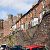
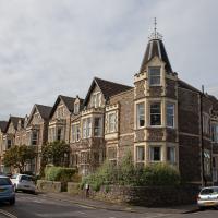
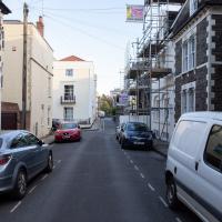
I headed to Bedminster to do a crossword with my support bubble today. On the way I delved into a couple of bits of Hotwells history, first of all snapping a "now" shot to go with a historical photo of Holy Trinity I happened across recently, and second of all to snap the Britannia Buildings.
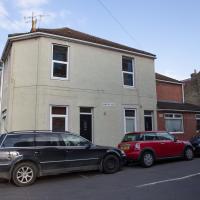
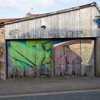
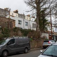
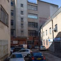
The Britannia Buildings are a little strip of offices on a corner of the Hotwell Road. They've mostly been the headquarters of a cleaning company for years, but I've often wondered what this distinctive curve of offices, its ground floor standing proudly out from the upper floors, used to be. Well, after my last wander, where I poked about the landing stage just down the road, I found out! Researching the paddleboat company P&A Campbell I came across this nugget in The A-Z of Curious Bristol, by Maurice Fells (£):
The firm of P & A Campbell was the main steamer operator in the Bristol Channel, with its local headquarters in offices close to the Hotwells pier and overlooking the harbour at the Cumberland Basin. Campbell's named their offices Britannia Buildings, after one of the ships in their White Funnel Fleet.
So! Turns out the Britannia Buildings were named after a paddle steamer—you can see some pictures of Britannia here.
In related news, I've now bought three of Maurice Fells' local history books, and they were hand-delivered by the author on Sunday, a half-hour after I ordered them online (through a message exchange on Nextdoor!) Not even Amazon Prime has managed to deliver me anything that quickly...
Once the Imperial Tobacco building, now a part of Ashton Gate Primary School. A change for the better, I think.
"I'd like to buy an owl, please." "We don't sell owls." "Someone told me you did." "Who?" "See! I just heard one!"
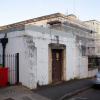
It's odd that someone seems to have renovated this building in such a way that the ground floor looks newer than the upper floors.
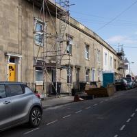
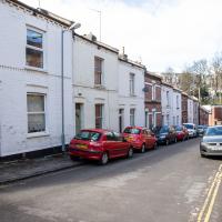
Hard to get a handle on this terrace; it's not easy for any mount to look pleasant when it's covered with scaffolding, skips and portaloos.
...but pleasant or not, the "mount" bit is right. I believe the big building in the distance is Monica Wills house, a retirement community, and another tobacco connection—you'll find the Wills name all around Bristol.
One Albermarle Row, Granby Green and... People
12 Mar 2021
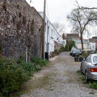
I was browsing some historical photos the other day, and came across "Rear of Unspecified House" in the Bristol Archives' John Trelawny Ross collection, and immediately recognised it as being the back of 1 Albermarle Row, just around the corner from me. I've not had much time to research the history of this odd little addition to Albermarle Row, or what happened to 1-4 Cumberland Place, number 4 of which used to be attached to the side of 1 Albermarle Row, but it was interesting to look at old maps for a few minutes and work out what used to be where.
That all connects with the little local bit of land at Granby Green, too, as it used to be numbers 1-3 Cumberland Place. There was something of a planning battle over Granby Green, and I've included an old edition of Hotwells & Cliftonwood News that I found online, a copy of which would have been popped through my letterbox at the time.
I was also inspired by some old pictures of Hotwell Road to try to put a few more people in my pictures, though I set my pre-focus a couple of extra metres out from normal to make sure I didn't get too close to anyone!
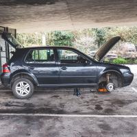
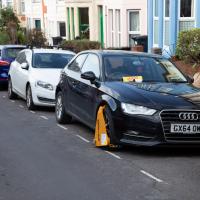
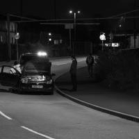
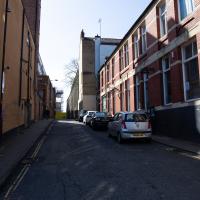
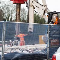
That seems to be a driveshaft flopping out of the wheel arch at the front, so I guess he's doing more than changing his tyres. This is probably a sensible place to work on your car on a rainy day -- sheltered, lots of space, decent light, nice and level. Plus I think it's the Lockside Car Park and I reckon theyr'e closed for lockdown.
Leigh Woods Walk
14 Mar 2021
An enormous walk today, or at least it felt enormous. My feet are sore, anyway. I started off recreating a couple of local historical photos in Hotwells, but then headed for my traditional walk along the towpath in the Avon Gorge to the far extreme of Leigh Woods, up and through the woods to the height of the Suspension Bridge, finally crossing into Clifton Village for a well-deserved vanilla latte.
I say "traditional" because this used to be a very regular route for me, first walking, years and years ago, and later jogging—this route combined with a circuit of the Downs on the other side used to be my way of making sure I was fit to do a half-marathon (I did six of them in total, between 2010 and 2014).
I miss the routine of this walk, even though it's a long way and it used to pretty much wipe me out when I did it—I'd come back home and collapse and do very little for the rest of the day. But perhaps that's what Sundays are for, and I should try to remember that.
Doing this walk regularly was quite a meditative experience. Not so much of that today, but once I got to the further extreme of the towpath, where the roar of the Portway traffic on the other side of the river dwindles and I turned into Leigh Woods to climb ever closer to birdsong and further from rushing cars, I did seem to recapture a little of the feeling of previous walks. (I would say my mind cleared, but I was mentally singing along to Life Without Buildings' The Leanover for most of the wander. There are worse songs to have stuck in one's head, though; it's a great track...)
Anyway. Apparently the walk made me more likely to ramble in words, too. I'll stop now :)
I should see if there's actually a little public street set back between Princess Victoria Street and The Mall. I did consider having a look the last time I passed, but I think there was a lorry backing out of the way into the little back road at the time.
John Carr's Terrace
16 Mar 2021
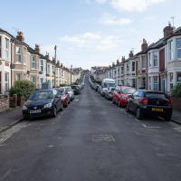
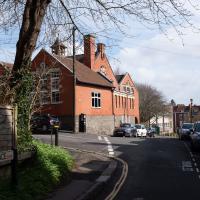
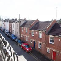
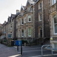
I wanted a nice simple lunch-hour walk that took me past a cafe today, and I managed to find the perfect road to knock off my list of targets to do it. Situated just off Jacobs Wells Road, right next to Queen Elizabeth's Hospital, John Carr's Terrace, and Rosebery terrace above it, which I'd completely forgotten existed, are a little cul-de-sac that many Bristolians will have wandered past a thousand times without ever seeing.
There's a reason it's next to QEH:
Known traditionally as "The City School", Queen Elizabeth's Hospital was founded by the will of affluent merchant John Carr in 1586, gaining its first royal charter in 1590.
John Carr's terrace itself isn't much to write home about, architecturally, but I like the secluded feel of it, and I really liked Rosebery Terrace with its little houses, commanding position and friendly, slightly tumbledown feel.
On the way home I popped into Foliage Cafe for a coffee and a very pleasant nutella and banana pastry, then walked home past the refurbishment of the old Thali Cafe into a new and interesting clinic...
What I'd forgotten is that above John Carr's terrace on the other side of the road is yet another hidden terrace: Rosebery Terrace. You can see John Carr's QEH towering grandly in the background.
Harbourside Milestone
17 Mar 2021
The other day I realised (hello, Maggie!) that my next walk would be my hundredth, and that I'd done 393.4km so far. I figured it would be nice to get to 100 walks and 400km on the same walk, so I went for a nice long harbourside wander after work, rather than dashing out at lunchtime. As it turned out, we're just coming up to the time of year where I can leave the house at 5:30 in the evening and there's still just enough light to take photos by the time I've made it around the harbourside. Though only just, and mostly because I've got a full-frame camera that's not bad in low light...
Still, the evening light made a lovely change, and some of the photos turned out to be pretty good photos per se, rather than just record shots of my walk. I'm looking forward to more evening walks like this as summer approaches.
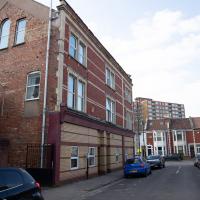
On the way around this evening I wandered through one of the oldest bits of the city to extend my walk and snapped some interesting bits of architecture, including an NCP car park(!) and a nighttime shot of one of my favourite subjects, the clock tower at the Albion dockyard.
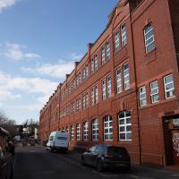
Featuring the building that once housed the Merchant Ventuers Trade School. (I presume they sold it.)
Before the Venturers bought it it was occupied by Bristol Grammar school.
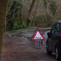
This is a Metrobus-only road leading to Ashton Avenue Bridge; I imagine his car died on the Cumberland Road and this was his best option for getting it safely out of the way.
I wasn't going to take a very long walk on this nice spring evening; it just happened. I was going to knock off a path or two on Brandon Hill, home over centuries to hermits and windmills, cannons and Chartists, and then just wander home, stopping only to fill up my milk bottle at the vending machine in the Pump House car park.
However, when I heard a distant gas burner I stayed on the hill long enough to see if I could get a decent photo of both the hot air balloon drifting over with Cabot Tower in the same frame (spoiler: I couldn't. And only having the fixed-focal-length Fuji with me didn't help) and then, on the way home, bumped into my "support bubble", Sarah and Vik, and extended my walk even further do creep carefully down the slipway next to the old paddle steamer landing stage and get some photos from its furthest extreme during a very low tide...
I got interested in Bristol's medieval water supplies after poking around near Jacobs Wells Road and Brandon Hill. It was during that research I found out about a pipe that's still there today, and, as far as I know, still actually functioning, that was originally commissioned by Carmelite monks in the 13th century. They wanted a supply of spring water from Brandon Hill to their priory on the site of what's now the Bristol Beacon—Colston Hall, as-was. It was created around 1267, and later, in 1376, extended generously with an extra "feather" pipe to St John's On The Wall, giving the pipework its modern name of "St John's Conduit".
St John's on the Wall is still there, guarding the remaining city gate at the end of Broad Street, and the outlet tap area was recently refurbished. It doesn't run continuously now, like it did when I first moved to Bristol and worked at the end of Broad Street, in the Everard Building, but I believe the pipe still functions. One day I'd like to see that tap running...
There are a few links on the web about the pipe, but by far the best thing to do is to watch this short and fascinating 1970s TV documentary called The Hidden Source, which has some footage of the actual pipe and also lots of fantastic general footage of Bristol in the seventies.
On my walk today I was actually just going to the building society in town, but I decided to trace some of the route of the Carmelite pipe, including visiting streets it runs under, like Park Street, Christmas Street, and, of course, Pipe Lane. I also went a bit out of my way to check out St James' Priory, the oldest building in Bristol, seeing as it was just around the corner from the building society.
There are far too many pictures from this walk, and my feet are now quite sore, because it was a long one. But I enjoyed it.
In the background, two tower blocks, Irving House and Terry House, that hardly anyone notices, as they're mostly hidden when you're on the busiest streets that surround them, Park Street and Park Row. The entrance to their little estate is next to the Esso station on Park Row.
I'm planning on going and having a closer look at them tomorrow.

Things have been calm during the day, but the evenings are still quite protest-ey and there's definitely a higher police presence in the city right now.
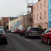
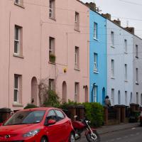
Swinging By Sydney Row
01 Apr 2021
Another workday, another quick coffee excursion. This time I decided to swing past Sydney Row on the way back from the marina car park where Imagine That have their horsebox. I didn't know until recently that the terrace was built for workers at the adjacent dockyard.
I've also gradually come to the conclusion that I don't really think very two-dimensionally when it comes to finding my way around or associating one place with another. I only realised in the last few days that the odd industrial building that takes up the other half of Syndey Row, the one that's always covered with graffiti, is the back of the dockyard works. In my defence, as it's tucked away in a corner of the little industrial estate that I've never ventured into (I rarely find I have a need for the products of safety valve manufacturers), I don't think I've ever seen the front of the building...
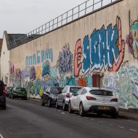
I don't think I ever put two and two together before and worked out that this was the back of one of the industrial buldings on the Albion Dockyard. I'm not sure you can see it from the front, or at least not without wandering into the fairly private-looking works area.
I made a "that doesn't auger well" pun on Twitter but hardly anyone noticed it. #dadjoke
An Evening Wander to the Gallows
06 Apr 2021
I'd originally intended just to pop up to the area around Alma Road, where I'd missed a few streets on earlier wanders. It was such a nice evening, though, I decided to extend my walk up to the very top of Pembroke Road, just outside my one mile radius, to take a few snaps of something intriguing I'd found in my researches.
I've driven, walked and jogged past the little triangle of land at the top of Pembroke road a great deal in my time in Bristol, but I didn't know that it used to be the site of a gibbet, in fact that the road itself there used to be called Gallows Acre Lane. According to the Durdham Down history trail, by Francis Greenacre (an excellent name for a Downs researcher!) among other sources:
...it was below this quarry near the top of Pembroke Road, once called Gallows Acre Lane, that a gibbet stood. It was sometimes occupied by those who had committed robberies on the Downs and was last used in 1783 to hang Shenkin Protheroe for the murder of a drover. Stories quickly spread that he descended from the gibbet at midnight every night and stalked through Clifton. Such was the alarm that his body was cut down and buried.
Also very close to this little triangle of land was one of the gates of the extensive turnpike system...
Anyway. Along the way I encountered a wooden tortoise and a real squirrel, among other things. It was a good walk, and more light in the evenings means I can move my wanders out of the ticking countdown clock of work lunch-hours and be a bit more leisurely.
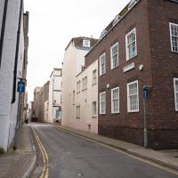
The actual street isn't much to look at. Unusually for Clifton, the front of one terrace stares directly at the back of another.
One of Bristol's most famous punning business names (along with mobile kebeb seller Jason Donervan and off-licence Amy's Wine House), Happytat is a long-running secondhand furniture shop on Stokes Croft.
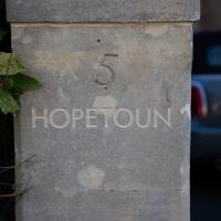
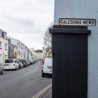
I thought it sounded Scottish. Hopetoun House is allegedly Scotland's "finest stately home". Not sure why there's one in Clifton, too.
Clifton Village Lunchtime Coffee
07 Apr 2021
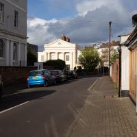
Unusually for my recent lunchtime coffee trips, I managed to find a new road to walk down: Caledonia Mews, which has a little entrance off Princess Victoria Street and runs between it and Caledonia Place. I've noticed it before a couple of times—if you look up from Princess Victoria Street you can see some of it, standing tall above the low buildings on the street itself—but until last night I'd not set foot in it, I think.
As well as focusing on this charming little mews, I looked in on the demolished site of the old WH Smith, and spotted what I think is part of the now-private-houses St Vincent Rocks Hotel that I'd not really noticed before, tucked away between Sion Lane and Sion Hill.
For some reason I always think of Princess Victoria Street as running north-to-south, but that's because of my terrible sense of direction, I suppose, as it's really more east-north-east.