Tagged: avon-gorge
I've been pretty awful at reading so far this year, apparently averaging about one book per month. That's a far cry from 2019, say, where I got through 41 books in the year. Today's wander was prompted by my rubbish reading, as I needed to go hand back some books to the library, because I'd managed to renew them so many times that I hit the limit on renewals. Oops. Several of them were still unread.
So, off to the Central Library for me, tail between my legs. On the way there I did my best to recreate a historical photo of Dowry Square; while I was in the area I walked under the adjacent Norman arch and poked around behind the Cathedral, and I also had a little diversion to the city centre and came back along the south side of the river, hitting some trouble with the lock gates as I finally crossed the harbour back towards home.
I'm in the habit of going over to the Tobacco Factory Market on a Sunday. I think I've walked all the routes around that way, but as a Plimsoll Bridge swing let me cross the road to the far side of Brunel Way on my return journey and I took a couple of photos of the brownfield development at the old Ashton Gate Depot site I thought I'd call it a Wander and pop some photos up.
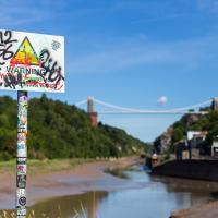
"STEEP DROP INTO MUD AND FAST FLOWING WATER".
This sign has been mildly annoying photographers since it was put up, getting a bit in the way of several alternative views from this bit of land. I presume it was installed in response to some kind of accident, but I'd hazard a guess that whatever difficulties someone got into probably wouldn't have been prevented by a sign that stated the completely bloody obvious.
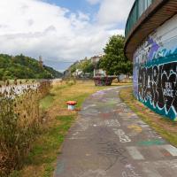
We start the day wandering around the periphery of the Cumberland Basin flyover system. Across Entrance Lock and then around the edge of Spike Island is my preferred route to get to Asthon Avenue Bridge and cross the river.
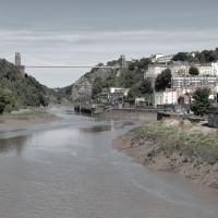
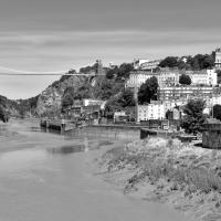
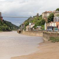
I took two shots from the south side of Brunel Way, a slightly different vantage point from my usual snapping point at the end of Spike Island down below. I'm not sure if I prefer this colour one...