Tagged: body-of-water
I mostly went out to hang out with my friends Sarah and Vik in Bedminster, but along the way I thought I'd take a closer look at something a little nearer home: the last crossing point of the Rownham Ferry.
That reminds me; I must re-read Iain M Banks's Use of Weapons again. In the novel he used the name Size Isn't Everything for one of the Culture's General System Vehicles, a spacecraft approximately 80km long... In the Culture, spacecraft are sentient and Culture ships choose their own names, often ironically.
He we have something of the opposite size of craft.
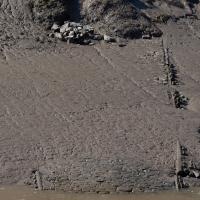
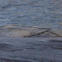
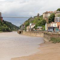
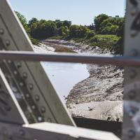
There, hopefully you can see it now—the slipway of the last incarnation of the Rownham Ferry, in use from as early as the 12th century to 1932, when this particular slipway was last used.
There's not much to see at the moment, as the tide's a bit too high. I'm going to head over to the Tobacco Factory Market, meet some friends, do a crossword or two, and head back at lower tide.
Now the tide's lower, we can see the end of the slipway we looked at earlier poking out from the Somerset side. According this article from the Bristol & Avon Family History Society:
In 1793 the ferry was identified as being used by many passengers to "cross the river at Rownham ferry and walk to the sweet and wholesome village of Ashton to eat strawberries and cream"
A Swing of the Plimsoll Bridge
24 Apr 2022
I was originally going to head over to the Ashton area to see if I'd missed any bits around the football stadium—and also to grab some lunch from the Tobacco Factory Market—but in the end I got a little distracted by having accidentally chosen exactly the right time to see the Plimsoll Bridge swing on one of the first busy days of Spring, where a lot of pleasure trips tend to head out down the Avon (and possibly the New Cut) from Hotwells.
In the end I mostly snapped that, and just a couple of photos from the Ashton area where I grabbed some lunch but didn't do any new exploring.
I've been pretty awful at reading so far this year, apparently averaging about one book per month. That's a far cry from 2019, say, where I got through 41 books in the year. Today's wander was prompted by my rubbish reading, as I needed to go hand back some books to the library, because I'd managed to renew them so many times that I hit the limit on renewals. Oops. Several of them were still unread.
So, off to the Central Library for me, tail between my legs. On the way there I did my best to recreate a historical photo of Dowry Square; while I was in the area I walked under the adjacent Norman arch and poked around behind the Cathedral, and I also had a little diversion to the city centre and came back along the south side of the river, hitting some trouble with the lock gates as I finally crossed the harbour back towards home.
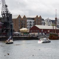
Library business concluded, I decided that my feet weren't quite sore enough, so decided to head back home by completing a circuit of the harbour rathter than just heading back down the noisy Hotwell Road. Wandering past the Arnolfini, I spotted this from a viewpoint not far from where the status of John Cabot stands, surveying the docks.
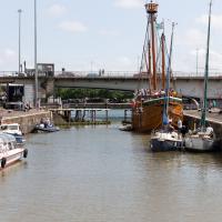
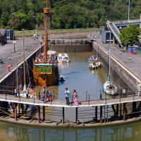
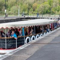
As you can see, there were quite a lot of boats waiting to leave Bristol for a jaunt down the river, most notably the Matthew, and Bristol Packet's Bagheera.
As a pedestrian I have a few alternative routes to cross. I decided to stroll down to the outer lock gate and get back to my side of the harbour there rather than going the long way around over the Plimsoll Bridge.
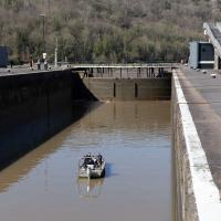
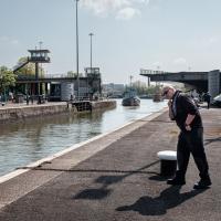
In the distance you can see a lockkeeper fishing in the water with a grappling hook on the end of some blue line to see if he can figure out what the gate is fouling on.
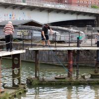
I was expecting them to pull a shopping trolley out at any moment. They weren't managing to snag anything, though.
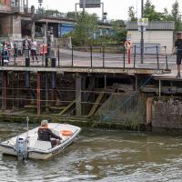
While I was tempted to hang around to see if they eventually pulled anything out of the way, the heat of the day was beating down pretty hard by this point and I didn't want to risk sunburn, so I headed home. As did all the boats in the lock, who returned back into Cumberland Basin and presumably eventually back to the city, refunding/rebooking their passengers.
I found out that my decision to leave had been a good one two days later, on Tuesday evening, when I happened to be on my walking commute home during another locking out, this time with the lock gates working. I asked the lock keeper about the problem, and apparently they'd tried hooking out whatever was fouling the gate for quite some time on Sunday, but eventually gave up and sent divers in on Monday, who pulled out a large section of chain-link fence that was fouling the south lock gate and got everything working again.
I'm in the habit of going over to the Tobacco Factory Market on a Sunday. I think I've walked all the routes around that way, but as a Plimsoll Bridge swing let me cross the road to the far side of Brunel Way on my return journey and I took a couple of photos of the brownfield development at the old Ashton Gate Depot site I thought I'd call it a Wander and pop some photos up.
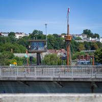
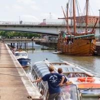
One of the things I like about Bristol is the strange contrasts. Here we have two crow's nests. The first is the Cumberland Basin Flyover System's Plimsoll Bridge control room, used to give the swing bridge operator a good view of the whole area surrounding the bridge. The second is the reason for the swing, the crow's nest on the tall mast of the replica of John Cabot's Matthew, as it passes through into Entrance Lock.