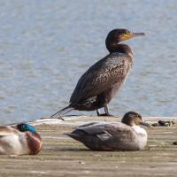
Tagged: body-of-water
Bower Ashton is an interesting little area just south of the river from me—in fact, the Rownham Ferry used to take people over from Hotwells to Bower Ashton, operating from at least the twelfth century to around the 1930s.
It's a strangely contradictory little area, with a cluster of old and new houses sandwiched in between the busy A-roads and significantly more industrial area of Ashton and the bucolic country estate of Ashton court roughly east to west, and also between Somerset and Bristol, north to south.
I've been around here before, mostly poking around Bower Ashton's arguably most well-known bit, the Arts faculty campus of the University of the West of England, but I'd missed at least Parklands Road and Blackmoors Lane, so I initially planned just to nip across briefly and wander down each in turn. On a whim, though, I texted my friends Sarah and Vik in case they were out and about, and ended up diverting to the Tobacco Factory Sunday market first, to grab a quick flat white with them, extending my journey a fair bit.
To start with, though, I nipped to a much more local destination, to see something that you can't actually see at all, the Gridiron...
(I also used this wander as a test of the cameras in my new phone. I finally upgraded after a few years, and the new one has extra, separate wide and telephoto lenses compared to the paltry single lens on my old phone. Gawd. I remember when speed-dial was the latest innovation in phones...)
One last snap before we move on. I'm using the wide lens on the iPhone here, and have managed to include a silhouette selfie...
The Gridiron and Bower Ashton Part Two
03 Dec 2021
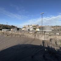
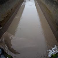
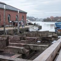
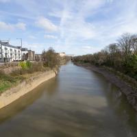
On my last wander, to Bower Ashton, I was intending to knock Blackmoors Lane off my list "to-do" list, but got a bit diverted. I also took a little look into the history of the Gridiron, once a cheaper alternative to dry dock that was nestled just south of North Entrance Lock.
Today I had to go to send a parcel off somewhere, so I decided on going to the North Street Post Office via Blackmoors Lane. I didn't have much intention of anything else, but as luck would have it I walked out both at low tide and also as some lockkeepers seemed to be having a bit of a training session, and one of the more senior people was (a) happy to answer a few random questions on the Gridiron and (b) actually knew a lot about it, as Gridiron maintenance had been one of his jobs, more than twenty years ago...
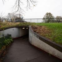
I am actually getting better at finding my way around this concrete tangle of roads and underpasses. This way avoids having to dash across Winterstoke Road or walk quite a long way down to the first pedestrian crossing.
The road up above is the A3029, also known at this point as Brunel Way. It replaced the earlier Ashton Avenue, which as you'd expect headed from here and crossed Ashton Avenue Bridge. This parevenu diverts from the original route at about this point and has its own bridge a little further downstream.
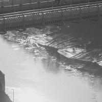
Yes, having compared it with old photos and the 1946 aerial view I posted on Sunday I'm sure that that's the end of the gridiron, all 200 feet of which is apparently still there beneath the silt.
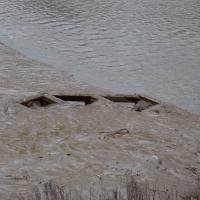
So, this is all that can be seen today of a 200-foot long, 38-foot wide grid of wood, I think—at first I figured it was metal, but Nick Howes posted a historic photo on Twitter where the grid itself certainly looks to be made of timber—hidden completely by a simple build-up of silt.
Up until the year 2000, it had been in use since some time in the 1890s, I think. Grace's guide's copy of the Institution of Civil Engineer's obituary of John McCurrich certainly attributes the construction of a gridiron to him while he was Docks Engineer for Bristol, and he held that post from 1890 until his death in 1899.
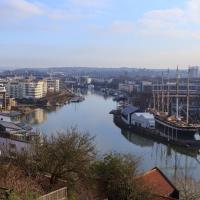
A Water-Based Wander
11 Dec 2021
I woke up on this Saturday with a headache, feeling like I'd not slept at all. As well as that, I'm still in some pain from the wisdom tooth extraction I had a few weeks ago. I moped about the flat for a while and then decided that the best thing to do was to force myself out on at least a small walk to get some fresh air and coffee.
Was there anywhere I could walk locally that I'd never been? Actually, yes! Although it's not a road, and I didn't walk it, there is actually one route that I've not travelled so far in my wanders. And it even had coffee near its far end...
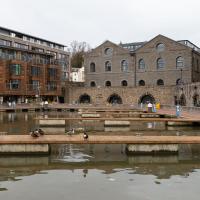
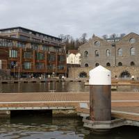
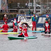
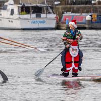
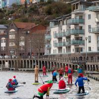
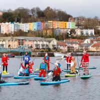
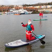
My friend Lisa texted me to see if I wanted to pop down and take a photo or two of the event she was taking part in: Santa SUP. SUP Bristol organise stand-up paddleboarding on the floating harbour, and their annual Santas-on-paddlboards event is quite the sight.
On the way there, I grabbed a historical photo I'd been wanting to recreate for a while of the shiny and new Cumberland Basin flyovers back in 1965, because I reckoned I could fit finding the same viewpoint into my outbound journey. Also, after having only used it on a wander for the very first time yesterday, I managed two crossings in the cross-harbour ferry today to get to the best locations for snapping the paddleboarders...
So, then, this wander is mostly a bunch of photos of paddleboarding Santas. Tis the season... Enjoy!

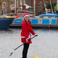

Well, she did ask me to come and take photos, so I tried to snap a few extra of her on the way around :)
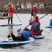
Apparently there was quite a headwind on this bit. I think keeping closer to the side helps.
A Random New Year's Day Wander
01 Jan 2022
I picked a fairly arbitrary reason for a wander today. Really, I just wanted to do a New Year's Day wander just to get out of the house and to set a precedent for the year to come.
My ostensible reason was to investigate what looked like a road on my map that quartered the lawn in front of the Ashton Court mansion. As it turned out, this is just a muddy footpath/desire line similar to a half-dozen other tracks nearby, and must be some kind of bug or misclassification with the mapping system I'm using, but that's not important. What's important is that I went for a little walk on the first day of the year. As a bonus, I did happen to wander down a couple of sections of new footpath, so technically I broke some new ground too, which is nice.
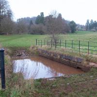
Strange little pond, yes? I think this may be a "cart dip" pond, used for rehydrating the wheels of old carts and carriages, which apparently kept things working better. Not sure on the details, though.
We'll leave today's wander with a snap of the Patent Slip. I wonder if the newer timber closest to the camera is the greenheart that they're renewing some of the structure with? Hardy stuff, as Wikipedia says:
The wood is extremely hard and strong, so hard that it cannot be worked with standard tools. It is durable in marine conditions, so it is used to build docks and other structures... The Fram and the Endurance, made famous in the polar expeditions of Amundsen and Shackleton, were the two strongest wooden ships ever constructed and were sheathed in greenheart to prevent them from being crushed by ice.
Near and Far
05 Jan 2022
I took advantage of a rare recent day where it wasn't tipping down with rain to get away from my desk on a lunchtime workday and head up to Clifton Village. I'd hoped to snap a reproduction of historical photo which I'd worked out had been taken from the Suspension Bridge, but the gods were not smiling on me. Still, taking only a nice long lens with me worked out very well as the lovely haze of the day made more distant views quite dramatic...
Lunchtime Cliftonwood Wander
18 Jan 2022
Another workday, another quick lunchtime trip to get me out of the house. This time my flimsy pretext is a tiny bit of Clifton Vale Close that I'd apparently not walked, and the fact that although I'd walked down Church Lane at least once before I still hadn't taken a single photo of it. Really I just fancied a mosey through Cliftonwood in the sunshine, with the promise of a coffee from Clifton Village at the top of the hill.
Bedminster Trip for New Walking Shoes
26 Feb 2022
I needed to buy new walking shoes—my old ones were squeaking and it was driving me up the wall—so I ordered some for collection from Taunton Leisure on East Street in Bedminster, and decided to make picking them up an official wander.
I didn't cover any new ground within my mile, but I did take advantage of the trip to take in a few interesting things just outside my normal radius, mostly New Gaol-related. Along the way there are a couple of sanitation-related diversions, including a visit to a rare manhole cover. You can hardly wait, I can tell!
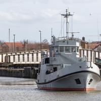
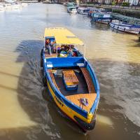
Anyway, on to happier contemplations. Here we see the Merchant's Road bridge (Junction Bridge, to give it its official title) swinging closed behind the Pride of Bristol.
You can see the New Gaol entrance there on the left, poking out incongruously from the modern flats, with the spire of St Mary's rising from behind it in the distance.
In Which We Begin and End with Love
05 Mar 2022
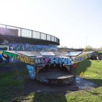
I had a lot to get done around the house, so as soon as I heard there might be a shiny new piece of street art near me, under the Cumberland Basin flyovers, I immediately decided that was all the excuse I needed to set off on a round-the-harbour lunchtime walk to get some fresh air and see if I could spot it. So, here's a circular wander that takes in graffiti, boats, wildlife and graffiti again...
Leigh Woods Purple Path
12 Mar 2022
There's a few tracks in Leigh Woods that lie within my mile and show up on my map but that I've not walked yet, so I decided to take one of my traditional big long walks through the woods on this nice crisp sunny morning.
For years—decades, even—I've been doing a similar route from my place, along the towpath to the far woods entrance, up the hill for a varied walk on one of the marked tracks and then across the Suspension Bridge to Clifton Village for a coffee-based reward. It's my default "long walk", really, and I almost always enjoy it. Today, at last, spring actually seemed to be springing, which made for some extra positivity...
I'm sure both the entire flyover system and its monument bench looked splendid when they were first put up, in 1965.
Here you can hear a live performance of the song Virtute et Industrial by Adge Cutler and the Wurzels that includes a brief reference to the then-newly-completed flyover system:
Hast seen our brand new bridge, up there in Cumberland Basin?
The cars go by like thunder, and up and round and under
Where they goes, nobody knows, tain't no bleedin' wonder!
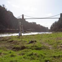
This is probably the most popular spot to take photos of the bridge from this direction. I'd guess the large majority of photos of the Suspension Bridge are taken from the other side.