Tagged: harbour
Fresh Fields
17 Oct 2021
For the first time in a while, I had the time and energy to go further afield and knock off some new roads from my "to do" list. I headed through the first Hotwells Festival to Ashton and Bedminster to cross off a few of the suburban roads south of North Street.
First, though, I decided to try to reproduce an old photo of the now-demolished Rownham Hotel just around the corner from where I live...
Bower Ashton is an interesting little area just south of the river from me—in fact, the Rownham Ferry used to take people over from Hotwells to Bower Ashton, operating from at least the twelfth century to around the 1930s.
It's a strangely contradictory little area, with a cluster of old and new houses sandwiched in between the busy A-roads and significantly more industrial area of Ashton and the bucolic country estate of Ashton court roughly east to west, and also between Somerset and Bristol, north to south.
I've been around here before, mostly poking around Bower Ashton's arguably most well-known bit, the Arts faculty campus of the University of the West of England, but I'd missed at least Parklands Road and Blackmoors Lane, so I initially planned just to nip across briefly and wander down each in turn. On a whim, though, I texted my friends Sarah and Vik in case they were out and about, and ended up diverting to the Tobacco Factory Sunday market first, to grab a quick flat white with them, extending my journey a fair bit.
To start with, though, I nipped to a much more local destination, to see something that you can't actually see at all, the Gridiron...
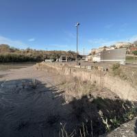
(I also used this wander as a test of the cameras in my new phone. I finally upgraded after a few years, and the new one has extra, separate wide and telephoto lenses compared to the paltry single lens on my old phone. Gawd. I remember when speed-dial was the latest innovation in phones...)
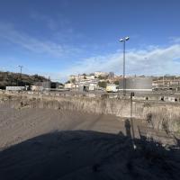
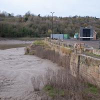
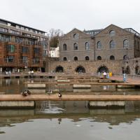
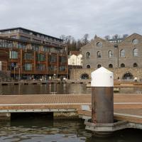
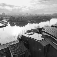
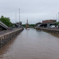
You can't actually see the Gridiron in this photo, but I believe it's still there, under that amazing buildup of silt.
The Gridiron—one of the few photos of it can be seen on the Maritime Mud and Miasma page of About Bristol—was a cheaper alternative to putting your boat in a dry dock. It was a 200-foot long grid (there seems to be some debate over whether the grid itself is actually metal, or in fact timber; I'll have to try to find out), 38 feet wide, nestled here between the north and south entrance locks. A ship captain could sail his vessel over here at high tide, then as the tide gradually receded, the ship—up to 250 feet, as overhanging a bit was apparently okay—would settle onto the gridiron.
At that point an inspection and repair crew could make their way down to the gridiron by ladder and do whatever work they could manage before the tide rose up again.
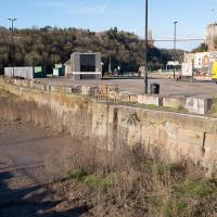
You can still see some ladders in place, I can only presume they were there to get you down to the gridiron, but that is just a guess; information on it seems quite hard to find.
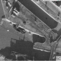
Image from 1946 Aerial layer of KYP Bristol/English Heritage.
As you can see, it was pretty big, and clearly still in use in 1946...
One last snap before we move on. I'm using the wide lens on the iPhone here, and have managed to include a silhouette selfie...
A Water-Based Wander
11 Dec 2021
I woke up on this Saturday with a headache, feeling like I'd not slept at all. As well as that, I'm still in some pain from the wisdom tooth extraction I had a few weeks ago. I moped about the flat for a while and then decided that the best thing to do was to force myself out on at least a small walk to get some fresh air and coffee.
Was there anywhere I could walk locally that I'd never been? Actually, yes! Although it's not a road, and I didn't walk it, there is actually one route that I've not travelled so far in my wanders. And it even had coffee near its far end...
I'm heading for a coffee from Imagine That, in the Bristol Marina. Which is on the other side of harbour. Normally I'd have walked down that side to get there, but today...
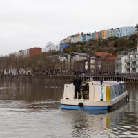
First, though, we'll take a poke around the Harbour Inlet. Here's Skyloom just pulling away from the pump-out station.
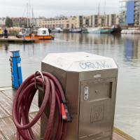
This is a LeeSan LeeStrom LS200W Pump Out Station, I believe. It pumps things out of boats. You would probably rather I drew a veil over the details.
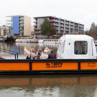
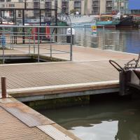
The cross-harbour ferry "ties up" to the quay at either side by dropping a hoop over a short post fitted to the edge. The hoop is lifted and dropped remotely, by a line running to the little cabin aft. The passenger ramp is also remotely operated—you can see the little block and tackle arrangement running to a pulley with another line back to the cabin.
The boat's crewed by a single person, and they're usually accurate enough with their aim and their remote controls that they don't need to leave the cabin at all during their back-and-forth trips from here, the harbour inlet, to the SS Great Britain steps on the other side. These days they've stopped taking coins, and avoid corona cooties by staying behind their cabin window and holding up a card reader to take your £1.20.
Bristol has a long tradition of ferries. The Rownham Ferry near me was operating in the 12th century, and I was reading about the planned temporary closure of Gaol Ferry Bridge this morning, which fairly obviously is the bridge that replaced the ferry that used to run between Bedminster and the New Gaol.
Interesting how "new" is quite a stretchy word. The "New" Gaol was demolished in 1898, and of course the bridge spans the "New" Cut, the diverted section of river that was completed in 1809...
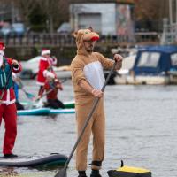
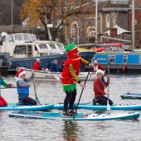
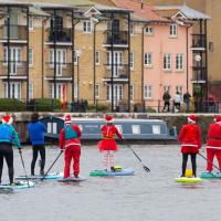
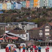
My friend Lisa texted me to see if I wanted to pop down and take a photo or two of the event she was taking part in: Santa SUP. SUP Bristol organise stand-up paddleboarding on the floating harbour, and their annual Santas-on-paddlboards event is quite the sight.
On the way there, I grabbed a historical photo I'd been wanting to recreate for a while of the shiny and new Cumberland Basin flyovers back in 1965, because I reckoned I could fit finding the same viewpoint into my outbound journey. Also, after having only used it on a wander for the very first time yesterday, I managed two crossings in the cross-harbour ferry today to get to the best locations for snapping the paddleboarders...
So, then, this wander is mostly a bunch of photos of paddleboarding Santas. Tis the season... Enjoy!
Lunchtime Cliftonwood Wander
18 Jan 2022
Another workday, another quick lunchtime trip to get me out of the house. This time my flimsy pretext is a tiny bit of Clifton Vale Close that I'd apparently not walked, and the fact that although I'd walked down Church Lane at least once before I still hadn't taken a single photo of it. Really I just fancied a mosey through Cliftonwood in the sunshine, with the promise of a coffee from Clifton Village at the top of the hill.
Bedminster Trip for New Walking Shoes
26 Feb 2022
I needed to buy new walking shoes—my old ones were squeaking and it was driving me up the wall—so I ordered some for collection from Taunton Leisure on East Street in Bedminster, and decided to make picking them up an official wander.
I didn't cover any new ground within my mile, but I did take advantage of the trip to take in a few interesting things just outside my normal radius, mostly New Gaol-related. Along the way there are a couple of sanitation-related diversions, including a visit to a rare manhole cover. You can hardly wait, I can tell!
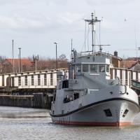
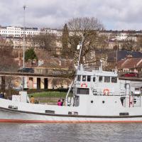
Anyway, on to happier contemplations. Here we see the Merchant's Road bridge (Junction Bridge, to give it its official title) swinging closed behind the Pride of Bristol.
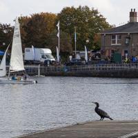
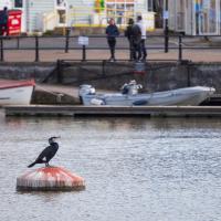
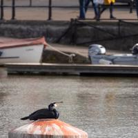
I took a long lens with me today in case the cormorants were around; I've been meaning to try taking a better snap of them for a while. Here's one on a buoy that seems to have "hosting cormorants" as its only purpose. There's often one there, anyway.
And there's often also a cormorant and some other birds hanging out on the end of this pontoon at the slipway near the Nova Scotia, too.
A Quick Swing Past Ashton Court
05 Jun 2022
Another day not dissimilar to my last wander: I'm feeling a bit tired and rather than just moping around the house I thought I'd find some tiny bit of somewhere that I'd not yet walked and get outdoors. This time I headed for the Tobacco Factory Market in Bedminster, as I often do, but went the long way around via Ashton Court Mansion as I knew there were some footpaths and a small section of road I'd not ticked off up there. Finishing all the Ashton Court footpaths will be quite a long job, but you've got to start somewhere...
I did feel rather better by the time I got home, and, pretty much astoundingly given the weather forecast, managed to avoid the rain completely.
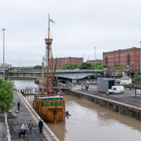
Fairly typical Bristol scene here, as the traffic is held up for a bridge swing caused by a replica of a 15th century caravel.
I'd normally walk over those open lock gates she's just sailed through, but it's easy enough to walk down to the gates at the river end.
