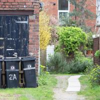
Tagged: land-lot
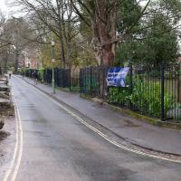
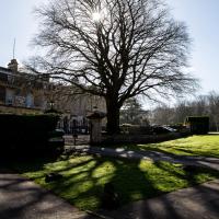
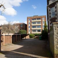
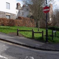
I went to get my first dose of the Oxford/AstraZeneca Covid-19 vaccine today. Handily, the vaccination centre was Clifton College Prep School in Northcote road, next to Bristol Zoo, a road that's just within my 1-mile range that I hadn't visited before.
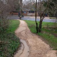
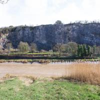
I parked up near Ladies Mile and tried to find a few of the tracks marked on the map I'm using, but couldn't see most of them. Whether that's just because they've disappeared over time, or with the recent lack of use or waterlogging from the 24 hours of rain we just had, I'm not sure. It was a pretty fruitless search, anyway.
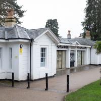
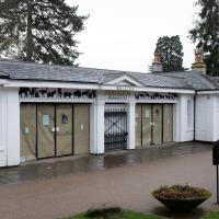
The vaccine shot was virtually the same setup as when I got my winter flu jab back in November, except for the venue. I snapped a couple of pictures of the school while I was there, but I was in and out in five minutes, and you probably don't want to linger around a vaccination centre, I suppose.
Instead I wandered around the compact block of the Zoo, now sadly scheduled for closure. By coincidence I finished E H Young's Chatterton Square this morning: set in Clifton (fictionalised as "Upper Radstowe") near the Zoo, the occasional roars of the lions that can be heard by the residents of the square (Canynge Square in real life) form part of the background of the novel. The book's set in 1938 (though written and published post-war, in 1947). It seems a shame that the incongruous sounds of the jungle will no longer be heard from 2022. All I heard today were some exotic birds and, I think, some monkeys.
I was told not to drive for fifteen minutes following the jab, so I wandered out of my area up to the top of Upper Belgrave Road to check out an interesting factoid I'd read while looking into the history of the reservoir at Oakfield Road, that the site of 46 Upper Belgrave Road was a bungalow, shorter than the adjacent houses, and owned by Bristol Water, kept specifically low so that the pump man at Oakfield Road could see the standpipe for the Downs Reservoir (presumably by or on the water tower on the Downs) and turn the pump off when it started overflowing. Sadly I couldn't confirm it. There is one particularly low house on that stretch, but it's number 44, and though small, it's two-storey, not a bungalow, so nothing really seems to quite fit in with the tale.
I'm writing this about nine hours after getting the jab, by the way, and haven't noticed any ill effects at all. My arm's not even sore, as it usually would be after the normal flu jab. In twelve weeks I should get an appointment to get the second dose.
The Zoo's been here since 1836. Shame they coudln't hold out until 2036. I wonder if I'll get the chance to go again before they shut down and it all becomes luxury flats?
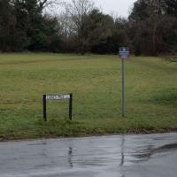
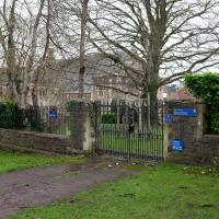
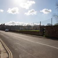
This is the "foot" of Northcote road; it has a longer "leg" where the main entrance to the vaccine centre was, but I was a bit early.
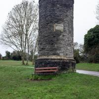
This is a ventilation shaft for the Clifton Down Tunnel. The railway tunnel was opened in 1877, and is still in use. According to this page (which might've been put together by my friend Rob, by the looks of it!): this ventilation shaft used to be topped with crenellations, and also:
Clifton Down Tunnel is 1751 yards long. Halfway along its length there is an opening into a cave that exits half way up the cliffside of the Avon Gorge.
...so that's quite fascinating. I think it also used to connect to the Bristol Port Railway and Pier tunnel that I found in the Avon Gorge on another wander.
EDIT TO ADD (14 Oct 2021): I'm just reading Colin Maggs' The Bristol Port Railway and Pier (Oakwood Press, 1975) and the tunnel was indeed built for the Clifton Extension Railway, which linked the Bristol Port Railway line with the rest of the national network. It sounds like quite a feat of engineering, including the use of a diamond boring machine invented by Major Beaumont, MP: "Cutting facets of black diamonds were fixed round the end of a steel tube to form a kind of auger. This tube was rapidly revolved by compressed air and advanced so that its diamond points came into contact with the rock and water forced through the tube washed away grit and kept the tube cool."
Downs Wander
23 Feb 2021
Just a quick trip to knock off a path or two on Clifton Down. I'm not actually convinced I walked down the paths I was hoping to, but I suppose I'll see once I upload this and look at it on the map :)
Today's highlight turned out to be retrospective—looking up Gertrude Hermes' amazing wood engravings when I got home. (By complete coincidence, I was trying to discover the location of the Stella Matutina's former Hermes Lodge in Bristol as part of my researches last night...)
A Day Off Wander in Clifton
26 Feb 2021
I'm on the first day of a long weekend, and I certainly picked the right one for it. This may be the first proper spring-like day of the year in Bristol; it was glorious.
I headed up to Clifton, around the area where I got my Covid vaccine jab the other day, to knock off a few remaining roads in that area and because it would be good exercise for an extended lunchtime walk.
Along the way I saw some very Clifton sights, including an Aston Martin, some Jacobethan architecture, and some private college sports grounds. Mostly, though, I just enjoyed the sunshine, and took every opportunity I could to snap views across the city.
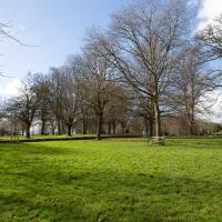
Say what you like about the Society of Merchant Venturers, their clubhouse does have a fine, fine tree in its garden.
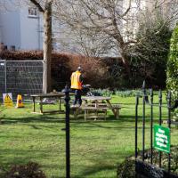
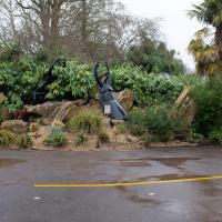
At first glance you might think this is a lawnmower, but I believe this is actually a geophysical survey being carried out around the sinkhole that opened up in Canynge Road garden over Christmas. Looks like a geophysicist using ground-penetrating radar to me, anyway. I've seen Time Team!
Ah, there's something of a clue: his hi-vis tabard says "Fugro" on the back. That's Ingenieursbureau voor Funderingstechniek en Grondmechanica, Dutch for "Engineering Company for Foundation technology and Soil Mechanics". Sounds fairly ground-survey-ey to me.
I'm glad my friend Lisa joined me today; she drove in from Shirehampton and told me that the Portway was looking rather lovely, so we set off that way. She's also braver than I am when it comes to doing urbex stuff, so this was just the opportunity to take a peek into the Portnalls Number One Railway Tunnel/Bridge Road Deep Valley Shelter whose entrance I'd found on a previous wander.
It was definitely dark and spooky and impressively big, with a side tunnel that Lisa explored that leads to a little door I don't think I've previously noticed on the side of the Portway. I didn't get many photos—even my astoundingly powerful little torch (£) didn't do much to light things up, and you're not going to get much joy hand-holding a camera in that darkness—but I did shoot a little video, which I might edit and add later.
After plumbing the bowels of the earth, we went up Bridge Valley Path to Clifton, explored some bits around the College and Pembroke Road, then came home via Foliage Cafe for coffee. Nice.
Harbour Circumnavigation
01 Mar 2021
Normally I don't have enough time in my lunch hour to get all the way around the harbourside. This is a shame, as Wapping Wharf is a great place to get coffee and a snack, but it's pretty much diametrically (perimetrically?) opposite me on the harbour. Today I had the day off, so I decided to go and knock off a few streets around Anchor Road that I'd not covered, as well as visiting the site of the Read Dispensary (well, one of them) and dropping into Mokoko for one of their astounding almond croissants. From there I came back along the south side, checking out the views from as much of the Chocolate Path as you can venture down at the moment, and swapping from Cumberland Road to Coronation Road at Vauxhall Bridge.
There's a lot of meh photos on this walk—my chief output from this project could be politely described as "record shots"—but a few turned out well, especially those of Vauxhall Bridge from the Chocolate Path, which reminded me how much of a loss the current closure of the Chocolate Path is to walkers and cyclists in Bristol.
I headed to Bedminster to do a crossword with my support bubble today. On the way I delved into a couple of bits of Hotwells history, first of all snapping a "now" shot to go with a historical photo of Holy Trinity I happened across recently, and second of all to snap the Britannia Buildings.
The Britannia Buildings are a little strip of offices on a corner of the Hotwell Road. They've mostly been the headquarters of a cleaning company for years, but I've often wondered what this distinctive curve of offices, its ground floor standing proudly out from the upper floors, used to be. Well, after my last wander, where I poked about the landing stage just down the road, I found out! Researching the paddleboat company P&A Campbell I came across this nugget in The A-Z of Curious Bristol, by Maurice Fells (£):
The firm of P & A Campbell was the main steamer operator in the Bristol Channel, with its local headquarters in offices close to the Hotwells pier and overlooking the harbour at the Cumberland Basin. Campbell's named their offices Britannia Buildings, after one of the ships in their White Funnel Fleet.
So! Turns out the Britannia Buildings were named after a paddle steamer—you can see some pictures of Britannia here.
In related news, I've now bought three of Maurice Fells' local history books, and they were hand-delivered by the author on Sunday, a half-hour after I ordered them online (through a message exchange on Nextdoor!) Not even Amazon Prime has managed to deliver me anything that quickly...
The Palladian doctor's surgery is somewhat oddly juxtaposed with Gaywood House itself.
One Albermarle Row, Granby Green and... People
12 Mar 2021
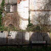
I was browsing some historical photos the other day, and came across "Rear of Unspecified House" in the Bristol Archives' John Trelawny Ross collection, and immediately recognised it as being the back of 1 Albermarle Row, just around the corner from me. I've not had much time to research the history of this odd little addition to Albermarle Row, or what happened to 1-4 Cumberland Place, number 4 of which used to be attached to the side of 1 Albermarle Row, but it was interesting to look at old maps for a few minutes and work out what used to be where.
That all connects with the little local bit of land at Granby Green, too, as it used to be numbers 1-3 Cumberland Place. There was something of a planning battle over Granby Green, and I've included an old edition of Hotwells & Cliftonwood News that I found online, a copy of which would have been popped through my letterbox at the time.
I was also inspired by some old pictures of Hotwell Road to try to put a few more people in my pictures, though I set my pre-focus a couple of extra metres out from normal to make sure I didn't get too close to anyone!
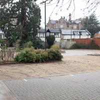
There was a suggestion that the new green space below Wallace Place be called "Gromit Green" :D
This was a hard-won green by all accounts. I remember the brilliantly-acronymed Friends of Granby Green popping leaflets through our doors to drum up local support for having it declared a Town Green to stop more development. See the next picture from some background, and a tiny picture of what it looked like before it was turned into this little green space.
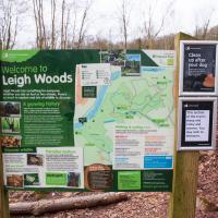
Leigh Woods Walk
14 Mar 2021
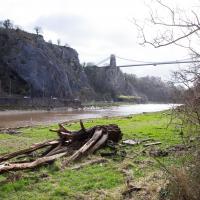
An enormous walk today, or at least it felt enormous. My feet are sore, anyway. I started off recreating a couple of local historical photos in Hotwells, but then headed for my traditional walk along the towpath in the Avon Gorge to the far extreme of Leigh Woods, up and through the woods to the height of the Suspension Bridge, finally crossing into Clifton Village for a well-deserved vanilla latte.
I say "traditional" because this used to be a very regular route for me, first walking, years and years ago, and later jogging—this route combined with a circuit of the Downs on the other side used to be my way of making sure I was fit to do a half-marathon (I did six of them in total, between 2010 and 2014).
I miss the routine of this walk, even though it's a long way and it used to pretty much wipe me out when I did it—I'd come back home and collapse and do very little for the rest of the day. But perhaps that's what Sundays are for, and I should try to remember that.
Doing this walk regularly was quite a meditative experience. Not so much of that today, but once I got to the further extreme of the towpath, where the roar of the Portway traffic on the other side of the river dwindles and I turned into Leigh Woods to climb ever closer to birdsong and further from rushing cars, I did seem to recapture a little of the feeling of previous walks. (I would say my mind cleared, but I was mentally singing along to Life Without Buildings' The Leanover for most of the wander. There are worse songs to have stuck in one's head, though; it's a great track...)
Anyway. Apparently the walk made me more likely to ramble in words, too. I'll stop now :)
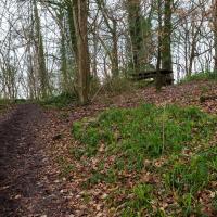
I've explored the quarry on the other side there, but only later found out that it also used to be a tennis court (see next pic.)
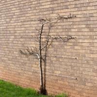
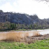
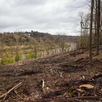
I think this may be some of the non-native tree clearance mentioned in this Bristol Post article from September 2020.
Stephen Eyres, head of forestry and land management for Forestry England in West England, said: "This felling operation will significantly change the appearance of the Avon Gorge, for a while it will look stark and bare whilst it sits fallow for a year.
"It gives us a fantastic opportunity to replant next winter with native trees.
"We are very pleased to be able to plant a small amount of the Bristol Whitebeam, one of eight native trees of the genus Sorbus that are endemic to the Avon Gorge.
"This species has been carefully propagated from seed collected in the Avon Gorge specifically for us to replant here in Leigh Woods."
Tree surgeons will clear small areas of non-native trees such as red oak, Japanese larch and western hemlock, which have reached maturity.
John Carr's Terrace
16 Mar 2021
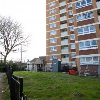
I wanted a nice simple lunch-hour walk that took me past a cafe today, and I managed to find the perfect road to knock off my list of targets to do it. Situated just off Jacobs Wells Road, right next to Queen Elizabeth's Hospital, John Carr's Terrace, and Rosebery terrace above it, which I'd completely forgotten existed, are a little cul-de-sac that many Bristolians will have wandered past a thousand times without ever seeing.
There's a reason it's next to QEH:
Known traditionally as "The City School", Queen Elizabeth's Hospital was founded by the will of affluent merchant John Carr in 1586, gaining its first royal charter in 1590.
John Carr's terrace itself isn't much to write home about, architecturally, but I like the secluded feel of it, and I really liked Rosebery Terrace with its little houses, commanding position and friendly, slightly tumbledown feel.
On the way home I popped into Foliage Cafe for a coffee and a very pleasant nutella and banana pastry, then walked home past the refurbishment of the old Thali Cafe into a new and interesting clinic...
At the end of John Carr's Terrace. Apparently it's a 5 bedroom semi and is ranked as the most expensive property in BS8 1DW, with a valuation of nearly two million quid. I couldn't see much of it. I wonder if it's owned by QEH's headmaster, or something...
Quick Around-the-Harbour Wander with Lisa
20 Mar 2021
My friend Lisa was meeting another friend for a walk near the suspension bridge, so we fitted in a quick harbourside loop from my place first. We discussed gardening (we're both envious of the gardening skills of the Pooles Wharf residents; we can just about keep herbs alive, whereas they're growing heartily-fruiting lemon trees outdoors in England along with everything from bonsai to magnolias), cafes, work and architecture, among other things.
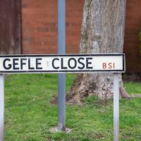
I lived near here when I first moved to Bristol in the mid-1990s. I never had to say the name of the street out loud, but it always reminded me of "GELF" back then—the Genetically Engineered Life Form that was a monster-of-the-week in a couple of Red Dwarf Episodes.
Having just done the tiniest bit of research after noticing while looking at maps that a section of harbourside here used to be Gefle Close, I found out a couple of things that make me feel a bit dim now: It's pronounced, as near as I can work out, "Yev-leh", not "geffel", and it's a port in Sweden, more properly spelled "Gävle", apparently.
Which makes a lot of sense, given that this street is on the Baltic Wharf housing estate, on the site of the wharves where apparently a lot of things from that area were imported and unloaded, especially timber, though Gävle seems to be more well known copper and iron.
It seems Gävle is pleasantly green and widely-spaced these days, having had major fires rip through it three times in the last three hundred years, and finally rebuilit itself with big espanades and a larger grid system with firebreaks. Sounds nice.