Tagged: property
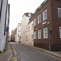
Harbourside Milestone
17 Mar 2021
The other day I realised (hello, Maggie!) that my next walk would be my hundredth, and that I'd done 393.4km so far. I figured it would be nice to get to 100 walks and 400km on the same walk, so I went for a nice long harbourside wander after work, rather than dashing out at lunchtime. As it turned out, we're just coming up to the time of year where I can leave the house at 5:30 in the evening and there's still just enough light to take photos by the time I've made it around the harbourside. Though only just, and mostly because I've got a full-frame camera that's not bad in low light...
Still, the evening light made a lovely change, and some of the photos turned out to be pretty good photos per se, rather than just record shots of my walk. I'm looking forward to more evening walks like this as summer approaches.
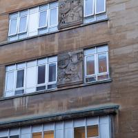
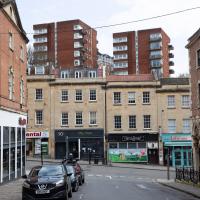
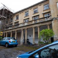
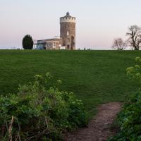
On the way around this evening I wandered through one of the oldest bits of the city to extend my walk and snapped some interesting bits of architecture, including an NCP car park(!) and a nighttime shot of one of my favourite subjects, the clock tower at the Albion dockyard.
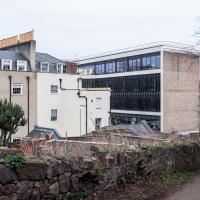
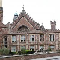
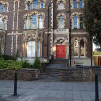
Rear of City Hall, which is still more normally known by its old name of the Council House.
Quick Around-the-Harbour Wander with Lisa
20 Mar 2021
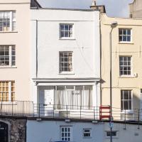
My friend Lisa was meeting another friend for a walk near the suspension bridge, so we fitted in a quick harbourside loop from my place first. We discussed gardening (we're both envious of the gardening skills of the Pooles Wharf residents; we can just about keep herbs alive, whereas they're growing heartily-fruiting lemon trees outdoors in England along with everything from bonsai to magnolias), cafes, work and architecture, among other things.
This was one of the details I used to line up my "after" pic of Mardyke with the 1930s "before" pic on my last wander.
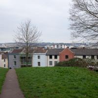
I wasn't going to take a very long walk on this nice spring evening; it just happened. I was going to knock off a path or two on Brandon Hill, home over centuries to hermits and windmills, cannons and Chartists, and then just wander home, stopping only to fill up my milk bottle at the vending machine in the Pump House car park.
However, when I heard a distant gas burner I stayed on the hill long enough to see if I could get a decent photo of both the hot air balloon drifting over with Cabot Tower in the same frame (spoiler: I couldn't. And only having the fixed-focal-length Fuji with me didn't help) and then, on the way home, bumped into my "support bubble", Sarah and Vik, and extended my walk even further do creep carefully down the slipway next to the old paddle steamer landing stage and get some photos from its furthest extreme during a very low tide...
Towpath Evening
25 Mar 2021
I was honestly just about to do the homework from my oh-so-thrilling ITIL course when my friends Sarah and Vik asked me if I'd like to come out for a wander down the towpath with them. I enjoyed the company, the evening light and the delicate clouds.
I got interested in Bristol's medieval water supplies after poking around near Jacobs Wells Road and Brandon Hill. It was during that research I found out about a pipe that's still there today, and, as far as I know, still actually functioning, that was originally commissioned by Carmelite monks in the 13th century. They wanted a supply of spring water from Brandon Hill to their priory on the site of what's now the Bristol Beacon—Colston Hall, as-was. It was created around 1267, and later, in 1376, extended generously with an extra "feather" pipe to St John's On The Wall, giving the pipework its modern name of "St John's Conduit".
St John's on the Wall is still there, guarding the remaining city gate at the end of Broad Street, and the outlet tap area was recently refurbished. It doesn't run continuously now, like it did when I first moved to Bristol and worked at the end of Broad Street, in the Everard Building, but I believe the pipe still functions. One day I'd like to see that tap running...
There are a few links on the web about the pipe, but by far the best thing to do is to watch this short and fascinating 1970s TV documentary called The Hidden Source, which has some footage of the actual pipe and also lots of fantastic general footage of Bristol in the seventies.
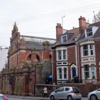
On my walk today I was actually just going to the building society in town, but I decided to trace some of the route of the Carmelite pipe, including visiting streets it runs under, like Park Street, Christmas Street, and, of course, Pipe Lane. I also went a bit out of my way to check out St James' Priory, the oldest building in Bristol, seeing as it was just around the corner from the building society.
There are far too many pictures from this walk, and my feet are now quite sore, because it was a long one. But I enjoyed it.
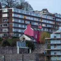
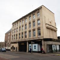
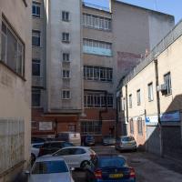
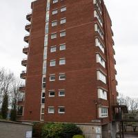
In the background, two tower blocks, Irving House and Terry House, that hardly anyone notices, as they're mostly hidden when you're on the busiest streets that surround them, Park Street and Park Row. The entrance to their little estate is next to the Esso station on Park Row.
I'm planning on going and having a closer look at them tomorrow.
This is the place that still has some of the reused fixtures and fittings of the RMS Mauretania installed inside.
No, I did not witness some kind of accident or crime; I think Mum was dropping kid's coat down to Dad to save him coming back upstairs for it once they realised how cold it was outside.
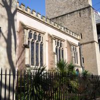
The nave, however, is from the original Priory, built in the second quarter of the twelfh century.
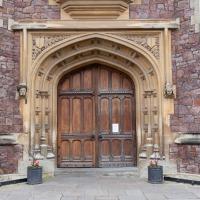
I bumped into my friend Lisa in town during yesterday's wander, and we decided to have a wander today, too. We managed quite a long ramble, starting up through Clifton and nipping down Park Row to investigate the two tower blocks I'd noticed popping up behind Park Street yesterday, then took in a few roads I'd not managed to get to before, including cutting through the grounds of Bristol Grammar School.
First glimpse of Bristol Grammar School, which was previously housed in the Batholomew's Hospital building at the bottom of Christmas steps and also in a the grand old building on Unity Street.

The surroundings seem a bit down-at-heel. The listing says:
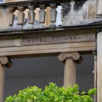
Terrace of 4 houses, now offices. c1826. Possibly by RS Pope. Limestone ashlar with party wall stacks, roof not visible. Double-depth plan. Neoclassical style. Each of 3 storeys and basement; 3-window range. A composed terrace of projecting end houses linked by a colonnade of Ionic columns, spaced 1:2:2:1 to each house, to an entablature and balustrade of square balusters and panels with wreaths.
Coffee Run
31 Mar 2021
Not a literal run, but I didn't hang about, as I had a job interview to get to (I was an interviewer, not the interviewee, but you still have to be there on time...) Along the way to pick up a lunchtime coffee I mostly seemed to take photos of the high tide, though I also came across a bit of outreach work for small spiny mammals...
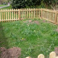
The enclosure seems to be there to keep some daffodils safe, but that sounds too much like overkill to be true.
Swinging By Sydney Row
01 Apr 2021
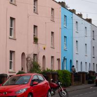
Another workday, another quick coffee excursion. This time I decided to swing past Sydney Row on the way back from the marina car park where Imagine That have their horsebox. I didn't know until recently that the terrace was built for workers at the adjacent dockyard.
I've also gradually come to the conclusion that I don't really think very two-dimensionally when it comes to finding my way around or associating one place with another. I only realised in the last few days that the odd industrial building that takes up the other half of Syndey Row, the one that's always covered with graffiti, is the back of the dockyard works. In my defence, as it's tucked away in a corner of the little industrial estate that I've never ventured into (I rarely find I have a need for the products of safety valve manufacturers), I don't think I've ever seen the front of the building...
I noticed I'd missed a bit of Circular Road and Ladies Mile, and it was a nice evening for a sunset wander up to Clifton. There was something I recorded along the way, not photographically but in video.
Bristol Zoo, the world's oldest provincial zoo, has recently decided to close its Clifton site after 185 years of occupation, which means that the sounds of wild animals will no longer drift incongruously through this leafy Georgian area. They're moving everything up to their existing second site, The Wild Place Project near Cribbs Causeway. As I was wandering the Downs, I heard some fierce roaring noises, so I decided to see if I could get a little closer while they were still going on and record a sound that's soon to disappear.
I don't have a way yet to put video directly on this site, so here's a link to the video of my attempt to catch a bit of the zoo noises that I just popped on YouTube. It's sad that this might be the last time I hear such noises in Clifton.
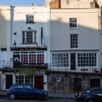
I was trying to take a photo of the Portcullis and what I thought was also a disused pub next door, assuming it was big building on the right, but according to this discussion on Flickr, the Gaping Goose was actually next-door-but-one. I'll have to see if I can reproduce that photo of the sign...
Well, that was a bit of a scramble, and some weird venturing off-piste on either side of the normal, sane path to the hill that I'd normally take, but it was interesting. And here I am.
I want to go see the Observatory's camera obscura again at some point.
An Evening Wander to the Gallows
06 Apr 2021
I'd originally intended just to pop up to the area around Alma Road, where I'd missed a few streets on earlier wanders. It was such a nice evening, though, I decided to extend my walk up to the very top of Pembroke Road, just outside my one mile radius, to take a few snaps of something intriguing I'd found in my researches.
I've driven, walked and jogged past the little triangle of land at the top of Pembroke road a great deal in my time in Bristol, but I didn't know that it used to be the site of a gibbet, in fact that the road itself there used to be called Gallows Acre Lane. According to the Durdham Down history trail, by Francis Greenacre (an excellent name for a Downs researcher!) among other sources:
...it was below this quarry near the top of Pembroke Road, once called Gallows Acre Lane, that a gibbet stood. It was sometimes occupied by those who had committed robberies on the Downs and was last used in 1783 to hang Shenkin Protheroe for the murder of a drover. Stories quickly spread that he descended from the gibbet at midnight every night and stalked through Clifton. Such was the alarm that his body was cut down and buried.
Also very close to this little triangle of land was one of the gates of the extensive turnpike system...
Anyway. Along the way I encountered a wooden tortoise and a real squirrel, among other things. It was a good walk, and more light in the evenings means I can move my wanders out of the ticking countdown clock of work lunch-hours and be a bit more leisurely.
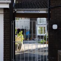
From the satellite view on Google Maps, it looks like it's a little courtyard surrounded by houses on all sides.
According to the listing:
A fine composition with an Ionic tetrastyle-in-antis temple front, with a full entablature and dentil pediment with scroll and wreath in the tympanum.
It's certainly eyecatching, and very much doing its own thing compared to the rest of the road. Built c. 1845.
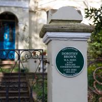
The Guardian's obit calls her "a saviour of historic Bristol".
At that time, there were 400 buildings in the city earmarked for demolition but Dorothy, who was instrumental in their listing, managed to save most of them, including the 18th-century Brunswick Square in St Paul's, via many public inquiries. Among her later successes, Dorothy helped to save the Clifton lido – dating from 1849, it is one of the oldest surviving lidos in Britain – which nearly succumbed to a developer's bulldozer in the late 1990s.
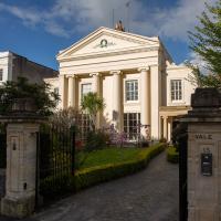
Okay, so it's not much of a secret, but it's hard to work out who it belongs to. There's a lot of big properties on Alma Road. I think this garden might belong to Laurel Bank, number 21, formerly Clark's Grammar School, apparently.
Interestingly, it seems that Clark's was a network of schools, including one not far from where I grew up in Ilford, on Cranbook Road. There's a website with some memories of the former Bristol school here, and one of the photos, titled "The Staffroom Window" is pretty much identical to my photo here.
I remember nothing of Clark's from my childhood, though they seem to be exactly the kind of place that my lot—Ilford County High—would have played cricket against, or something, so perhaps they got a mention in the occasional assembly.
There's some fantastic verbiage in the listing:
A symmetrical front has the middle set forward, quoins, and sill and lintel bands, recessed party wall with quoins, and overhanging eaves. Openings have semicircular arches with alternate sandstone and limestone voussoirs, hoodmoulds, foliate springers and plate-glass sashes.
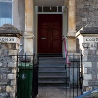
Personally, I just rather like the front door.