Tagged: property
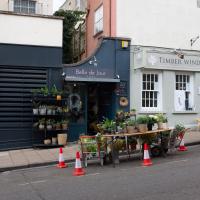
Clifton Village Lunchtime Coffee
07 Apr 2021
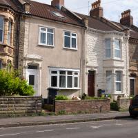
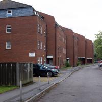
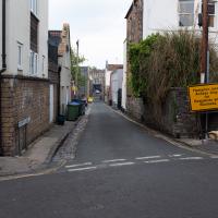
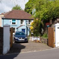
Unusually for my recent lunchtime coffee trips, I managed to find a new road to walk down: Caledonia Mews, which has a little entrance off Princess Victoria Street and runs between it and Caledonia Place. I've noticed it before a couple of times—if you look up from Princess Victoria Street you can see some of it, standing tall above the low buildings on the street itself—but until last night I'd not set foot in it, I think.
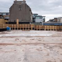
As well as focusing on this charming little mews, I looked in on the demolished site of the old WH Smith, and spotted what I think is part of the now-private-houses St Vincent Rocks Hotel that I'd not really noticed before, tucked away between Sion Lane and Sion Hill.
A London Wander in Southville
10 Apr 2021
There's a bit of Southville that I've been meaning to get to for some time, where the streets seem to take some strong inspiration from London. There's a Camden Road that crosses with an Islington Road, and a Dalston Road, even an Edgeware Road. For me these names are more evocative than the rather more exotic names I passed by to get there—Sydney Row or Hanover Place, say, because I've actually been to the places in London. The last time I was in Islington I saw Monkey Swallows the Universe play at The Angel, and I can't think of Camden without remembering a gondola trip with my friend Tara where a cheery youth played Beatles music for us on a saz...
I really liked this little area, with its mostly well-kept pretty houses and hints here and there of the creative side of the residents. It's arty and down-to-earth at the same time, and I wouldn't mind living there, I think.
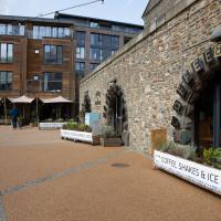
On the way there I got the chance to walk through Underfall Yard for the first time in a while, and on the way back I had my first take-away hot food for many months, grabbing some crispy fried squid from the excellent Woky Ko at Wapping Wharf.
I was taken by the colour and texture of these three houses. I have three towels with a very similar colour and finish, at least visually...
Like the building with the clock tower around the corner, this was apparently offices for the shipbuilding firm. The listing says it's mid-nineteenth century, and:
Originally offices for Charles Hill & Sons, formed 1848, shipbuilders at the Albion Dockyard (qv). Their last ship was launched in 1976
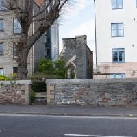
I think this may be a remnant of St Raphael's Church, whose adjacent almshouses for aged seamen are now the site of the flats at Perret's Court, just to the left there.
Ah! Yes, according to ChurchCrawler:
1853-9 by Henry Woodyer, closed 1878 following disapproval of the bishop and not reopened until 1893. Some war damage, the church was again closed and became part of a factory in 1953 and demolished 1954. Part of the W front still stands in the garden between two blocks of flats.
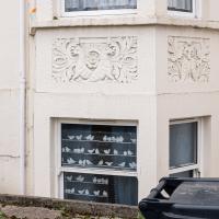
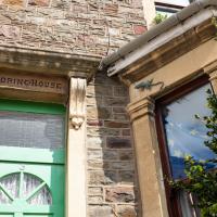
It was actually the decorative stone carvings of animals that caught my eye, but the birds in the window stand out a lot more in the photo.
A famous contralto, apparently. Contralto Corner quotes Sir Thomas Beecham:
"On a clear day, you could have heard her across the English Channel"
...and notes that:
She gained her DBE as a result of the WWI concerts that she organized.
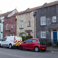
I think it's a guesthouse. There are several on this stretch of Coronation Road. Nice big place, and that stonework would probably clean up a treat. I imagine we'll see less of this once electric vehichles become more of a thing.
...are doing their own thing. One's just been strangely painted white, but I'm guessing the other one might have been a victim of the war.
There's a lot of villas in the Bedminster house names. One of the definitions in Chambers has "A superior middle-class house", and there's a lot of superior middle-class people in Southville, so...
(I jest; it's a lovely area.)
Long Bemmie Wander with Lisa
11 Apr 2021
My friend Lisa joined me again, this time for a long wander through "Bemmie". In fact, I tweeted recently using "Bedmo" as my abbreviation for Bedminster, and apparently there's something of a culture war going on. From what I can glean, the longer-term residents call it "Bemmie" and consider "Bedmo" a name made up by hipster gentrifiers.
I had no idea, but then I didn't grow up around here, and I don't live in Bedminster, and I'm not a hipster. I'm not sure I've ever gentrified anywhere, either; Hotwells was already quite gentrified by the time I arrived. I probably just lowered the tone a bit.
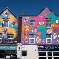
Anyway. Lisa and I entered Bemmie by the traditional toll gate (though actually you'd only have paid if you were coming from the Long Ashton direction, not merely nipping across from Hotwells) and then almost literally combed the streets to knock several new roads off my list of targets. Along the way we saw lots of street art, as you'd expect, and admired the area's panoply of gorgeous knockers.
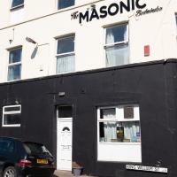
I love the Masonic's typography. Not been in myself, that I recall. I have the impression that it's more for locals than for visitors; more of a Merchants Arms than a Grain Barge, in Hotwells terms. The far side of the pub used to be a popular wall for street art until the new flats were built there. I remember one of Dan Kitchener's pieces most fondly.
Normally when you're looking at a date on the side of a building in Bristol it's a little further in the past. It's interesting to see one so recent. I wonder if in a hundred years time people will stand here thinking about the dim and distant past.
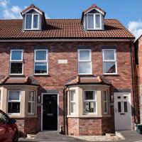
Dartmouth Mews is basically a tiny square with a little terrace down two opposite sides, built very much to match the character of the existing little Victorian houses around here.
I might prefer a smaller house with a little front garden, given the panoply of recycling boxes the council expects us to keep lying around.
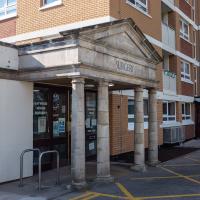
I continue to be fascinated by the GP's surgery at the back of Gaywood House. Did there just happen to be a Palladian temple sitting there in Bedmo when they put up the tower block, so they figured they'd build around it?
This is a tweet that seems to have taken off, after it was retweeted by Shit Planning, but nobody's come forward to enlighten me on exactly what this neoclassical portico is doing on an NHS GP's surgery at the back of a tower block.
Later: A confidential informant tells me that this dates from the 1990s and is basically an architect's little joke. I will reveal neither the architect nor my source, though it's possible they may come forward at some point...
Better Look at an Extension
14 Apr 2021
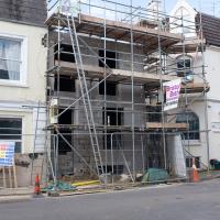
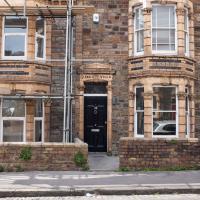
Apart from a lovely coffee and a slice of Victoria sponge from Twelve, there weren't any new sights on this little lunchtime jaunt except for a slightly better look at the long raised extension at the back of the St Vincent's Rocks Hotel, where I at least got to see the arches it's raised up on. I also got a fair bit of exercise by walking up the Zig Zag to get there, and saw far more people out than I have in months, what with the lockdown having just been significantly lifted. As I walked past The Mall pub they were turning people away from their already-full garden, and the (outdoor) cafe tables were pretty full up.
I only found out that this was a raised extension when I read the listing after snapping the last photo. Today I ventured as close as I could and got to glimpse a bit of the rather nice support arches.
These aren't listed per se, but they're on the "local list" and named as 8-14 St Vincents Rocks, so I think that confirms that it used to be part of the hotel.
Coffee, Pirates and a Spitfire
15 Apr 2021
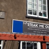
Just a quick trip to Imagine That for a flat white and a date ball (they're really nice), snapping the general sights along the way. No new roads, as has rapidly become the default on my lunchtime wanders, but as I'm in the routine of this project it almost seems strange not to pop my wanders up on the site.
Man on a Mission
17 Apr 2021
I went rather outside my area today, as I went to pick something up from the Warhammer shop on Wine Street (Games Workshop as-was, and before that I think perhaps a rare retail outlet for Her Majesty's Stationery Office? I may be mis-remembering...) Anyway, a friend of mine wanted something picking up and posting to him, so I figured I'd knock some streets off my list along the way.
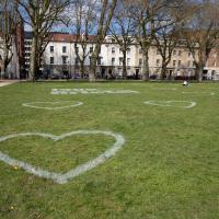
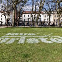
I first headed for the St George's Road area, walking down the narrow Brandon Steps and finding some strange wall art on Brandon Steep, then headed to the Old City via Zed Alley. The Warhammer shop visit was friendly and efficient, and, mission accomplished, I treated myself to a sausage roll and a flat white from Spicer + Cole, to take away and eat in Queen Square with its current decoration of hearts. I finished off with a detour up Park Street, looking out for St John's Conduit markers, before finally crossing Brandon Hill on the way home.
Quite a long wander, all told, and I'm a bit knackered today...
Apparently they're a "Cloud and Cyber Security Specialist". Let's not let them near this website, please; I wrote a lot of the code in a hurry when I was tired...
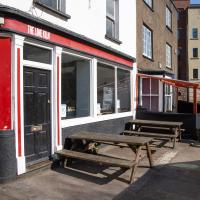
The Lime Kiln pub, and Lime Kiln Cottage next door. Both listed; I wonder if the Lime Kiln Pub (early nineteenth century stands on the site of an old lime kiln that Lime Kiln Cottage (dated 1775) was attached to?
I've mentioned the Lord Mayor's Chapel before when wandering the area behind it, where the Gaunts Hospital used to stand. Now known as either the Lord Mayor's Chapel or St Mark's Church, it was formerly (i.e. before 1722!) known as Gaunt's Chapel. It was built around 1230, and named after Maurice de Gaunt, who founded both the Gaunt's Hospital and this, its attached chapel.
A New Wander, a New Cafe
21 Apr 2021
Obviously, I was trying to connect to the industrial history of the Canon's Marsh area, to the old gasworks, the docks railway, the warehouses they blew up to make way for all the rather soulless modern stuff (though I do like the Lloyds building, at least.) But what I mostly got out of today's walk is a new cafe to go to for my lunchtime outings. It's perhaps a little closer than both Imagine That and Hopper Coffee; not quite as close as Foliage and Twelve up in Clifton Village, but also not at the top of a steep hill.
No, not the mediocre Costa, but only a little way away from there: Rod and Ruby's, which opened in 2018 and which I've seen in passing several times but never popped into until today. What can I say? I was foolish. Great flat white, lovely interior, astoundingly good cannoli.
Sometimes you just have to get your head out of history and enjoy a pastry.
Leftovers with Lisa
01 May 2021
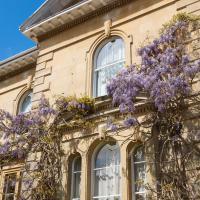
I didn't get to all the little leftover streets around the northeastern part of my area in today's wander, but I definitely knocked a few off the list, plus Lisa and I enjoyed the walk, and didn't get rained on too badly. We spotted the hotting-up of Wisteria season, checked out Birdcage Walk (both old and new), ventured onto the wrong side of the tracks1 and generally enjoyed the architecture.
1 Well, technically we probably shouldn't have been on the grounds of those retirement flats, but nobody started chasing us around the garden with a Zimmer frame

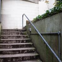
Many people use the cut-through from Alma Vale Road through to the side door to Clifton Down Shopping Centre, up these delightful concrete steps.
Lisa and I walked past the other end of this little street on an earlier walk. We didn't miss much, apparently.
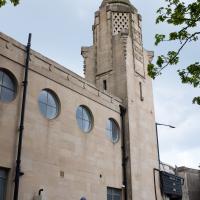
Now the Everyman cinema, restored to its former use a few years back. It's pricey, but you get an armchair or sofa to sit on and they'll bring you food or a gin & tonic while you're there. Very civilised.
Originally put up in 1920, the ballroom and restaurant are now offices and pub.
Victoria Square Underpass
06 May 2021
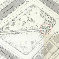
I'm meant to be taking a little break from this project, but in my Victoria Square researches after my last walk I noticed a curiosity I wanted to investigate. The community layer on Know Your Place has a single photograph captioned, "The remains of an 'underpass' in Victoria Square".
Looking back through the maps, I could see that there really did used to be an underpass across what used to be Birdcage Walk. I can only guess that it was there to join the two halves of the square's private garden that used to be separated by tall railings that were taken away during WWII. Maybe it was a landscaping curiosity, maybe it was just to save them having to un-lock and re-lock two gates and risk mixing with the hoi polloi on the public path in the middle...
Anyway. Intrigued, I popped up to Clifton Village this lunchtime for a post-voting coffee, and on the way examined the remains of the underpass—still there, but only if you know what you're looking for, I'd say—and also visited a tiny little road with a cottage and a townhouse I'd never seen before, just off Clifton Hill, and got distracted by wandering the little garden with the war memorial in St Andrew's churchyard just because the gate happened to be open.
EDIT: Aha! Found this snippet when I was researching something completely different, of course. From the ever-helpful CHIS website:
When there were railings all round the garden and down the central path, in order that the children could play together in either garden there was a tunnel for them to go through. This was filled in during the 1970s but almost at the south east end of the path if one looks over the low wall the top of the arches can still be seen.
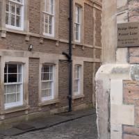
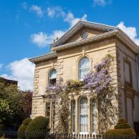
I wander on impulse down a little side-street I'd never really noticed before and find a curious cottage (Prospect Cottage, right) and a big 18th century listed house I've never seen before (Clifton Retreat, hidden behind the wisteria and other foliage ahead/left.)
If you'd shown me this photo before today, of a place I've been within spitting distance of thousands of times, I'd have not had a clue where it was. Bristol's fractal nature never ceases to amaze me.
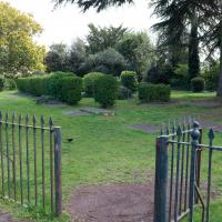
I'm going to call this the memorial garden. Don't know if it has an official name, but it's a railinged-off area with the war memorial in it...
Up until WWII, anyway. The outline of the church remains around this square of land; the stones you can see bottom left are one of its walls. Among the many interesting images accompanying Bristol 24/7's story about the Bristol Blitz you can see an image of St Andrew's Church after the bombing raid of November 1940. I'd call it an interior shot, but most of the interior had become the exterior by that point...
Sequel Injection
07 May 2021
I saw this tweet the other day and started thinking of my second Covid-19 vaccination as my "Sequel Injection" (to a geek, it's funny. You'll have to take my word for it.) Whatever you call it, this morning I went and got it.
It was in the same place I got my initial injection—my left arm! No, okay, it was at the Clifton College Prep School. I didn't take any photos of the event itself; the NHS production line is so efficient you barely have time to do anything else, even if the privacy of other patients wasn't a factor.
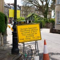
Along the way I mused at all the road resurfacing going on in Clifton, and also discovered a secret (okay, not-well-known and possibly slightly trespassey) way into Canynge Square, and on the way back I knocked off a few streets from my "leftovers list" of north-east Clifton. I've got much of Clifton done now, with the only obvious "to dos" on the east side of Whiteladies Road...
It was quite a long walk, and I'm feeling pretty tired now, though that might be the effects of the jab too, I suppose. Anyway. Tomorrow and Monday I'm walking outside Bristol, I think, and I imagine my feet will need some recovery time on Sunday, so it might be a while before I post another Wander.
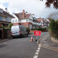
Told you they were doing a lot of resurfacing.
Here's a related fun fact to go with a dull picture, at least: the "greatest advance in road construction since Roman times" is the process of "Macadamisation": crushed stone bound with gravel on a firm base of large stones, with a camber, raised above the surrounding ground. It was invented by Bristol Turnpike Trust surveyor John McAdam, and was later refined by the addition of tar as a binding agent, giving us tarmacadam, or "tarmac", as we generally call it today.
So, basically, this ROAD CLOSED AHEAD sign, due to resurfacing, can be traced back to 1820s Bristol, where the very idea of surfacing roads was invented.
This is where I got the "ohhh, I know where we are..." moment: this is the other side of the weird bit around the back of Clifton Down shops, overlooking the oddly-placed private car park, adjacent to the little path with steps that people use to cut through to the shops from Alma Vale Road.
Interestingly, I could definitely hear the sounds of running heavy machinery coming from this building, so I guess the original pump house might still house the modern pumping machinery.