Tagged: underpass
Victoria Square Underpass
06 May 2021
I'm meant to be taking a little break from this project, but in my Victoria Square researches after my last walk I noticed a curiosity I wanted to investigate. The community layer on Know Your Place has a single photograph captioned, "The remains of an 'underpass' in Victoria Square".
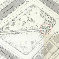
Looking back through the maps, I could see that there really did used to be an underpass across what used to be Birdcage Walk. I can only guess that it was there to join the two halves of the square's private garden that used to be separated by tall railings that were taken away during WWII. Maybe it was a landscaping curiosity, maybe it was just to save them having to un-lock and re-lock two gates and risk mixing with the hoi polloi on the public path in the middle...
Anyway. Intrigued, I popped up to Clifton Village this lunchtime for a post-voting coffee, and on the way examined the remains of the underpass—still there, but only if you know what you're looking for, I'd say—and also visited a tiny little road with a cottage and a townhouse I'd never seen before, just off Clifton Hill, and got distracted by wandering the little garden with the war memorial in St Andrew's churchyard just because the gate happened to be open.
EDIT: Aha! Found this snippet when I was researching something completely different, of course. From the ever-helpful CHIS website:
When there were railings all round the garden and down the central path, in order that the children could play together in either garden there was a tunnel for them to go through. This was filled in during the 1970s but almost at the south east end of the path if one looks over the low wall the top of the arches can still be seen.
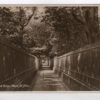
Before WWII, you can see why one might have wanted an underpass to cross between the two halves of the private garden on either side of Birdcage Walk.
Via Vaughan Postcard Collection, Bristol Archives.
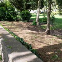
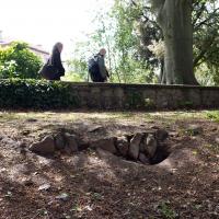
It's not glaringly obvious, but it does have the shape of an entrance to an underpass to me. I'd never really have noticed it walking past until I saw it on the map and decided to look more closely.
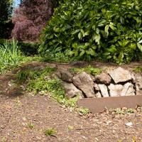
I'm assuming this used to be an arched tunnel entrance. It's in the right place, anyway. This is on the north side, looking south
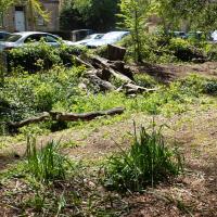
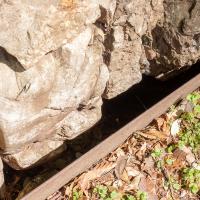
Looks to me like there's still at least a partial cavity. I wonder when and why it was filled in? I imagine it became dangerous at some point after the railings were taken down during the war, and there wasn't such a need for it anyway, as people could get from one side to the other at ground level quite easily.
EDIT: Aha! Found this snippet when I was researching something completely different, of course. From the ever-helpful CHIS website:
When there were railings all round the garden and down the central path, in order that the children could play together in either garden there was a tunnel for them to go through. This was filled in during the 1970s but almost at the south east end of the path if one looks over the low wall the top of the arches can still be seen.
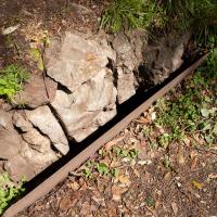
This is more convincing as a walled-off underpass entrance. You can see there's a sheet of steel that's been placed in front of what looks like an entrance before it's been buried with earth.
Misty Walk
30 Oct 2020
Something of a misty start took me around the viewpoint at the end of Spike Island and then on to try to find a new way into Greville Smyth Park. I got lost.
A Coffee and a Curve
27 Mar 2022
I wanted to have a wander along to the Tobacco Factory Market for some shopping, and checking the map for any leftover nearby streets I noticed a tiny curve of road on the way into the modern flats at Paxton Drive that it didn't look like I'd walked down before. I wouldn't take me too far out of my way, so I decided to head there first and then across to North Street to get my groceries and a coffee...
A Door, a Square, a Few Night Shots
04 Dec 2021
I didn't take many pictures on this quite long wander, partly because Lisa and I wandered across to Bedminster via Bower Ashton, which I've snapped quite a lot of on the last couple of walks, and also because we lost the light fairly quickly, though spending a half-hour drinking mulled wine in the Ashton might have had a little to do with that...
Before we left Hotwells I wanted to visit a door I'd heard about on Cornwallis Crescent and also take a little look at a couple of houses in Dowry Square to consider the 1960s regeneration of Hotwells.
Bower Ashton is an interesting little area just south of the river from me—in fact, the Rownham Ferry used to take people over from Hotwells to Bower Ashton, operating from at least the twelfth century to around the 1930s.
It's a strangely contradictory little area, with a cluster of old and new houses sandwiched in between the busy A-roads and significantly more industrial area of Ashton and the bucolic country estate of Ashton court roughly east to west, and also between Somerset and Bristol, north to south.
I've been around here before, mostly poking around Bower Ashton's arguably most well-known bit, the Arts faculty campus of the University of the West of England, but I'd missed at least Parklands Road and Blackmoors Lane, so I initially planned just to nip across briefly and wander down each in turn. On a whim, though, I texted my friends Sarah and Vik in case they were out and about, and ended up diverting to the Tobacco Factory Sunday market first, to grab a quick flat white with them, extending my journey a fair bit.
To start with, though, I nipped to a much more local destination, to see something that you can't actually see at all, the Gridiron...
(I also used this wander as a test of the cameras in my new phone. I finally upgraded after a few years, and the new one has extra, separate wide and telephoto lenses compared to the paltry single lens on my old phone. Gawd. I remember when speed-dial was the latest innovation in phones...)
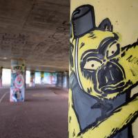
I have no idea who this is, but that doesn't mean he's not incredibly well-known, it just means that I know very little about, probably, comics.
I went out simply wanting to knock off the very last little unwalked section of Clanage Road, over by Bower Ashton, which has been annoying me for a while as it's quite close by and I've walked the other bits of it several times. So, my plan was to nip over to Greville Smyth Park via a slightly unusual route to wander Clanage Road and tick it off.
Along the way, though, I inevitably got a bit distracted. I took a few photos of Stork House, a grand Hotwell Road building that's recently been done up a bit (I imagine it's student lets, though I'm not sure) and which I found a reference to in a book about the Port Railway and Pier the other week, and also tried to match up a historical photo of Hotwells before the Cumberland Basin Flyover System laid it waste, which included some interesting markers I'll have to do a bit more digging into...
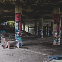
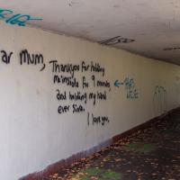
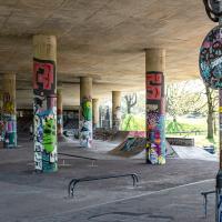
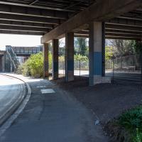
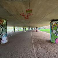
Quite the insult. This is in the underpass on the way to Ashton Gate. Normally I find it hard to make my way to North Street when coming from this direction, because of all the badly-marked underpasses that lead in improbable directions, but today I just followed the moderate throng of sports fans on the assumption that they were heading for Ashton Gate, which would take me in the right direction.
