Tagged: road
Ticking Off a Pocket of Paths in Leigh Woods
03 Jun 2022
I managed to go for a wander a while ago that was meant to finish off a little tangle of paths in Leigh Woods, or at the very least finish off my wandering of the Purple Path there. And I managed to miss doing either of those things through some kind of navigational incompetence.
Today I woke up with a bit of a headache, feeling a bit knackered as soon as I dragged myself out of bed, but at least with the energy to realise that I'd be better off (a) going for a walk in what looked likely to be the last of the Jubilee weekend sunshine than (b) moping around the flat until it started raining, at which point I could mope more thoroughly.
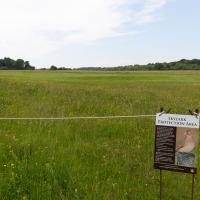
I had a look at my map, considered going to Ashton Court, but remembered that there was a music festival there today, and instead found these little leftovers of Leigh Woods and decided to have one more try at walking them.
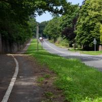
At this point I'd just walked up the steep bit of Rownham Hill and was already too hot and a bit knackered. Still, at least it's levelling out.
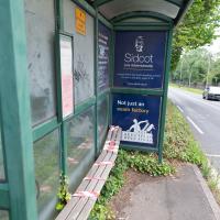
I imagine the delighted customer who emplaced the previous missive on the end of the shelter had stood here for a significant portion of their life. Well, that's often how I end up feeling while waiting for a bus in Bristol.
Sidcot School, advertised at the end there, is one of only seven Quaker-run schools in England, founded 1699, situated in the Mendips. A fee-charging school, they do of course have a network of their own minibus services—ten routes in total—to ferry the kids there and back, so they probably don't have to wait for First to turn up.
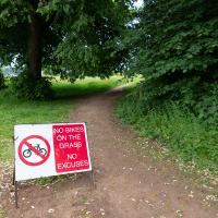
Guessing this is a polite hint from the golf club. In my mind's eye I can see an irate greenkeeper chasing a couple of mountain bikers in his golf buggy.
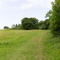
To the left is the edge of the golf course. I'm looking to wander along the edge and the behind the railway, which is behind those trees.
I think I'm pretty much a mile away from my house right here. Nice of someone to erect a marker.
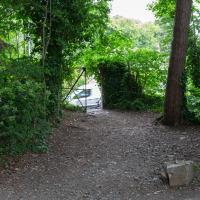
Time to exit Ashton Court and head for my main target at Leigh Woods.
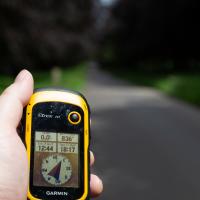
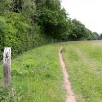
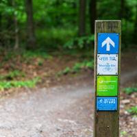
I decided to make sure to cover the whole of the little pocket of paths I was targeting by pre-programming a route into my GPS, and following its instructions to go from point to point. The start of my path is nearly due east from here, and less than a kilometre away.
This will not be the most interesting of walks—it's just some fairly enclosed paths in a forest—so there won't be too many photos...
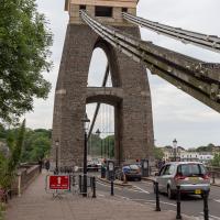
Right, back to Clifton Village for a coffee and some lunch to take home. I see the one way system—brought in as a social distancing measure—is still in place.
I've been pretty awful at reading so far this year, apparently averaging about one book per month. That's a far cry from 2019, say, where I got through 41 books in the year. Today's wander was prompted by my rubbish reading, as I needed to go hand back some books to the library, because I'd managed to renew them so many times that I hit the limit on renewals. Oops. Several of them were still unread.
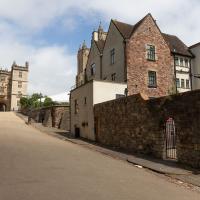
So, off to the Central Library for me, tail between my legs. On the way there I did my best to recreate a historical photo of Dowry Square; while I was in the area I walked under the adjacent Norman arch and poked around behind the Cathedral, and I also had a little diversion to the city centre and came back along the south side of the river, hitting some trouble with the lock gates as I finally crossed the harbour back towards home.
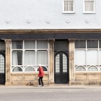
Off to the side of the photo we've just seen is the pub frontage on the Hotwell Road, apparently a later addition. The listing says
The right-hand return has a late C19 ashlar public house front with 5 panelled pilasters and foliate capitals to left-hand and central doorways, 2 windows with tripartite frames and semicircular-arched panes below, panelled aprons and dentil cornice.
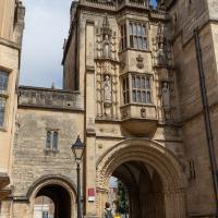
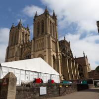
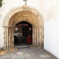
And now we've teleported down the Hotwell Road to College Green, where I found that the library wasn't open yet (I'd forgotten they didn't open until 1pm on a Sunday) so carried on past it and turned through an old Norman archway.
This was a section I wanted to walk, as although I have actually wandered through the arch and pottered around this bit of Bristol before, I think that was one of the days my GPS battery died halfway through a walk, so I never posted any records of it. Here I can redress the issue. We've seen the other side of this grand bit of architecture before, and the next photo has the information plaque which will tell you more about it more concisely than I could.
One fact that isn't on the plaque is that Catherine Hughes, the local artist who made the pomegranates for the front of the Cabot Cafe, had her studio in one of the upper rooms for a time. I presume this was wangled by her father, a local estate agent who was heavily involved in the whole College Green area. From the Clifton and Redland Free Press, 18 April 1900:
Comparatively few people are aware that the interesting structure known as the Abbey Gate House, College Green, the fifteenth century building above the fine old Norman archway, is now given over to the fine arts. It is the studio of Miss Catherine Hughes, and a private view of a charming exhibition of water colour drawings, by that young lady and Miss Ludlow, both local limners, was held last week, when a large number of ladies and gentlemen accepted the invitation to inspect the works, among the company being some local artists. Miss Hughes and Miss Ludlow studied under Ludovici in London, and are now following their profession in Bristol
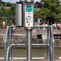
...which was good in some ways; I've always been curious about the control panel for the lock gates, and as the lockkeeper went to have a closer look at the gates themsevles I took this snap and, in the next photo, a close-up.
Nipping Up the Zig Zag to the Shops
19 Aug 2023
It's been a long while since I did one of these walks.
I'm thinking of finishing up the project by walking one or two last bits of road, thus being able to declare with all honesty that I've done my best to walk every public road within my mile (and quite a few alleyways besides.) As a prelude, and just because I felt like it, I decided to drag out the camera and GPS on this little wander to the local shops.
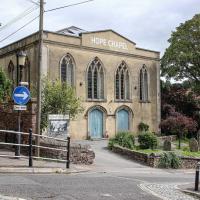
I may not personally be a fan of evangelical Christianity, but at least they keep the place looking nice. It's still very tidy since the recent renovation, installaltion of solar panels on the roof and repainting of the HOPE CHAPEL sign.
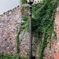
One of many exemplars of the sorry state of the historic cast iron lamp posts of Clifton Village. I get the feeling that the Council wish they'd all just rust away so that they can be replaced by cheap ugly lighting rather than needing any kind of maintenance.
On that somewhat sour note, I headed home before the few spots of rain I felt became anything more severe.