Tagged: cliftonwood
Nothing New
02 Dec 2020
This may be the very first time I've gone for a One Mile Matt wander and not actually gone down any new roads, trod any new steps. I just wanted a coffee, frankly, so I went the same old way to Imagine That in the marina and back again.
Strangers' Burial Ground
04 Dec 2020
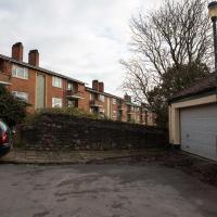
I tried to find the Strangers' Burial Ground the last time was up in Clifton, but I'd not realised that Lower Clifton Hill continues further on after the turning with Constitution Hill. Sadly it was chained shut, but it still looks beautifully-maintained, perhaps by the same man referenced by this story from John Hodgson, which helped me find it. Apparently Thomas Beddoes is buried here.
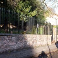
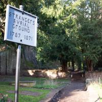
An "overflow graveyard for St Paul’s, Clifton (demolished), much used by visitors to the Hotwells. Closed 1871", says the listing for the walls and gates.
This raises a question for me: where was the old St Paul's Church, Clifton (demolished)? There's a St Paul's there today, on St Paul's Road, unsurprisingly. I know that stands on the site of where its previous incarnation burned down, but would that count as "demolished"? Did there used to be another St Pauls? I'll have to dig my old maps out.
Rainy Clifton
13 Dec 2020
A long walk around Cliftonwood and Clifton with my friend Lisa, taking in some of the 12 Days of Christmas display at Queens Parade, picking up a take-away coffee from Pinkmans of Park Street, and poking our heads up against the glass of SS Peter and Paul Catholic Cathedral.
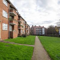
Cliftonwood and Clifton Village Lunchtime Stroll
14 Dec 2020
The lunchtime walk has been feeling a bit of a chore lately, especially as I only have an hour and have to keep a mental watch out for my "bingo" point or risk being late back. Today I went for a deliberately brief local walk and got home in time to have lunch on my sofa rather than while I was back at work.
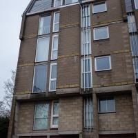
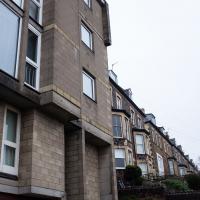
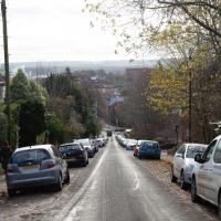
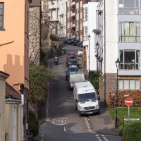
It's interesting filling in the gaps in my Clifton Village knowledge, especially starting to "see" the bits I can't see, the negative spaces. The size of both Fosseway Court and the Bishop's House gardens (check out the latter on Google Maps for an idea) are both something I've noticed by just getting to know the areas around them. I may also have to walk into the driveway of the very well-hidden Nuffield hospital to get an idea of how big it is.
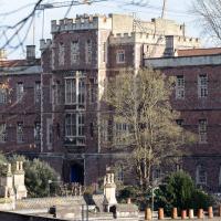
None of those are anything compared to the trick of hiding the gargantuan public school that is Queen Elizabeth's Hospital so well that I keep on forgetting it's there, until a glimpse of it from somewhere like Lower Clifton Hill reminds me about it, of course...
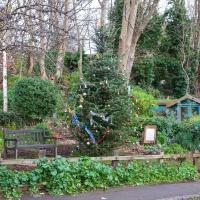
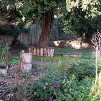
Unlike the similar photo I took yesterday, this one doesn't have camera shake, but it's still remarkably difficult to communicate how charming the Cliftonwood Community Garden is without just being there.
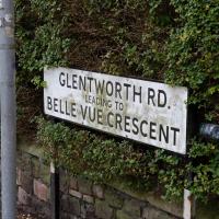
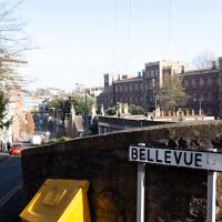
Generally "Belle Vue" transitions gradually into "Bellevue" over time, it seems, but some holdouts remain
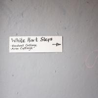
Clifton Hill
23 Nov 2020
I've just got to the bit in Fanny Burney's Evelina where our eponymous heroine visit a grand house on Clifton Hill during her stay in Hotwells. It was interesting to wonder if it could be any of the places I passed in my lunchtime jaunt, which took in both Clifton Hill and Lower Clifton Hill.
From Evelina (1778):
"Yes, Ma'am; his Lordship is coming with her. I have had certain information. They are to be at the Honourable Mrs. Beaumont's. She is a relation of my Lord's, and has a very fine house upon Clifton Hill."
Another Lunchtime, Another Quick Coffee Trip
28 Jan 2021
With very little photography, and no new streets. Still, I did manage to buy milk at the "Simple Cow" vending machine—and "simple" is very definitely false advertising; it took me bloody ages to work out how to use the thing—and snap the new ACER/SEPR piece down in Cumberland Piazza.
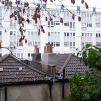
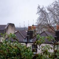
Picture Postcards, Bikers and Wild Food
25 Feb 2021
I almost didn't bother bringing out my GPS today, but as it turned out I may have knocked off a tiny bit of Baltic Wharf, having been diverted through there on my way back from Imagine That café by finding Cumberland Road closed. Not sure whether it was just some kind of delivery to the roadworks there or if they're surfacing the increasingly-dodgy looking bit of the one lane that's left open...
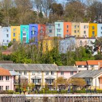
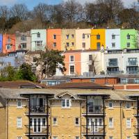
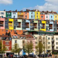
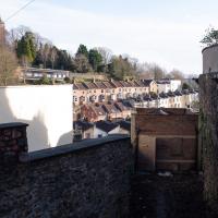
I also snapped a picturesque view of Cliftonwood, hung out with a biker gang, and found a little something to nibble on growing on the Hotwell Road.
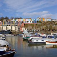
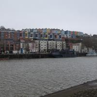
Straight from the camera, this is a very traditional picture-postcard view of Bristol, I feel. This came out at 1/175 at ISO 200 after I'd set the aperture to f/16, so you could also consider it a validation of the "sunny sixteen" rule :)
Harbour Circumnavigation
01 Mar 2021
Normally I don't have enough time in my lunch hour to get all the way around the harbourside. This is a shame, as Wapping Wharf is a great place to get coffee and a snack, but it's pretty much diametrically (perimetrically?) opposite me on the harbour. Today I had the day off, so I decided to go and knock off a few streets around Anchor Road that I'd not covered, as well as visiting the site of the Read Dispensary (well, one of them) and dropping into Mokoko for one of their astounding almond croissants. From there I came back along the south side, checking out the views from as much of the Chocolate Path as you can venture down at the moment, and swapping from Cumberland Road to Coronation Road at Vauxhall Bridge.
There's a lot of meh photos on this walk—my chief output from this project could be politely described as "record shots"—but a few turned out well, especially those of Vauxhall Bridge from the Chocolate Path, which reminded me how much of a loss the current closure of the Chocolate Path is to walkers and cyclists in Bristol.
Mardyke then and Now
18 Mar 2021
Reproducing historical photos seems to be a developing interest for me. On today's wander I just went for my normal coffee at Imagine That, but along the way I stopped at Baltic Wharf (the modern housing estate; historically-speaking, I was probably in between Canada Wharf and Gefle Wharf—about here, in fact) to reproduce a 1930s photo of the Mardyke area from the Tarring collection.
Mardyke, from what I can work out, means "a ditch along the margins". Before my researches, I only really knew the name from the Mardyke pub, a big place on the Hotwell Road. Everyone knows the Mardyke, partly because of its size and signage, but I've only been in once or twice, too long ago to remember much of what it was like. However, the wharf there used to be known as Mardyke Wharf, and the area in general as Mardyke. (I just found an 1826 painting by Thomas Leeson Rowbotham of "Mardyke seen from near Hilhouse's Dock, showing the 'Clifton Ark' floating chapel" that shows the area before much development had happened, incidentally, and now I feel like I need to find out a bit more about the floating chapel...)
I enjoyed snapping the "after" photo; the process involved moving a group of swans out of the place I needed to stand to get the photo; luckily I've started carrying waterfowl food along with my on my harbourside jaunts, so I could use bribery rather than a more confrontational approach. Not sure I'd fancy my chances against a swan, though I did once team up with another passerby to shoo a recalcitrant one off the Redcliffe bascule bridge so a busful of commuters could continue their journey to work...
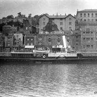
Via Know Your Place Bristol/the Tarring Collection.
The Mardyke area—apparently Mardyke means a dyke on the margins, which would make sense for the location—in the 1930s. That's got to be a Campbell paddle steamer from their White Funnel fleet, but I don't know which one. Looks to be a similar configuration to the Princess May, though the paddles look a bit different. In the background, the Mardyke Pub still stands today, but the three largest buildings do not. They are:
Top right: the Clifton National School (there's a Loxton sketch uploaded to this Wander where you can see the name on the front.)
Directly in front and below the Clfiton National School, on the main Hotwell Road: The Clifton Industrial School, Mardyke building.
Standing halfway up the hill, more towards the middle of the picture: the Clifton Industrial School, Church Path Steps building.
Lots of info to be found on the Industrial Schools here:
In addition to their classroom lessons, the boys were employed in tailoring, shoemaking and brush-making, with basket making later added. The boys also assisted with the kitchen, laundry, and house work. In 1870, some additional rooms were rented in the locality for use as an infirmary if required. A School band was established.
I can't find so much on the National School (though apparently the Bristol Archives have some of their records) but the Clifton & Hotwells Character Appraisal suggest it was built in 1835 and, along with the Industrial School buildings, destroyed during WWII:
A bomb also largely destroyed the Clifton National School and Mardyke House School. The lack of bomb- proof shelters in Clifton led to the Clifton Rocks Railway to be used as shelter, which was prepared for occupation in 1940.
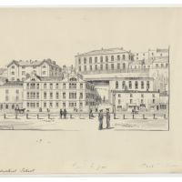
Showing both the Clifton Industrial School on the Hotwell Road, and the Clifton National Schools building on the hill above.
(via the Loxton Collection from Bristol Libraries on Flickr.)
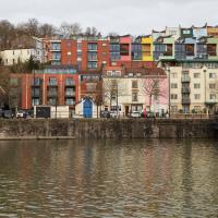
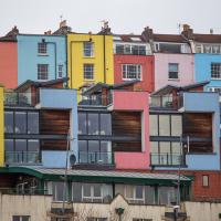
The colourful modern flats stand on School Road, presumably the last hint that the Clifton National Schools building was there before. It's nice to see both the Mardyke Pub and some of the ordinary houses from the terrace dead centre still there and looking much the same.
Coffee, Pirates and a Spitfire
15 Apr 2021
Just a quick trip to Imagine That for a flat white and a date ball (they're really nice), snapping the general sights along the way. No new roads, as has rapidly become the default on my lunchtime wanders, but as I'm in the routine of this project it almost seems strange not to pop my wanders up on the site.