Tagged: deciduous
Coffee, Pirates and a Spitfire
15 Apr 2021
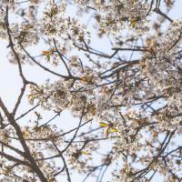
Just a quick trip to Imagine That for a flat white and a date ball (they're really nice), snapping the general sights along the way. No new roads, as has rapidly become the default on my lunchtime wanders, but as I'm in the routine of this project it almost seems strange not to pop my wanders up on the site.
Man on a Mission
17 Apr 2021
I went rather outside my area today, as I went to pick something up from the Warhammer shop on Wine Street (Games Workshop as-was, and before that I think perhaps a rare retail outlet for Her Majesty's Stationery Office? I may be mis-remembering...) Anyway, a friend of mine wanted something picking up and posting to him, so I figured I'd knock some streets off my list along the way.
I first headed for the St George's Road area, walking down the narrow Brandon Steps and finding some strange wall art on Brandon Steep, then headed to the Old City via Zed Alley. The Warhammer shop visit was friendly and efficient, and, mission accomplished, I treated myself to a sausage roll and a flat white from Spicer + Cole, to take away and eat in Queen Square with its current decoration of hearts. I finished off with a detour up Park Street, looking out for St John's Conduit markers, before finally crossing Brandon Hill on the way home.
Quite a long wander, all told, and I'm a bit knackered today...
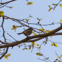
The best feature of the car park. Blue tit, I think, though it's hard to tell the colours when it's backlit like this.
The Mall Gardens
19 Apr 2021
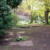
Just a quick errand to the Post Office to send off Mollog's Mob, but afterwards I bought a flat white and a new plant from Foliage Cafe and headed for The Mall Gardens to enjoy sitting in the sun and reading a book on the first day this year that's been properly warm enough for it. Nice.
The Mall Gardens does actually have some signs up letting people know it's a public garden, but I think it was only my researches for this project that brought the number of public gardens there are in Clifton to my attention, and reminded me that I could make use of this space in Clifton Village, a little closer to the coffee shops and a little more sheltered than Clifton Down.
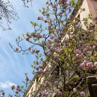
Hard to capture how nice this big magnolia in the Cornwallis Crescent back garden is on camera.
Leftovers with Lisa
01 May 2021
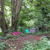
I didn't get to all the little leftover streets around the northeastern part of my area in today's wander, but I definitely knocked a few off the list, plus Lisa and I enjoyed the walk, and didn't get rained on too badly. We spotted the hotting-up of Wisteria season, checked out Birdcage Walk (both old and new), ventured onto the wrong side of the tracks1 and generally enjoyed the architecture.
1 Well, technically we probably shouldn't have been on the grounds of those retirement flats, but nobody started chasing us around the garden with a Zimmer frame
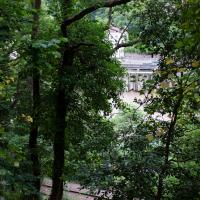
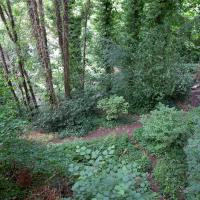
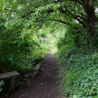
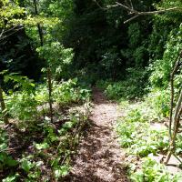
Leigh Woods Solo
19 Jun 2021
I hadn't really planned to go out for a wander yesterday; I just got the urge and thought "why not?" (Well, the weather forecast was one possible reason, but I managed to avoid the rain, luckily.)
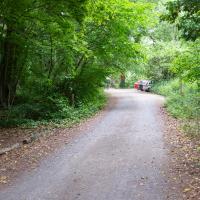
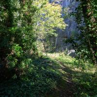
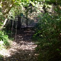
I wanted to finish off the A369—as it turns out I may still have a small section to go, but I've now walked the bulk of it out to my one-mile radius—and also a few random tracks in Leigh Woods. I'm still not really sure that I'm going to walk them all, especially after discovering today that "the map is not the territory" applies even more in the woods, where one of the marked tracks on the map wasn't really that recognisable as a track in real life... I'm glad I'd programmed the route into the GPS in advance!
Anyway. A pleasant enough walk, oddly bookended, photographically at least, by unusual vehicles. Leigh Woods was fairly busy, especially the section I'd chosen, which was positively dripping with teenage schoolkids with rah accents muttering opprobrium about the Duke of Edinburgh. I'm presuming the harsh remarks were more about taking part in his award scheme than the late Consort himself, but I didn't eavesdrop enough to be certain...
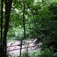
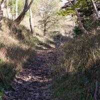
I went off the beaten track onto something more overgrown and ended up with a closer view of the railway.
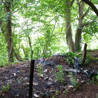
I passed some of a team of what looked like intrepid volunteer litter-pickers on my way up the hill, kitted out with borrowed Bristol Waste litter-picking tools. Sad, but I suppose there's always a balance between people leaving their crap behind and other people picking it up.
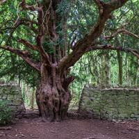
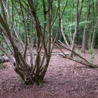
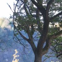
My favourite tree in Leigh Woods. Some of the bricks from the wall are actually embedded in the trunk; presumably there was a period where people didn't keep moving the wall safely back away from the new growth.
I think it was Leigh Woods that taught me the difference between coppicing and pollarding.
A Cliftonwood Revisit with Lisa
10 Jul 2021
Lisa had a couple of hours to spare before going up in a hot air balloon (exciting!) so we went for a quick local walk, revisiting a bit of Cliftonwood we've seen before, exploring the secret garden I'd visited before that I thought she'd enjoy (I didn't take any new photos there) and then pushing on to another garden, Cherry Garden. Last time we passed this way, I'd noticed the gate, but we hadn't gone in as I'd assumed it was private. I'd since found it on CHIS's list of communal gardens in Clifton, so I wanted to have a look inside this time, and try to figure out whether it was private-communal or public, and possibly Council-owned, like several of the other gardens in Clifton.
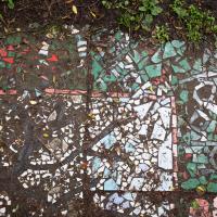
Mosaic also seems to be a bit of a Cliftonwood feature. We've seen some on Ambra Vale, on Argyle Place, just around the corner here on the White Hart Steps, set into the wall just a bit further up the hill and of course at the entrance to Saint Peter's House.
Green Squares and Secret Gardens
31 Jul 2021
At the end of July I went to have a look around some of the private gardens opened up by the annual Green Squares and Secret Gardens event. Sadly it was compressed into a single day this year, for various Covid-related reasons, it seems, so I didn't get to poke around too many places. I went to:
- A talk by the oldest resident of Victoria Square
- The St Vincent's Rocks Hotel garden
- The Paragon garden
- Cornwallis Crescent gardens, both east and west
- The Polygon garden
And snapped a few things in between, too. It was a lovely day—a bit too hot, if anything—and it was interesting to get into a few places I'd only ever seen from the outside, especially The Paragon and Cornwallis gardens, which are the least visible to passing strangers of all of them.
I recently indulged myself by buying a little piece of history. I've mentioned Samuel Loxton and featured and linked to his drawings before, often in the eminently browsable Loxton Collection albums that Bristol Libraries has on Flickr. So when I saw a Loxton drawing of Hotwells pop up on eBay, I decided to get myself a little treat.
I don't think there's any Loxton drawing that features the road I actually live in—it's not very visible from anywhere else, not being one of these Clifton terraces that's perched at the top of a hill, or anything like that, and it's invisible in most views of the area. However, this Loxton drawing, Hotwells, Looking across the river from near the Clifton Bridge station, is probably the closest near-miss I've seen.
I decided to wander out one morning and see if I could reproduce the picture, and also take a photo or two of what's now become of the Clifton Bridge Station, which is still just about discernible in places.
(Then on an even stranger whim I decided to check out a possible little cut-through from Cumberland Road to the harbourside I'd been eyeing up on my commute to work, so walked to Wapping Wharf for a croissant via this potential new route, but that bit's not quite as interesting...)
There's a line of horse chestnuts between Ashton Avenue Bridge and Clifton Bridge Station, all of which seemed to be producing some excellent conkers this year.
The more I research it, the more I find that Hotwells had far better transport links back in Victorian and Edwardian times than it has today. Along with buses that went to more useful places than the City Centre, there were trams, the funicular up to Clifton, the landing stage for paddle steamer services and two railway stations all within easy walking distance of me.
Today I took a day off work as preparation for doing the bookkeeping for my tax return1, and took a wander along to the site of what would have been my nearest station, Hotwells (or Clifton, as it started out in life), nestled in the shadow of the suspension bridge, the Bristol terminus of the Bristol Port Railway and Pier.
From there I wandered down the Portway, following the original line, until I got to the area around Sneyd Park Junction, where the tunnel from the slightly later Clifton Extension Railway joined up with this originally-isolated BPR line. Then I headed up to Clifton through the "goat gully" at Walcombe Slade, seeing the few above-ground bits of evidence of the tunnel (which is still in regular use) along the way.
It was a lovely day, and a good walk, and it was interesting to daydream of the times when I could have walked a few minutes from my flat down to Dowry Parade, caught a short tram ride to Hotwells Stations, and then headed from there to Avonmouth, perhaps even to board a transatlantic passenger service. The completion of the Clifton Extension Railway that linked the Avonmouth station with Temple Meads made relatively direct transatlantic travel from London via Bristol possible, with passengers travelling up from Paddington to Temple Meads, on to Avonmouth on the Clifton Extension Railway and Port Railway and Pier line, then perhaps catching a Cambpell's paddle steamer—which sometimes acted as tenders for large steamers—to a larger ship that was headed out for Canada, say.
1 I've learned that the best approach is to take two days off and deliberately do something that's not my bookkeeping on the first day, as otherwise I just inevitably end up procrastinating and feeling guilty on the first day no matter what. I have an odd brain, but at least I'm learning strategies for dealing with its strange ways as I get older...
2 Information mostly gleaned from Colin Maggs' The Bristol Port Railway & Pier and the Clifton Extension Railway, The Oakwood Press, 1975.
There are no signs of the railway to be found between the gate and the nearest tunnel entrance further north, as you'd expect, really.
Bower Ashton is an interesting little area just south of the river from me—in fact, the Rownham Ferry used to take people over from Hotwells to Bower Ashton, operating from at least the twelfth century to around the 1930s.
It's a strangely contradictory little area, with a cluster of old and new houses sandwiched in between the busy A-roads and significantly more industrial area of Ashton and the bucolic country estate of Ashton court roughly east to west, and also between Somerset and Bristol, north to south.
I've been around here before, mostly poking around Bower Ashton's arguably most well-known bit, the Arts faculty campus of the University of the West of England, but I'd missed at least Parklands Road and Blackmoors Lane, so I initially planned just to nip across briefly and wander down each in turn. On a whim, though, I texted my friends Sarah and Vik in case they were out and about, and ended up diverting to the Tobacco Factory Sunday market first, to grab a quick flat white with them, extending my journey a fair bit.
To start with, though, I nipped to a much more local destination, to see something that you can't actually see at all, the Gridiron...
(I also used this wander as a test of the cameras in my new phone. I finally upgraded after a few years, and the new one has extra, separate wide and telephoto lenses compared to the paltry single lens on my old phone. Gawd. I remember when speed-dial was the latest innovation in phones...)
All of a sudden, everything's a bit quieter and there's open fields in front of me. And livestock, if you can spot the cow in the far distance, just to the right of the tree.
Well, it doesn't seem to lead into the school, and presumably it leads somewhere...