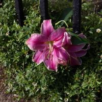
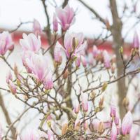
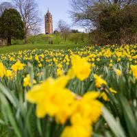
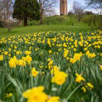
Tagged: flower
A Promenade on New Year's Day
01 Jan 2021
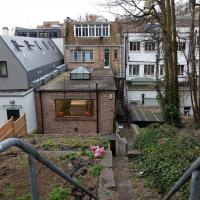
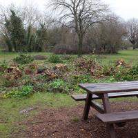
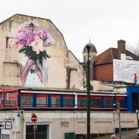
I wandered along the gorge today and found the entrance to the disused Portnalls Number 1 railway tunnel of the Bristol Port Railway and Pier. The door was unlocked, but as soon as I opened it I felt a sense of current habitation and decided discretion was the best option. There's a lot of people homeless in Bristol at the moment, and they don't need disturbing. For the same reason, I've omitted posting some pictures of a little encampment somewhat off the beaten track of the new Zig Zag, where I reversed direction as soon as I realised I'd come across a current habitation of some sort.
Up in Clifton it took me a little while to work out that the picture of the Promenade I was trying to reproduce was taken from the viewpoint I'd thought, it was just that the Alderman's fountain was moved from the top of Bridge Valley Road to the other side of the promenade in 1987, so trying to use it as my initial landmark wasn't very helpful!
Finally I swung past the Society of Merchant Venturers, who presumably still own most of Clifton, having bought the entire manor, including Clifton Down, in 1676, and I imagine aren't in much danger of running out of money. That's true to their motto: indocilis pauperiem pati is apparently from the Odes of Horace, and translates as "will not learn to endure poverty"...
I imagine this alarm was last connected to anything during the tunnel's last commercial incarnation, where is was a shooting range for a Bristol gun club. Not even the lights are wired up these days. Or the water.
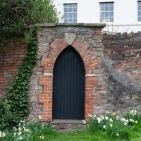
Prince's Lane
06 Jan 2021
The International Grotto Directory website says:
Prince’s Lane might have been one of the original ancient tracks from Hotwells to Clifton, in the Avon Gorge. The site later formed part of Rownham Woods which comprised some thirteen acres. By the end of the 18th century and the early 19th century, the Society of Merchant Venturers granted to Samuel Powell a building lease, for The Colonnade (1786), St. Vincent’s Parade (1790), Prince’s Buildings (1796), and Rock House. Rock House is generally considered to be the oldest surviving building associated with the Hotwell (see Chapter 20). John Power conveyed part of the woods to William Watts for the construction of Windsor Terrace (1790-1808).
The above development of the Avon Gorge cleared Rownham Woods, and created a triangle of land on the north side of the gorge, that became enclosed as a result, by Mansion Houses, whose garden walls all entered on to Prince’s Lane. The Lane started at the bottom of the gorge, at the base rock of Windsor Terrace, and came out half way up Sion Hill. It is clearly shown as a public footpath, dotted with trees, in Ashmead’s map of 1828. Some of the gardens were quite steep in parts and therefore, had to be terraced, because of the gradient of the gorge.
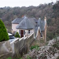
I've passed Prince's Lane literally thousands of times in my life, every time I've walked past the Avon Gorge Hotel, which itself started (in 1898) as the Grand Clifton Spa and Hydropathic Institution and pumped water up from the Hot Well for its hydropathic treatments. I've never actually ventured down it until today, or at least nothing like as far down it as I did this afternoon—I may have poked my head around the back of the hotel to see the original pump rooms at some point in the past.
This was a great wander, though it does very much feel like a private road, and frankly I may have been pushing my luck a bit by winding my way between the astoundingly big back gardens of the houses of some presumably very wealthy Cliftonites, but I felt vaguely justified in exploring the history of one of the oldest footpaths in my part of Bristol...
Mirror Maze
10 Jan 2021
Went for a wander with my friend Lisa—the current lockdown rules seem to be that one local walk for exercise per day with a maximum of one person not in one's "bubble" is fine—up to the University of Bristol area right at the edge of my one-mile perimeter to see the Jeppe Hein Mirror Maze, among other things. On the way we mused about Merchant Venturers, the slave and tobacco trades, and dating in the time of Covid.
In Between
06 Feb 2021
A lovely walk in the early spring sunshine with my friend Lisa. We headed directly for Jacobs Wells Road, to start off around the scene of one of our earlier walks, but this time took in Jacobs Wells from QEH upward, stopping to snap some photos of a Bear With Me, some interesting areas between Park Street and Brandon Hill including a peculiarly quiet enclave with a ruined old build I'd never found before, then crossed the Centre to grab take-away pies from Pieminister (I had the Heidi Pie) and head back to my place down the harbourside.
I went to get my first dose of the Oxford/AstraZeneca Covid-19 vaccine today. Handily, the vaccination centre was Clifton College Prep School in Northcote road, next to Bristol Zoo, a road that's just within my 1-mile range that I hadn't visited before.
I parked up near Ladies Mile and tried to find a few of the tracks marked on the map I'm using, but couldn't see most of them. Whether that's just because they've disappeared over time, or with the recent lack of use or waterlogging from the 24 hours of rain we just had, I'm not sure. It was a pretty fruitless search, anyway.
The vaccine shot was virtually the same setup as when I got my winter flu jab back in November, except for the venue. I snapped a couple of pictures of the school while I was there, but I was in and out in five minutes, and you probably don't want to linger around a vaccination centre, I suppose.
Instead I wandered around the compact block of the Zoo, now sadly scheduled for closure. By coincidence I finished E H Young's Chatterton Square this morning: set in Clifton (fictionalised as "Upper Radstowe") near the Zoo, the occasional roars of the lions that can be heard by the residents of the square (Canynge Square in real life) form part of the background of the novel. The book's set in 1938 (though written and published post-war, in 1947). It seems a shame that the incongruous sounds of the jungle will no longer be heard from 2022. All I heard today were some exotic birds and, I think, some monkeys.
I was told not to drive for fifteen minutes following the jab, so I wandered out of my area up to the top of Upper Belgrave Road to check out an interesting factoid I'd read while looking into the history of the reservoir at Oakfield Road, that the site of 46 Upper Belgrave Road was a bungalow, shorter than the adjacent houses, and owned by Bristol Water, kept specifically low so that the pump man at Oakfield Road could see the standpipe for the Downs Reservoir (presumably by or on the water tower on the Downs) and turn the pump off when it started overflowing. Sadly I couldn't confirm it. There is one particularly low house on that stretch, but it's number 44, and though small, it's two-storey, not a bungalow, so nothing really seems to quite fit in with the tale.
I'm writing this about nine hours after getting the jab, by the way, and haven't noticed any ill effects at all. My arm's not even sore, as it usually would be after the normal flu jab. In twelve weeks I should get an appointment to get the second dose.
Clifton Down Dash
02 Mar 2021
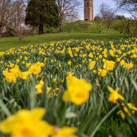
A quick wander up to Clifton Village to wander down a path or two either around Observatory Road that I'd missed out previously. On the way around I took a moment to take in the incongruous 11 Windsor Terrace, smiled at a couple of mounted police, stopped to smell the crocuses, grabbed a coffee in Foliage and came home through the Polygon accompanied by the delightful Spring sound of a woodchipper running at full blast. Nice.
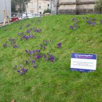
"The Crocus was chosen as the purple colour matched the dye painted on the fingers of children who have been immunised."
I'm still not entirely clear on how the crocuses are helping to eliminate polio, but the website's here...
Quick Around-the-Harbour Wander with Lisa
20 Mar 2021
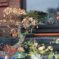
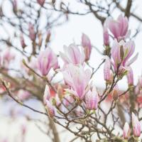
My friend Lisa was meeting another friend for a walk near the suspension bridge, so we fitted in a quick harbourside loop from my place first. We discussed gardening (we're both envious of the gardening skills of the Pooles Wharf residents; we can just about keep herbs alive, whereas they're growing heartily-fruiting lemon trees outdoors in England along with everything from bonsai to magnolias), cafes, work and architecture, among other things.
There's a lot of pretty amazing gardening goes on on the harbourside stretch between the Pump House and the Grain Barge.
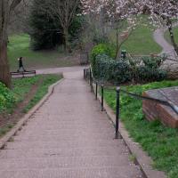
I wasn't going to take a very long walk on this nice spring evening; it just happened. I was going to knock off a path or two on Brandon Hill, home over centuries to hermits and windmills, cannons and Chartists, and then just wander home, stopping only to fill up my milk bottle at the vending machine in the Pump House car park.
However, when I heard a distant gas burner I stayed on the hill long enough to see if I could get a decent photo of both the hot air balloon drifting over with Cabot Tower in the same frame (spoiler: I couldn't. And only having the fixed-focal-length Fuji with me didn't help) and then, on the way home, bumped into my "support bubble", Sarah and Vik, and extended my walk even further do creep carefully down the slipway next to the old paddle steamer landing stage and get some photos from its furthest extreme during a very low tide...
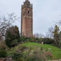
Built in the 1890s, funded by public subscription, to commemorate the 400th anniversary of the journey of John Cabot from Bristol to Newfoundland in my namesake, the Matthew.
From Wikipedia:
The site of the tower was occupied in the Middle Ages by a chapel which may have belonged to St James' Priory. During the 16th century the chapel was replaced by a windmill.
Perhaps in the aftertimes I'll be able to drag myself once more up its narrow staircase and take a snap from the balcony at the top.
I got interested in Bristol's medieval water supplies after poking around near Jacobs Wells Road and Brandon Hill. It was during that research I found out about a pipe that's still there today, and, as far as I know, still actually functioning, that was originally commissioned by Carmelite monks in the 13th century. They wanted a supply of spring water from Brandon Hill to their priory on the site of what's now the Bristol Beacon—Colston Hall, as-was. It was created around 1267, and later, in 1376, extended generously with an extra "feather" pipe to St John's On The Wall, giving the pipework its modern name of "St John's Conduit".
St John's on the Wall is still there, guarding the remaining city gate at the end of Broad Street, and the outlet tap area was recently refurbished. It doesn't run continuously now, like it did when I first moved to Bristol and worked at the end of Broad Street, in the Everard Building, but I believe the pipe still functions. One day I'd like to see that tap running...
There are a few links on the web about the pipe, but by far the best thing to do is to watch this short and fascinating 1970s TV documentary called The Hidden Source, which has some footage of the actual pipe and also lots of fantastic general footage of Bristol in the seventies.
On my walk today I was actually just going to the building society in town, but I decided to trace some of the route of the Carmelite pipe, including visiting streets it runs under, like Park Street, Christmas Street, and, of course, Pipe Lane. I also went a bit out of my way to check out St James' Priory, the oldest building in Bristol, seeing as it was just around the corner from the building society.
There are far too many pictures from this walk, and my feet are now quite sore, because it was a long one. But I enjoyed it.
I bumped into my friend Lisa in town during yesterday's wander, and we decided to have a wander today, too. We managed quite a long ramble, starting up through Clifton and nipping down Park Row to investigate the two tower blocks I'd noticed popping up behind Park Street yesterday, then took in a few roads I'd not managed to get to before, including cutting through the grounds of Bristol Grammar School.
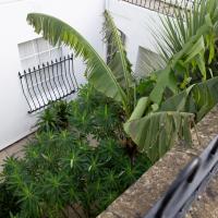
The gardens of Irving and Terry House were very well-kept, mostly container planting to soften the stark concrete of the place. Plant identification credit to my friend Sarah—neither Lisa nor I are that great at identifying plants, so I texted Sarah a picture :)