Tagged: flower
The Long Lunchtime at the End of the World
27 Nov 2020
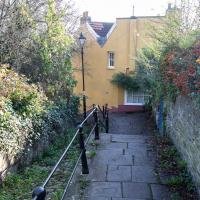
I took an extra-long break at lunchtime today as I'd taken the day off my normal day-job to do the accounts for my previous side-job, which is still generating paperwork, though not much in the way of money. This took me through some undiscovered bits of Cliftonwood, including Worlds End Lane, which unexpectedly leads to White Hart Steps. That's certainly not where I expected the end of the world to lead to...
Ten O'Clock Shop and Can't Dance Coffee
30 Nov 2020
I had to return a faulty AirPod Pro to Apple (there's a first-world problem!) so I just took a quick trip up the hill to the nearest UPS drop-off point, The Ten O'Clock Shop, which is famously open until 11pm. Unfortunately it's a fairly cramped little place and neither of the staff were wearing masks, so I made it a very quick drop indeed and got out of there as quickly as I could.
I grabbed a quick coffee from Can't Dance, a stall that's—as of yesterday—in a tiny converted cargo container on the edge of Victoria Square; up until this week they were running from a little trike parked in the same place. Hopefully the new premises will let them see out the winter without worrying quite so much about the weather.
I tried to fit in a few extra streets from the surrounding area on my there and back, but that was basically my wander today: a quick little shopping trip.
Cliftonwood and a Secret Garden
03 Dec 2020
I love the isolation of Cliftonwood -- the geography of it, with its solid boundary of Clifton Vale to the west and Jacob's Wells Road to the east mean that you tend not to be in Cliftonwood unless you've got a reason to be there. It's not a cut-through to anywhere, at least not from side-to-side, and you can only really exit to the south on foot.
I sense that I'd be happy living in Cliftonwood -- like my bit of Hotwells, it's a quiet little area with a sort of quirky feel to it. Plus it contributes the colourful houses that are the backdrop of about half of all Bristol postcards ever made :)
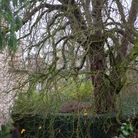
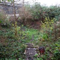
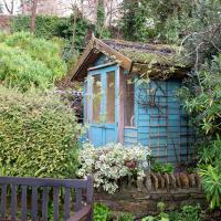
I found the "secret" garden especially interesting, just for the fact that it really does feel quite secret, despite the obvious name on the gate. I've lived a half-mile from it for twenty years and I don't think I've ever noticed it before, despite exploring the area a few times.
Strangers' Burial Ground
04 Dec 2020
I tried to find the Strangers' Burial Ground the last time was up in Clifton, but I'd not realised that Lower Clifton Hill continues further on after the turning with Constitution Hill. Sadly it was chained shut, but it still looks beautifully-maintained, perhaps by the same man referenced by this story from John Hodgson, which helped me find it. Apparently Thomas Beddoes is buried here.
More Cliftonwood
05 Dec 2020
Back to Cliftonwood for a wander that included some of the belle views of Bellevue Crescent and other bits of the easternmost part. Highlights included watching someone bump-starting an elderly Nissan Micra in the narrow confines of Bellevue Crescent.
Mark's Bread
07 Dec 2020
I realised that if Hopper Coffee in Greville Smyth Park was in reach during my lunch hour, then perhaps Mark's Bread at the end of North Street would be do-able, too. And I was right. I also managed to cross Clift Road, with its pretty gable bargeboards, off my list, and encounter a dapper gent walking his dogs while playing loud jazz music from somewhere under his jacket. That's North Street for you.
Bedminster, Ashton, Ashton Court sunset walk
12 Dec 2020
A walk with Sarah focusing on Ashton and the surrounds, taken on a day with really nice light around sunset. Just what I needed.
Rainy Clifton
13 Dec 2020
A long walk around Cliftonwood and Clifton with my friend Lisa, taking in some of the 12 Days of Christmas display at Queens Parade, picking up a take-away coffee from Pinkmans of Park Street, and poking our heads up against the glass of SS Peter and Paul Catholic Cathedral.
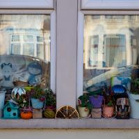
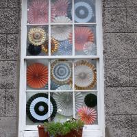
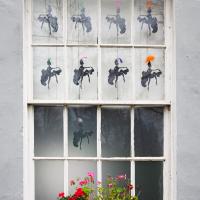
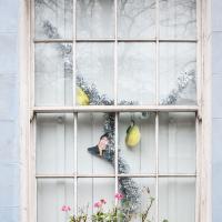
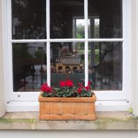
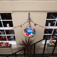
This house in Queens Parade had chosen not to take part in the Twelve Days theme, but nevertheless had an interesting display.
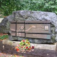
"The Katyn massacre was a series of mass executions of nearly 22,000 Polish military officers and intelligentsia carried out by the Soviet Union, specifically the NKVD ("People's Commissariat for Internal Affairs", the Soviet secret police) in April and May 1940. Though the killings also occurred in the Kalinin and Kharkiv prisons and elsewhere, the massacre is named after the Katyn Forest, where some of the mass graves were first discovered." — Wikipedia
Gardens and Cottages
17 Dec 2020
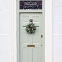
I think the cute little Duncan Cottage was my favourite bit of this wander up the hill to get coffee and a pain-au-raisin from Twelve, though I did enjoy gently musing on the public and private gardens of Clifton, inspired by a closer pass than usual to Royal York Crescent's garden.
I managed absent-mindedly to clear my GPS track before saving it, so this hand-created track-log may cause me problems in the future. I suppose we'll see.
Saint Vincent's Spring
28 Dec 2020
Fractionally outside my one-mile zone, but I got curious about Saint Vincent's spring, whose last remnants you can see in a defunct drinking fountain on the Portway. Along the way I passed Gyston's cave, sometimes called St Vincent's cave, in the sheer wall of the gorge. It's now accessible by a tunnel from the observatory—I tried it about twenty years ago, I think, and still recall the vertiginous moment of looking down from the protruding balcony and realising that you could see straight through the grille floor to the drop below—but from what I can work out the tunnel is relatively recent. Before the tunnel was dug it was accessible only by access across the cliff face, which must have been even more terrifying.
This cave was first mentioned as being a chapel in the year AD 305 and excavations, in which Romano-British pottery has been found, have revealed that it has been both a holy place and a place of refuge at various times in its history.
A few different sources say that the cave became a hermitage and chapel to St Vincent following Bristol's early trading in Iberian wines; St Vincent of Saragossa is Lisbon's patron saint, and a lot of nearby things bear the name.
I'm not sure where the crossover of Vincent and Ghyston happens, though. On the giants Goram and Vincent (or Ghyston), Wikipedia says:
The name Vincent for one of the giants rests on the fact that at Clifton, at the narrowest point of the Avon Gorge, there was formerly an ancient hermitage and chapel dedicated to St Vincent, at or near the present cave in the cliff-face which bears his name. Another (apparently modern) version of the story calls the Clifton giant Ghyston, which is in fact the name, of obscure origin, for the whole of the cliff-face of the Avon Gorge at least as early as the mid-fifteenth century, in the detailed description of the Bristol area by William Worcestre. The place-name was personified to produce the giant's name. Vincent's Cave is called Ghyston cave or The Giant’s Hole in an article in the July 1837 issue of Felix Farley’s Bristol Journal.
In my research on the original Hot Well House, I've seen quite a few contemporary paintings which state their viewpoint as "from St. Vincent's Rock", so in the 16th century it seems the cliff-face name was typically St Vincent Rock rather than Ghyston's Rock, perhaps.
I am, as you can tell, no historian!
On the way, I also wandered around the base of the popular climbing area, which I think is the site of the old Black Rock quarry.
