Tagged: neighbourhood
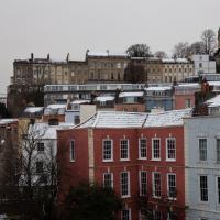
A Promenade on New Year's Day
01 Jan 2021
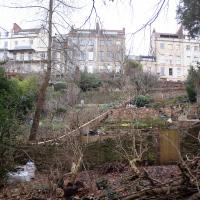
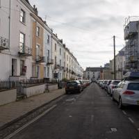
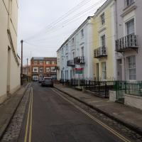
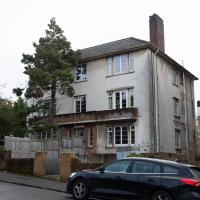
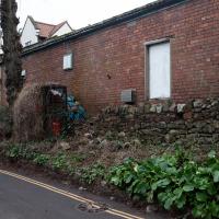
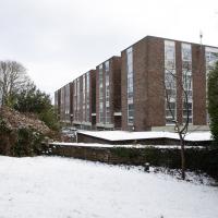
I wandered along the gorge today and found the entrance to the disused Portnalls Number 1 railway tunnel of the Bristol Port Railway and Pier. The door was unlocked, but as soon as I opened it I felt a sense of current habitation and decided discretion was the best option. There's a lot of people homeless in Bristol at the moment, and they don't need disturbing. For the same reason, I've omitted posting some pictures of a little encampment somewhat off the beaten track of the new Zig Zag, where I reversed direction as soon as I realised I'd come across a current habitation of some sort.
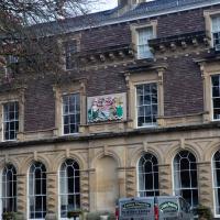
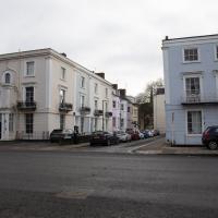
Up in Clifton it took me a little while to work out that the picture of the Promenade I was trying to reproduce was taken from the viewpoint I'd thought, it was just that the Alderman's fountain was moved from the top of Bridge Valley Road to the other side of the promenade in 1987, so trying to use it as my initial landmark wasn't very helpful!
Finally I swung past the Society of Merchant Venturers, who presumably still own most of Clifton, having bought the entire manor, including Clifton Down, in 1676, and I imagine aren't in much danger of running out of money. That's true to their motto: indocilis pauperiem pati is apparently from the Odes of Horace, and translates as "will not learn to endure poverty"...
Tiny Houses, Crocodiles and Views
05 Jan 2021
I didn't really intend to record my walk today, but once I was out and about I couldn't really resist taking some pictures. The sun was lovely, but it was cold...
Prince's Lane
06 Jan 2021
The International Grotto Directory website says:
Prince’s Lane might have been one of the original ancient tracks from Hotwells to Clifton, in the Avon Gorge. The site later formed part of Rownham Woods which comprised some thirteen acres. By the end of the 18th century and the early 19th century, the Society of Merchant Venturers granted to Samuel Powell a building lease, for The Colonnade (1786), St. Vincent’s Parade (1790), Prince’s Buildings (1796), and Rock House. Rock House is generally considered to be the oldest surviving building associated with the Hotwell (see Chapter 20). John Power conveyed part of the woods to William Watts for the construction of Windsor Terrace (1790-1808).
The above development of the Avon Gorge cleared Rownham Woods, and created a triangle of land on the north side of the gorge, that became enclosed as a result, by Mansion Houses, whose garden walls all entered on to Prince’s Lane. The Lane started at the bottom of the gorge, at the base rock of Windsor Terrace, and came out half way up Sion Hill. It is clearly shown as a public footpath, dotted with trees, in Ashmead’s map of 1828. Some of the gardens were quite steep in parts and therefore, had to be terraced, because of the gradient of the gorge.
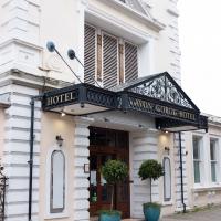
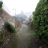
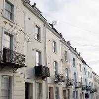
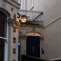
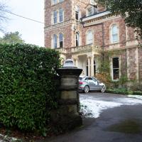
I've passed Prince's Lane literally thousands of times in my life, every time I've walked past the Avon Gorge Hotel, which itself started (in 1898) as the Grand Clifton Spa and Hydropathic Institution and pumped water up from the Hot Well for its hydropathic treatments. I've never actually ventured down it until today, or at least nothing like as far down it as I did this afternoon—I may have poked my head around the back of the hotel to see the original pump rooms at some point in the past.
This was a great wander, though it does very much feel like a private road, and frankly I may have been pushing my luck a bit by winding my way between the astoundingly big back gardens of the houses of some presumably very wealthy Cliftonites, but I felt vaguely justified in exploring the history of one of the oldest footpaths in my part of Bristol...
A Little Local Wander
07 Jan 2021
Which included a literal "local", the Pump House, to try out their shop/deli/cafe. A flat white, some apples and a New York Deli toastie. Eleven quid, mind, but the Pump House was never a cheap pub...
I enjoyed the fog, and wandering down a few more out-of-the-way back alleys and what-have-you on the Hotwell Road.
I'm thinking of getting up early and going for a morning walk tomorrow, weather-depending, but at the moment my motivation to do things like this seems to be much strong in the evenings when I'm just thinking about it rather than in the morning when I actually have to do it. But it's going to be cold, and low tide is quite early, so there's always a chance of getting some footage of the hot well actually being visibly hot; you never know...
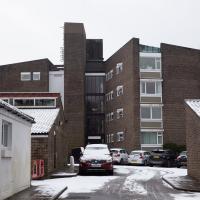
I decided to explore the Freeland Place car park briefly today. As expected it's basically just a car park, though at least it links up with Hinton Lane at the bottom so I didn't have to retrace my steps.
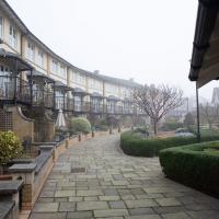
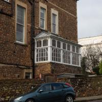
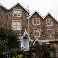
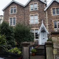
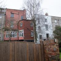
I didn't walk into the private garden here, but it was nice to get a new perspective on this curved terrace I've walked past so many times on the way down the harbourside into town.
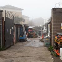
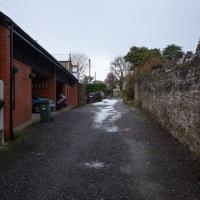
The alleyway behind Brandon Tools leads to their shop yard. I think I may have been out there once, when I hired a pressure washer, but I'd forgotten it was there.
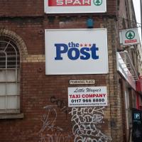
And, inevitably, a load of tagging. The Spar is a pretty awful example of the kind of chain shop that's not good at the best of times. It survives, I imagine, because there aren't any other shops.
Morning Walk
08 Jan 2021
Tempted by a hopeful repeat of yesterday's weather, I got up early this morning and went for a short walk up into Clifton Village, around Observatory Hill, back down the Zig Zag and home. Instead of beautiful and mysterious fog and crisp freezing brightness I got some murk and slight dampness which included witnessing a road-raging van driver and finding that it still wasn't cold enough for the hot well to be even gently steaming when I got down there. I've still never seen it steaming, but I've been told it does, on colder days.
Mirror Maze
10 Jan 2021
Went for a wander with my friend Lisa—the current lockdown rules seem to be that one local walk for exercise per day with a maximum of one person not in one's "bubble" is fine—up to the University of Bristol area right at the edge of my one-mile perimeter to see the Jeppe Hein Mirror Maze, among other things. On the way we mused about Merchant Venturers, the slave and tobacco trades, and dating in the time of Covid.
One of the roads I used to walk down regularly on my way home from a job at the top of Whiteladies Road. I used to enjoy cutting through here and crossing through the closed-to-cars bit just around from the Lido at the far end.
Northern Clifton
16 Jan 2021
A raggedy wander with my friend Lisa, picking up a few stray streets and venturing only briefly onto Whiteladies Road, where it was too damn busy, given the current pandemic. We retreated fairly quickly. Found a couple of interesting back alleys, and got a very pointed "can I help you?" from a man who was working in his garage in one of the rather run-down garage areas behind some posh houses, and clearly didn't want us just wandering around there.
Here's an interesting sinkhole-related snippet:
"In September 2007, Peter Insole of Bristol City Council visited no.52 Clifton Park Road, Clifton to investigate the report of a mine shaft in the rear garden that had been exposed during gardening work. In the southwestern corner of the garden a rough rock cut shaft approximately 1m in diameter was observed. It was not possible to fully survey the feature for health and safety reasons, but it appeared to be excavated through sandstone or Dolomitic Conglomerate and was at least 2m deep. The shaft opened out into tunnels or chambers beneath the rear gardens of the Canynge Square properties. It is possible that this feature was associated with a previously observed cellar or chamber beneath the rear garden of 22 Canynge Square, although there are no known cartographic or documentary records for mining activity in the area."
Birthday Coffee
21 Jan 2021
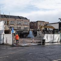
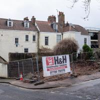
A quick jaunt to Clifton Village to grab a birthday coffee and cake (courgette, lime & pistachio, thanks for asking) from Twelve, and rubberneck at the demolition of the block that used to house the WH Smith, among other things. I remember the Havana Cafe, Mail Boxes Etc (for those who wanted a Clifton postcode without living there?) and others.
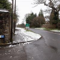
Snowy Leigh Wander
24 Jan 2021
I started this wander with my "support bubble" Sarah and Vik, after Sarah texted me to say "SNOW!" We parted ways on the towpath and I headed up into the bit of Leigh Woods that's not actually the woods—the village-like part in between Leigh Woods and Ashton Court, where I'd noticed on a map a church I'd not seen before. I found St Mary the Virgin and quite a few other things I'd never experienced, despite having walked nearby them many, many times over many years, including a castellated Victorian water tower that's been turned into a house...
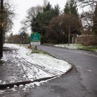
There's something quite pleasant about being able to walk to a different county. I've always liked passing the sign.
In EH Young's Chatterton Square, Rosamund describes a similar escape-to-the-countryside feeling when crossing the Suspension Bridge and heading for "Monks' Pool", which surely must be Abbot's Pool at Abbots Leigh in real life. I've actually swum there, I think the only time I've been "wild swimming" in the UK.
I knew from cryptic crosswords that "kraal" is "a traditional African village of huts, typically enclosed by a fence.". As for the "Chakas" bit, maybe it's a referenece to Zulu king Shaka? There is apparently a Shakaskraal in South Africa...
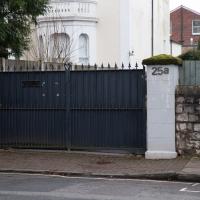
Well, it's a public road, but I did feel quite conspicuous walking down to the end of the cul-de-sac just to turn around and come back up. The whole area seems rather posh and wealthy, so it wouldn't have surprised me to have to explain myself to someone jumping out to ask me what I was up to.
Another Lunchtime, Another Quick Coffee Trip
28 Jan 2021
With very little photography, and no new streets. Still, I did manage to buy milk at the "Simple Cow" vending machine—and "simple" is very definitely false advertising; it took me bloody ages to work out how to use the thing—and snap the new ACER/SEPR piece down in Cumberland Piazza.
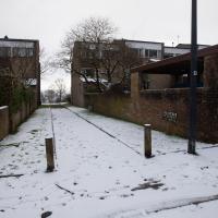
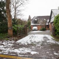
This was just a little car park, presumably for the house behind? Probably going to be turned into half a dozed bijou flats, or something...