Tagged: photograph
Solstice Rain
21 Dec 2020
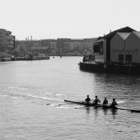
Despite the weather, Sarah and Vik and I wandered around Ashton Court a bit as the sun rose. Not that you could really tell. Sadly, the bit we wanted to watch the sunrise from was closed, because people hadn't been treating the deer with appropriate respect. Ah well, at least it was some exercise.
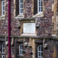
I went to have a peep at the giant sinkhole that's opened up in Canynge Square—ironically, having recently discovered the gardens were public I'd had the (triangular!) square on my list to re-visit for a few days, but now there's no entrance to the gardens due to the danger. The area was well fenced-off for safety, but I tried to get a couple of photos from behind the barriers.
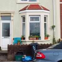
I also explored the area around Camp Road, an real melange of architectures, one of the most mixed-up areas I've seen in Clifton, in fact, and confirmed my friend Claire's suspicion that an earlier snap of a sign from Manilla Road was in fact for a fire hydrant. Nice.
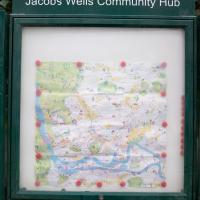
Jacob's Well Wander
01 Feb 2021
I just wanted to get some exercise, really, so I set out to knock off the lower bit of Jacobs Wells Road that I'd not managed to walk up yet. I set the new signboard that the community association had had erected as my destination, after reading about it on their blog.
As it turned out, I couldn't even read it, as the building that houses the actual Jacob's Well had water flooding out onto the pavement. I wonder if it was actual Jacob's Well water? Have the soles of my walking shoes been mystically blessed now?
You can't see much of the flood in the photos I snapped, but I did shoot a little video, too. Ed on Twitter said:
I spoke to the seller at the time with a view to buying it - I mentioned an old friend who grew up nearby remembers it flooding regularly. He swore blind my friend was wrong.
This was quite hard to read in person and I only nipped out for a quick walk in my lunch hour, so I didn't have the time to spend checking it out.
Clifton Village, including Oxford Place
15 Feb 2021
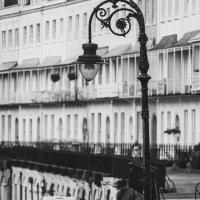
I've noticed Oxford Place as a tiny little side/back road I've overlooked on my wanders a few times. Today I decided to pop down and have a look, as well as taking a few general snaps of Princess Victoria Street, which I thought deserved more pictures, as it's basically my closest decent shops, and in the Beforetimes I'd visit the Co-Op up there all the time, as well as the cafes (you'll be missed, Clifton Village branch of Boston Tea Party, recently closed in favour of Eat a Pitta.)
I'm definitely becoming more familiar with the area through the One Mile Matt jaunts and associated reading. Today I didn't just think, "oh, I'll head home down that weird alleyway with the electrical substation in it"—no, I thought, "I'll head home down Hanover Lane", because I actually knew its name. And on the way back from there I nodded sagely to myself as I passed St Vincent's Road, knowing now which St Vincent it's likely to be (St Vincent of Saragossa) and also eyed up the modern flats on Clifton Vale and wondered if they might have been built on the site of the former Vauxhall Pleasure Gardens... I don't know all the answers, but at least I have some idea of the historical questions I'm interested in.
Meridian
17 Feb 2021
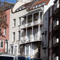
The long road between Clifton Road and Park Place—the little triangle of grass in front of the Pro-Cathedral, which also houses Quinton House pub, the Park Launderette and Mr Swantons Barbers—is one I've travelled a lot, as it's a nice route between my place and the top of Park Street, especially Ocado. It has many names along the way, even though it feels like just one continuous road. It's York Place, Tottenham Place, Meridian Place and Bruton Place before it finally spits you out onto Park Place.
It was Meridian Place I was interested in today, as I wanted to explore the set of steps that lead down from it in the direction of Jacobs Wells Road. Turns out they lead to Meridian Vale and Meridian Mews, and come out between the Strangers Burial Ground and the Eldon House, opposite the entrance to Bellevue Terrace. I liked the little terrace on Meridian Vale, though they probably don't get a lot of light in the front windows, what with Meridian Place and Tottenham Place towering above them.
On the way back home I popped into the little lane behind Regent Street that houses the Chesterfield Hospital, as I realised I'd neglected that up until now. It was... unexciting.
Very Brief Hotwells Wander
18 Feb 2021
Really just a quick loop of the Cumberland Basin. I was going to go further, and it was a nice early spring day, but I hadn't slept that well and I wasn't really in the mood. Ah well. Not every walk is great. At least I got out of the house for a bit.
I wasn't going to take a very long walk on this nice spring evening; it just happened. I was going to knock off a path or two on Brandon Hill, home over centuries to hermits and windmills, cannons and Chartists, and then just wander home, stopping only to fill up my milk bottle at the vending machine in the Pump House car park.
However, when I heard a distant gas burner I stayed on the hill long enough to see if I could get a decent photo of both the hot air balloon drifting over with Cabot Tower in the same frame (spoiler: I couldn't. And only having the fixed-focal-length Fuji with me didn't help) and then, on the way home, bumped into my "support bubble", Sarah and Vik, and extended my walk even further do creep carefully down the slipway next to the old paddle steamer landing stage and get some photos from its furthest extreme during a very low tide...
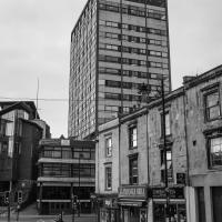
I bumped into my friend Lisa in town during yesterday's wander, and we decided to have a wander today, too. We managed quite a long ramble, starting up through Clifton and nipping down Park Row to investigate the two tower blocks I'd noticed popping up behind Park Street yesterday, then took in a few roads I'd not managed to get to before, including cutting through the grounds of Bristol Grammar School.

Long Bemmie Wander with Lisa
11 Apr 2021
My friend Lisa joined me again, this time for a long wander through "Bemmie". In fact, I tweeted recently using "Bedmo" as my abbreviation for Bedminster, and apparently there's something of a culture war going on. From what I can glean, the longer-term residents call it "Bemmie" and consider "Bedmo" a name made up by hipster gentrifiers.
I had no idea, but then I didn't grow up around here, and I don't live in Bedminster, and I'm not a hipster. I'm not sure I've ever gentrified anywhere, either; Hotwells was already quite gentrified by the time I arrived. I probably just lowered the tone a bit.
Anyway. Lisa and I entered Bemmie by the traditional toll gate (though actually you'd only have paid if you were coming from the Long Ashton direction, not merely nipping across from Hotwells) and then almost literally combed the streets to knock several new roads off my list of targets. Along the way we saw lots of street art, as you'd expect, and admired the area's panoply of gorgeous knockers.
So far on my wanders I think I've visited the roads of Bellevue Court, Bellevue Crescent, Bellevue Cottages, just-plain-Bellevue and Bellevue Terrace. It's almost like Bristol has a few nice views...
Man on a Mission
17 Apr 2021
I went rather outside my area today, as I went to pick something up from the Warhammer shop on Wine Street (Games Workshop as-was, and before that I think perhaps a rare retail outlet for Her Majesty's Stationery Office? I may be mis-remembering...) Anyway, a friend of mine wanted something picking up and posting to him, so I figured I'd knock some streets off my list along the way.
I first headed for the St George's Road area, walking down the narrow Brandon Steps and finding some strange wall art on Brandon Steep, then headed to the Old City via Zed Alley. The Warhammer shop visit was friendly and efficient, and, mission accomplished, I treated myself to a sausage roll and a flat white from Spicer + Cole, to take away and eat in Queen Square with its current decoration of hearts. I finished off with a detour up Park Street, looking out for St John's Conduit markers, before finally crossing Brandon Hill on the way home.
Quite a long wander, all told, and I'm a bit knackered today...